Results
1 2 3 Next »
215 results found
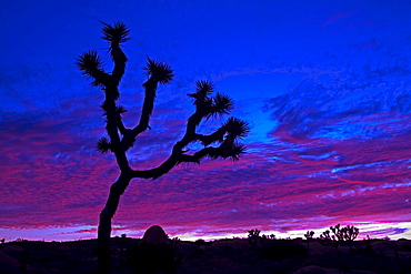
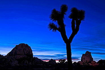
Joshua tree at sunset, Jumbo Rocks area, Joshua Tree National Park, California, United States of America, North America
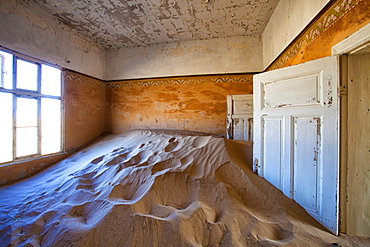
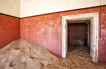
Interior of building slowly being consumed by the sands of the Namib Desert in the abandoned former German diamond mining town of Kolmanskop, Forbidden Diamond Area near Luderitz, Namibia, Africa
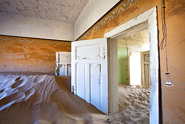
Interior of building slowly being consumed by the sands of the Namib Desert in the abandoned former German diamond mining town of Kolmanskop, Forbidden Diamond Area near Luderitz, Namibia, Africa

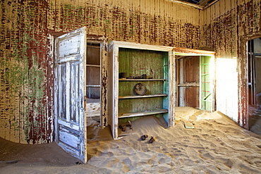
Interior of building slowly being consumed by the sands of the Namib Desert in the abandoned former German diamond mining town of Kolmanskop, Forbidden Diamond Area near Luderitz, Namibia, Africa
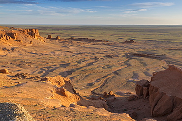
Sunrise, Flaming Cliffs, area of dinosaur bone and egg fossils, Gurvan Saikhan National Park, Bayanzag, Gobi Desert, Mongolia, Central Asia, Asia
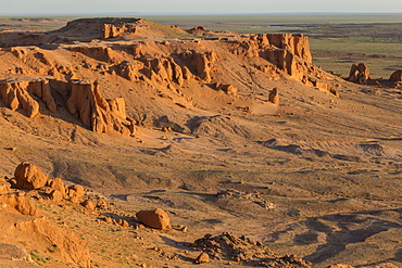
Sunrise, Flaming Cliffs, area of dinosaur bone and egg fossils, Gurvan Saikhan National Park, Bayanzag, Gobi Desert, Mongolia, Central Asia, Asia
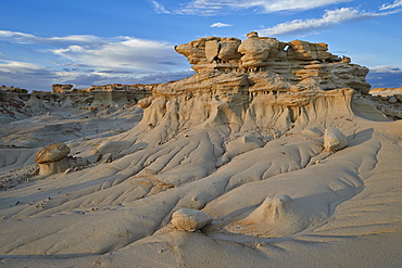
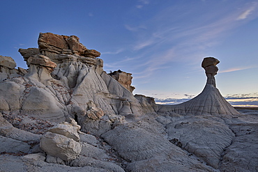
Badlands, Ah-Shi-Sle-Pah Wilderness Study Area, New Mexico, United States of America, North America
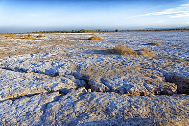
Mahrejan salt lake, Yazd area, Iran, Middle East
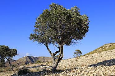
Olive tree in semi desert area near Rodalquilar, Cabo de Gata natural park, Almeria, Andalusia, Spain, Europe
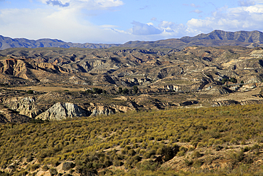
Limestone desert landscape, Paraje Natural de Karst en Yesos de Sorbas, Almeria, Andalusia, Spain, Europe

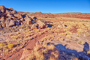
Rocks in the badlands, Ah-Shi-Sle-Pah Wilderness Study Area, New Mexico, United States of America, North America
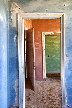
Interior of building slowly being consumed by the sands of the Namib Desert in the abandoned former German diamond mining town of Kolmanskop, Forbidden Diamond Area near Luderitz, Namibia, Africa
Interior of building slowly being consumed by the sands of the Namib Desert in the abandoned former German diamond mining town of Kolmanskop, Forbidden Diamond Area near Luderitz, Namibia, Africa
Interior of building slowly being consumed by the sands of the Namib Desert in the abandoned former German diamond mining town of Kolmanskop, Forbidden Diamond Area near Luderitz, Namibia, Africa
Hoodoo at dusk, Ah-Shi-Sle-Pah Wilderness Study Area, New Mexico, United States of America, North America
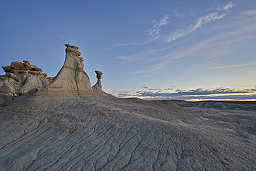
Hoodoos, Ah-Shi-Sle-Pah Wilderness Study Area, New Mexico, United States of America, North America
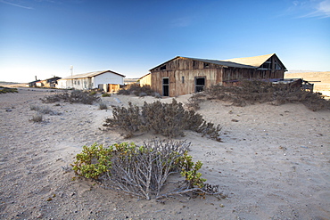
Buildings in the abandoned former German diamond mining town of Kolmanskop on the edge of the Namib Desert, Forbidden Diamond Area near Luderitz, Namibia

Interior of building slowly being consumed by the sands of the Namib Desert in the abandoned former German diamond mining town of Kolmanskop, Forbidden Diamond Area near Luderitz, Namibia, Africa
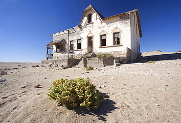
House slowly being reclaimed by the desert in the abandoned former German diamond mining town of Kolmanskop on the edge of the Namib Desert, Forbidden Diamond Area near Luderitz, Namibia, Africa
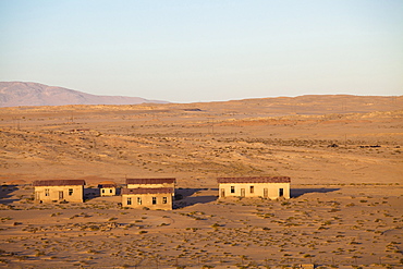
Buildings in the abandoned former German diamond mining town of Kolmanskop on the edge of the Namib Desert, Forbidden Diamond Area near Luderitz, Namibia
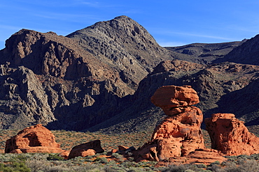
Beehives area, Valley of Fire State Park, Overton, Nevada, United States of America, North America

Rock formation in the badlands, Ah-Shi-Sle-Pah Wilderness Study Area, New Mexico, United States of America, North America
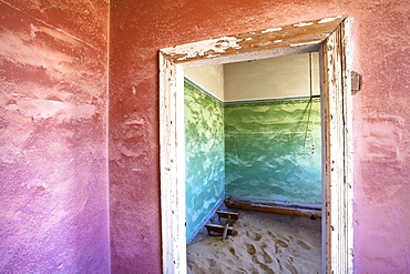
Interior of building slowly being consumed by the sands of the Namib Desert in the abandoned former German diamond mining town of Kolmanskop, Forbidden Diamond Area near Luderitz, Namibia, Africa

Navajo Dome area, Capitol Reef National Park, Utah, United States of America, North America
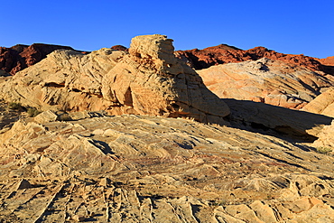
White Domes area, Valley of Fire State Park, Overton, Nevada, United States of America, North America
Silhouette of Joshua tree, Hidden Valley area, Joshua Tree Nationa Park, California, United States of America, North America
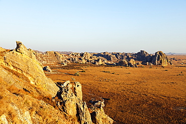
Desert landscape, Isalo National Park, central area, Madagascar, Africa
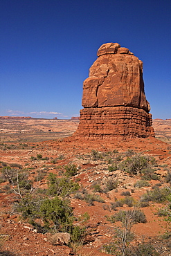
Rock formation, Courthouse Towers area, Arches National Park, Utah, United States of America, North America
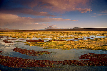
Landscape in the Isluga area of the Atacama Desert, Chile, South America
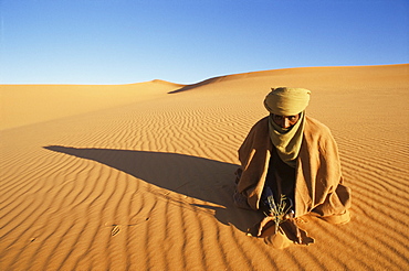
Akakus area, Southwest desert, Libya, North Africa, Africa
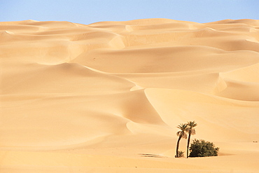
Mandara area, Southwest desert, Libya, North Africa, Africa
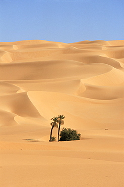
Mandara area, Southwest desert, Libya, North Africa, Africa
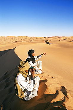
Akakus (Acacus) area, Southwest desert, Libya, North Africa, Africa
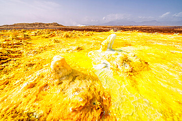
Yellow acid sulphur sediments in the thermal area of Dallol, Danakil Depression, Afar Region, Ethiopia, Africa

El Tatio Geysers, at 4300m above sea level El Tatio is the world's highest geyser field, the area is ringed by volcanoes and fed by 64 geysers, Atacama Desert, Norte Grande, Chile, South America

El Tatio Geysers, at 4300m above sea level El Tatio is the world's highest geyser field, the area is ringed by volcanoes and fed by 64 geysers, Atacama Desert, Norte Grande, Chile, South America

Caravan (Trailer) at the camping area of Sand Hollow State Park, opened in 2003, covering 20000 acres, near St. George, Utah, United States of America, North America
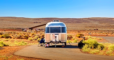
Caravan (Trailer) at the camping area of Sand Hollow State Park, opened in 2003, covering 20000 acres, near St. George, Utah, United States of America, North America
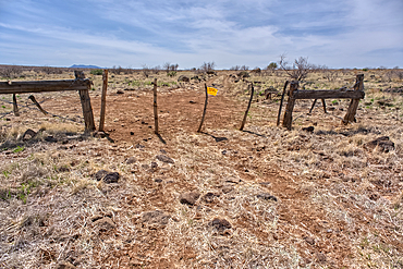
An entry gate to Silver Creek Canyon in Agua Fria National Monument Arizona, USA
Silver Creek Canyon in the Agua Fria National Monument, Black Canyon City Arizona, USA

El Tatio Geysers, 4300m above sea level, El Tatio is the world's highest geyser field, the area is ringed by volcanoes and fed by 64 geysers, Atacama Desert, Norte Grande, Chile, South America
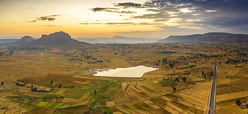
Aerial panoramic by drone of asphalt road crossing the inland area towards Gheralta Mountains, Dugem, Tigray Region, Ethiopia, Africa
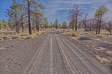
Fire Road 546 where it branches off from Sunset Crater National Monument into Coconino National Forest of Arizona, USA
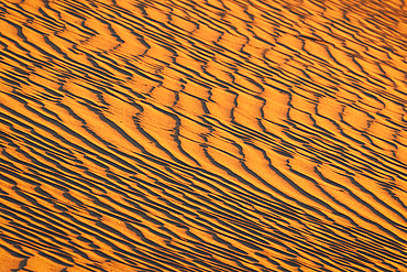
Details of the sand dunes at Mesquite Flat, Death Valley, California, United States of America, North America
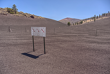
The boundary fence between Coconino National Forest and Sunset Crater National Monument of Arizona, USA
Petrified sand dunes, White Canyon State Park, Red Cliffs Desert Reserve near St. George, Utah, United States of America
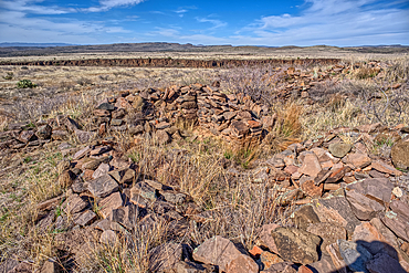
The Pueblo La Plata Indian Ruins near Silver Creek Canyon in the Agua Fria National Monument of Arizona. Located north of Black Canyon City
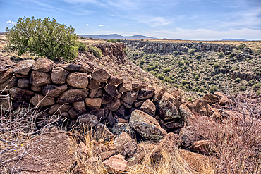
Ancient wall of the Fort Silver Indian Ruins overlooking Silver Creek Canyon in Agua Fria National Monument of Arizona
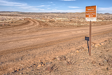
Road sign along Bloody Basin Road in the Agua Fria National Monument of Arizona directing the way to the Pueblo La Plata Indian Ruins
The primitive Bloody Basin Road winding thru the Agua Fria National Monument north of Black Canyon City Arizona
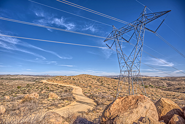
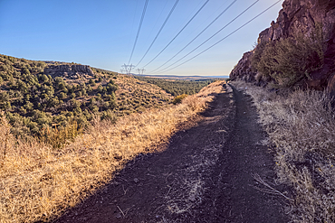
High Tension Power Lines stretching across Bloody Basin in Agua Fria National Monument north of Black Canyon City Arizona
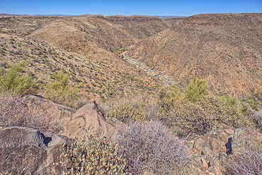
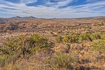
The Agua Fria River Canyon in the Agua Fria National Monument north of Black Canyon City Arizona, USA
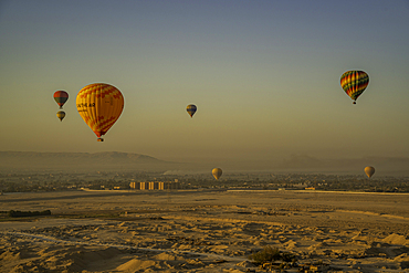
View of other balloons from hot air balloon over Luxor at sunrise, Luxor, Egypt, Africa
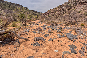
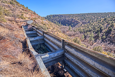
The granite riverbed of the Agua Fria River Canyon in the Agua Fria National Monument of Arizona.
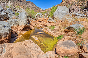
An ephemeral pool of water in the granite riverbed of the Agua Fria River Canyon in the Agua Fria National Monument of Arizona.
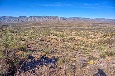
View of Black Canyon on the west side of the Agua Fria National Monument of Arizona with the Bradshaw Mountains in the distance.
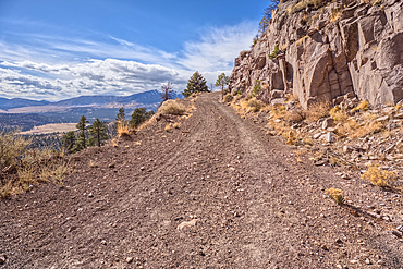
The Forest Service Road that leads to the summit of O'Leary Peak in the Coconino National Forest of Arizona.
Aerial view taken by drone of desert area near Capitol Reef National Park on a summer day, Hanksville, Utah, United States of America
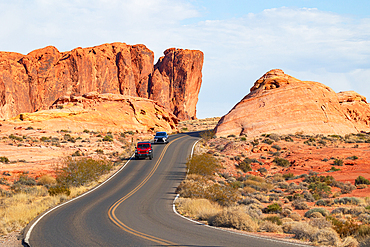
Two cars drive along the scenic road in Valley of Fire State Park on a sunny summer day, Nevada, United States of America
The boundary fence on the east side of Petrified Forest National Park, Arizona, United States of America
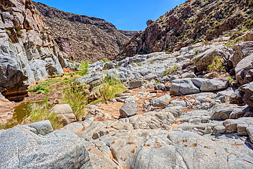
An island of rock in an unnamed canyon that leads to Dead Wash in Petrified Forest National Park, Arizona, United States of America
Boulder pile in a valley leading to Dead Wash in Petrified Forest National Park, Arizona, United States of America
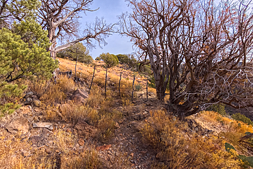
Boundary gate and cattle-proof fence between Coconino National Forest and Wet Beaver Creek Wilderness, Arizona, United States of America
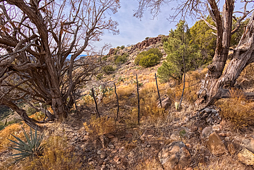
Boundary gate and cattle-proof fence between Coconino National Forest and Wet Beaver Creek Wilderness, Arizona, United States of America
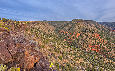
Casner Canyon in Wet Beaver Creek Wilderness viewed from White Mesa summit, in Coconino National Forest, Arizona, United States of America
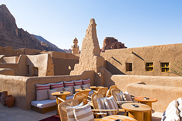
Terrace cafe at Dar Tantora The House Hotel, a renovated original mudbrick village in the oasis of AlUla, Medina Province, Saudi Arabia
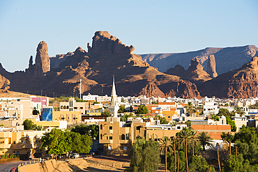
New neighborhoods of the Old town of AlUla, Medina Province, Saudi Arabia
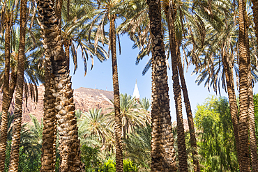
Date palm grove in the oasis of AlUla, Medina Province, Saudi Arabia

Thuraya Wellness lounge, Our Habitas AlUla, sustainable luxury resort in ancient oasis in canyons of Ashar Valley, Medina Province, Saudi Arabia
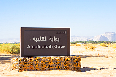
Alqaleebah Gate's sign of Sharaan Nature Reserve, AlUla, Medina Province, Saudi Arabia
Palm plantation colonized by invasive Sodom apple plant (Calotropis procera), Sharaan Nature Reserve, AlUla, Medina Province, Saudi Arabia
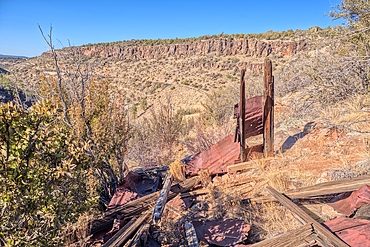
The remains of a Guard Shack above the Johnson Canyon Railroad Tunnel, Kaibab National Forest of Arizona, USA
High voltage power lines stretching across Johnson Canyon in the Kaibab National Forest of Arizona, USA
A metal retaining wall along the Johnson Canyon Railroad, Kaibab National Forest of Arizona, USA

Sport Utility Vehicle traveling on Forest Service Road 709 in the Kaibab National Forest of Arizona, USA

Sport Utility Vehicle traveling on Forest Service Road 709 in the Kaibab National Forest of Arizona, USA
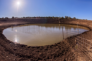
The Thirteen Mile Cattle Tank off of Corva Road in the Kaibab National Forest near Ash Fork Arizona, USA
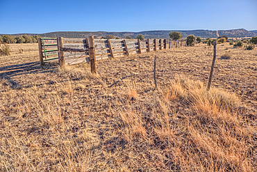
A livestock corral for the Thirteen Mile Cattle Tank off of Corva Road, Kaibab National Forest, Arizona, USA
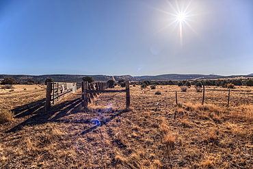
A livestock corral for the Thirteen Mile Cattle Tank off of Corva Road, Kaibab National Forest, Arizona, USA
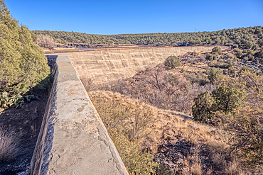
Johnson Canyon face of the Stone Dam in the Kaibab National Forest, Arizona, USA
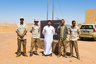
Guide and Ranger team of the Sharaan Nature Reserve, AlUla, Medina Province, Saudi Arabia

Helicopter on take-off area near the Maraya Theatre, in AlUla's Ashar Valley, Medina Province, Saudi Arabia

Helicopter on take-off area near the Maraya Theatre, in AlUla's Ashar Valley, Medina Province, Saudi Arabia
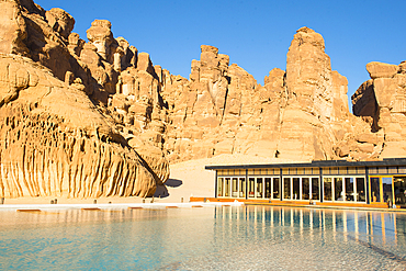
Swimming pool, surrounded by sandstone rock structures, Our Habitas AlUla, oasis in canyons of the Ashar Valley, Medina Province, Saudi Arabia
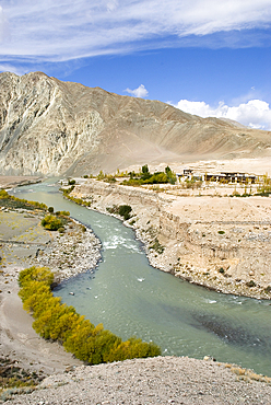
Indus River valley, Leh district, Ladakh region, state of Jammu and Kashmir, India, Asia

Meerkat (Suricata suricatta), Hertfordshire Zoo, United Kingdom
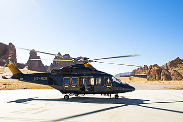
Helicopter on take-off area near the Maraya Theatre, in AlUla's Ashar Valley, Medina Province, Saudi Arabia
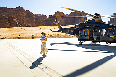
Helicopter on take-off area near the Maraya Theatre, in AlUla's Ashar Valley, Medina Province, Saudi Arabia
Aerial view of the Site of Hegra (Madain Salih), UNESCO, in the area of AlUla, Medina Province, Saudi Arabia
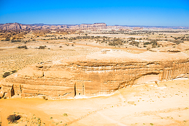
Aerial view of Jabal Ithlib area within Site of Hegra (Madain Salih), UNESCO, in the area of AlUla, Medina Province, Saudi Arabia
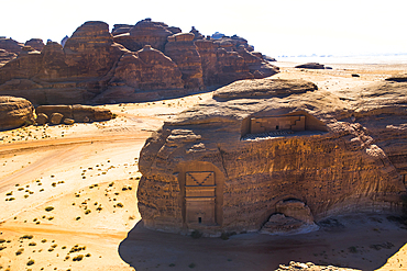
Aerial view of Qasr al-Farid, the largest tomb within Site of Hegra (Madain Salih), UNESCO, in the area of AlUla, Medina Province, Saudi Arabia
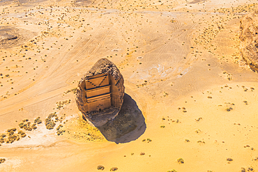
Aerial view of Qasr al-Farid, the largest tomb within Site of Hegra (Madain Salih), UNESCO, in the area of AlUla, Medina Province, Saudi Arabia
Aerial view of Qasr al-Farid, the largest tomb within Site of Hegra (Madain Salih), UNESCO, in the area of AlUla, Medina Province, Saudi Arabia
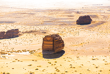
Aerial of tombs carved in sandstone rock of Jabal Banat (Qasr al-Bint), Hegra (Madain Salih), UNESCO, AlUla area, Medina Province, Saudi Arabia
Aerial of tombs carved in sandstone rock of Jabal Banat (Qasr al-Bint), Hegra (Madain Salih), UNESCO, AlUla area, Medina Province, Saudi Arabia
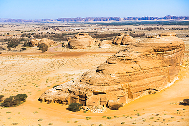
Aerial of tombs carved in sandstone rock of Jabal Banat (Qasr al-Bint), Hegra (Madain Salih), UNESCO, AlUla area, Medina Province, Saudi Arabia

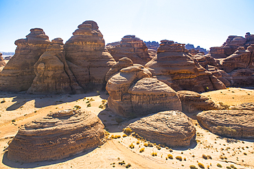
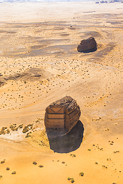
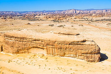
Aerial view of red sandstone formation, in the area of AlUla, Medina Province, Saudi Arabia
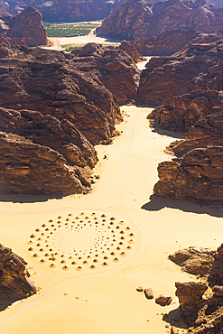
Aerial view of a work of land art in the middle of red sandstone formation, in the area of AlUla, Medina Province, Saudi Arabia
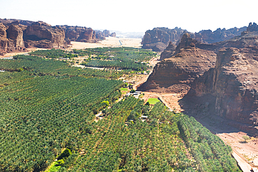
Aerial view of Palm grove and farms in the oasis of AlUla, Medina Province, Saudi Arabia
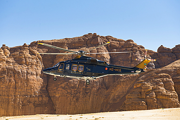
Helicopter approaching the landing area near the Maraya Theatre, in AlUla's Ashar Valley, Medina Province, Saudi Arabia