Results
« Previous 1 … 8 9 10 11 12 … 16 Next »
1537 results found
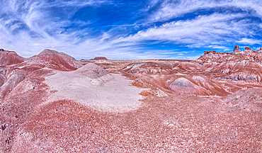
A small hill of gray bentonite clay that appears to be melting into the purple bentonite of Hamilili Valley on the south end of Petrified Forest National Park, Arizona, United States of America, North America
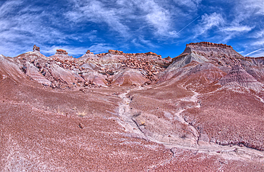
Crumbling cliffs of a mesa near Hamilili Point in Petrified Forest, Arizona, United States of America, North America
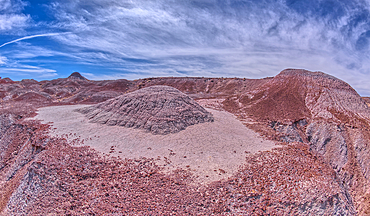
A small hill of gray bentonite clay that appears to be melting into the purple bentonite of Hamilili Valley on the south end of Petrified Forest National Park, Arizona, United States of America, North America
The summit of Haystack Mesa in Petrified Forest National Park, Arizona, United States of America, North America
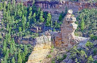
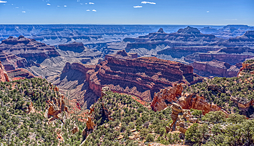
View of the formation called Duck On A Rock in the afternoon, Grand Canyon National Park, UNESCO World Heritage Site, Arizona, United States of America, North America
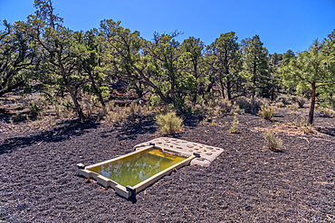
A water catchment in the Coconino National Forest, Sunset Crater National Monument, Arizona, USA
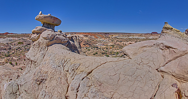
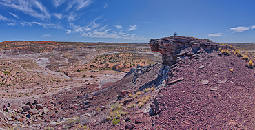
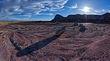
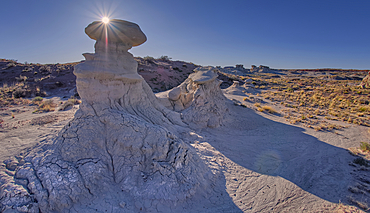
Mushroom shaped sandstone spire on an eroded ridge west of Hamilili Point in Petrified Forest National Park, Arizona, United States of America, North America
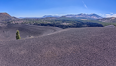
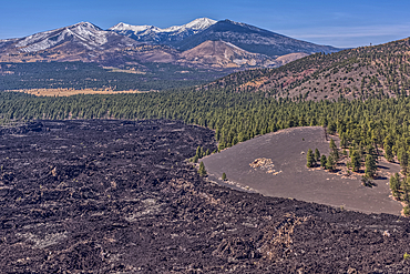
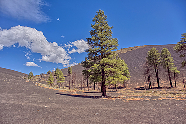
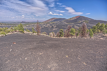
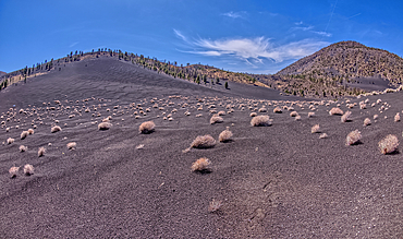
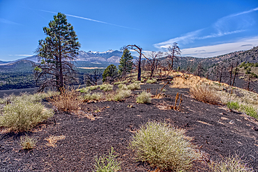
Volcanic cinder rim in Coconino National Forest, Arizona, USA
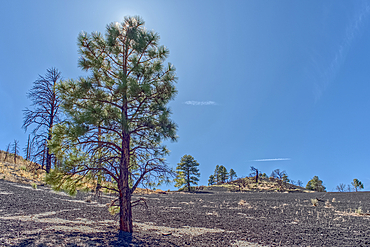
Volcanic cinder hill in Coconino National Forest, Arizona, USA
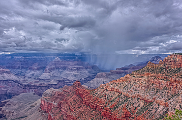
A rain storm over the North Rim of Grand Canyon National Park, Arizona, USA
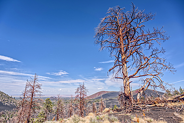
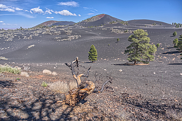
Burned trees on a Volcanic cinder rim in Coconino National Forest, Arizona, USA
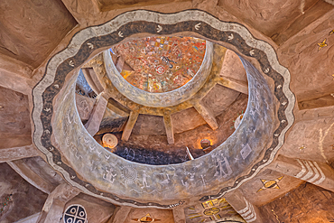
An interior view of the historic Desert View Watchtower at Grand Canyon South Rim, artwork created by Fred Kobotie in 1933, now owned by the National Park Service, UNESCO World Heritage Site, Arizona, United States of America, North America
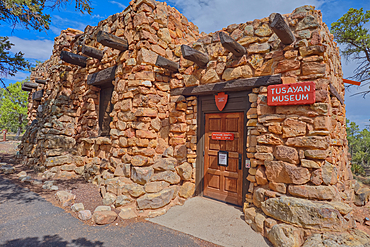
The Tusayan Museum building at Grand Canyon South Rim, Arizona, United States of America, North America

The Kiva of the ancient Tusayan Ruins at Grand Canyon South Rim, UNESCO World Heritage Site, Arizona, United States of America, North America
The point where Fuller Canyon Road divides in Grand Canyon North Rim Arizona. Left fork leads to Point Imperial. Right fork leads to Cape Royal.
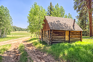
An abandoned homestead in the Kaibab National Forest off of Highway 67 north of Grand Canyon North Rim Arizona. Public land. No property release needed. Preserved by Forest Service as a historical landmark.
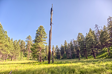
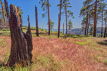
A burned tree in a grassy meadow in a valley near Clear Creek Canyon at Grand Canyon North Rim Arizona.
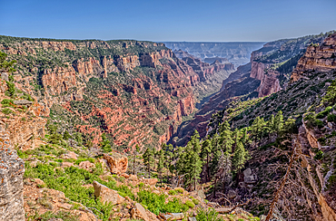
View of Clear Creek Canyon from its north cliffs at Grand Canyon North Rim Arizona.
Burned trees on the north end of Clear Creek Canyon at Grand Canyon North Rim Arizona.
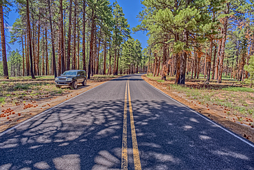
An SUV parked along Cape Royal Road at Grand Canyon North Rim Arizona.
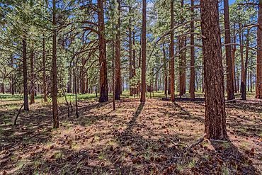
The forest of Grand Canyon North Rim Arizona near the edge of Clear Creek Canyon.
Upper section of Bear Canyon facing south, located in northeastern section of Prescott National Forest near Drake, Arizona, United States of America, North America
Humphrey's Peak, Coconino National Forest, Arizona, USA
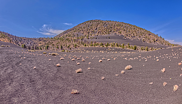
Volcanic cinder hills in Coconino National Forest, Arizona, USA
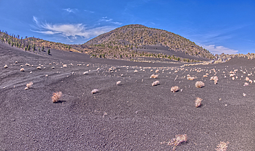
Volcanic cinder hills in Coconino National Forest, Arizona, USA
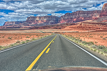
Vermilion Cliffs National Monument, Arizona, USA
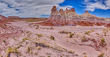
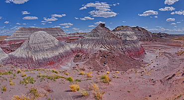
Tall hoodoo towers in the valley below Blue Mesa in Petrified Forest National Park, Arizona, United States of America, North America
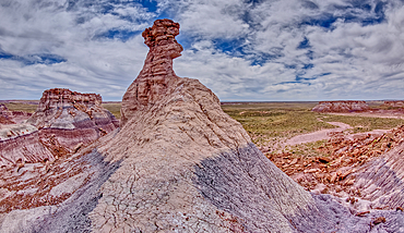
A hoodoo spire shaped like a Horse Head, in the valley below Blue Mesa of Petrified Forest National Park, Arizona, United States of America, North America
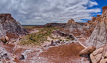
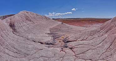
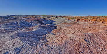
A valley below the east cliffs of Blue Mesa in Petrified Forest National Park, Arizona, United States of America, North America
The Billings Gap Overlook on the east side of Blue Mesa in Petrified Forest National Park, Arizona, United States of America, North America
The Billings Gap Overlook on the east side of Blue Mesa in Petrified Forest National Park, Arizona, United States of America, North America
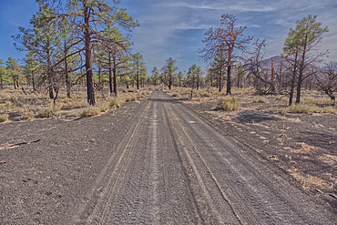
Fire Road 546 where it branches off from Sunset Crater National Monument into Coconino National Forest of Arizona, USA
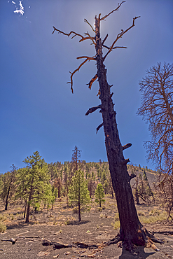
A burned tree below a volcanic cinder hill in the Coconino National Forest, Arizona, USA
Volcanic cinder hills in Coconino National Forest, Arizona, USA
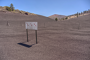
The boundary fence between Coconino National Forest and Sunset Crater National Monument of Arizona, USA
Volcanic cinder hills in Coconino National Forest, Arizona, USA
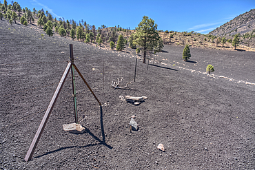
The boundary fence between Coconino National Forest and Sunset Crater National Monument of Arizona.
Volcanic cinder hills in Coconino National Forest, Arizona, USA
The Little Teepees on the north side of Haystack Mesa in Petrified Forest National Park, Arizona, United States of America, North America

Hawksbill sea turtle (Eretmochelys imbricata), a critically endangered species, feeding on soft coral, side view, South Ari Atoll, Maldives.
East slopes of Haystack Mesa in Petrified Forest National Park, Arizona, United States of America, North America
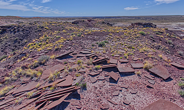
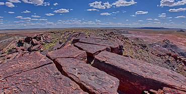
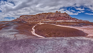
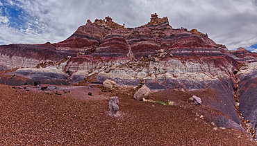
Slabs of brown sandstone on the summit of Crystal Mesa west of Hamilili Point in Petrified Forest National Park, Arizona, United States of America, North America
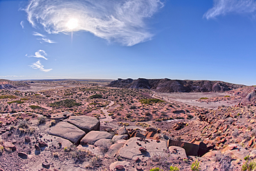
View from the summit of Crystal Mesa west of Hamilili Point in Petrified Forest National Park, Arizona, United States of America, North America
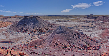
The south Haystack Hill in Petrified Forest National Park, Arizona, United States of America, North America
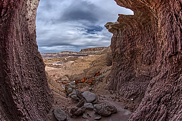
A shallow cave carved out of a cliff wall below the Blue Mesa in Petrified Forest National Park, Arizona, United States of America, North America
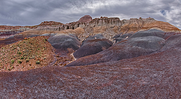
Hoodoo filled cliffs on the north side of Blue Mesa in Petrified Forest National Park, Arizona, United States of America, North America
The east cliffs of Blue Mesa near sunset, Petrified Forest National Park, Arizona, United States of America, North America
Billings Gap Overlook on Blue Mesa towards sunset, Petrified Forest National Park, Arizona, United States of America, North America
View of Anvil Hill and Crystal Butte from the summit of Crystal Mesa west of Hamilili Point in Petrified Forest National Park, Arizona, United States of America, North America
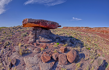
A rock table sculpted by the wind on Crystal Mesa west of Hamilili Point in Petrified Forest National Park, Arizona, United States of America, North America
View of Crystal Mesa west of Hamilili Point in Petrified Forest National Park, Arizona, United States of America, North America
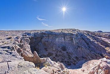
A dry waterfall west of Hamilili Point in Petrified Forest National Park, Arizona, United States of America, North America
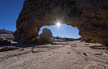
A small bentonite arch in Goblin Garden west of Hamilili Point in Petrified Forest National Park, Arizona, United States of America, North America
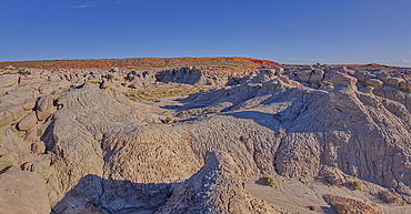
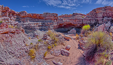
Goblin Garden west of Hamilili Point in Petrified Forest National Park, Arizona, United States of America, North America
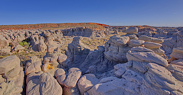
Goblin Garden west of Hamilili Point in Petrified Forest National Park, Arizona, United States of America, North America
Goblin Garden west of Hamilili Point in Petrified Forest National Park, Arizona, United States of America, North America
Goblin Garden west of Hamilili Point in Petrified Forest National Park, Arizona, United States of America, North America
Goblin Garden west of Hamilili Point in Petrified Forest National Park, Arizona, United States of America, North America
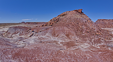
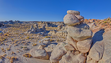
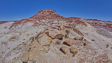
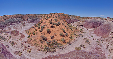
Anvil Hill west of Hamilili Point in Petrified Forest National Park, Arizona, United States of America, North America
Gray clay flats below Anvil Hill west of Hamilili Point in Petrified Forest National Park, Arizona, United States of America, North America
A dry waterfall in Crystal Creek below Crystal Mesa west of Hamilili Point in Petrified Forest National Park, Arizona, United States of America, North America
A sloping red sand dune above Hamilili Wash in Petrified Forest National Park, Arizona, United States of America, North America
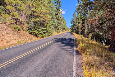
Cape Royal Road winding through Fuller Canyon at Grand Canyon North Rim, UNESCO, Arizona, United States of America
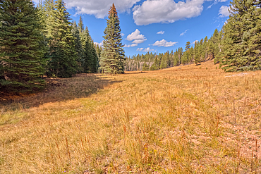
A meadow in Fuller Canyon off Cape Royal Road at Grand Canyon North Rim, Arizona, United States of America
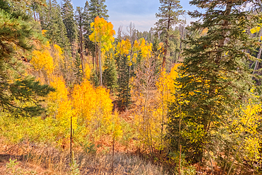
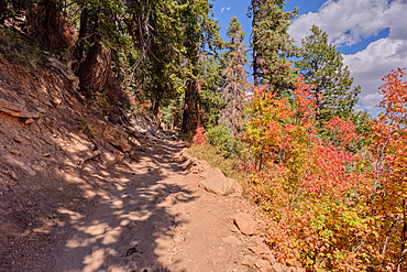
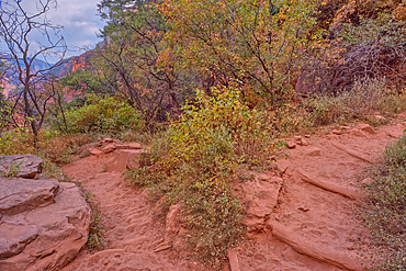
Autumn colored Aspen trees off Cape Royal Road in Grand Canyon North Rim, UNESCO, Arizona, United States of America
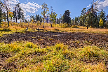
Greenland Lake reduced to a mud hole, Grand Canyon North Rim, UNESCO, Arizona, United States of America

Aspen trees in autumn colors east of Greenland Lake, Grand Canyon North Rim, Arizona, United States of America
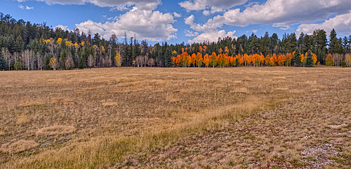
Deciduous trees with yellow and orange fall colors mixed with green Pine Trees, Kaibab National Forest, Arizona, United States of America
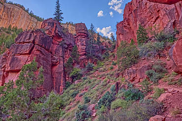
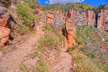
Red Wall cliffs of Roaring Springs Canyon on North Kaibab Trail, Grand Canyon North Rim, UNESCO, Arizona, United States of America
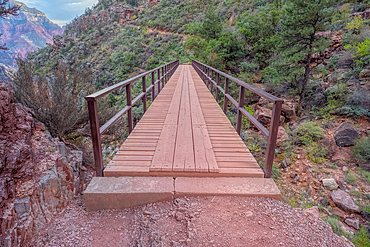
Red Wall Bridge crossing Roaring Springs Canyon on North Kaibab Trail, Grand Canyon North Rim, UNESCO, Arizona, United States of America
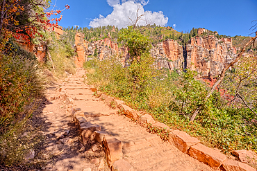
Looking back up the first leg of the North Kaibab Trail at Grand Canyon North Rim, UNESCO, Arizona, United States of America
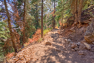
The upper leg of the North Kaibab Trail at Grand Canyon North Rim, UNESCO, Arizona, United States of America

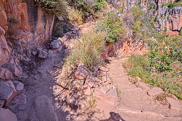
The Coconino Overlook along the North Kaibab Trail at Grand Canyon North Rim, UNESCO, Arizona, United States of America
The 11th switchback along the North Kaibab Trail at Grand Canyon North Rim, UNESCO, Arizona, United States of America
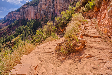
The 12th switchback along the North Kaibab Trail at Grand Canyon North Rim, UNESCO, Arizona, United States of America
The 17th switchback along the North Kaibab Trail at Grand Canyon North Rim, UNESCO, Arizona, United States of America
The 18th switchback along the North Kaibab Trail at Grand Canyon North Rim, UNESCO, Arizona, United States of America
The 23rd switchback along the North Kaibab Trail at Grand Canyon North Rim, UNESCO, Arizona, United States of America
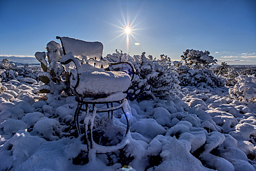
Snow covered landscape, Chino Valley, Arizona, USA
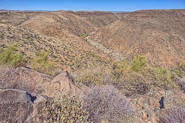
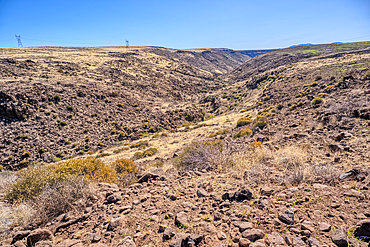
The Agua Fria River Canyon in the Agua Fria National Monument north of Black Canyon City Arizona, USA
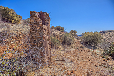
Remnants of the Richinbar Mine within the Agua Fria National Monument, Black Canyon City, Arizona, USA
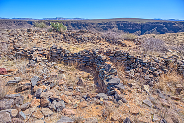
Ancient Indian Ruins near the historic Richinbar Mine in the Agua Fria National Monument, Black Canyon City, Arizona, USA
An unnamed tributary canyon near the Sunset Point Rest Stop, Arizona, USA
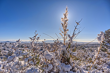
Snow covered landscape, Chino Valley, Arizona, USA
Volcanic cinder hills in Coconino National Forest, Arizona, USA
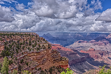
A rain storm over the North Rim of Grand Canyon National Park, Arizona, USA
Burned trees on a Volcanic cinder rim in Coconino National Forest, Arizona, USA
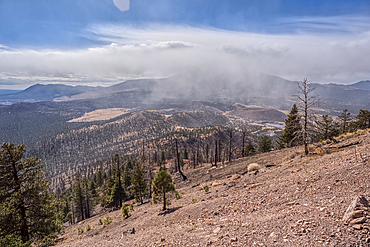
A snow squall storm building up over Humphrey's Peak. Viewed from O'Leary Peak in the Coconino National Forest of Arizona. Adjacent to Sunset Crater National Monument.
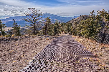
End of the Forest Service Road that leads to the O'Leary Peak Watchtower and Overlook. The metal grating is to add traction for vehicles. Adjacent to Sunset Crater National Monument Arizona in the Coconino National Forest.
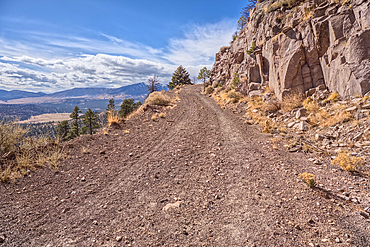
The Forest Service Road that leads to the summit of O'Leary Peak in the Coconino National Forest of Arizona.
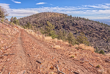
The eastern summit of O'Leary Peak in the Coconino National Forest of Arizona. Adjacent to the Sunset Crater National Monument.
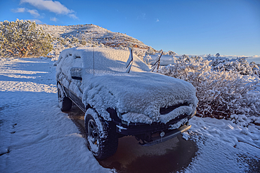
A snow covered vehicle from a late winter storm, Chino Valley, Arizona, USA
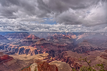
Rainy skies over the North Rim of Grand Canyon National Park, Arizona, USA
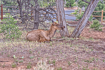
A female Elk relaxing under a tree, Yavapai Point, Grand Canyon South Rim, Arizona, USA
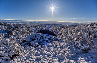
Snow covered landscape, Chino Valley, Arizona, USA
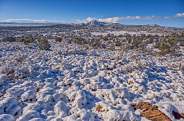
Snow covered landscape, Chino Valley, Arizona, USA
View of Thor's Temple south of Honan Point, Grand Canyon National Park, Arizona, USA
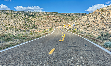
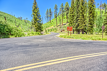
Highway US89A ascending onto the Kaibab Plateau, Arizona, USA
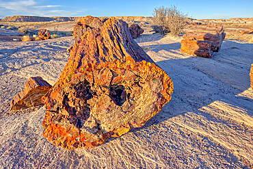
The Giant Petrified Logs of Petrified Forest National Park, located along a trail behind the Rainbow Museum, Arizona, United States of America, North America
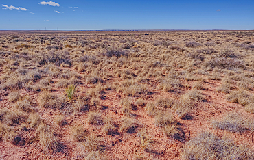
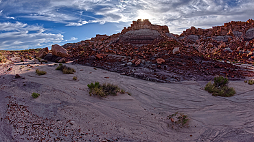
The grassland prairie near Dead Wash in Petrified Forest, Arizona, United States of America