Results
« Previous 1 … 6 7 8 9 10 … 16 Next »
1537 results found
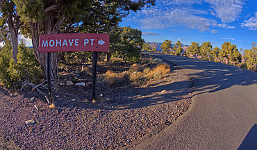
A sign marking the one way entrance to Mohave Point off of Hermit Road, Grand Canyon, UNESCO World Heritage Site, Arizona, United States of America, North America
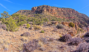
A look back at the cliffs of Hermits Rest, the Hermit Trailhead starts on the cliff line to the upper left of the photo, viewed from 1000 feet off of the official trail, Grand Canyon, Arizona, United States of America, North America
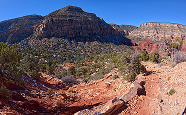
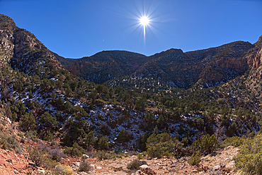
The very rocky pathway of the unmaintained Hermit Canyon Trail at Grand Canyonin winter with Waldron Canyon on the left in the distance, Grand Canyon, Arizona, United States of America, North America
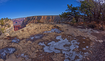
Frozen water puddles along the cliffs of Grand Canyon east of the Monument Creek Vista, Grand Canyon National Park, UNESCO World Heritage Site, Arizona, United States of America, North America

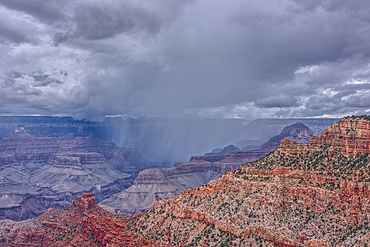
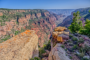
The Great Mohave Wall at Grand Canyon viewed just west of Monument Creek, part of the canyon below this cliff wall, Grand Canyon National Park, UNESCO World Heritage Site, Arizona, United States of America, North America
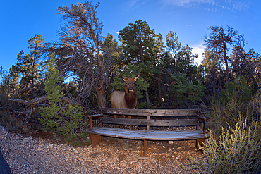
A female Elk that came out of the forest along the Greenway Trail that runs between Pima Point and Monument Creek Vista, Grand Canyon, Arizona, United States of America, North America
View of Waldron Canyon southwest of Hermit Canyon in winter, accessible via Hermit Trail, Grand Canyon, Arizona, United States of America, North America

Off trail view of Waldron Canyon southwest of Hermit Canyon in winter, accessible via Hermit Trail to the Waldron Trail Junction, Grand Canyon, Arizona, United States of America, North America
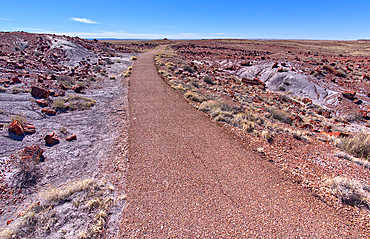
The paved trail that leads to the historic Agate House in Petrified Forest National Park, Arizona, United States of America, North America
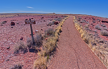
A warning sign to stay on the trail to the historic Agate House in Petrified Forest National Park, Arizona, United States of America, North America
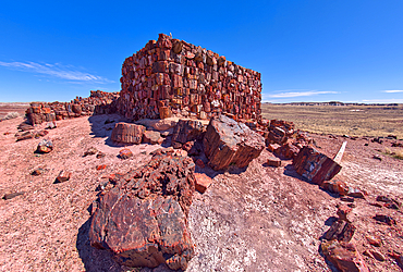
Closeup of the historic Agate House in Petrified Forest National Park, Arizona, United States of America, North America
A warning sign to stay on the trail to the historic Agate House in Petrified Forest National Park, Arizona, United States of America, North America
A divide in the trail loop for the Giant Logs trail at Petrified Forest National Park with the Rainbow Forest Museum on upper left, Arizona, United States of America, North America
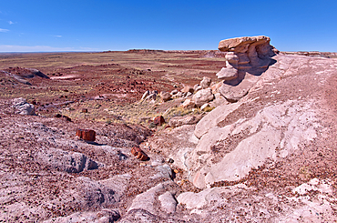
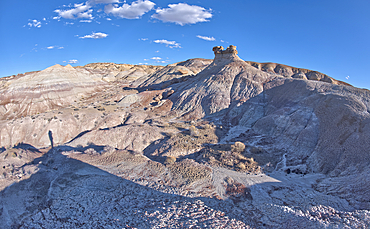
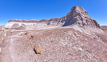
A scenic overlook on the west side of the Giant Logs Trail at Petrified Forest National Park, Arizona, United States of America, North America
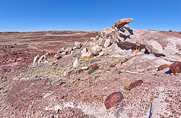
A scenic overlook on the west side of the Giant Logs Trail at Petrified Forest National Park, Arizona, United States of America, North America
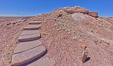
Steps along the Giant Logs Trail leading to a scenic overlook in Petrified Forest National Park, Arizona, United States of America, North America
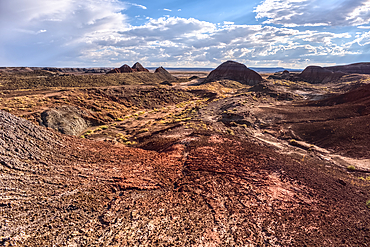
Hills of purple and gray bentonite near Hamilili Point on the south end of Petrified Forest National Park, Arizona, United States of America, North America
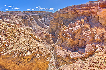
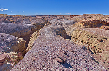
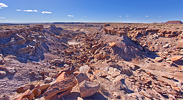
A deep canyon eroded thru the hills of purple and gray bentonite clay near Hamilili Point on the south end of Petrified Forest National Park, Arizona, United States of America, North America
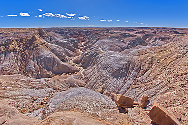
A deep canyon eroded thru the hills of purple and gray bentonite clay near Hamilili Point on the south end of Petrified Forest National Park, Arizona, United States of America, North America
Purple badlands of bentonite near Hamilili Point on the south end of Petrified Forest National Park, Arizona, United States of America, North America
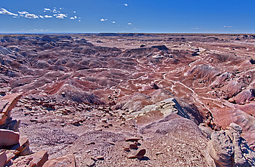
Purple badlands of bentonite near Hamilili Point on the south end of Petrified Forest National Park, Arizona, United States of America, North America
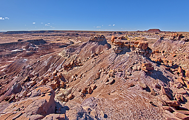
Rock islands above the purple badlands near Hamilili Point on the south end of Petrified Forest National Park, Arizona, United States of America, North America
Rock islands just off a mesa near Hamilili Point on the south end of Petrified Forest National Park, Arizona, United States of America, North America
The crumbling cliffs of a mesa near Hamilili Point on the south end of Petrified Forest National Park, Arizona, United States of America, North America
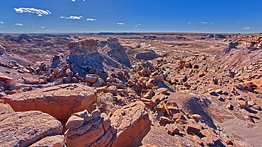
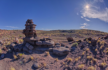
A solitary rock hoodoo in the purple badlands near Hamilili Point on the south end of Petrified Forest National Park, Arizona, United States of America, North America
A solitary rock hoodoo in the purple badlands near Hamilili Point on the south end of Petrified Forest National Park, Arizona, United States of America, North America
A solitary rock hoodoo in the purple badlands near Hamilili Point on the south end of Petrified Forest National Park, Arizona, United States of America, North America
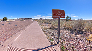
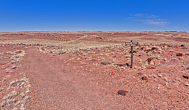
A sign along the main road pointing the way to the Long Logs Trail, and Agate House, Petrified Forest National Park, Arizona, United States of America, North America
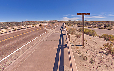
Sign along the path to the Long Logs Trail, marking the Jim Camp Wash along the main road of Petrified Forest National Park, Arizona, United States of America, North America

The sun shade shelter along the Long Logs Trail at Petrified Forest National Park, Arizona, United States of America, North America
View of a bentonite hill along the Long Logs Trail in Petrified Forest National Park, Arizona, United States of America, North America

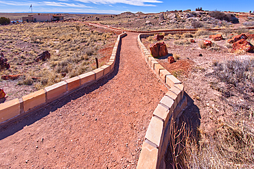
A circular walkway for the Long Logs Trail in Petrified Forest National Park, Arizona, United States of America, North America
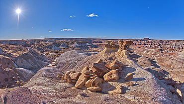
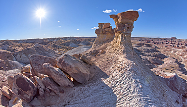
A lone hoodoo rock on the edge of a ridge overlooking the Jim Camp Wash on the south end of Petrified Forest National Park, Arizona, United States of America, North America
A cliff overhang shaped like the head of a Duck west of Hamilili Point on the south end of Petrified Forest National Park, Arizona, United States of America, North America
Sandstone that has been eroded into forms that resemble clam shells on the south end of Petrified Forest National Park, Arizona, United States of America, North America
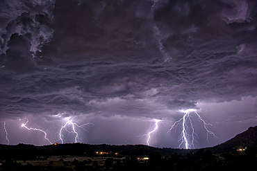
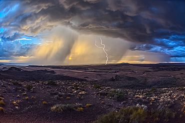
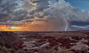
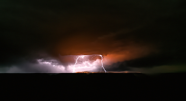
A long exposure capturing multiple lightning strikes on August 14th, 2025 on the south side of Sullivan Butte in Chino Valley Arizona.
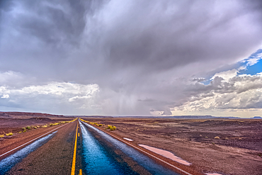
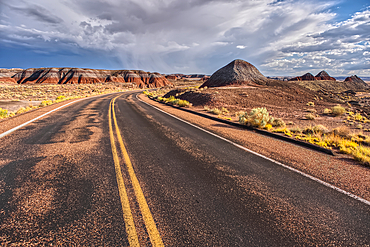
The main road thru Petrified Forest National Park Arizona on a rainy day.
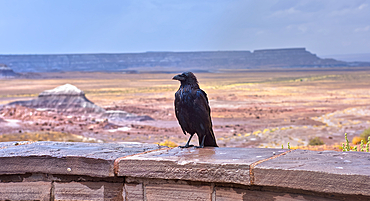
A wild and wet Raven standing on a stone wall at the Jasper Forest overlook in Petrified Forest Arizona during a rainstorm.
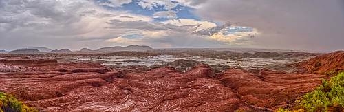
A heavy rainstorm over a section of Petrified Forest National Park Arizona called the Flattops. Because the rain was falling at the time of this photo some falling rain has been captured in the photo.
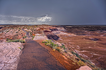
A storm approaching Blue Mesa in Petrified Forest National Park Arizona.
A paved trail leading below Blue Mesa in Petrified Forest National Park Arizona.
A paved trail leading below Blue Mesa in Petrified Forest National Park Arizona on a rainy day.
A paved trail leading below Blue Mesa in Petrified Forest National Park Arizona on a rainy day.
A storm approaching Blue Mesa in Petrified Forest National Park Arizona.
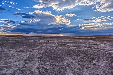
A desolate barren valley of rock and sand in Petrified Forest National Park Arizona just west of Blue Mesa.
A desolate barren valley of rock and sand in Petrified Forest National Park Arizona just west of Blue Mesa.
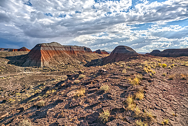
Northside view of the Teepees at Petrified Forest National Park Arizona.
Northside view of the Teepees at Petrified Forest National Park Arizona.
Northside view of the Teepees at Petrified Forest National Park Arizona.
Main road leading to the Teepees at Petrified Forest National Park Arizona.
Building storm approaching Petrified Forest National Park Arizona. Viewed from a gray plain south of the Teepees.
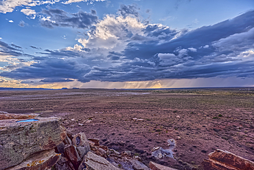
Building storm approaching Petrified Forest National Park Arizona. Viewed from the Newspaper Rock Overlook.
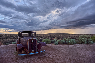
An old Model-T marking historic Route-66 in Petrified Forest National Park Arizona with an approaching storm in the background.
Storm approaching Petrified Forest National Park Arizona. Viewed from Whipple Point.
Storm approaching Petrified Forest National Park Arizona. Viewed from Nizhoni Point.
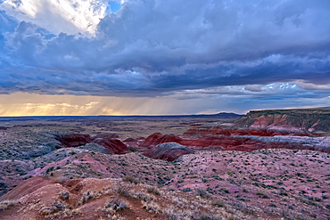
Storm approaching Petrified Forest National Park Arizona. Viewed from Pintado Point near sunset.
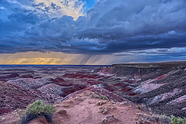
Storm approaching Petrified Forest National Park Arizona. Viewed from Kachina Point near sunset.
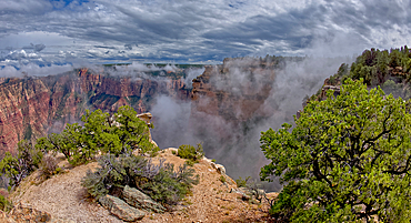
Steamlike fog rising out of Grand Canyon South Rim just east of Grandview Point, Grand Canyon National Park, UNESCO World Heritage Site, Arizona, United States of America, North America
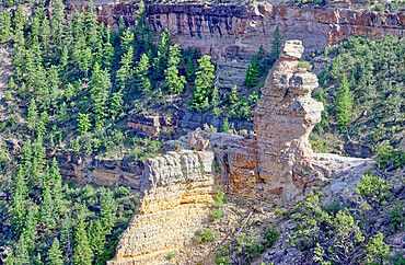
View of the formation called Duck On A Rock in the afternoon, Grand Canyon National Park, UNESCO World Heritage Site, Arizona, United States of America, North America
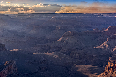
Echo Cliffs near Marble Canyon Arizona enshrouded with smoke from the Dragon Bravo Wildfire burning on Grand Canyon North Rim.
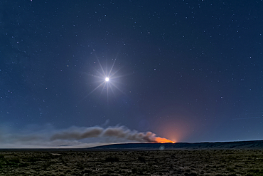
Dragon Bravo Wildfire on Grand Canyon North Rim viewed from US89A near Vermilion Cliffs Arizona at night under moonlight.
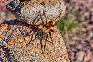
A male Tarantula native to the Chino Valley area of Arizona crawling on rocks. This is a male because the females hide underground and don't roam around like the males.
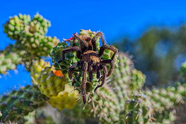
A male Tarantula native to the Chino Valley area of Arizona crawling on a cactus. This is a male because the females hide underground and don't roam around like the males.

A male Tarantula native to the Chino Valley area of Arizona crawling on a cactus. This is a male because the females hide underground and don't roam around like the males.
Dragon Bravo wildfire burning on the North Rim of Grand Canyon Arizona with a lightning storm. Viewed from Yavapai Point on the South Rim at night. The fire started from a lightning strike on July 4th, 2025.
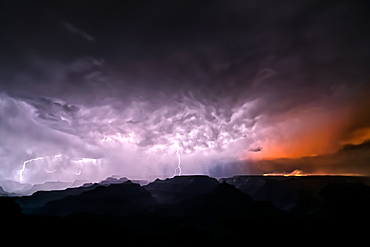
Dragon Bravo wildfire burning on the North Rim of Grand Canyon Arizona with a lightning storm. Viewed from Yavapai Point on the South Rim at night. The fire started from a lightning strike on July 4th, 2025.
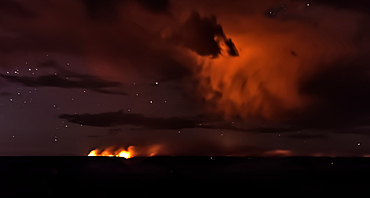
Dragon Bravo wildfire burning on the North Rim of Grand Canyon Arizona. Viewed from Pipe Creek Vista on the South Rim at night. The fire started from a lightning strike on July 4th, 2025. Due to high winds and long exposure time there is motion blur.
Smoke from the Dragon Bravo wildfire burning on the North Rim of Grand Canyon Arizona. Viewed from Shoshone Point on the South Rim. The fire started from a lightning strike on July 4th, 2025.
Smoke from the Dragon Bravo wildfire burning on the North Rim of Grand Canyon Arizona. Viewed from Shoshone Point on the South Rim. The fire started from a lightning strike on July 4th, 2025.
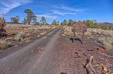
Fire Road 546 where it branches off from Sunset Crater National Monument into Coconino National Forest of Arizona, USA
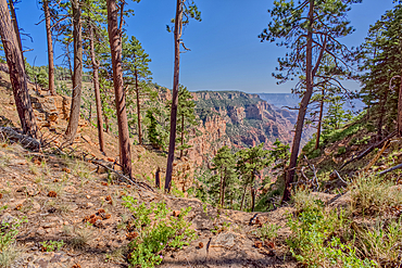
A rain storm over the North Rim of Grand Canyon National Park, Arizona, USA
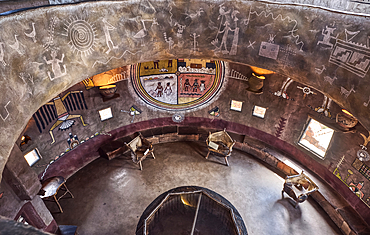
Downward view from the second floor in historic Desert View Watchtower at Grand Canyon South Rim, artwork created by Fred Kobotie in 1933, now owned by the National Park Service, UNESCO World Heritage Site, Arizona, United States of America, North America
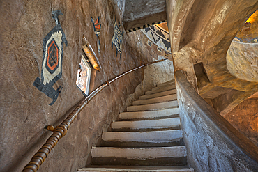
Stairs up to the third floor in the historic Desert View Watchtower at Grand Canyon South Rim, artwork created by Fred Kobotie in 1933, now owned by the National Park Service, UNESCO World Heritage Site, Arizona, United States of America, North America

Stairs up to the seconnd floor in the historic Desert View Watchtower at Grand Canyon South Rim, artwork created by Fred Kobotie in 1933, now owned by the National Park Service, UNESCO World Heritage Site, Arizona, United States of America, North America

The top floor of the historic Watchtower at Grand Canyon South Rim, Grand Canyon, UNESCO World Heritage Site, Arizona, United States of America, North America

The main house of the ancient Tusayan Ruins at Grand Canyon South Rim, UNESCO World Heritage Site, Arizona, United States of America, North America
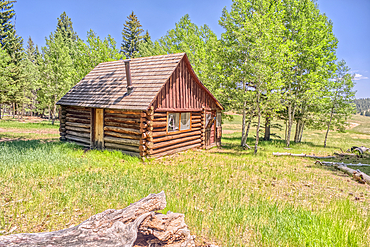
An abandoned homestead in the Kaibab National Forest off of Highway 67 north of Grand Canyon North Rim Arizona. Public land. No property release needed. Preserved by Forest Service as a historical landmark.
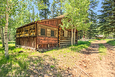
An abandoned homestead in the Kaibab National Forest off of Highway 67 north of Grand Canyon North Rim Arizona. Public land. No property release needed. Preserved by Forest Service as a historical landmark.
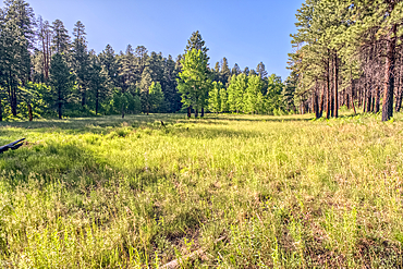
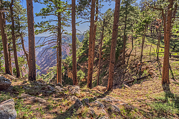
A grassy meadow in a valley near Clear Creek Canyon at Grand Canyon North Rim Arizona.
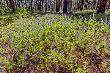
A field of purple wildflowers called Lupine at Grand Canyon North Rim Arizona near Clear Creek Canyon. Species Lupinus in the family Fabaceae.
View of Clear Creek Canyon from its north cliffs at Grand Canyon North Rim Arizona.
Dry Waterfall on the north end of Clear Creek Canyon at Grand Canyon North Rim Arizona.
Dry Waterfall on the north end of Clear Creek Canyon at Grand Canyon North Rim Arizona.
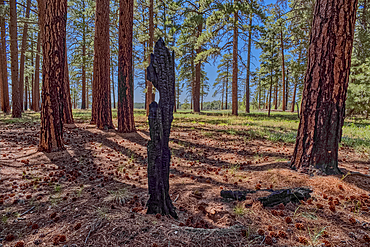
Burned tree in the forest of Grand Canyon North Rim Arizona near the edge of Clear Creek Canyon.
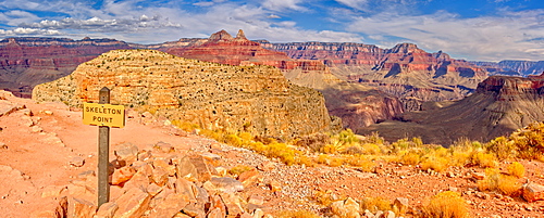
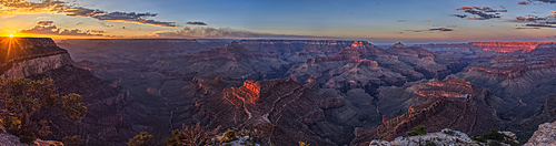
Grand Canyon view from Skeleton Point along the South Kaibab Trail on the south rim, Grand Canyon National Park, UNESCO World Heritage Site, Arizona, United States of America, North America
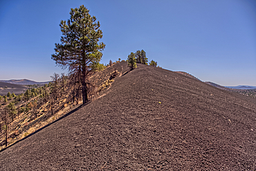
Volcanic cinder hills in Coconino National Forest, Arizona, USA
The southeast summit of O'Leary Peak, Coconino National Forest, Arizona, USA
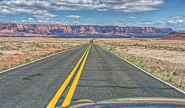
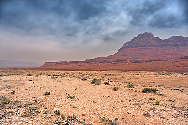
Vermilion Cliffs National Monument, Arizona, USA
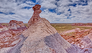
A hoodoo spire shaped like a Horse Head, in the valley below Blue Mesa of Petrified Forest National Park, Arizona, United States of America, North America
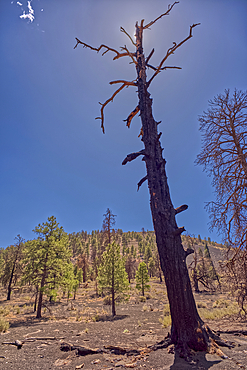
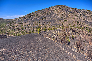
A burned tree below a volcanic cinder hill in the Coconino National Forest, Arizona, USA
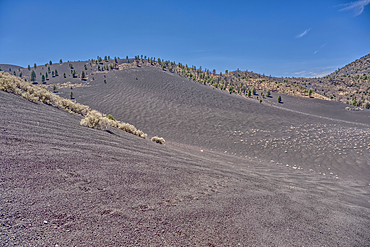
Volcanic cinder hills in Coconino National Forest, Arizona, USA
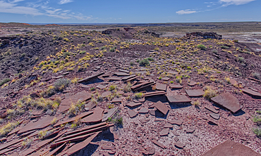
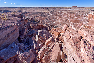
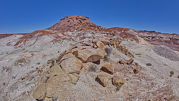
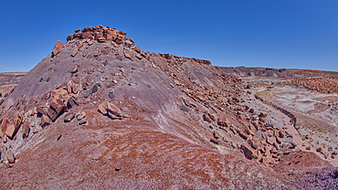
Slabs of brown sandstone on the summit of Crystal Mesa west of Hamilili Point in Petrified Forest National Park, Arizona, United States of America, North America
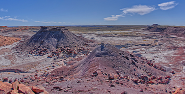
View of Anvil Hill and Crystal Butte from the summit of Crystal Mesa west of Hamilili Point in Petrified Forest National Park, Arizona, United States of America, North America
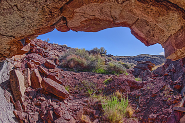
A cliff cave below Crystal Mesa west of Hamilili Point in Petrified Forest National Park, Arizona, United States of America, North America
A rock spire sculpted by the wind on Crystal Mesa west of Hamilili Point in Petrified Forest National Park, Arizona, United States of America, North America
Gray clay flats below Anvil Hill west of Hamilili Point in Petrified Forest National Park, Arizona, United States of America, North America
Crystal Mesa above Crystal Creek west of Hamilili Point in Petrified Forest National Park, Arizona, United States of America, North America
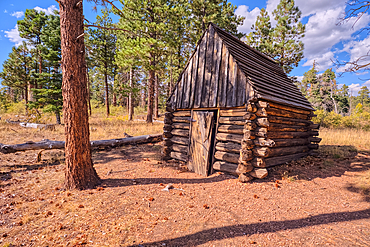
The historic Salt Cabin dating back to 1870s near Greenland Lake at Grand Canyon North Rim, UNESCO, Arizona, United States of America
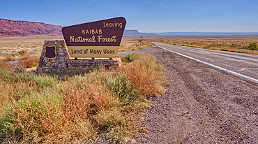
Highway US89A looking east to Vermilion Cliffs National Monument with Kaibab National Forest boundary sign, Arizona, United States of America
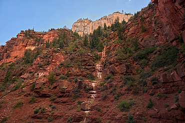
Ephemeral Spring on Red Wall of Roaring Springs Canyon, North Kaibab Trail, Grand Canyon North Rim, UNESCO, Arizona, United States of America