Results
« Previous 1 … 8 9 10 11 12 … 21 Next »
2001 results found
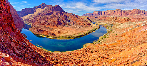
Bend in Colorado River near Lee's Ferry, Glen Canyon Recreation Area, Vermilion Cliffs National Monument in background, Arizona, United States of America, North America
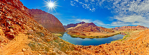
Bend in Colorado River near Lee's Ferry, Glen Canyon Recreation Area, Vermilion Cliffs National Monument in background, Arizona, United States of America, North America
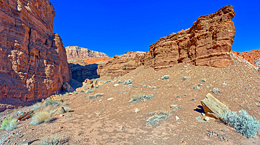
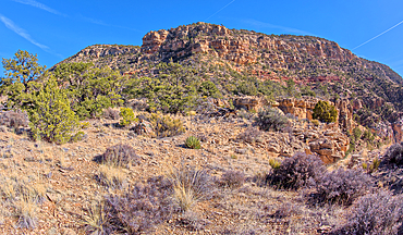
Cliffs of Chocolate Canyon at Vermilion Cliffs National Monument, Arizona, United States of America, North America
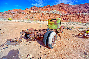
Antique truck at Lonely Dell Ranch, Vermilion Cliffs National Monument, Arizona, United States of America, North America
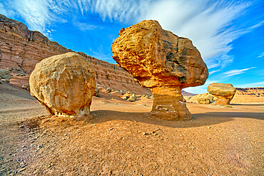
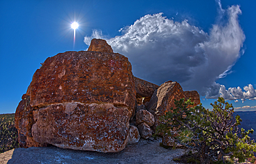
Balanced boulders at the base of Vermilion Cliffs in Glen Canyon Recreation Area, Arizona, United States of America, North America

Cattle Tank viewed from Woodchute Mountain Trail, located in Prescott National Forest with Prescott in the background, Arizona, United States of America, North America

Love Locks spelling the word LOVE, The Distillery District, Toronto, Ontario, Canada, North America

Love Locks attached to a wall, The Distillery District, Toronto, Ontario, Canada, North America
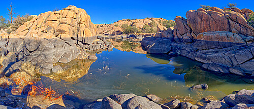
Reflective lagoon along East Bay Trail of Willow Lake, gray line on rock is where the water level used to be, Prescott, Arizona, United States of America, North America
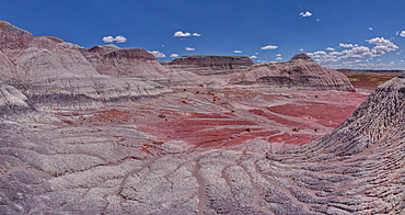
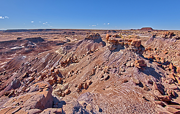
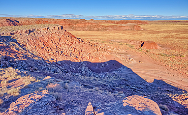
Hoodoo formations in the Devil's Playground in Petrified Forest National Park, Arizona, United States of America, North America

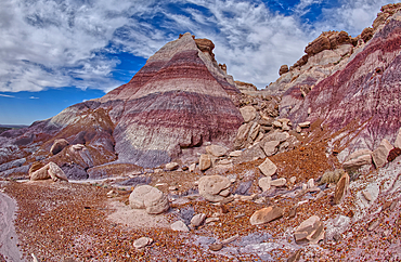
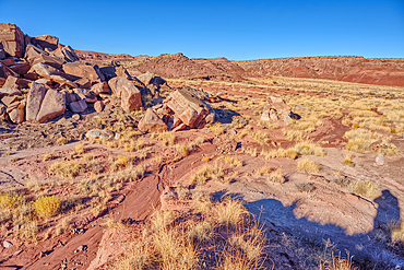
Boulders in Devil's Playground called Gnomes of Desolation, Petrified Forest National Park, Arizona, United States of America, North America
A dry waterfall ledge on the south end of Agate Plateau overlooking Jasper Forest in Petrified Forest National Park Arizona.

A hoodoo near a natural Spring west of Pintado Point in Petrified Forest National Park Arizona called the Guardian.
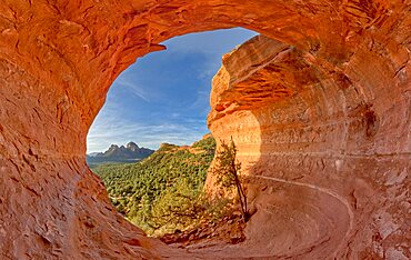
The Birthing Cave on the side of Mescal Mountain in Sedona Arizona. Ancient Indian women came here to give birth.
Man and woman running happy hand in hand on idyllic beach during honeymoon, overhead view, Barbuda, Antigua and Barbuda, West Indies, Caribbean, Central America

Man and woman in love embracing looking at the crystal sea, Myrtos beach, Kefalonia, Ionian Islands, Greek Islands, Greece, Europe
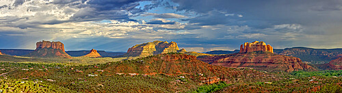
The Village of Oak Creek on the south side of Sedona viewed from the Airport Loop Trail, Arizona, United States of America, North America
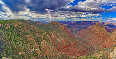
Lightning striking the Sinking Ship at Grand Canyon, viewed from the Buggeln Hill summit, Grand Canyon National Park, UNESCO World Heritage Site, Arizona, United States of America, North America
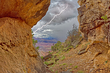
Grand Canyon viewed from inside a cave between Zuni and Papago Points while a storm is rolling into the area, Grand Canyon National Park, UNESCO World Heritage Site, Arizona, United States of America, North America
A monsoon storm rolling across Grand Canyon between Zuni Point and Papago Point, Grand Canyon National Park, UNESCO World Heritage Site, Arizona, United States of America, North America

The Horse Collar Ruins with a sign warning to not disturb them due to instability, located between the Sipapu Arch Bridge and the Kachina Arch Bridge, Natural Bridges National Monument, Utah, United States of America, North America
Storm clouds approaching Lipan Point at Grand Canyon South Rim, Grand Canyon National Park, UNESCO World Heritage Site, Arizona, United States of America, North America
North East Branch of Haystack Mesa in Petrified Forest National Park, Arizona, United States of America, North America
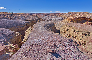
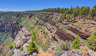
View from below the north cliffs of Blue Mesa in Petrified Forest National Park, Arizona, United States of America, North America
East slopes of Haystack Mesa in Petrified Forest National Park, Arizona, United States of America, North America
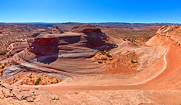
View from the top of a sandstone mesa, a fossilized sand dune, at Ferry Swale in the Glen Canyon Recreation Area near Page, Arizona, United States of America, North America
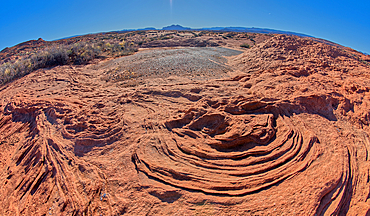
The ripples of fossilized sand dunes in the badlands of Horseshoe Bend, Arizona, United States of America, North America
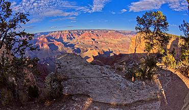
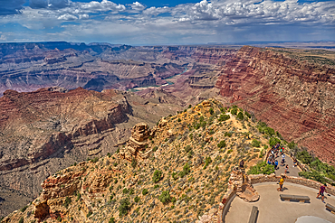
Grand Canyon view from a cliff between Hopi Point and Mohave Point, Grand Canyon, UNESCO World Heritage Site, Arizona, United States of America, North America
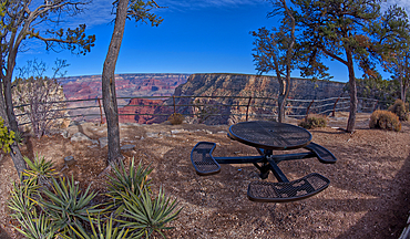
Steel picnic table along the rim trail overlooking Grand Canyon South Rim off Hermit Road halfway between Monument Creek Vista and The Abyss, Grand Canyon, Arizona, United States of America, North America

I Love Sal Wall Mural decorating a building in Santa Maria Town, Santa Maria, Sal, Cape Verde Islands, Atlantic, Africa
A look back at the cliffs of Hermits Rest, the Hermit Trailhead starts on the cliff line to the upper left of the photo, viewed from 1000 feet off of the official trail, Grand Canyon, Arizona, United States of America, North America
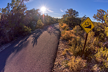
The paved Greenway trail west of Monument Creek Vista with a sign warning cyclists of a steep gradient ahead, Grand Canyon, Arizona, United States of America, North America
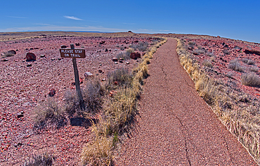
A warning sign to stay on the trail to the historic Agate House in Petrified Forest National Park, Arizona, United States of America, North America
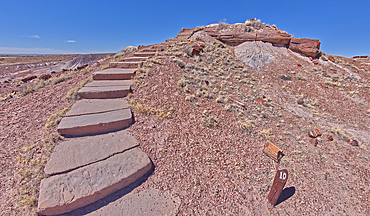
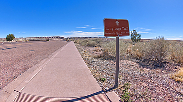
Steps along the Giant Logs Trail leading to a scenic overlook in Petrified Forest National Park, Arizona, United States of America, North America
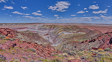
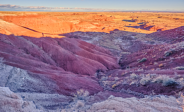
Hills of purple and gray bentonite near Hamilili Point on the south end of Petrified Forest National Park, Arizona, United States of America, North America
Purple badlands of bentonite near Hamilili Point on the south end of Petrified Forest National Park, Arizona, United States of America, North America
Rock islands above the purple badlands near Hamilili Point on the south end of Petrified Forest National Park, Arizona, United States of America, North America
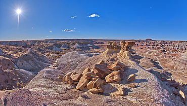
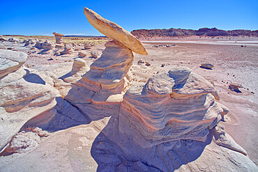
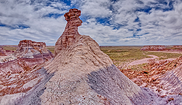
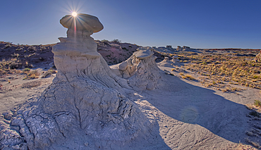
A solitary rock hoodoo in the purple badlands near Hamilili Point on the south end of Petrified Forest National Park, Arizona, United States of America, North America
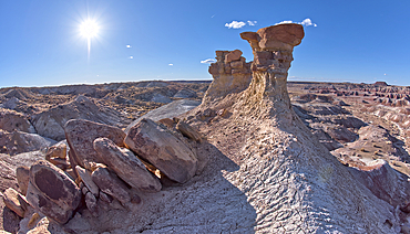
A solitary rock hoodoo in the purple badlands near Hamilili Point on the south end of Petrified Forest National Park, Arizona, United States of America, North America
A solitary rock hoodoo in the purple badlands near Hamilili Point on the south end of Petrified Forest National Park, Arizona, United States of America, North America
A sign along the main road pointing the way to the Long Logs Trail, and Agate House, Petrified Forest National Park, Arizona, United States of America, North America

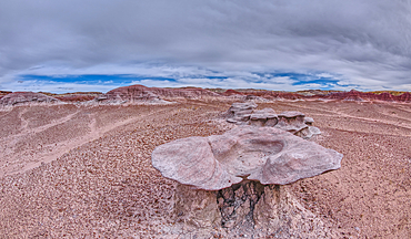
A circular walkway for the Long Logs Trail in Petrified Forest National Park, Arizona, United States of America, North America
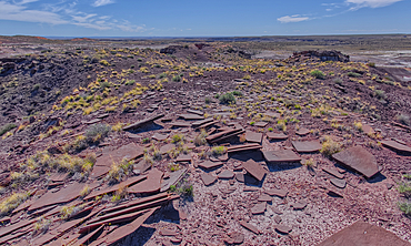
Sandstone that has been eroded into forms that resemble clam shells on the south end of Petrified Forest National Park, Arizona, United States of America, North America
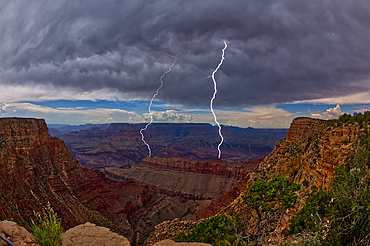
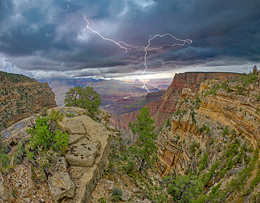
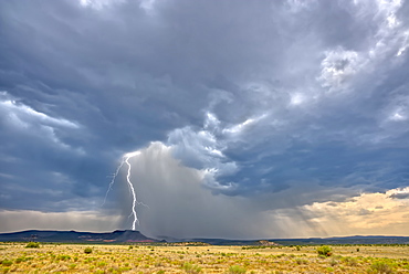
Lightning striking inside the Grand Canyon during the 2023 Arizona Monsoon season, viewed from No Name Overlook between Pinal Point on the left and Lipan Point on the right, Grand Canyon National Park, UNESCO World Heritage Site, Arizona, United States of America, North America
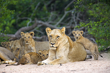
Lioness (Panthera leo), with cubs, Kruger National Park, South Africa, Africa
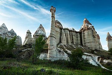
View with strange phallic rocks, Valley of Love, Cappadocia, Turkey, Asia Minor, Asia
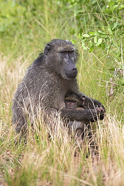
Chacma baboon (Papio cynocephalus), with infant, Kruger National Park, South Africa, Africa

A section of Petrified Forest National Park called Angel Garden, northwest of the Onyx Bridge, Arizona, United States of America, North America
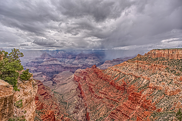
A rain storm over the North Rim of Grand Canyon National Park Arizona. Viewed from the Pipe Creek Vista on the South Rim.
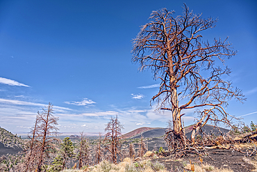
Burned trees on a Volcanic cinder rim in Coconino National Forest near Sunset Crater National Monument of Arizona.
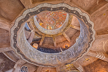
An interior view of the historic Desert View Watchtower at Grand Canyon South Rim, artwork created by Fred Kobotie in 1933, now owned by the National Park Service, UNESCO World Heritage Site, Arizona, United States of America, North America
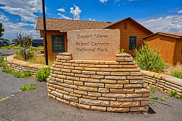
The welcome sign for Desert View Point on the east side of Grand Canyon South Rim, UNESCO World Heritage Site, Arizona, United States of America, North America
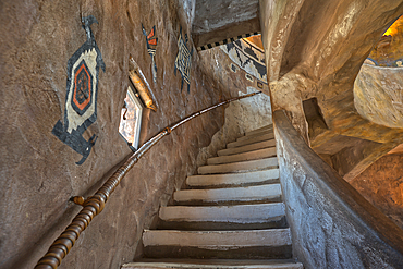
Stairs up to the third floor in the historic Desert View Watchtower at Grand Canyon South Rim, artwork created by Fred Kobotie in 1933, now owned by the National Park Service, UNESCO World Heritage Site, Arizona, United States of America, North America
Southwest view of Grand Canyon South Rim Arizona from the top floor of the historic Watchtower, taken through glass window, Grand Canyon, UNESCO World Heritage Site, Arizona, United States of America, North America
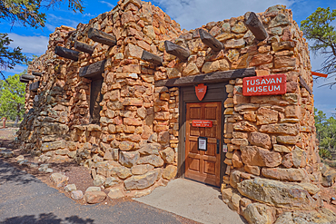
The Tusayan Museum building at Grand Canyon South Rim, Arizona, United States of America, North America

The top floor of the historic Watchtower at Grand Canyon South Rim, Grand Canyon, UNESCO World Heritage Site, Arizona, United States of America, North America
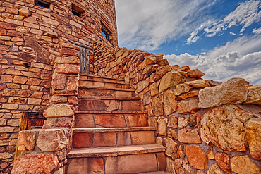
Steps to a platform above the observation deck of the Desert View Watchtower at Grand Canyon South Rim, HDR enhanced, Arizona, United States of America, North America
North view of Grand Canyon South Rim Arizona from the top floor of the historic Watchtower, taken through glass window, Grand Canyon, UNESCO World Heritage Site, Arizona, United States of America, North America

The main house of the ancient Tusayan Ruins at Grand Canyon South Rim, UNESCO World Heritage Site, Arizona, United States of America, North America
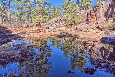
A still pond in Keyhole Sink in the Kaibab National Forest near Williams Arizona. This sink is an open ended sinkhole where water can flow out of it.
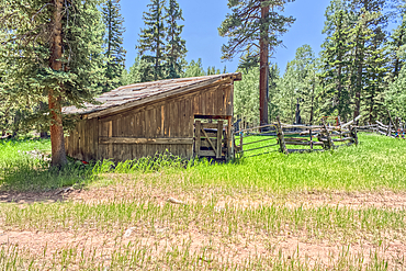
An abandoned homestead in the Kaibab National Forest off of Highway 67 north of Grand Canyon North Rim Arizona. Public land. No property release needed. Preserved by Forest Service as a historical landmark.
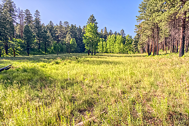
A grassy meadow in a valley near Clear Creek Canyon at Grand Canyon North Rim Arizona.
Dry Waterfall on the north end of Clear Creek Canyon at Grand Canyon North Rim Arizona.
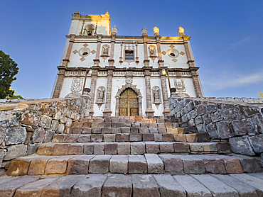
Mission San Ignacio Kadakaaman, founded by Jesuit missionaries in 1728, Baja California Sur, Sea of Cortez, Mexico, North America
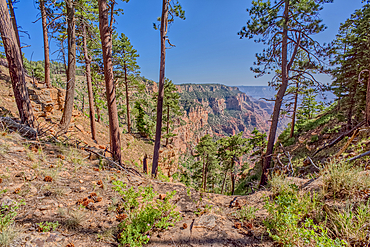
Cliff views just south of Naji Point on the North Rim of Grand Canyon National Park, UNESCO World Heritage Site, Arizona, United States of America, North America
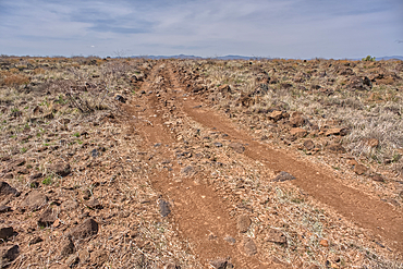
A primitive road in the Agua Fria National Monument that branches off from Forest Service Road 9023 near Silver Creek Canyon Arizona.
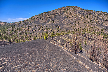
The southeast summit of O'Leary Peak viewed from a volcanic ridge in Coconino National Forest near Sunset Crater National Monument of Arizona.
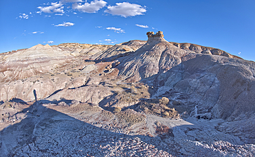
A hoodoo spire shaped like a Horse Head, in the valley below Blue Mesa of Petrified Forest National Park, Arizona, United States of America, North America
A massive monsoon storm moving over Matterhorn Mesa north of Drake, viewed from Forest Service Road 492, Arizona, United States of America, North America

Snorkeler exploring heart-shaped reef in Banda Sea, Indonesia.

Mass in St. Anthony's Catholic Church, Hanoukope, Lome, Togo
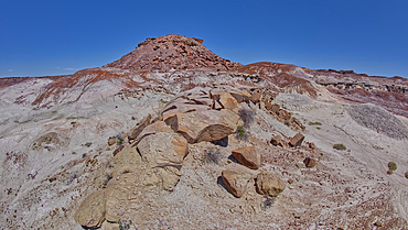
Slabs of brown sandstone on the summit of Crystal Mesa west of Hamilili Point in Petrified Forest National Park, Arizona, United States of America, North America
Goblin Garden west of Hamilili Point in Petrified Forest National Park, Arizona, United States of America, North America
Gray clay flats below Anvil Hill west of Hamilili Point in Petrified Forest National Park, Arizona, United States of America, North America
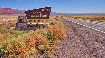
Highway US89A looking east to Vermilion Cliffs National Monument with Kaibab National Forest boundary sign, Arizona, United States of America
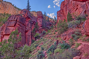
Red Wall cliffs of Roaring Springs Canyon on North Kaibab Trail, Grand Canyon North Rim, UNESCO, Arizona, United States of America
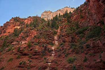
Ephemeral Spring on Red Wall of Roaring Springs Canyon, North Kaibab Trail, Grand Canyon North Rim, UNESCO, Arizona, United States of America
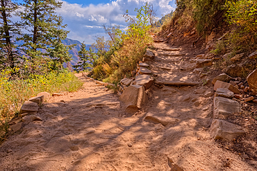
The 7th switchback along the North Kaibab Trail at Grand Canyon North Rim, UNESCO, Arizona, United States of America

The cliff wall of the Keyhole Sink in the Kaibab National Forest near Williams Arizona. This sink is an open ended sinkhole where water can flow out of it.
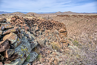
Ancient wall of the Fort Silver Indian Ruins overlooking Silver Creek Canyon in Agua Fria National Monument of Arizona. Located near the Pueblo La Plata ruins.
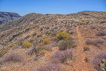
Path leading to a scenic overlook in the Agua Fria National Monument near the abandoned Richinbar Mine.
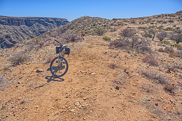
A bicycle parked near the abandoned Richinbar Mine in the Agua Fria National Monument.
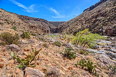
The granite riverbed of the Agua Fria River Canyon in the Agua Fria National Monument of Arizona.
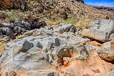
The granite riverbed of the Agua Fria River Canyon in the Agua Fria National Monument of Arizona.
The granite riverbed of the Agua Fria River Canyon in the Agua Fria National Monument of Arizona.
The granite riverbed of the Agua Fria River Canyon in the Agua Fria National Monument of Arizona.
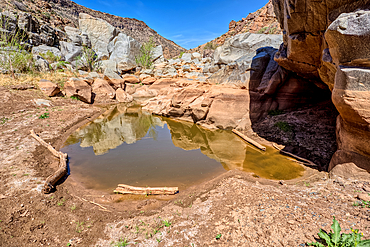
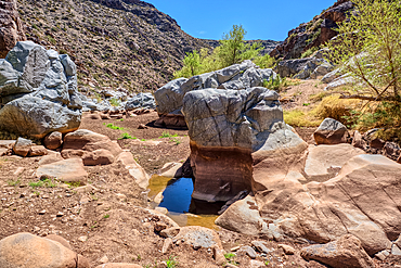
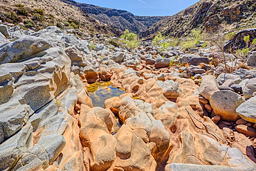
An ephemeral pool of water in the granite riverbed of the Agua Fria River Canyon in the Agua Fria National Monument of Arizona.
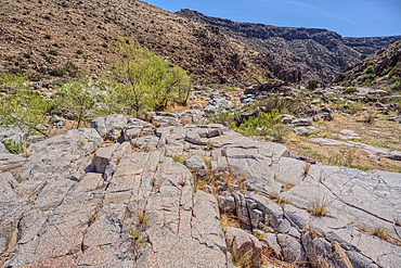
The granite riverbed of the Agua Fria River Canyon in the Agua Fria National Monument of Arizona.
The granite riverbed of the Agua Fria River Canyon in the Agua Fria National Monument of Arizona.
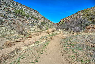
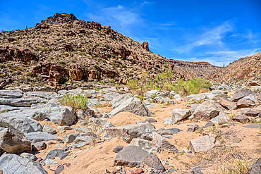
Badger Springs Creek Canyon in the Agua Fria National Monument of Arizona.
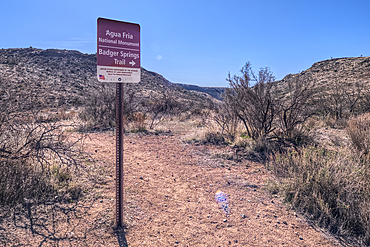
Sign marking the Badger Springs Trail in the Agua Fria National Monument of Arizona.
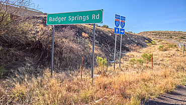
Sign marking Badger Springs Road off of I-17 Arizona. This road leads to a hiking trail in the Agua Fria National Monument.

Mother with traditional dressed children, Nenets festival, Salekhard, Yamal Peninsula, Russia
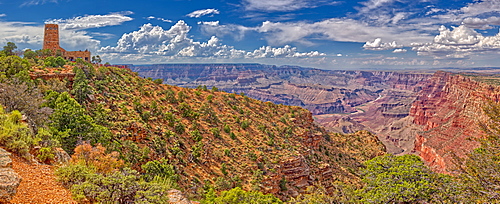
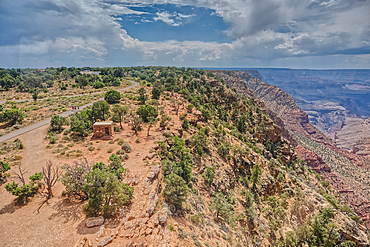
View of the Grand Canyon east of the historic Watch Tower, managed by the National Park Service, Grand Canyon National Park, UNESCO World Heritage Site, Arizona, United States of America, North America
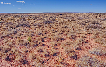
The grassland prairie near Dead Wash in Petrified Forest, Arizona, United States of America
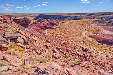
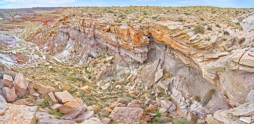
An unnamed canyon that leads into Dead Wash at Petrified Forest National Park, Arizona, United States of America
Boulder pile in a valley leading to Dead Wash in Petrified Forest National Park, Arizona, United States of America
Dead Wash Valley in Petrified Forest National Park, Arizona, United States of America
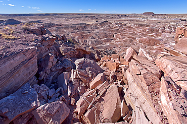
Cliff view of Dead Wash Valley in Petrified Forest National Park, Arizona, United States of America
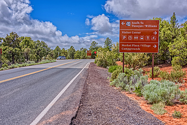
A sign along State Route 64 in Arizona directing travelers in Grand Canyon National Park.