Results
« Previous 1 … 9 10 11 12 13 … 21 Next »
2001 results found
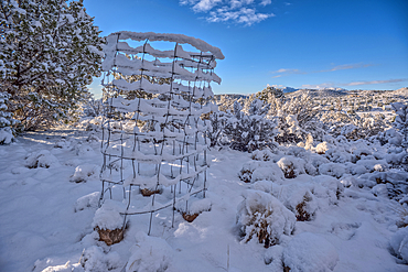
Snow covered landscape from a late winter storm in Chino Valley Arizona.
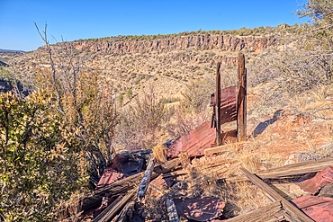
The remains of a Guard Shack above the Johnson Canyon Railroad Tunnel, Kaibab National Forest of Arizona, USA
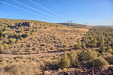
High voltage power lines stretching across Johnson Canyon in the Kaibab National Forest of Arizona, USA

A dilapidated bridge along the Johnson Canyon Railroad, Kaibab National Forest of Arizona, USA
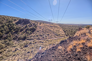
High voltage power lines stretching across Johnson Canyon in the Kaibab National Forest of Arizona, USA
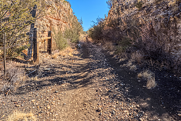
A narrow and overgrown section of the abandoned Johnson Canyon Railroad in the Kaibab National Forest of Arizona, USA
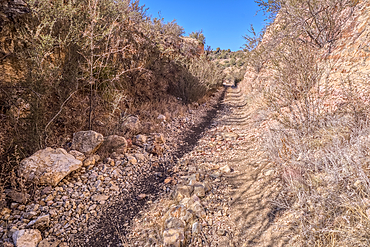
A narrow and overgrown section of the abandoned Johnson Canyon Railroad in the Kaibab National Forest of Arizona, USA

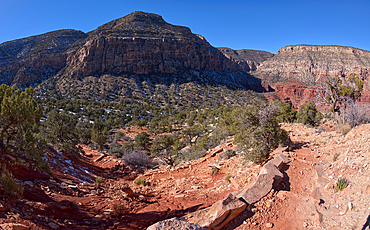
View of Johnson Canyon from the Johnson Canyon Railroad Grade, Kaibab National Forest of Arizona, USA
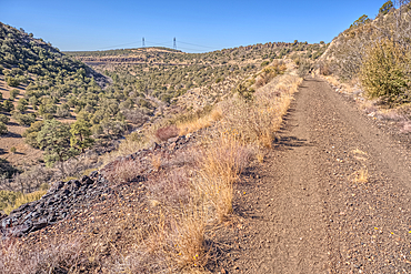
View of Johnson Canyon from the abandoned Johnson Canyon Railroad Grade in the Kaibab National Forest of Arizona, USA

An old relic from the Johnson Canyon Railroad, Kaibab National Forest of Arizona, USA
View from below the rim of the giant sinkhole known as Johnson Crater in the Kaibab National Forest near Ash Fork Arizona, USA
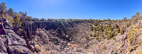
Super Panorama of the giant sinkhole known as Johnson Crater in the Kaibab National Forest near Ash Fork Arizona, USA
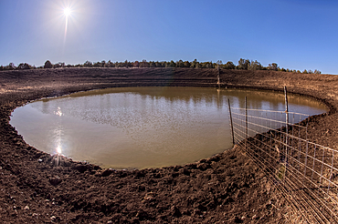
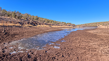
The Thirteen Mile Cattle Tank off of Corva Road in the Kaibab National Forest near Ash Fork Arizona, USA
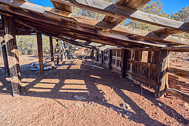
The old abandoned homestead of Rods Winter Camp in the Kaibab National Forest of Arizona, USA
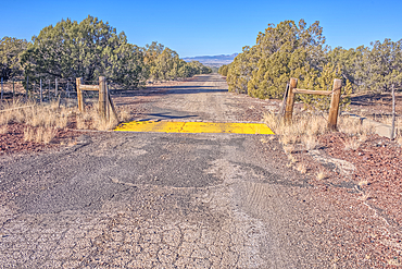
The crumbling remains of Arizona Route 66 in the Kaibab National Forest, USA
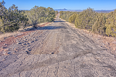
The crumbling remains of Arizona Route 66 in the Kaibab National Forest, USA
View from the shore of Stone Dam Lake in the Kaibab National Forest, Arizona, USA

Hands of Pope Francis, born Jorge Mario Bergoglio on 17 December 1936, Vatican, Rome, Lazio, Italy

Holy Quran with Muslim prayer beads and Bible with rosary, Interfaith symbols between Christianity and Islam, Ho Chi Minh City, Vietnam
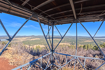
View from second deck of fire watchtower on summit of Apache Maid Mountain, Coconino National Forest, Arizona, United States of America
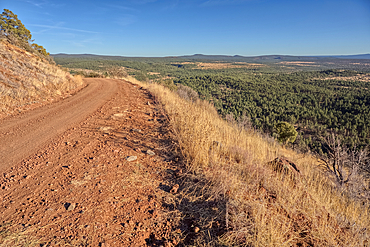
Road to the summit of Apache Maid Mountain, Coconino National Forest, Arizona, United States of America
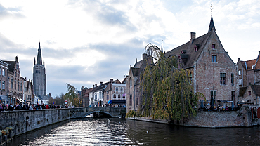
View from the Rozenhoedkaai, one of the city's most picturesque spots, Bruges, Belgium
View of the lake created by the historic Bainbridge Steel Dam near Ash Fork, Kaibab National Forest, Arizona, United States of America

A large wall of fractured Granite along a trail in Constellation Park in Prescott called The Lost Wall, Arizona, United States of America, North America
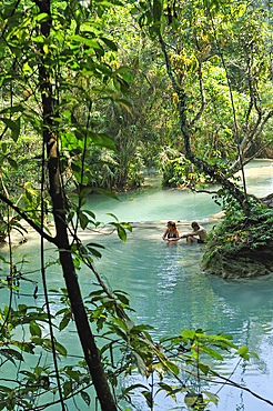
Couple bathing at Kuang Si waterfalls, Luang Prabang, Laos
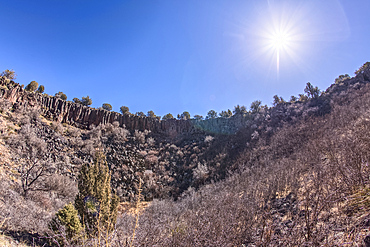
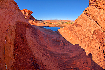
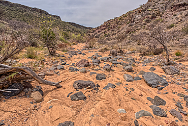
Basalt boulders and cliffs in a section of Johnson Canyon halfway between the Bainbridge Steel Dam and Stone Dam near Ash Fork Arizona in the Kaibab National Forest.
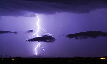
A bright lightning bolt passing through a cloud and striking in the Gila Bend Mountains south of Arlington, Arizona, United States of America, North America

Couple in engagement dress, Marin, California, United States of America, North America
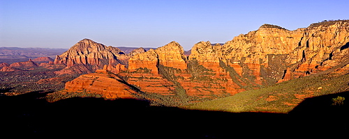
Early morning view of Sedona from Schnebly Hill Vista, Capitol Butte on the left and Wilson Mountain on the right, Sedona, Arizona, United States of America, North America
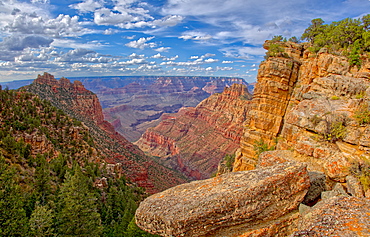
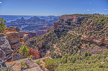
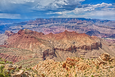
Grand Canyon view just below the summit of Buggeln Hill on the South Rim, Grand Canyon National Park, UNESCO World Heritage Site, Arizona, United States of America, North America
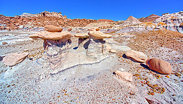
Mounds and cliffs of expansive clay called Bentonite in the Jasper Forest of Petrified Forest National Park, Arizona, United States of America, North America
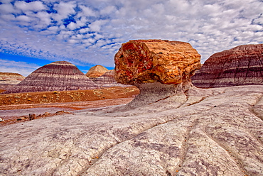
A large petrified log along the Blue Mesa Trail in Petrified Forest National Park, Arizona, United States of America, North America
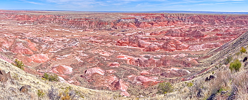
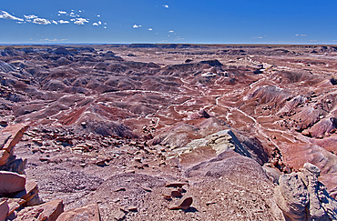
Panorama view of the Painted Desert from Tawa Point in Petrified Forest National Park, Arizona, United States of America, North America
A dry waterfall made of purple bentonite in the Flat Tops of Petrified Forest National Park, Arizona, United States of America, North America
Three hoodoos in a triangular formation in Devil's Playground called the Unholy Trinity, Petrified Forest National Park, Arizona, United States of America, North America
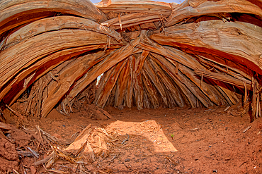
Interior of an Ancient Hogan used in Navajo ceremonies, in Navajo National Monument, Navajo Indian Reservation northwest of the town of Kayenta, Arizona, United States of America, North America
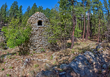
The historic Walker Charcoal Kiln, dating from the late 1880s used to turn oak wood into charcoal for silver smelters, Prescott National Forest, just south of Prescott, Arizona, United States of America, North America
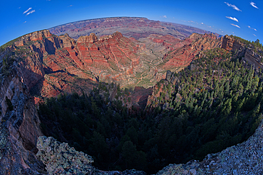
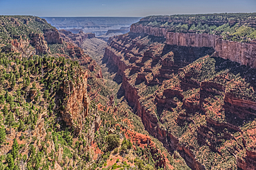
Fisheye view of Hance Canyon from the South Rim of Grand Canyon with Grandview Point is on the left, Grand Canyon National Park, UNESCO World Heritage Site, Arizona, United States of America, North America
A dry waterfall in Crystal Creek below Crystal Mesa west of Hamilili Point in Petrified Forest National Park, Arizona, United States of America, North America
A wavy sandstone formation with a puddle of water north of the Horseshoe Bend Overlook along the Colorado River in Page, Arizona, United States of America, North America
The very rocky pathway of the unmaintained Hermit Canyon Trail at Grand Canyonin winter with Waldron Canyon on the left in the distance, Grand Canyon, Arizona, United States of America, North America
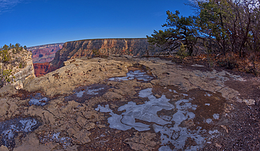
Frozen water puddles along the cliffs of Grand Canyon east of the Monument Creek Vista, Grand Canyon National Park, UNESCO World Heritage Site, Arizona, United States of America, North America
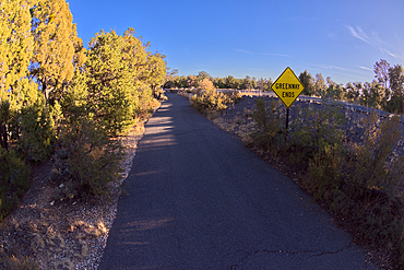
Sign marking the end of the paved Greenway Trail that runs between Monument Creek Vista and Pima Point, Grand Canyon, Arizona, United States of America, North America
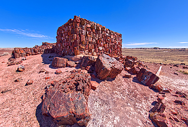
Closeup of the historic Agate House in Petrified Forest National Park, Arizona, United States of America, North America
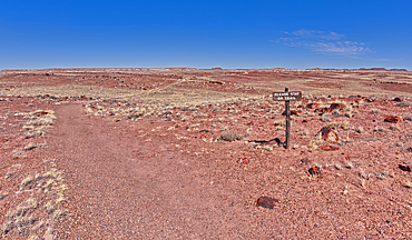
A warning sign to stay on the trail to the historic Agate House in Petrified Forest National Park, Arizona, United States of America, North America
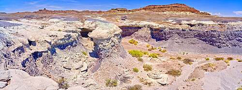
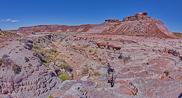
A deep canyon eroded thru the hills of purple and gray bentonite clay near Hamilili Point on the south end of Petrified Forest National Park, Arizona, United States of America, North America
Purple badlands of bentonite near Hamilili Point on the south end of Petrified Forest National Park, Arizona, United States of America, North America
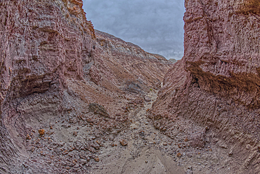
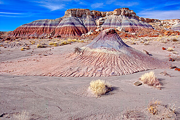
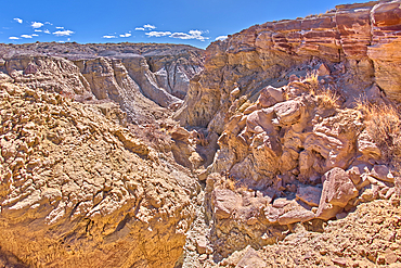
A narrow slot canyon of bentonite on the south end of Petrified Forest National Park, Arizona, United States of America, North America
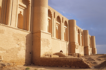
Palace of Love, Samarra, Iraq, Middle East
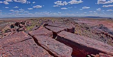
The summit of Haystack Mesa in Petrified Forest National Park, Arizona, United States of America, North America
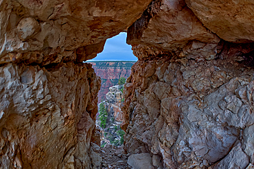
A gap between a stack of balanced boulders on a cliff east of Grandview Point at Grand Canyon South Rim, Grand Canyon National Park, UNESCO World Heritage Site, Arizona, United States of America, North America
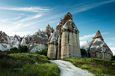
View with strange phallic rocks, Valley of Love, Cappadocia, Turkey, Asia Minor, Asia

A Love Letter For You, Murals project by Steve Powers, a series of 50 rooftop murals from 45th to 63rd Streets along the Market Street corridor, Market/Frankford Elevated railroad, Mural Arts Program, Philadelphia, Pennsylvania, United States of America, North America
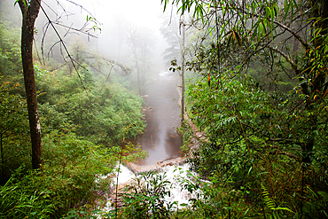
Tinh Yeu (Love Waterfall) in the jungle near Sa Pa (Sapa), Lao Cai province, Vietnam, Indochina, Southeast Asia, Asia
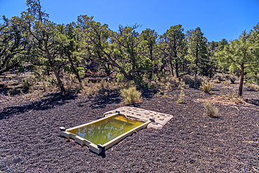
A water catchment to help local wildlife in the Coconino National Forest just outside Sunset Crater National Monument Arizona.
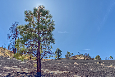
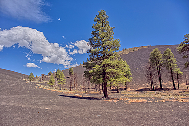
Volcanic cinder hill in Coconino National Forest near Sunset Crater National Monument of Arizona with a pine tree backlit by the sun.
View of Honan Point on the North Rim of Grand Canyon National Park Arizona.
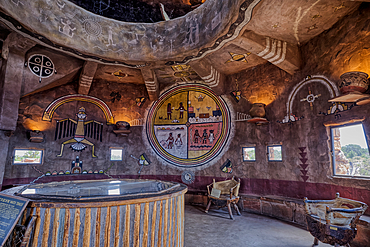
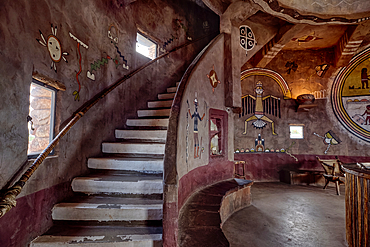
An interior view of the historic Desert View Watchtower at Grand Canyon South Rim, artwork created by Fred Kobotie in 1933, now owned by the National Park Service, Arizona, United States of America, North America
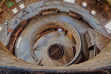
Downward view from the third floor in the historic Desert View Watchtower at Grand Canyon South Rim, artwork created by Fred Kobotie in 1933, now owned by the National Park Service, UNESCO World Heritage Site, Arizona, United States of America, North America
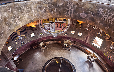
Downward view from the second floor in historic Desert View Watchtower at Grand Canyon South Rim, artwork created by Fred Kobotie in 1933, now owned by the National Park Service, UNESCO World Heritage Site, Arizona, United States of America, North America
Stairs up to the seconnd floor in the historic Desert View Watchtower at Grand Canyon South Rim, artwork created by Fred Kobotie in 1933, now owned by the National Park Service, UNESCO World Heritage Site, Arizona, United States of America, North America
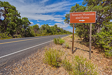
The direction sign for the Tusayan Museum and ruins at Grand Canyon South Rim, Arizona, United States of America, North America
Northwest view of Grand Canyon South Rim Arizona from the top floor of the historic Watchtower, taken through glass window, Grand Canyon, UNESCO World Heritage Site, Arizona, United States of America, North America
The observation deck of the Desert View Watchtower at Grand Canyon South Rim, UNESCO World Heritage Site, Arizona, United States of America, North America

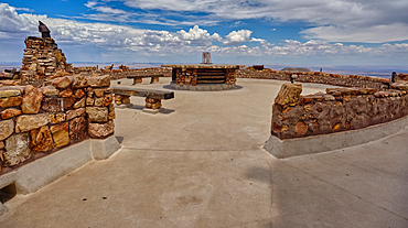
The Kiva of the ancient Tusayan Ruins at Grand Canyon South Rim, UNESCO World Heritage Site, Arizona, United States of America, North America

Pair of playful sea lions, Los Islotes, La Paz, Mexico.
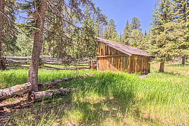
An abandoned homestead in the Kaibab National Forest off of Highway 67 north of Grand Canyon North Rim Arizona. Public land. No property release needed. Preserved by Forest Service as a historical landmark.
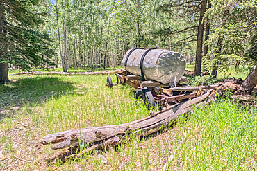
An abandoned homestead in the Kaibab National Forest off of Highway 67 north of Grand Canyon North Rim Arizona. Public land. No property release needed. Preserved by Forest Service as a historical landmark.
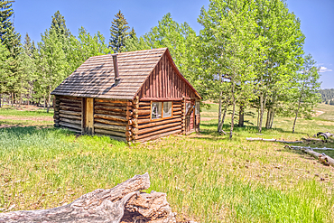
An abandoned homestead in the Kaibab National Forest off of Highway 67 north of Grand Canyon North Rim Arizona. Public land. No property release needed. Preserved by Forest Service as a historical landmark.
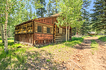
An abandoned homestead in the Kaibab National Forest off of Highway 67 north of Grand Canyon North Rim Arizona. Public land. No property release needed. Preserved by Forest Service as a historical landmark.
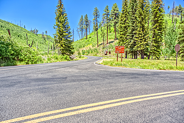
The point where Fuller Canyon Road divides in Grand Canyon North Rim Arizona. Left fork leads to Point Imperial. Right fork leads to Cape Royal.
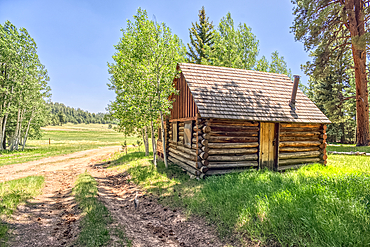
An abandoned homestead in the Kaibab National Forest off of Highway 67 north of Grand Canyon North Rim Arizona. Public land. No property release needed. Preserved by Forest Service as a historical landmark.
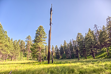
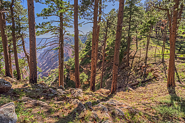
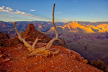
A burned tree in a grassy meadow in a valley near Clear Creek Canyon at Grand Canyon North Rim Arizona.
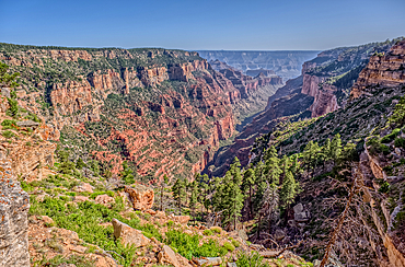
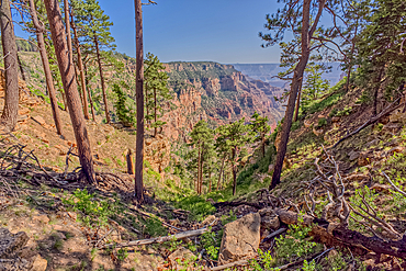
View of Clear Creek Canyon from its north cliffs at Grand Canyon North Rim Arizona.
Dry Waterfall on the north end of Clear Creek Canyon at Grand Canyon North Rim Arizona.
View of Clear Creek Canyon from its north cliffs at Grand Canyon North Rim Arizona.
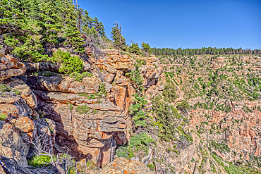
The jagged north cliffs of Clear Creek Canyon at Grand Canyon North Rim Arizona.
Dry Waterfall on the north end of Clear Creek Canyon at Grand Canyon North Rim Arizona.
Dry Waterfall on the north end of Clear Creek Canyon at Grand Canyon North Rim Arizona.
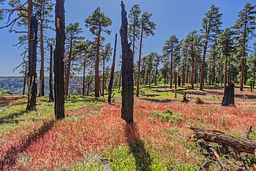
Burned trees at the north edge of Clear Creek Canyon at Grand Canyon North Rim Arizona.
View of Clear Creek Canyon from its east rim at Grand Canyon North Rim Arizona.
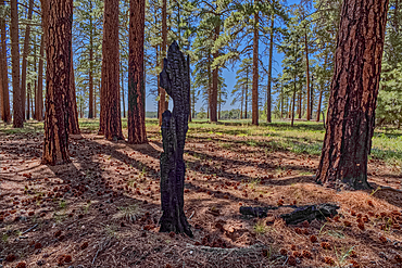
Burned tree in the forest of Grand Canyon North Rim Arizona near the edge of Clear Creek Canyon.
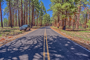
An SUV parked along Cape Royal Road at Grand Canyon North Rim Arizona.
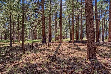
The forest of Grand Canyon North Rim Arizona near the edge of Clear Creek Canyon.
View of O'Neill Butte on the left and Grand Canyon on the right from the edge of Cedar Ridge along the South Kaibab Trail, Grand Canyon National Park, UNESCO World Heritage Site, Arizona, United States of America, North America
Couple sitting on a heart-shaped swing, Jordan, Middle East
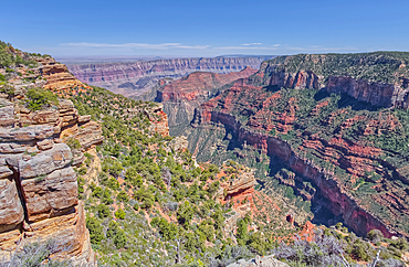
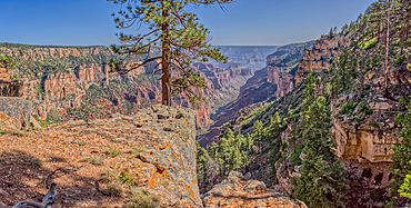
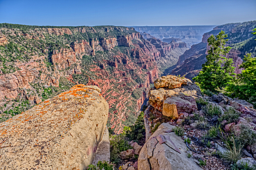
Cliff views from the edge of Naji Point on the North Rim of Grand Canyon, with Cape Final in the distance, Grand Canyon National Park, UNESCO World Heritage Site, Arizona, United States of America, North America
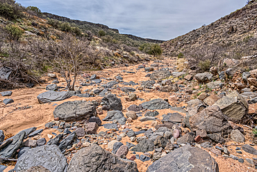
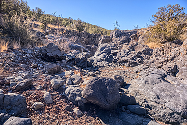
Silver Creek Canyon in the Agua Fria National Monument. Located north of Black Canyon City Arizona.
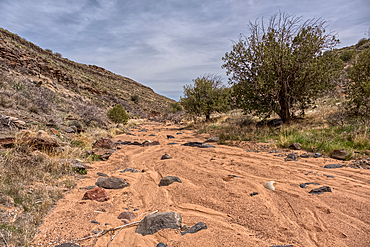
Silver Creek Canyon in the Agua Fria National Monument. Located north of Black Canyon City Arizona.
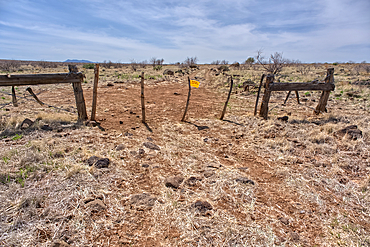
An entry gate to Silver Creek Canyon in Agua Fria National Monument Arizona. The gate is to keep cattle from wandering down into the canyon.
Silver Creek Canyon in the Agua Fria National Monument. Located north of Black Canyon City Arizona.
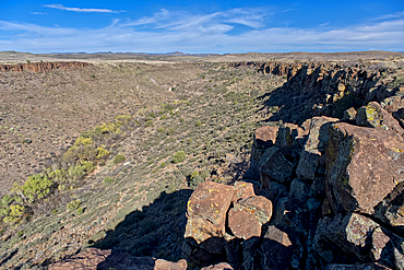
Silver Creek Canyon in the Agua Fria National Monument. Located north of Black Canyon City Arizona.
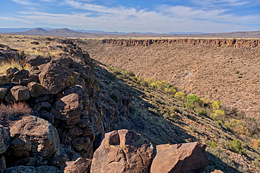
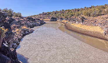
Silver Creek Canyon in the Agua Fria National Monument. Located north of Black Canyon City Arizona.

AI generated image of Two cute Chihuahua pups playing together

AI generated image of Two cute Dobermann pinscher pups playing together
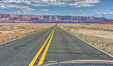
Vermilion Cliffs National Monument Arizona viewed thru the windshield of a moving vehicle traveling on highway US89A.
Volcanic cinder hills in Coconino National Forest near Sunset Crater National Monument of Arizona.
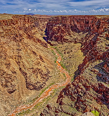
An area of the Little Colorado River Gorge east of the Grand Canyon, Arizona, Uninted States of America, North America
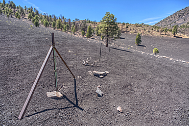
The boundary fence between Coconino National Forest and Sunset Crater National Monument of Arizona.

A pair of manatees appear to be greeting each other as they meet in the clear freshwater of the Fanning Spring inlet to the Suwannee River in Fanning Springs, Florida.