Results
« Previous 1 … 10 11 12 13 Next »
1207 results found
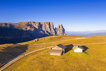
Aerial view by drone of sunrise on Alpe di Siusi (Seiser Alm) and Sciliar peaks in autumn, Dolomites, South Tyrol, Italy, Europe

Aerial drone view of Leme Beach in the Copacabana district at sunrise with the iconic Sugarloaf Mountain in the background, UNESCO World Heritage Site, Rio de Janeiro, Brazil, South America

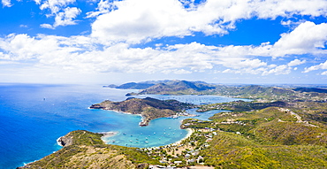
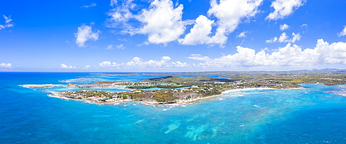
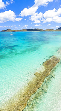
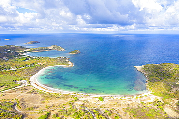
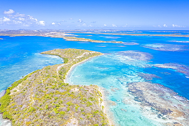
Aerial panoramic by drone of Carlisle Bay Beach and Caribbean Sea, Antigua, Antigua and Barbuda, Leeward Islands, West Indies, Caribbean, Central America

Aerial by drone of white sand beach and turquoise tropical lagoon, Ile Aux Cerfs, Flacq, East Coast, Mauritius, Indian Ocean, Africa

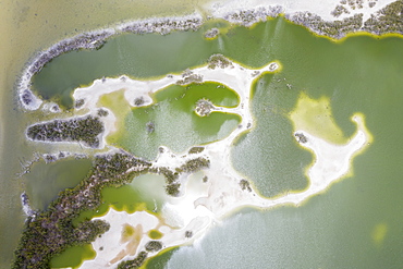
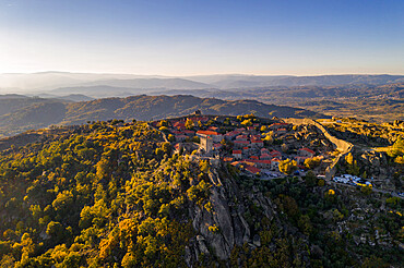
Aerial by drone of a monastery at the Kerkini lake, Macedonia, Greece, Europe

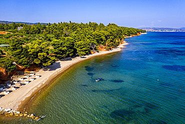
Aerial by drone of a sailing boat on Zografou Beach, Sithonia, Greece, Europe
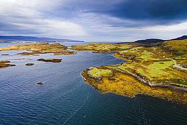
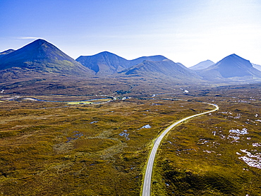
Aerial of Loch Dunvegan, Isle of Skye, Inner Hebrides, Scotland, United Kingdom, Europe

Drone view of Orvieto's Old Town cityscape at sunset, Orvieto, Umbria, Italy, Europe
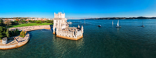
Aerial drone view of Belem Tower, UNESCO World Heritage Site, a 16th century fortification on the Tagus River, Belem, Lisbon, Portugal, Europe

Drone aerial view of Francisco Abellan Dam and Reservoir, Granada, Andalusia, Spain, Europe
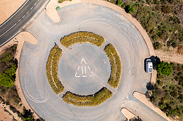
Drone aerial view of a helicopter landing parking on a desert like landscape at Francisco Abellan Dam, Granada, Andalusia, Spain, Europe
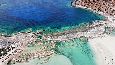
Aerial view of Balos Lagoon, Balos Beach and Cape Tigani, Gramvousa Peninsula, Chania Region, Crete, Greek Islands, Greece, Europe
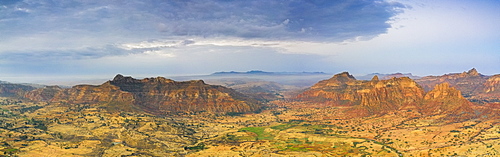
Aerial panoramic by drone of Gheralta Mountains and Dugem, Tigray Region, Ethiopia, Africa
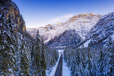
Aerial view by drone of sunrise on the scenic road Dobbiaco-Misurina along snowy woods, Dolomites, South Tyrol, Italy, Europe
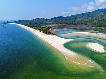
Aerial by drone of Tizit beach, Dawei, Mon state, Myanmar (Burma), Asia
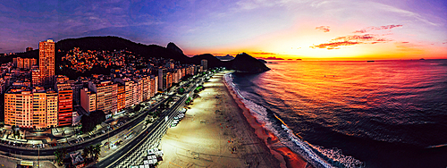
Panoramic aerial drone view of Leme Beach in the Copacabana district at sunrise with the iconic Sugarloaf Mountain in the background, UNESCO World Heritage Site, Rio de Janeiro, Brazil, South America

Aerial view of Cadiz Cathedral, by drone, Cadiz, Andalucia, Spain, Europe

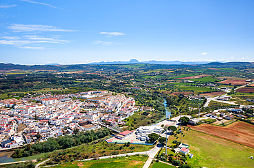
Aerial view, by drone, of Cadiz, Andalucia, Spain, Europe

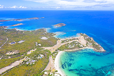
Aerial view by drone of the pink sand beach washed by the crystal water of Caribbean Sea, Antilles, West Indies, Caribbean, Central America

Aerial view by drone of coastal road beside white sand beach, Caribbean, Antilles, West Indies, Caribbean, Central America
Aerial panoramic by drone of Long Bay, Devil's Bridge and The Verandah resort, Antigua, Antigua and Barbuda, Leeward Islands, West Indies, Caribbean, Central America
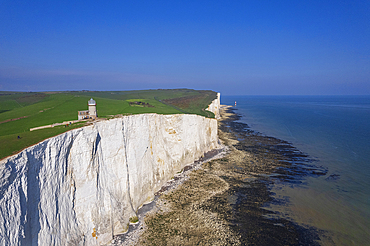
View from drone of Belle Tout lighthouse at low tide, Seven Sisters chalk cliffs, South Downs National Park, East Sussex, England, United Kingdom, Europe

Aerial drone sunrise view of St. Peter's Church and House of the Black Heads, Riga Old Town (Vecriga), UNESCO World Heritage Site, Riga, Latvia, Europe

Aerial drone view of the Medieval Cesis Old Town, Cesis, Latvia, Baltics, Europe
Drone aerial view of a road crossing a desert like landscape at Francisco Abellan Dam, Granada, Andalusia, Spain, Europe
Aerial panoramic by drone of tall rock towers of Gheralta Mountains, Hawzen, Tigray Region, Ethiopia, Africa

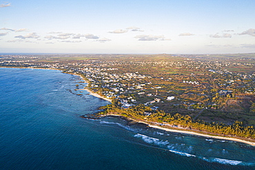
Aerial panoramic by drone of Flic en Flac beach with Tamaris village and Le Morne mountain, Black River, Mauritius, Indian Ocean, Africa
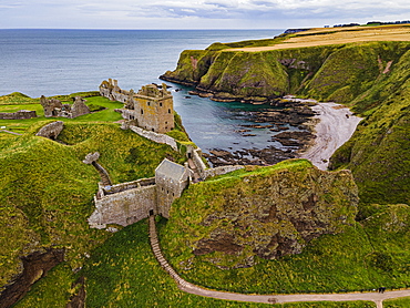
Aerial of Dunnottar Castle, Stonehaven, Aberdeenshire, Scotland, United Kingdom, Europe

Aerial by drone of Waimea, Kauai Island, Hawaii, United States of America, North America
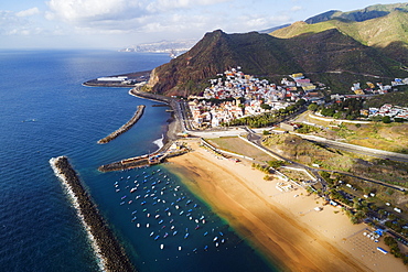
Aerial drone view of Playa de las Teresitas, San Andres, Tenerife, Canary Islands, Spain, Atlantic, Europe

Aerial drone view of Leme Beach in the Copacabana district at sunrise with the iconic Sugarloaf Mountain in the background, UNESCO World Heritage Site, Rio de Janeiro, Brazil, South America
Aerial panoramic by drone of Galleon beach and English Harbour, Antigua, Antigua and Barbuda, Leeward Islands, West Indies, Caribbean, Central America
Aerial panoramicby drone of Long Bay, Devil's Bridge and The Verandah resort, Antigua, Antigua and Barbuda, Leeward Islands, West Indies, Caribbean, Central America

Aerial panoramic by drone of boats in the blue Caribbean Sea approaching to Turners Beach, Antigua, Antigua and Barbuda, Leeward Islands, West Indies, Caribbean, Central America

City drone aerial view at sunset with iconic Palace, Mafra, Portugal, Europe
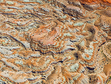
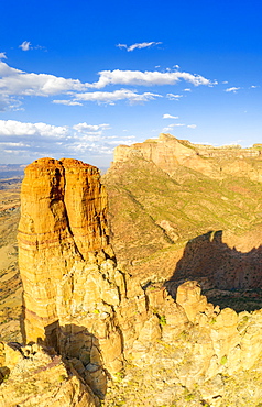
Aerial abstract view taken by drone of desert area near to Goblin Valley National Park during a sunny summer day, Utah, United States of America, North America
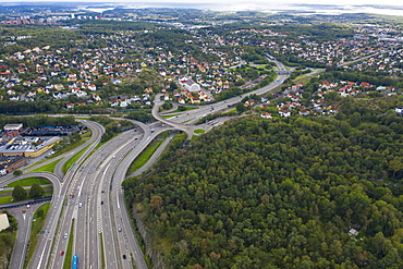
Aerial view by drone of Highway road in Gothenburg, Sweden, Scandinavia, Europe
Aerial by drone of tropical beach of Pointe Aux Biches, Trou Aux Biches and Mont Choisy, north-west coast, Mauritius, Indian Ocean, Africa
Aerial view by drone of Highway, Triglav National Park, Upper Carniola, Slovenia, Europe
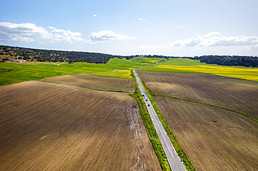
Drone aerial view of a road in a landscape with yellow flowers, Spain, Europe
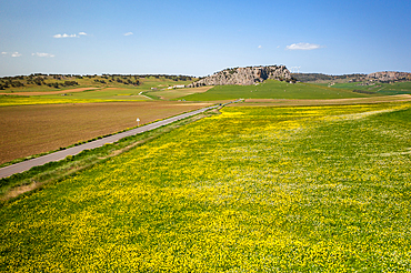
Drone aerial view of a road on a landscape with yellow flowers, Spain, Europe
Drone aerial view of Arcos de la Frontera village of the Pueblos Blancos region, Andalusia, Spain, Europe
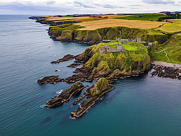
Aerial of Dunnottar Castle, Stonehaven, Aberdeenshire, Scotland, United Kingdom, Europe

Sunset on the autumnal landscape of Scermendone Alp and Orobie Alps, aerial view by drone, Rhaetian Alps, Valtellina, Lombardy, Italy, Europe

Lake Silvaplana and Sils hidden by the autumnal fog at dawn, aerial view by drone, Engadine, Canton of Graubunden, Switzerland, Europe
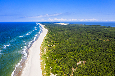
Aerial by drone of the Curonian Spit National Park, UNESCO World Heritage Site, Kaliningrad, Russia, Europe
Aerial panoramic by drone of white sand beach of Exchange Bay and Friars Head Bay, Antigua, Leeward Islands, West Indies, Caribbean, Central America

Aerial panoramic by drone of Lastoi De Formin and Cima Ambrizzola at sunset in autumn, Giau Pass, Dolomites, Veneto, Italy, Europe

Aerial by drone of the tower of Prosphorion, Ouranopoli, Mount Athos, Central Macedonia, Greece, Europe
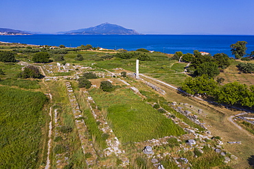
Aerial by drone of the Heraoin of Samos, UNESCO World Heritage Site, Samos, Greek Islands, Greece, Europe
Road leading into the Black Cuillin ridge, Isle of Skye, Inner Hebrides, Scotland, United Kingdom, Europe
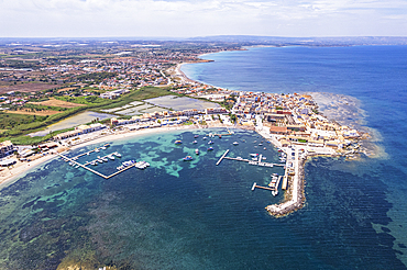
Aerial drone shot of the fishing village of Marzamemi in blue water, Marzamemi, Pachino municipality, Siracusa province, Sicily, Italy, Mediterranean, Europe

Drone view of Zannone island on a cloudy day, Zannone island, Ponza municipality, Circeo National Park, Pontine archipelago, Tyrrhenian sea, Latina province, Latium (Lazio), Italy Europe
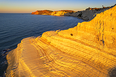
Aerial shot of Scala dei Turchi staircase seen from a drone at sunrise, Realmonte, Agrigento province, Sicily, Italy, Mediterranean, Europe

Aerial drone view of the Medieval Cesis Old Town, Cesis, Latvia, Baltics, Europe

Aerial view by drone of pagodas, Inle Lake, Shan state, Myanmar (Burma), Asia
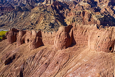
Aerial by drone of Shahr-e Zuhak. the red city, Bamyan, Afghanistan, Asia
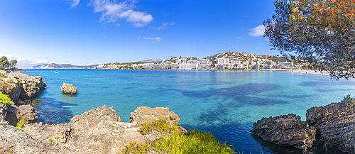
View of rocky shoreline by turquoise sea and Santa Ponsa, Majorca, Balearic Islands, Spain, Mediterranean, Europe
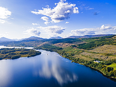
Aerial of Glen Garry, Highlands, Scotland, United Kingdom, Europe
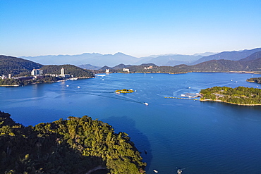
Aerial by drone over Sun Moon Lake, National Scenic Area, Nantou county, Taiwan, Asia
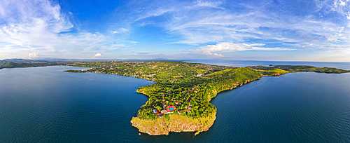
Aerial of Kigoma, on Lake Tanganyika, Tanzania, East Africa, Africa

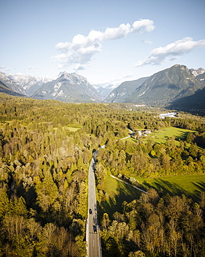
Aerial view by drone of car traveling on the scenic road Dobbiaco-Misurina along snowy woods at dawn, Dolomites, South Tyrol, Italy, Europe
Aerial view by drone of tropical lagoon next to Darkwood Beach, Antigua, Leeward Islands, West Indies, Caribbean, Central America
Aerial panoramic by drone of the transparent water of Caribbean Sea, Antilles, West Indies, Caribbean, Central America
Aerial panoramic by drone of Caribbean Sea surrounding Exchange Bay, Antigua, Leeward Islands, West Indies, Caribbean, Central America

Aerial view by drone of sunset over Lastoi De Formin and Cima Ambrizzola in a sea of clouds in autumn, Giau Pass, Dolomites, Veneto, Italy, Europe

Aerial view by drone of Barichara, Santander, Colombia, South America

Aerial view by drone of fog over scenic road crossing Giau Pass in a sea of clouds at sunset, Dolomites, Belluno province, Veneto, Italy, Europe

Aerial by drone of the tower of Prosphorion, Ouranopoli, Mount Athos, Central Macedonia, Greece, Europe
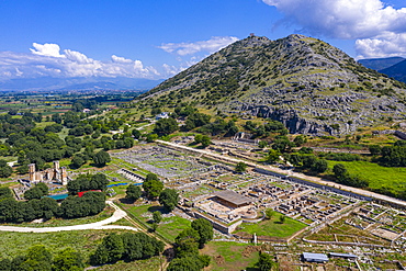
Aerial by drone of Philippi, UNESCO World Heritage Site, Macedonia, Greece, Europe
Drone aerial panorama of historic village of Sortelha with castle and with turbines on natural landscape, Centro, Portugal, Europe

Aerial drone view of the Medieval Cesis Old Town, Cesis, Latvia, Baltics, Europe
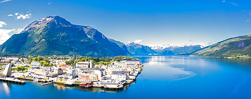
Aerial panoramic by drone of Andalsnes town and fjord, Rauma municipality, More og Romsdal county, Norway, Scandinavia, Europe

Foggy sunrise over woods of Maloja Pass at dawn, aerial view by drone, Engadine, Canton of Graubunden, Switzerland, Europe
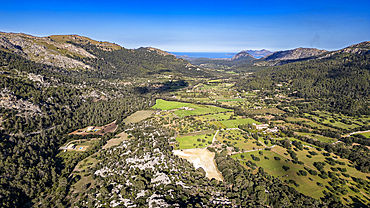
Aerial of the beautiful valley behind Pollenca, Mallorca, Balearic islands, Spain, Mediterranean, Europe
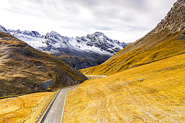
View by drone of scenic road in the autumnal landscape towards Cresta Di Reit, Braulio Valley, Bormio, Valtellina, Lombardy, Italy, Europe

Sunrise over Le Morne and coral reef in the turquoise lagoon, aerial view by drone, Baie Du Cap, South Mauritius, Indian Ocean, Africa
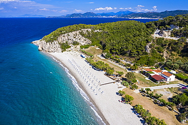
Aerial by drone of Metamorfosi Beach, Sithonia, Chalkidiki, Greece, Europe
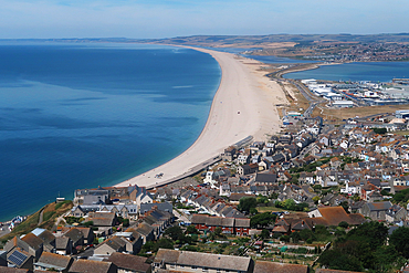
Chesil Beach, Jurassic Coast, South Dorset

Aerial by drone, Dresnica, Triglav National Park, Upper Carniola, Slovenia, Europe
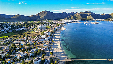
Aerial of Port de Pollenca, Mallorca, Balearic islands, Spain, Mediterranean, Europe

Aerial by drone of the white sand beach of Yantarny, Kaliningrad, Russia, Europe
Aerial view by drone of Half Moon Bay washed by Caribbean Sea, Antigua, Leeward Islands, West Indies, Caribbean, Central America
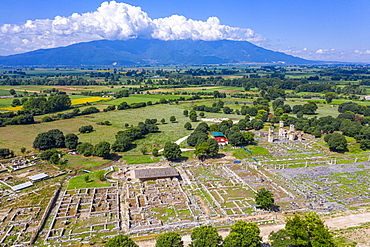
Aerial by drone of Philippi, UNESCO World Heritage Site, Macedonia, Greece, Europe
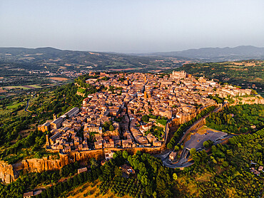
Drone view of Orvieto's Old Town cityscape at sunset, Orvieto, Umbria, Italy, Europe

Aerial of Port de Pollenca, Mallorca, Balearic islands, Spain, Mediterranean, Europe

Aerial by drone of Tlacotalpan, UNESCO World Heritage Site, Veracruz, Mexico, North America
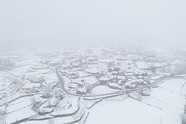
Drone aerial view of a road and remote village covered with snow in Vila Real, Norte, Portugal, Europe
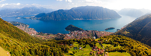
Aerial drone view of Lake Como from Narro, Tremezzina, Como, Lombardy, Italian Lakes, Italy, Europe

Aerial view of turquoise sea and Santa Ponsa, Majorca, Balearic Islands, Spain, Mediterranean, Europe

Aerial view of Cadiz, by drone, Andalucia, Spain, Europe
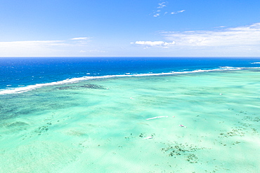
Aerial view by drone of coral reef in the turquoise water of Caribbean Sea, Antilles, West Indies, Caribbean, Central America
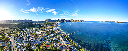
Aerial of Port de Pollenca, Mallorca, Balearic islands, Spain, Mediterranean, Europe

Drone shot of tractor with mower mowing grasses on agricultural field during a summer day, Italy, Europe

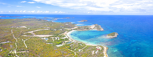
Aerial view by drone of Hermitage Bay and Pearns Point, Antigua, Antigua and Barbuda, Leeward Islands, West Indies, Caribbean, Central America
Turquoise coral reef meeting the blue Indian Ocean, aerial view by drone, Ile Aux Cerfs, Flacq district, Mauritius, Indian Ocean, Africa

Aerial by drone of Philippi, UNESCO World Heritage Site, Macedonia, Greece, Europe
Aerial by drone of Tsambou Beach, Samos, Greek Islands, Greece, Europe

Aerial of Panormos beach, Mykonos, Cyclades, Greek Islands, Greece, Europe
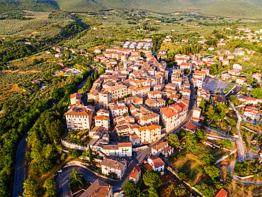
Aerial drone view of the village of Montecchio at sunset, Umbria, Italy, Europe