Results
« Previous 1 … 11 12 13
1207 results found

Aerial view of lighthouse at Cap Formentor at sunset, Majorca, Balearic Islands, Spain, Mediterranean, Europe
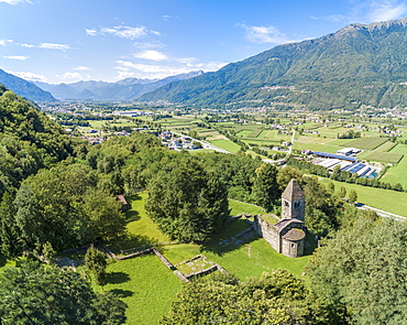
Panoramic of medieval Abbey of San Pietro in Vallate, Piagno, Sondrio province, Lower Valtellina, Lombardy, Italy, Europe (Drone)
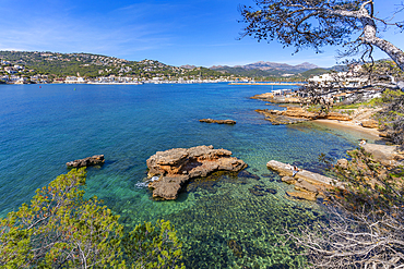
View of rocky shoreline and the sea at Port d'Andratx, Majorca, Balearic Islands, Spain, Mediterranean, Europe
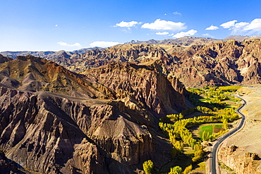
Aerial by drone of the mountains around Bamyan, Afghanistan, Asia
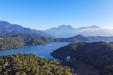
Aerial by drone over Sun Moon Lake, National Scenic Area, Nantou county, Taiwan, Asia
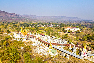
Aerial view by drone of pagodas, Inle Lake, Shan state, Myanmar (Burma), Asia
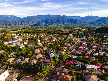
A drone view of Ozurgeti and the mountains of Guria, Georgia (Sakartvelo), Central Asia, Asia

Aerial by drone of the Curonian Spit National Park, UNESCO World Heritage Site, Kaliningrad, Russia, Europe

Aerial by drone of Tsambou Beach, Samos, Greek Islands, Greece, Europe
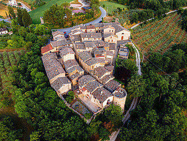
Aerial drone view of the village of Torre del Colle at sunset, Umbria, Italy, Europe
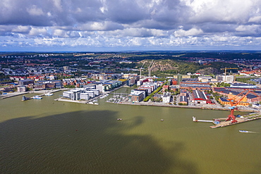
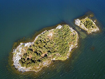
Aerial view by drone of Hesingen (Hisingen) island, Gothenburg, Sweden, Scandinavia, Europe
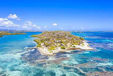
Aerial view by drone of coral reef in the turquoise water of Caribbean Sea, Antilles, West Indies, Caribbean, Central America
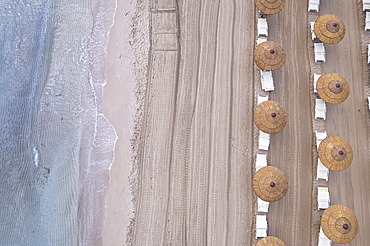
Drone view of beach straw umbrellas on an empty beach, Sicily, Mediterranean Sea, Italy, Europe
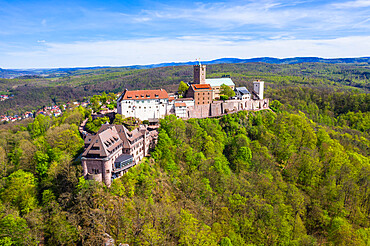
Aerial by drone of Wartburg Castle, UNESCO World Heritage Site, Thuringia, Germany, Europe
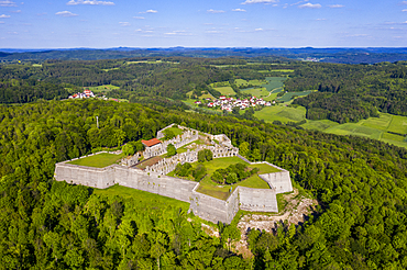
Aerial by drone of Fortress Rothenberg, Franconia, Bavaria, Germany, Europe

Aerial by drone of Fortress Rothenberg, Franconia, Bavaria, Germany, Europe
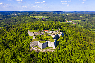
Aerial by drone of Fortress Rothenberg, Franconia, Bavaria, Germany, Europe
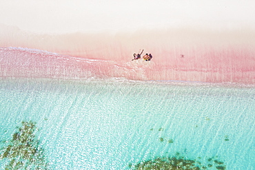
Man and woman having fun to fly a drone on pink sand beach, Caribbean, Antilles, West Indies, Central America
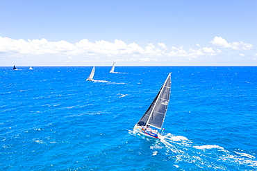
Aerial view by drone of sailing boats during a regatta, Antigua, Leeward Islands, West Indies, Caribbean, Central America
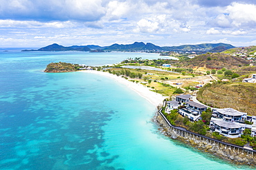
Aerial view by drone of Tamarind Hills luxury hotel ocean front and Ffryes Bay, Antigua, Antigua and Barbuda, Leeward Islands, West Indies, Caribbean, Central America
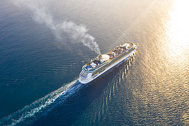
Cruise ship sailing in the Caribbean Sea at sunset, aerial view by drone, Antilles, West Indies, Caribbean, Central America
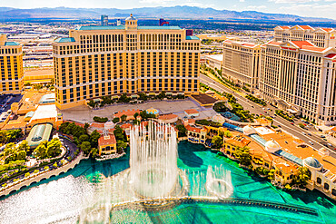
Bellagio Hotel and Casino, Las Vegas, Nevada, United States of America, North America
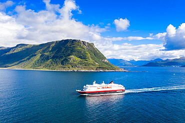
Aerial view by drone of Hurtigruten during a daily trip along the fjord, Alesund, More og Romsdal county, Norway, Scandinavia, Europe

Cruise ship sailing in the Caribbean Sea at sunset, aerial view by drone, Antilles, West Indies, Caribbean, Central America
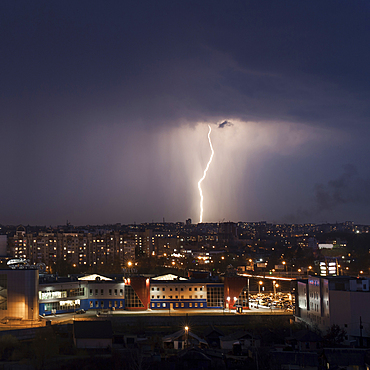
Lightning strike in city at night

Aerial view of airplane flying over trees

Aerial view of airplane flying over trees
High angle view of waterfront cityscape
Aerial view of trees in landscape
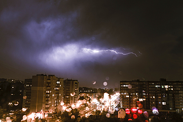
Lightning striking city at night

Scenic view of waterfront, Gravedona, Lake Como, Italy

Aerial view of river and trees
Aerial view of river and trees
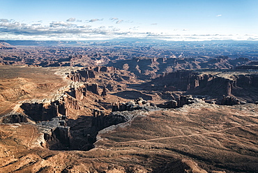
Aerial view of canyon, Moab, Utah, United States
Aerial view of waterfront cityscape
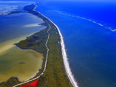
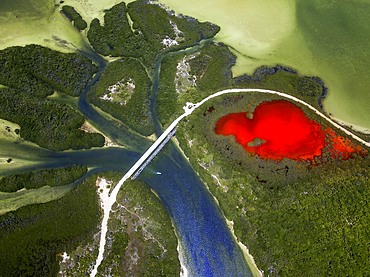
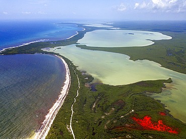
Aerial view of Punta Allen Sian Ka'an Reserve, Yucatan Peninsula, Mexico. Red lagoon near Boca Paila Bridge.
In the language of the Mayan peoples who once inhabited this region, Sian Ka'an means Origin of the Sky. Located on the east coast of the Yucatán peninsula, this biosphere reserve contains tropical forests, mangroves and marshes, as well as a large marine section intersected by a barrier reef. It provides a habitat for a remarkably rich flora and a fauna comprising more than 300 species of birds, as well as a large number of the region's characteristic terrestrial vertebrates, which cohabit in the diverse environment formed by its complex hydrological system.
Along its roughly 120 kilometres of coastline, the property covers over 400,000 hectares of land ranging from sea level to only ten m.a.s.l. The property boasts diverse tropical forests, palm savannah, one of the most pristine wetlands in the region, lagoons, extensive mangrove stands, as well as sandy beaches and dunes. The 120,000 hectares of marine area protect a valuable part of the Mesoamerican Barrier Reef and seagrass beds in the shallow bays. The lush green of the forests and the many shades of blue of the lagoons and the Caribbean Sea under a wide sky offer fascinating visual impressions.
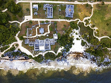
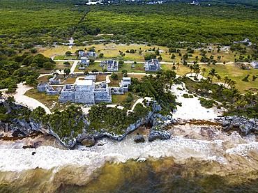
Aerial views of El Castillo and the Ruins of the Mayan temple grounds at Tulum, Quintana Roo, Yucatan, Mexico. Tulum is the site of a pre-Columbian Mayan walled city which served as a major port for Coba, in the Mexican state of Quintana Roo. The ruins are situated on 12 meter 39 ft tall cliffs along the east coast of the Yucatán Peninsula on the Caribbean Sea in the state of Quintana Roo, Mexico. Tulum was one of the last cities built and inhabited by the Maya; it was at its height between the 13th and 15th centuries and managed to survive about 70 years after the Spanish began occupying Mexico. Old World diseases brought by the Spanish settlers appear to have resulted in very high fatalities, disrupting the society, and eventually causing the city to be abandoned.
Aerial view of Punta Allen Sian Ka'an Reserve, Yucatan Peninsula, Mexico. Red lagoon near Boca Paila Bridge.
In the language of the Mayan peoples who once inhabited this region, Sian Ka'an means Origin of the Sky. Located on the east coast of the Yucatán peninsula, this biosphere reserve contains tropical forests, mangroves and marshes, as well as a large marine section intersected by a barrier reef. It provides a habitat for a remarkably rich flora and a fauna comprising more than 300 species of birds, as well as a large number of the region's characteristic terrestrial vertebrates, which cohabit in the diverse environment formed by its complex hydrological system.
Along its roughly 120 kilometres of coastline, the property covers over 400,000 hectares of land ranging from sea level to only ten m.a.s.l. The property boasts diverse tropical forests, palm savannah, one of the most pristine wetlands in the region, lagoons, extensive mangrove stands, as well as sandy beaches and dunes. The 120,000 hectares of marine area protect a valuable part of the Mesoamerican Barrier Reef and seagrass beds in the shallow bays. The lush green of the forests and the many shades of blue of the lagoons and the Caribbean Sea under a wide sky offer fascinating visual impressions.
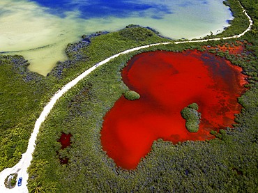
Aerial views of El Castillo and the Ruins of the Mayan temple grounds at Tulum, Quintana Roo, Yucatan, Mexico. Tulum is the site of a pre-Columbian Mayan walled city which served as a major port for Coba, in the Mexican state of Quintana Roo. The ruins are situated on 12 meter 39 ft tall cliffs along the east coast of the Yucatán Peninsula on the Caribbean Sea in the state of Quintana Roo, Mexico. Tulum was one of the last cities built and inhabited by the Maya; it was at its height between the 13th and 15th centuries and managed to survive about 70 years after the Spanish began occupying Mexico. Old World diseases brought by the Spanish settlers appear to have resulted in very high fatalities, disrupting the society, and eventually causing the city to be abandoned.
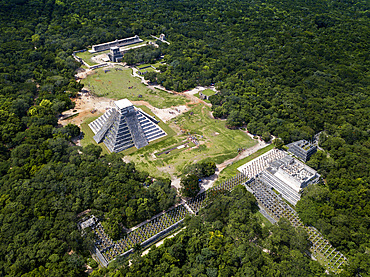
Aerial view of Mayan Ruin of Chichen Itza Archaeological Site Yucatan Peninsula, Quintana Roo, Caribbean Coast, Mexico
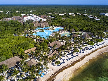
Aerial view of Grand Palladium White Sand Resort and Spa in Riviera Maya, Yucatan Peninsula, Quintana Roo, Caribbean Coast, Mexico
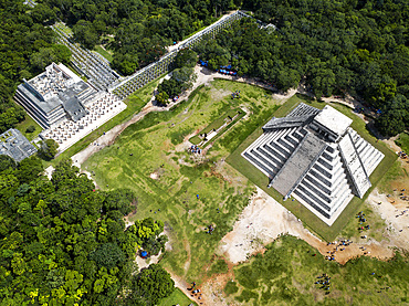
Aerial view of Mayan Ruin of Chichen Itza Archaeological Site Yucatan Peninsula, Quintana Roo, Caribbean Coast, Mexico
Aerial view of Punta Allen Sian Ka'an Reserve, Yucatan Peninsula, Mexico. Red lagoon near Boca Paila Bridge.
In the language of the Mayan peoples who once inhabited this region, Sian Ka'an means Origin of the Sky. Located on the east coast of the Yucatán peninsula, this biosphere reserve contains tropical forests, mangroves and marshes, as well as a large marine section intersected by a barrier reef. It provides a habitat for a remarkably rich flora and a fauna comprising more than 300 species of birds, as well as a large number of the region's characteristic terrestrial vertebrates, which cohabit in the diverse environment formed by its complex hydrological system.
Along its roughly 120 kilometres of coastline, the property covers over 400,000 hectares of land ranging from sea level to only ten m.a.s.l. The property boasts diverse tropical forests, palm savannah, one of the most pristine wetlands in the region, lagoons, extensive mangrove stands, as well as sandy beaches and dunes. The 120,000 hectares of marine area protect a valuable part of the Mesoamerican Barrier Reef and seagrass beds in the shallow bays. The lush green of the forests and the many shades of blue of the lagoons and the Caribbean Sea under a wide sky offer fascinating visual impressions.

Aerial view of Punta Allen Sian Ka'an Reserve, Yucatan Peninsula, Mexico
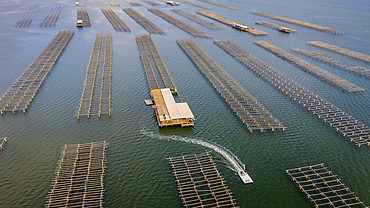
In Fangar Bay mussels and oysters are farmed. Ebro Delta Nature Reserve, Tarragona, Catalonia, Spain.
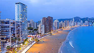
Aerial view of the Levante beach and the skyline by night. Benidorm. Alicante. Valencia Community. Spain
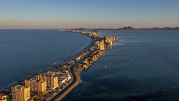
La Manga del Mar Menor, Murcia, Spain
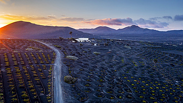
Vinery, La Geria, Lanzarote, Canary Islands, Spain

Vinery, La Geria, Lanzarote, Canary Islands, Spain
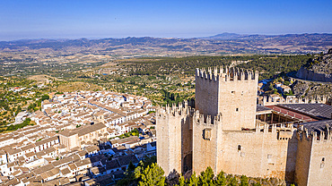
Renaissance castle and white village, Velez Blanco, Almeria, Andalucia, Spain,
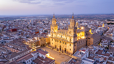
Jaen Cathedral at night, Jaen, Andalucia, Spain.
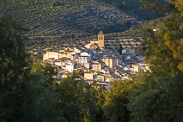
The village of Quesada and olive groves, Jaen province, Andalucia, Spain.
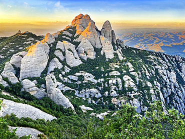
Montserrat is a mountain near Barcelona, in Catalonia. It is the site of a Benedictine abbey, Santa Maria de Montserrat, which hosts the Virgin of Montserrat sanctuary.
Montserrat is a multi-peaked mountain range near Barcelona, in Catalonia, Spain. It is part of the Catalan Pre-Coastal Range. The main peaks are Sant Jeroni (1,236 m), Montgrós (1,120 m) and Miranda de les Agulles (903 m). It is well known as the site of the Benedictine abbey, Santa Maria de Montserrat, which hosts the Virgin of Montserrat sanctuary. Montserrat literally means "saw (serrated, like the common handsaw) mountain" in Catalan. It describes its peculiar aspect with multitude of rock formations which are visible from a great distance. The mountain is composed of strikingly pink conglomerate, a form of sedimentary rock. Montserrat was designated as a National Park in 1987. On this mountain we will have access to the Monastery of Montserrat which houses the virgin that gives its name to the monastery, although it is also known as La Moreneta
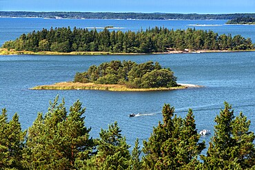
Aerial view of the islands in front Mossala Island Resort Southwest Finland archipelago. The archipelago ring road or Saariston rengastie is full of things to see, do and do. The Archipelago Trail can be taken clockwise or counter clockwise, starting in the historical city of Turku, and continuing through rural archipelago villages and astonishing Baltic Sea sceneries. The Trail can be taken from the beginning of June until the end of August.
Aerial view of small island in front Mossala Island Resort Southwest Finland archipielago. The archipelago ring road or Saariston rengastie is full of things to see, do and do. The Archipelago Trail can be taken clockwise or counter clockwise, starting in the historical city of Turku, and continuing through rural archipelago villages and astonishing Baltic Sea sceneries. The Trail can be taken from the beginning of June until the end of August.
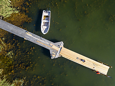
Aerial view of small dock in Korpo or Korppoo island, Korpostrom coast Southwest Finland Turku archipelago. The archipelago ring road or Saariston rengastie is full of things to see, do and do. The Archipelago Trail can be taken clockwise or counter clockwise, starting in the historical city of Turku, and continuing through rural archipelago villages and astonishing Baltic Sea sceneries. The Trail can be taken from the beginning of June until the end of August.
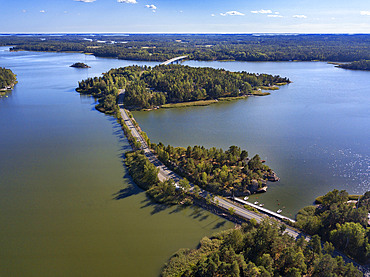
Aerial view of Kustavi small islands in Southwest Finland archipielago. The archipelago ring road or Saariston rengastie is full of things to see, do and do. The Archipelago Trail can be taken clockwise or counter clockwise, starting in the historical city of Turku, and continuing through rural archipelago villages and astonishing Baltic Sea sceneries. The Trail can be taken from the beginning of June until the end of August.
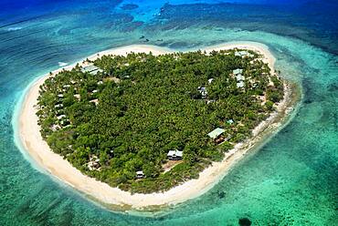
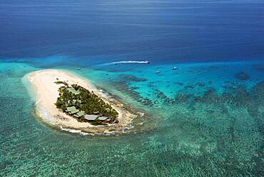
Aerial view of the heart-shaped island of Tavarua, near Viti Levu, Republic of Fiji, South Pacific Islands, Pacific
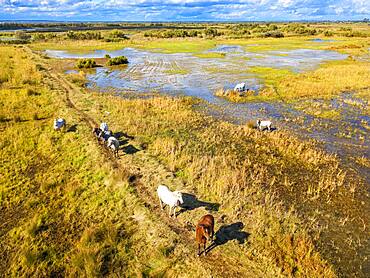
Camargue horses (Equus caballus), herd gallopping through water, Saintes-Marie-de-la-Mer, Camargue, Le-Grau-du-Roi, Department Gard, Languedoc-Roussillon, southern France
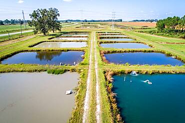
Algae colors the water in aquaculture ponds at the University of Georgia Tifton Campus Coastal Plain Experiment Station
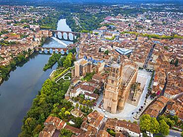
Gothic Saint Cecile Cathedral in Albi town. Pont Vieux bridge and the Church of Notre Dame du Breuil in Tarn village, Languedoc-Roussillon Occitanie Midi Pyrenees France.
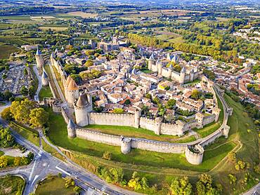
Aerial view of Carcassonne, medieval city listed as World Heritage by UNESCO, harboure d'Aude, Languedoc-Roussillon Midi Pyrenees Aude France
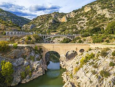
Pont du Diable, the Devil's Bridge, over Hérault River, near Saint Guilhem le Désert, Hérault, Languedoc Roussillon. Saint Jean de Fos, the Pont du Diable over the Herault river on the Routes of Santiago de Compostela, listed as World Heritage by UNESCO, Herault, France.
Namotu Island Mamanuca Islands, Fiji, South Pacific - aerial view
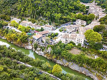
Aerial view Saint Guilhem le Desert, labelled Les Plus Beaux Villages de France (The Most Beautiful Villages of France), a stop on el Camino de Santiago, Herault, France.
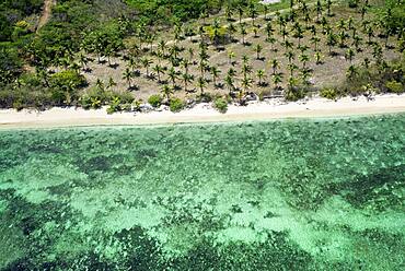
Aerial view of coco palms in Viti Levu coast beach, Fiji
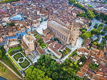
Gothic Saint Cecile Cathedral in Albi town. Pont Vieux bridge and the Church of Notre Dame du Breuil in Tarn village, Languedoc-Roussillon Occitanie Midi Pyrenees France.
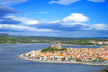
View of the watchtower at Gruissan in Languedoc-Roussillon, France, Aude, Gruissan, village in Circulade testifies of a Medieval origin, strategic sign of defense and Christian symbol
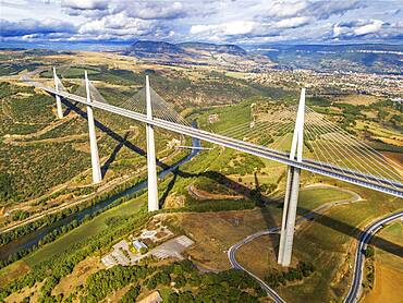
Aerial view Millau viaduct by architect Norman Foster, between Causse du Larzac and Causse de Sauveterre above Tarn, Aveyron, France. Cable-stayed bridge spanning the Tarn River Valley. A75 motorway, built by Michel Virlogeux and Norman Foster, located between Causses de Sauveterre and Causses du Larzac above Tarn River, Natural Regional Park of Grands Causses.
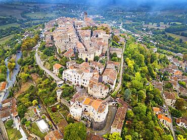
Aerial view of Cordes sur Ciel, labelled The Most Beautiful Villages of France, Tarn, Occitanie, France
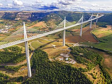
Aerial view Millau viaduct by architect Norman Foster, between Causse du Larzac and Causse de Sauveterre above Tarn, Aveyron, France. Cable-stayed bridge spanning the Tarn River Valley. A75 motorway, built by Michel Virlogeux and Norman Foster, located between Causses de Sauveterre and Causses du Larzac above Tarn River, Natural Regional Park of Grands Causses.
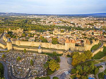
Aerial view of Carcassonne, medieval city listed as World Heritage by UNESCO, harboure d'Aude, Languedoc-Roussillon Midi Pyrenees Aude France
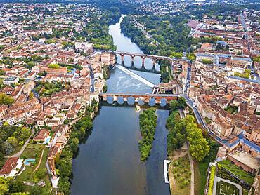
The Tarn River crossing Albi town. Pont Vieux bridge and the Church of Notre Dame du Breuil in Tarn village, Occitanie Midi Pyrenees France.

The Tarn River crossing Albi town. Pont Vieux bridge and the Church of Notre Dame du Breuil in Tarn village, Occitanie Midi Pyrenees France.
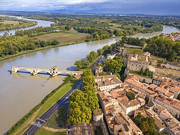
Aerial view of Avignon Bridge with Popes Palace and Rhone River at sunrise, Pont Saint-Benezet, Provence, France
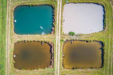
Algae colors the water in aquaculture ponds at the University of Georgia Tifton Campus Coastal Plain Experiment Station
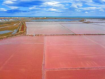
Salt production of Salins du Midi at Gruissan in Languedoc-Roussillon, France, Aude, Gruissan. Solar evaporaton salt pans salins. salt marshes, saline of Gruissan in aerial view.
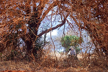
Vervet monkey Chlorocebus pygerythrus sitting on bare earth in Tsavo National Park Kenya
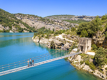
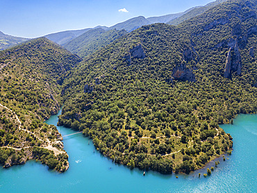
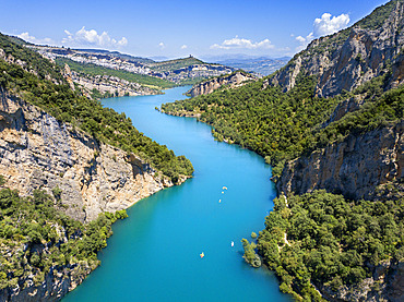
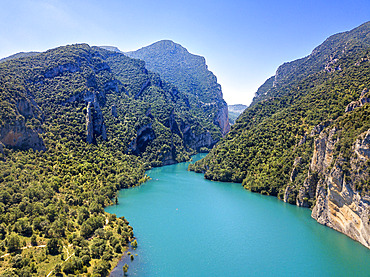
Congost de Mont-Rebei in the Pre-Pyrenees of Lleida, Catalonia. Serra del Montsec, La Noguera, Lleida, Spain
The Montrebei Gorge (in Catalan Congost de Mont-Rebei) is a place that is located between the provinces of Huesca and Lv©rida (Spain), between the regions of Ribagorza and Pallars JussvÜ. It is constituted in the narrowest part by which the Noguera Ribagorzana river, which constitutes the natural border between Aragon and Catalonia, crosses the Montsec mountain range, walls in vertical fall of more than 500 meters and a width at its minimum point of 20 meters . The Catalan part is part of the Noguera Nature Reserve. It is within the Sierra del Montsec Natural Interest Area.

Agricultural aerial landscape, Tierra Estella, Navarre, Spain, Europe

Quarry. Aerial view. Ancin area. Navarre, Spain, Europe

Agricultural area. Aerial view. Ayegui area. Navarre, Spain, Europe
Congost de Mont-Rebei in the Pre-Pyrenees of Lleida, Catalonia. Serra del Montsec, La Noguera, Lleida, Spain
The Montrebei Gorge (in Catalan Congost de Mont-Rebei) is a place that is located between the provinces of Huesca and Lv©rida (Spain), between the regions of Ribagorza and Pallars JussvÜ. It is constituted in the narrowest part by which the Noguera Ribagorzana river, which constitutes the natural border between Aragon and Catalonia, crosses the Montsec mountain range, walls in vertical fall of more than 500 meters and a width at its minimum point of 20 meters . The Catalan part is part of the Noguera Nature Reserve. It is within the Sierra del Montsec Natural Interest Area.

Reedbed and river. Alloz reservoir. Navarre, Spain, Europe

Quarry. Aerial view. Ancin area. Navarre, Spain, Europe
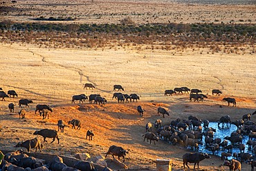
Migration of a group portrait of African buffalos Syncerus caffer herd drinking in front of Voi lodge, aerial view, Tsavo East National Park, Kenya
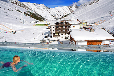
Kuhtai sky resort village and ski slopes near Innsbruck Tyrol Austria. Swimming pool of the Mooshaus Hotel.

Agricultural area and fog. Aerial view. Ayegui area. Navarre, Spain, Europe
Congost de Mont-Rebei in the Pre-Pyrenees of Lleida, Catalonia. Serra del Montsec, La Noguera, Lleida, Spain
The Montrebei Gorge (in Catalan Congost de Mont-Rebei) is a place that is located between the provinces of Huesca and Lv©rida (Spain), between the regions of Ribagorza and Pallars JussvÜ. It is constituted in the narrowest part by which the Noguera Ribagorzana river, which constitutes the natural border between Aragon and Catalonia, crosses the Montsec mountain range, walls in vertical fall of more than 500 meters and a width at its minimum point of 20 meters . The Catalan part is part of the Noguera Nature Reserve. It is within the Sierra del Montsec Natural Interest Area.
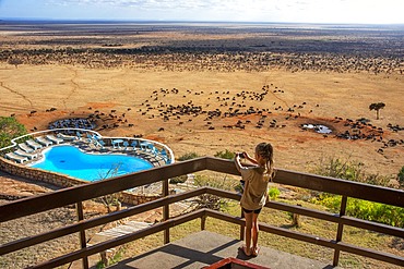
Tourist girl taking pictures of African buffalos Syncerus caffer herd drinking in front of Voi lodge, aerial view, Tsavo East National Park, Kenya
Agricultural area and fog. Aerial view. Ayegui area. Navarre, Spain, Europe
Congost de Mont-Rebei in the Pre-Pyrenees of Lleida, Catalonia. Serra del Montsec, La Noguera, Lleida, Spain
The Montrebei Gorge (in Catalan Congost de Mont-Rebei) is a place that is located between the provinces of Huesca and Lv©rida (Spain), between the regions of Ribagorza and Pallars JussvÜ. It is constituted in the narrowest part by which the Noguera Ribagorzana river, which constitutes the natural border between Aragon and Catalonia, crosses the Montsec mountain range, walls in vertical fall of more than 500 meters and a width at its minimum point of 20 meters . The Catalan part is part of the Noguera Nature Reserve. It is within the Sierra del Montsec Natural Interest Area.
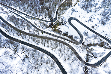
Snow-covered road. Olazagutia pass. Urbasa mountain range. Navarre, Spain, Europe
Congost de Mont-Rebei in the Pre-Pyrenees of Lleida, Catalonia. Serra del Montsec, La Noguera, Lleida, Spain
The Montrebei Gorge (in Catalan Congost de Mont-Rebei) is a place that is located between the provinces of Huesca and Lv©rida (Spain), between the regions of Ribagorza and Pallars JussvÜ. It is constituted in the narrowest part by which the Noguera Ribagorzana river, which constitutes the natural border between Aragon and Catalonia, crosses the Montsec mountain range, walls in vertical fall of more than 500 meters and a width at its minimum point of 20 meters . The Catalan part is part of the Noguera Nature Reserve. It is within the Sierra del Montsec Natural Interest Area.

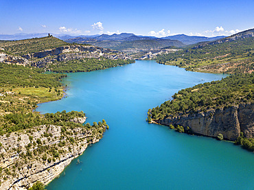
Reedbed and river. Alloz reservoir. Navarre, Spain, Europe
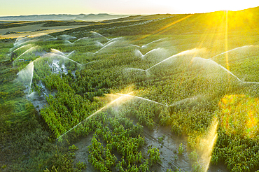
Farmland with watering. Aerial view. Navarre, Spain, Europe