Results
« Previous 1 2 3 4 5 … 7 Next »
646 results found
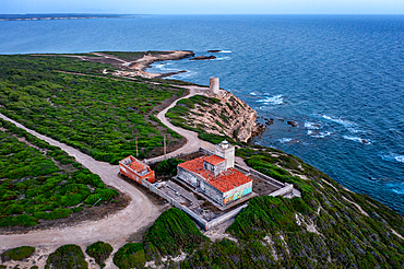
Lighthouse on Mannu Cape wild coast of Sardinia, aerial drone view at sunset, Sardinia, Italy, Mediterranean, Europe
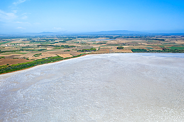
Salt lake of Sale de Porcus, aerial drone view, Sardinia, Italy, Mediterranean, Europe
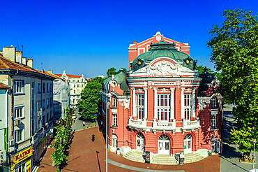
Aerial view by drone of State Opera House, Varna, Bulgaria, Europe
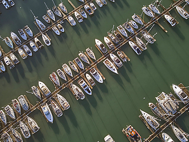
An aerial drone view of boats moored in the marina at Brixham, in Torbay, Devon, Great Britain.
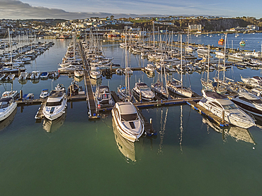
An aerial drone view of boats moored in the marina at Brixham, in Torbay, Devon, Great Britain.
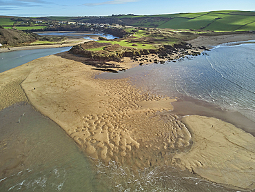
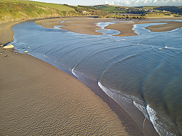
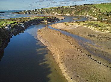
A low tide aerial drone view of the sandy shore and sand banks in the estuary of the River Avon, at Bantham, on the south coast of Devon, Great Britain.
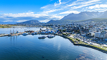
Aerial of Ushuaia, Beagle Channel, Tierra del Fuego, Argentina, South America
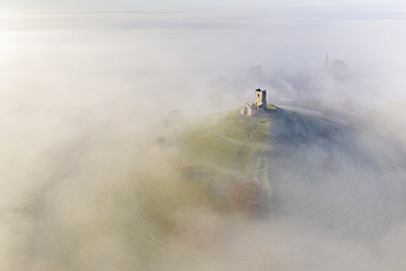
Aerial view by drone of St. Michael's Church on Burrow Mump, surrounded by a blanket of mist, Burrowbridge, Somerset, England, United Kingdom, Europe
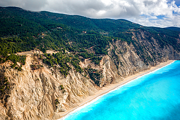
Drone view of Egremni beach cliffs and turquoise water, Lefkada island, Ionian Islands, Greek Islands, Greece
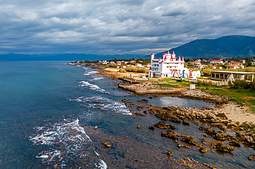
Drone aerial view of abandoned Fairytale Castle, by the sea, Agrilis Messinia, Peloponnese, Greece
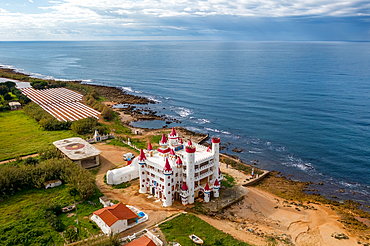
Drone aerial view of abandoned Fairytale Castle, by the sea, Agrilis Messinia, Peloponnese, Greece
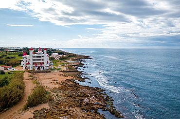
Drone aerial view of abandoned Fairytale Castle, by the sea, Agrilis Messinia, Peloponnese, Greece
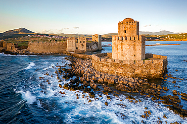
Bourtzi of Methoni castle, drone aerial view, in the sea, Methoni, Peloponnnese, Greece
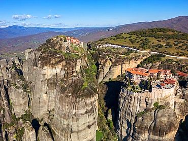
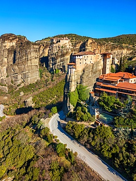
Drone aerial view of Meteora and ancient holy Monastery of Varlaam and Great Meteoron, UNESCO, Kalabaka, Greece
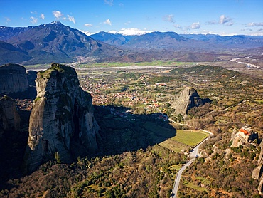
Drone aerial view of Meteora and ancient holy Monastery of Saint Nicholas Anapafsas, UNESCO, Kalabaka, Greece
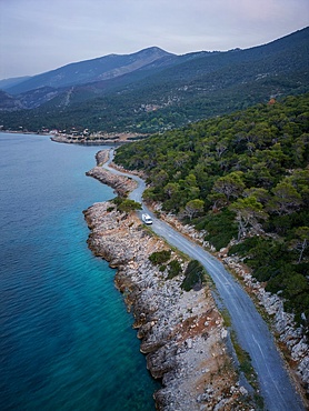
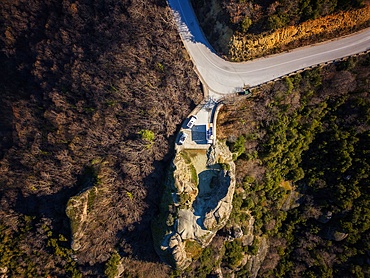
Camper van, drone aerial view, on the coast, Greece
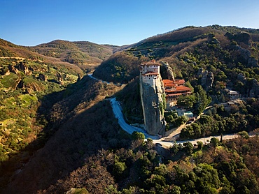
Drone aerial view of Meteora with ancient holy Monastery of Varlaam, UNESCO, Kalabaka, Greece
Drone aerial view of Meteora with ancient holy Monastery of Varlaam, UNESCO, Kalabaka, Greece
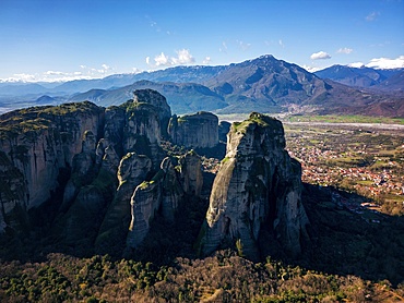
Drone aerial view of Meteora and ancient holy monastery, UNESCO, Kalabaka, Greece
Fishermen boats on a wild beach, drone aerial top view, Thessaloniki, Greece

Drone view of Epanomi Sandbar beach in Tsairi park on the coast, Thessaloniki, Greece
Drone aerial view of camper vans parked on a wild spot at Lake Polyfyto, Kozani, Macedonia, Greece
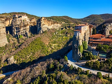
Drone aerial view of Meteora with ancient holy Monastery of Varlaam, UNESCO, Kalabaka, Greece
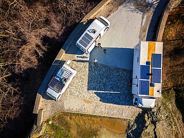
Drone aerial view of camper vans with solar panels on the roof, parked on a wild spot on the mountains in autumn, Kalabaka, Greece
Drone aerial view of camper vans with solar panels on the roof, parked on a wild spot on the mountains in autumn, Kalabaka, Greece
Drone aerial view of camper van parked on a wild spot by a beach, Thessaloniki, Greece
Drone aerial view of camper van drone top aerial view parked on a wild beach in Porto Koufo, Chalkidiki, Greece
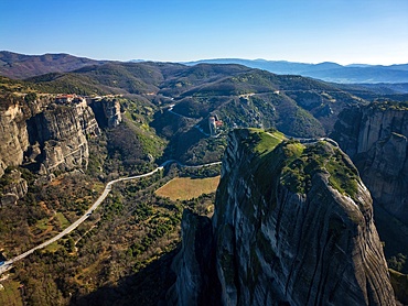
Drone aerial view of Meteora with ancient holy Monastery of Varlaam and Great Meteoron, UNESCO, Kalabaka, Greece
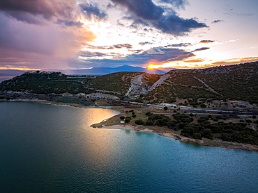
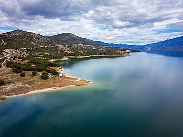
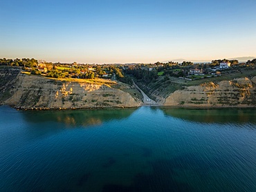
Drone aerial view of Lake Polyfyto and mountain landscape at sunset, Kozani, Macedonia, Greece
Drone aerial view of Lake Polyfyto mountain landscape and high bridge of Servia Neraida at sunset, Kozani, Macedonia, Greece
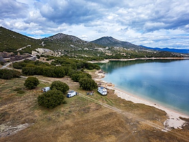
Drone aerial view of camper vans parked on a wild spot at Lake Polyfyto, Kozani, Macedonia, Greece

Drone top aerial view of camper van parked on a wild beach in Porto Koufo, Chalkidiki, Greece
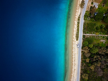
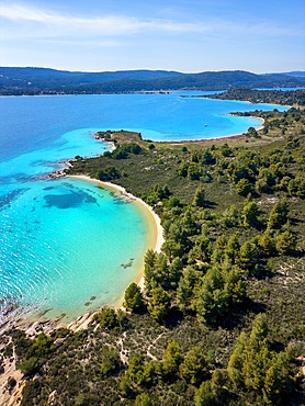
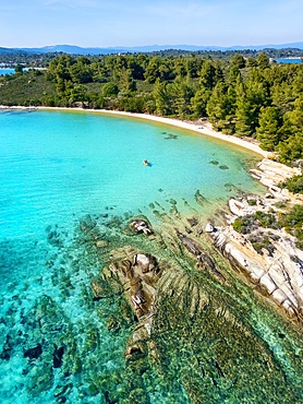
Karydi beach with turquoise water, drone aerial view, Sithonia, Chalkidiki, Greece

Karydi beach with turquoise water, drone aerial view, Sithonia, Chalkidiki, Greece
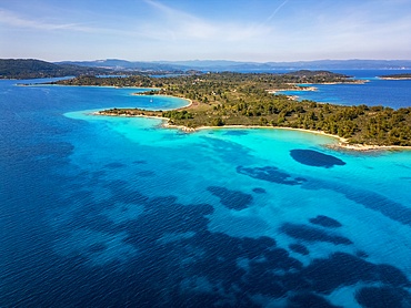
Diaporos island with wild beaches with turquoise water, drone aerial view, Chalkidiki, Greece
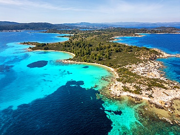
Diaporos island with wild beaches with turquoise water, drone aerial view, Chalkidiki, Greece
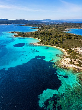
Diaporos island with wild beaches with turquoise water, drone aerial view, Chalkidiki, Greece
Diaporos island with wild beaches with turquoise water, drone aerial view, Chalkidiki, Greece

Diaporos island with wild beaches with turquoise water, drone top aerial view, Chalkidiki, Greece
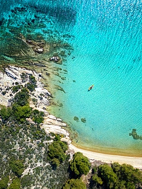
Diaporos island with wild beaches and kayak on the turquoise water, drone top aerial view, Chalkidiki, Greece
Diaporos island with wild beaches and a kayak on the turquoise water, drone aerial view, Chalkidiki, Greece
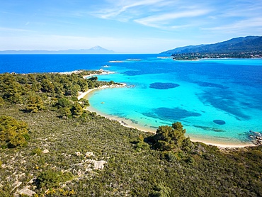
Diaporos island with wild beaches and turquoise water, drone aerial view, Chalkidiki, Greece
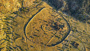
Aerial of Ouara, former capital of the Ouaddai Empire, Chad
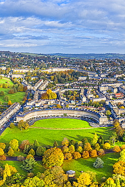
Aerial view by drone over the Georgian city of Bath, Royal Victoria Park and Royal Cresent, UNESCO World Heritage Site, Bath, Somerset, England, United Kingdom, Europe

Aerial view by drone over the Georgian city of Bath, Somerset, England, United Kingdom, Europe
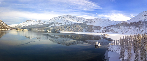
Aerial panoramic view of Lake Sils and Plaun da Lej during winter, Maloja Region, Canton of Graubunden, Engadine, Switzerland, Europe (Drone)
Aerial view of Cadiz, by drone, Andalucia, Spain, Europe
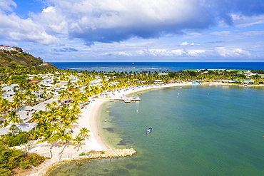
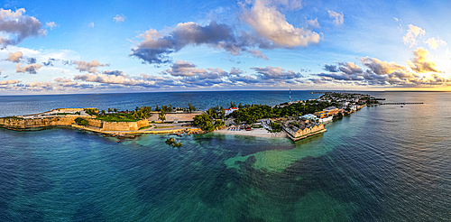
Aerial view by drone of St. James Bay, Antigua, Antigua and Barbuda, Leeward Islands, West Indies, Caribbean, Central America
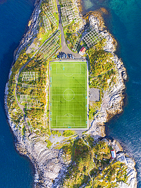
Aerial view taken by drone of Henningsvaer during an autumn day, famous fisherman's village in the Lofoten Islands, Nordland, Norway, Scandinavia, Europe
Aerial view taken by drone of Henningsvaer during an autumn day, famous fisherman's village in the Lofoten Islands, Nordland, Norway, Scandinavia, Europe

Aerial drone panoramic view of the historic Centre of Evora, a city with roots in Roman times, with its golden age in the 15th century when the residence of the Portuguese kings, Evora, Alentejo, Portugal, Europe
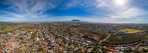
Aerial drone panoramic view of Northern residential suburbs in Cape Town, looking towards the south and Table Mountain, Cape Town, Western Cape, South Africa, Africa
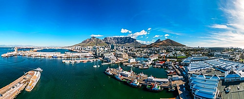
Aerial drone panoramic view of the V and A (Victoria and Alfred) Waterfront, a mixed-use destination located in the oldest working harbour in the Southern Hemisphere,with Table Mountain as backdrop, Cape Town, Western Cape, South Africa, Africa

Aerial drone panoramic view of Bo-Kaap, formerly known as the Malay Quarter, formerly a racially segregated area, on the slopes of Signal Hill above the city centre, Cape Town, Western Cape, South Africa, Africa
Aerial drone panoramic view of Parque dos Poetas, 25 hectare parkland with 60 statues in honour of 60 poets, Oeiras, Lisbon, Portugal, Europe
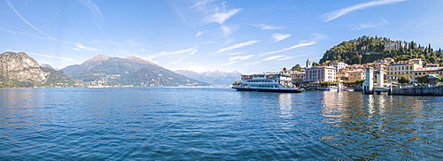
Panoramic aerial view of ferry boat at Bellagio on the shore of Lake Como, Province of Como, Lombardy, Italian Lakes, Italy, Europe (Drone)
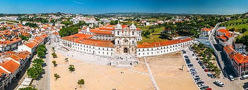
Aerial drone panoramic view of the Alcobaca Monastery (Alcobasa Monastery), UNESCO World Heritage Site, a Catholic monastic complex, Alcobaca, central Portugal, Eurpe
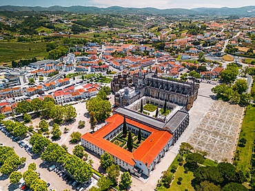
Aerial of the Monastery of the Dominicans of Batalha, built to commemorate the Portuguese victory over the Castilians at the battle of Aljubarrota in 1385, UNESCO World Heritage Site, Batalha, Centro, Portugal, Europe
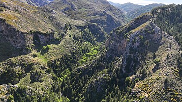
Aerial view of Gorge Sarakina Meskla, Crete, Greek Islands, Greece, Europe
Aerial of the Island of Mozambique, UNESCO World Heritage Site, Mozambique, Africa
Aerial drone panoramic view of Troia, a peninsula located in Grandola Municipality, next to Sado River estuary, with Arrabida mountain range on left, Alentejo, Portugal, Europe
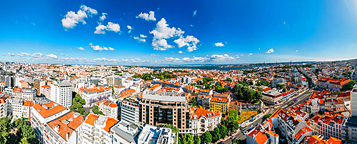
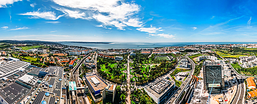
Aerial drone panoramic view of Lisbon's Baixa district on a sunny day looking south towards the Tagus with the 25 April Bridge visible, Lisbon, Portugal, Europe
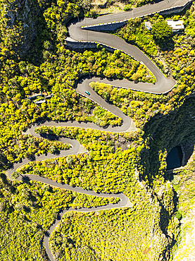
Vertical aerial view from the drone of a fantastic winding road on the island of Tenerife, Canary Islands, Spain, Atlantic, Europe
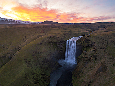
Aerial view taken by drone of Skogafoss Waterfall, southern Iceland, Polar Regions

Aerial view taken by drone of iceberg in Jokusarloon Glacier Lagoon during a summer day, Iceland, Polar Regions
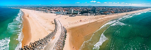
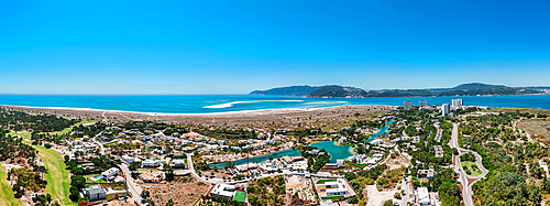
Aerial drone panoramic view of Espinho, near Porto, Norte, Portugal, Europe
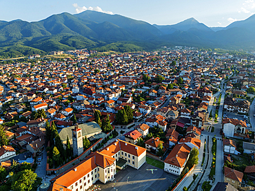
Old Town, Bansko, near the Pirin National Park, Bulgaria, Europe
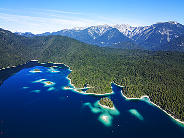
Aerial drone view of Eibsee lake, Garmisch Partenkirchen, Bavaria, Germany, Europe
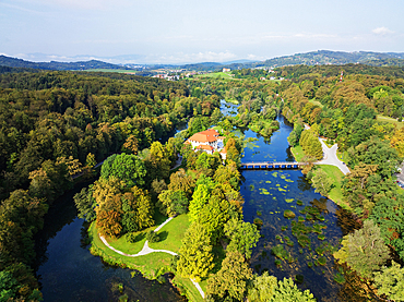
Aerial drone view of Otocec Castle, 13th to 17th century construction, Slovenia, Europe
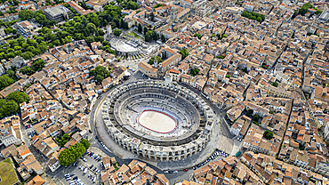
Aerial of the city with the Roman Amphitheatre, UNESCO World Heritage Site, Arles, Bouches du Rhone, Provence-Alpes-Cote d'Azur, France, Europe
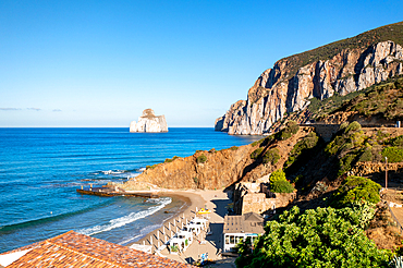
Capo Caccia, aerial drone view, Sardinia, Italy, Mediterranean, Europe
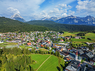
Aerial drone view, Seefeld, Tyrol, Austrian Alps, Austria, Europe
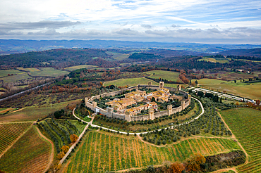
Monteriggioni historic village on top of the hill, drone aerial view, Monteriggioni, Tuscany, Italy, Europe
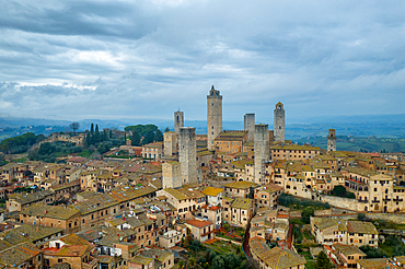
San Gimignano historic medieval village with iconic towers, UNESCO World Heritage Site, drone aerial view, San Gimignano, Tuscany, Italy, Euorpe
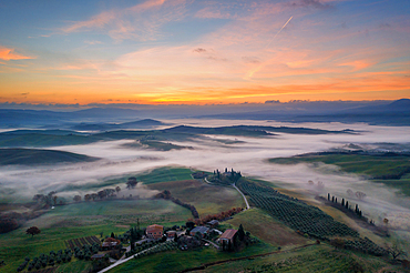
Val d'Orcia, UNESCO World Heritage Site, landscape drone aerial view with fog at sunrise, Tuscany, Italy, Europe
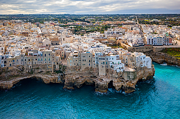
Polignano a Mare, drone aerial view of historic city on the cliffs of Adriatic Sea with turquoise water, Polignano a Mare, Apulia, Italy, Europe
Aerial drone panoramic view of Obidos, a town in the Oeste region, historical province of Estremadura and Leiria district, Portugal, Europe
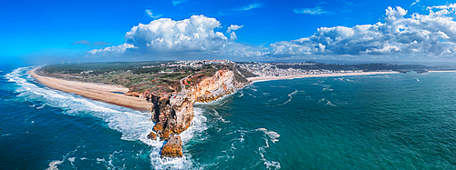
A breathtaking aerial drone panoramic view of Nazare's coastline with towering cliffs meeting the ocean, and waves crashing onto the sandy beach, Nazare, Oeste, Estremadura, Portugal, Europe
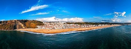
Aerial drone panoramic view of Nazare beach and Nazare city on a sunny day, Nazare, Oeste, Estremadura, Portugal, Europe
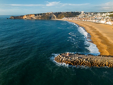
Aerial drone view of Nazare coastline showcasing beautiful beach, vibrant surf and rocky pier, Nazare, Oeste, Estremadura, Portugal, Europe
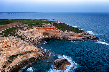
Lighthouse on Mannu Cape wild coast of Sardinia, aerial drone view at sunset, Sardinia, Italy, Mediterranean, Europe
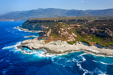
Cane Malu, aerial drone landscape, Sardinia, Italy, Mediterranean, Europe

Aerial drone panoramic view of Largo do Intendente Pina Manique in Lisbon, Portugal, Europe

Aerial drone panoramic view of Largo do Intendente Pina Manique in Lisbon, Portugal, Europe
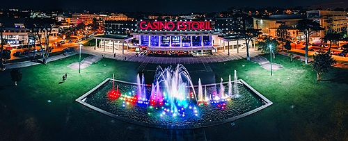
Aerial drone panoramic view of Casino Estoril at night, the inspiration of Ian Fleming's Casino Royale, Estoril, Portugal, Europe
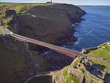
An aerial view of the dramatic ruins of Tintagel Castle, said to be the birthplace of King Arthur, on a rocky island off the shore, near the town of Tintagel, Cornwall, England, United Kingdom, Europe
Pan di Zucchero island and Masua beach aerial drone view, Sardinia, Italy, Mediterranean, Europe
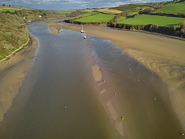
An aerial view of sand banks at low tide, in the mouth of the River Avon, at Bigbury, on the south coast of Devon, England, United Kingdom, Europe
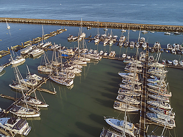
An aerial drone view of boats moored in the marina at Brixham, in Torbay, Devon, Great Britain.
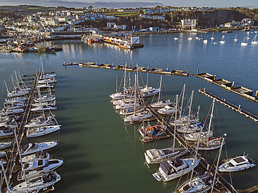
An aerial drone view of boats moored in the marina at Brixham, with the town of Brixham in the background, in Torbay, Devon, Great Britain.
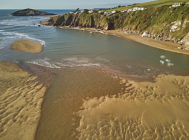
A low tide aerial drone view of the sandy shore and sand banks in the estuary of the River Avon, at Bantham, on the south coast of Devon, Great Britain.
A low tide aerial drone view of the sandy shore and sand banks in the estuary of the River Avon, at Bantham, on the south coast of Devon, Great Britain.
A low tide aerial drone view of the sandy shore and sand banks in the estuary of the River Avon, at Bantham, on the south coast of Devon, Great Britain.
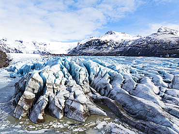
Aerial drone view of particular ice textures formed in the Svinafellsjokull glacier following global warming, Iceland, Polar Regions
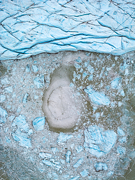
Aerial drone view of particular ice textures formed in the Hoffelsjokull glacier following global warming, Iceland, Polar Regions
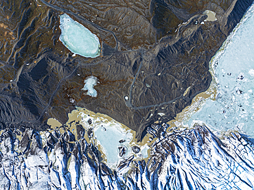
Aerial drone view of particular ice textures formed in the Svinafellsjokull glacier following global warming, Iceland, Polar Regions
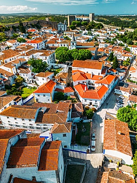
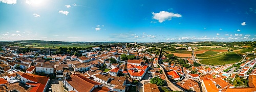
Aerial drone view of Obidos, a town in the Oeste region, historical province of Estremadura and Leiria district, Portugal, Europe
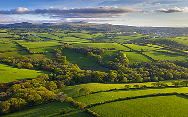
Aerial view by drone of rolling countryside near Dartmoor, Devon, England, United Kingdom, Europe
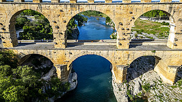
The Pont du Gard, a Roman aqueduct, UNESCO World Heritage Site, Vers-Pont-du-Guard, Occitanie, France, Europe

Aerial view by drone of mist over Restormel Castle in Cornwall, England, United Kingdom, Europe