Results
« Previous 1 … 36 37 38 39 Next »
3846 results found
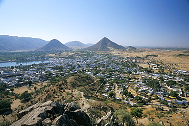
Holy lake beside holy city, with camel fair (mela) on sand dunes, Pushkar, Rajasthan, India, Asia

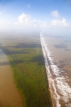
Area deforested and cleared for intense farming, Lake Langano, Ethiopia, Africa
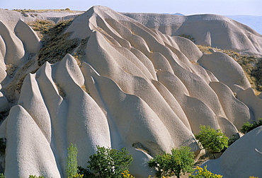
Rock formations, Cappadocia, Anatolia, Turkey, Asia Minor, Asia
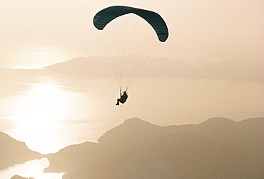
Man paragliding over the Mediterranean coast, Fethiye, Turkey, Asia
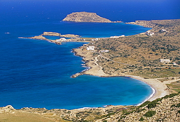
Aerial view of east coast of Karpathos near Lefkos, Karpathos, Dodecanese islands, Greece, Mediterranean, Europe
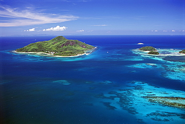
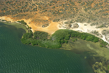
Aerial view of Ile Sainte Anne (St. Anne island) in blue sea, northeast coast, island of Mahe, Seychelles, Indian Ocean, Africa
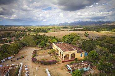
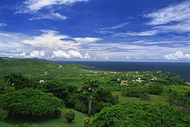
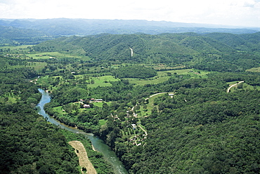
View of Hacienda from the Slave Tower, Valle de los Ingenios (Valley of the Sugar Mills), UNESCO World Heritage Site, Trinidad, Sancti Spiritus Province, Cuba, West Indies, Caribbean, Central America
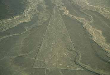
Trapezoid, Nazca Lines (Nasca Lines), UNESCO World Heritage Site, Peru, South America
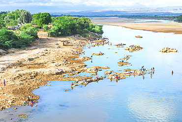
People washing and taking water from the Mandare River, Berenty, Fort Dauphin, Toliara Province, Madagascar, Africa
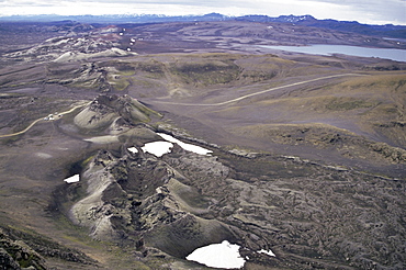
Fissure vent with spatter cones, Laki Volcano, Iceland, Polar Regions
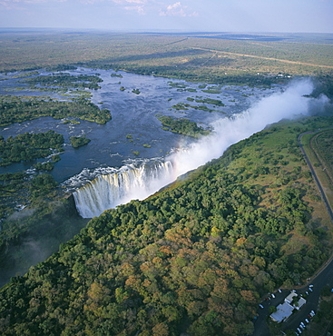
Aerial view of the Victoria Falls, UNESCO World Heritage Site, Zimbabwe, Africa
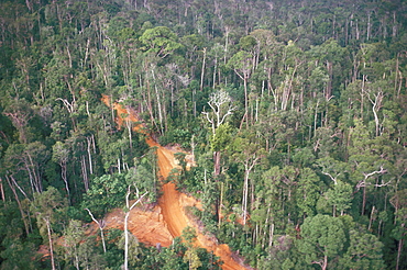
Logging road through rainforest, Brazil, South America
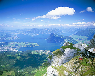
View from Mount Pilatus over Lake Lucerne, Switzerland, Europe
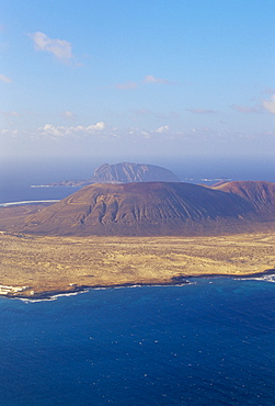
Aerial view of La Graciosa Island volcanoes from El Mirador del Rio, Lanzarote, Canary Islands, Spain, Atlantic, Europe
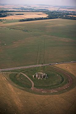
Aerial view of Stonehenge, UNESCO World Heritage Site, Salisbury Plain, Wiltshire, England, United Kingdom, Europe

Aerial view of Inverary castle and Loch Fyne, Inverary, Scotland, United Kingdom, Europe
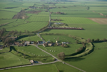
Aerial view of Avebury, UNESCO World Heritage Site, Wiltshire, England, United Kingdom, Europe
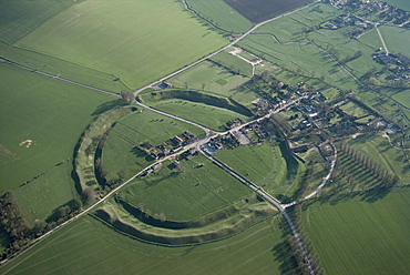
Aerial view of Avebury, UNESCO World Heritage Site, Wiltshire, England, United Kingdom, Europe

The Pu'u O'o cinder cone, the active vent on the southern flank of the Kilauea volcano, UNESCO World Heritage Site, Big Island, Hawaiian Islands, United States of America, North America
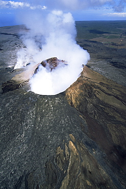
The Pu'u O'o cinder cone, the active vent on the southern flank of the Kilauea volcano, UNESCO World Heritage Site, Big Island, Hawaiian Islands, United States of America, North America
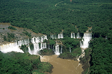
Aerial view of the Iguassu Falls, Iguassu National Park, UNESCO World Heritage Site, Parana, Brazil, South America
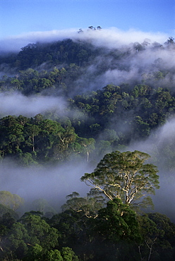
Aerial view of the canopy of virgin dipterocarp rainforest, Danum Valley Conservation Area, Sabah, Malaysia, island of Borneo, Southeast Asia, Asia
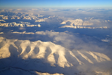
Aerial photo of Himalayas, Southern Ladakh, India, Asia
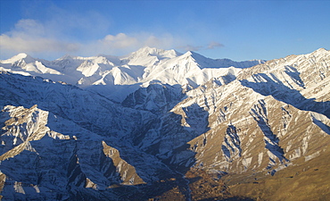
Aerial photo of Himalayas, Southern Ladakh, India, Asia
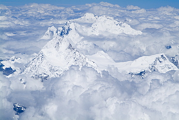
Mount Everest, Himalayas, border Nepal and Tibet, China, Asia
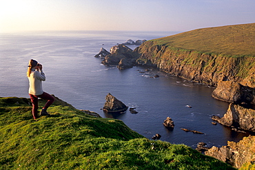
Birdwatching on cliffs of Hermaness Nature Reserve, looking north towards Vesta Skerry, Tipta Skerry gannetry, Muckle Flugga and its lighthouse in the distance, Unst, Shetland Islands, Scotland, United Kingdom, Europe
Indus River near Karachi Fort, Pakistan, Asia

Road in the Namibian desert, Namibia, Africa

Uluru (Ayers Rock), Uluru-Kata Tjuta National Park, UNESCO World Heritage Site, with the Olgas in the distance, Northern Territory, Australia, Pacific

The Pu'u O'o cinder cone, the active vent on the southern flank of the Kilauea volcano, Big Island, Hawaii, Hawaiian Islands, United States of America, North America

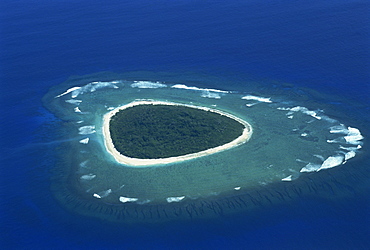
Little Hura on left and Big Hura on right, Male Atoll, Maldive Islands, Indian Ocean, Asia

Maldive Islands, Indian Ocean, Asia
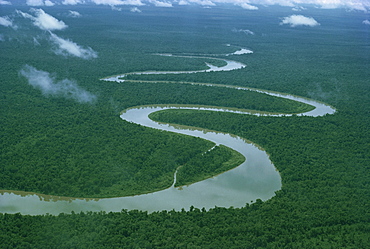
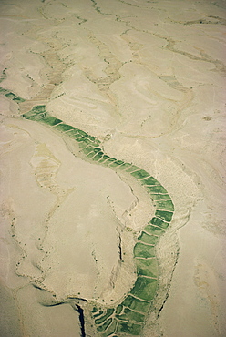
Meandering river, Irian Jaya, Indonesia, Southeast Asia, Asia
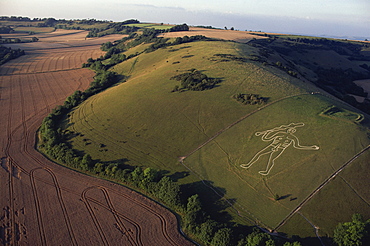
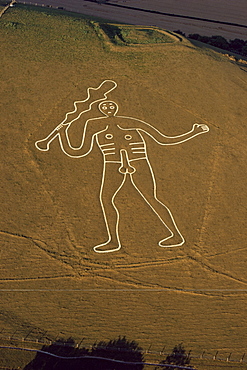
Aerial view of Cerne Abbas giant, Dorset, England, United Kingdom, Europe
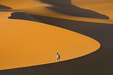
Tourist walking along a giant sand dune, Merzouga, Morocco, North Africa, Africa
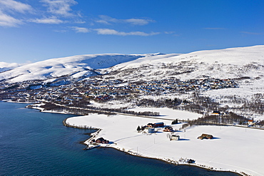
Aerial view of arctic landscape, Kvaloya Island (Whale Island) and Slettaelva Village from aircraft approaching Tromso in the Arctic Circle in Northern Norway
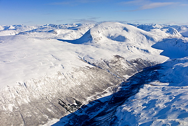
Aerial view of arctic landscape, snow covered road and Lyngen Alps from aircraft approaching Tromso in the Arctic Circle in Northern Norway
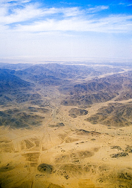
Saudi Arabian desert aerial view
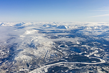
Aerial view of arctic landscape, frozen river and the Lyngen Alps from aircraft approaching Tromso in the Arctic Circle in Northern Norway
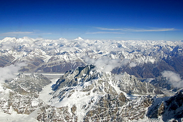
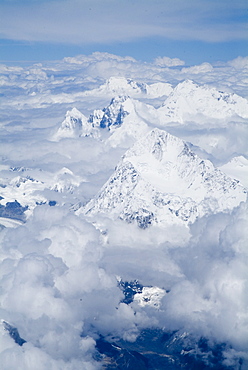
Karokoram mountains with K2 aerial view from an airplane, North Pakistan
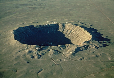
Meteor crater, the largest known in the world, Arizona, United States of America, North America
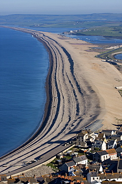
Chesil Beach and The Fleet Lagoon, Weymouth, Dorset, England, United Kingdom, Europe
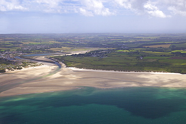
Aerial view of Hayle estuary, St. Ives Bay, Cornwall, England, United Kingdom, Europe
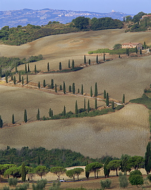
Aerial view of rural road lined with cypress trees, Tuscany, Italy, Europe
Aerial of reef formation and island, Fiji, Pacific Islands, Pacific

Maldon and Blackwater Estuary mudflats and coastal sea defences, Essex, England, United Kingdom, Europe
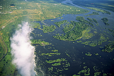
Victoria Falls (Mosi-oa-Tunya), UNESCO World Heritage Site, Zimbabwe, Africa
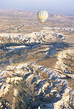
Hot air ballooning over rock formations, Cappadocia, Anatolia, Turkey, Asia Minor, Asia
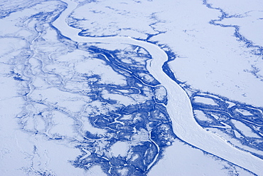
Churchill River from the airplane, Churchill, Hudson Bay, Manitoba, Canada, North America
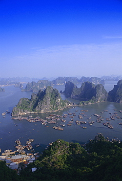
Ha Long (Ha-Long) Bay, UNESCO World Heritage Site, Hong Gai, Vietnam, Indochina, Southeast Asia, Asia
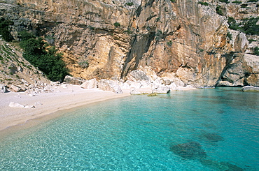
Cala Mariolu, Cala Gonone, Golfe di Orosei (Orosei gulf), island of Sardinia, Italy, Mediterranean, Europe

Fissure vent with spatter cones, Laki Volcano, Iceland, Polar Regions
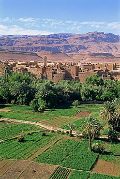
Aerial view over fields, trees and palmeries on the way to the Todra Gorge, Tinerhir, Morocco, North Africa, Africa
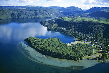
Aerial view of local lakes surrounded by forests and giant ferns, Rotorua, South Auckland, North Island, New Zealand, Pacific
Aerial view of the Cerne Abbas giant, Dorset, England, United Kingdom, Europe
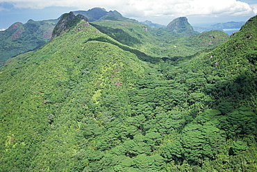
Aerial view of Morne Seychellois, Northern Region, island of Mahe, Seychelles, Indian Ocean, Africa
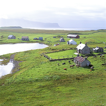
Crofts, Isle of Canna, Inner Hebrides, Scotland, United Kingdom, Europe
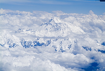
Mount Everest, Himalayas, border Nepal and Tibet, China, Asia
Coast near Bluefields, Nicaragua, Central America
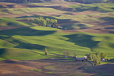
Rolling hills, The Palouse, Whitman County, Washington State, United States of America, North America
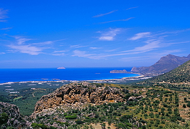
Aerial view of Falassarna coastline and beach, Falassarna, island of Crete, Greece, Mediterranean, Europe
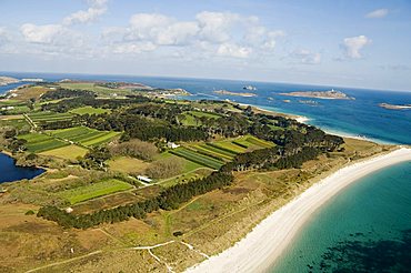
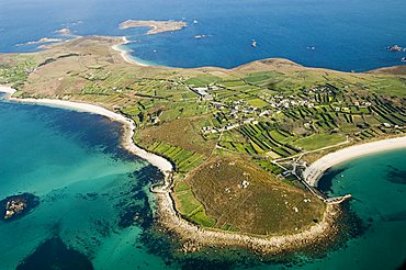
Tresco, Isles of Scilly, off Cornwall, United Kingdom, Europe
St. Martins, Isles of Scilly, off Cornwall, United Kingdom, Europe
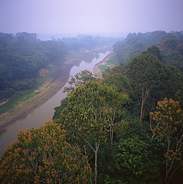
Morning mists in Rio Negro region of Amazon rainforest, Amazonas State, Brazil, South America
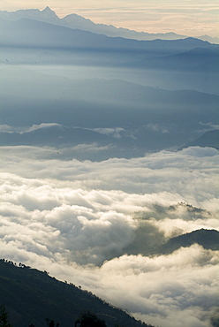
Himalaya view, Nagarkot, Nepal, Asia
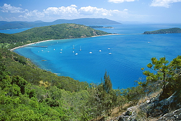
View over Bauer Bay, South Molle Island, Whitsundays, Queensland, Australia, Pacific
Aerial view of the eastern region of the island of Bali, Indonesia, Southeast Asia, Asia
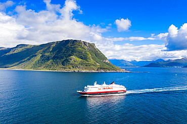
Aerial view by drone of Hurtigruten during a daily trip along the fjord, Alesund, More og Romsdal county, Norway, Scandinavia, Europe

Aerial view of the interior of the island of Kauai, including Waimea Canyon, Hawaii, United States of America, North America
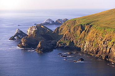
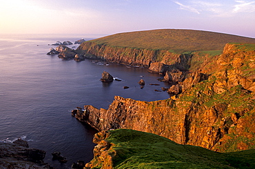
Cliffs of Hermaness Nature Reserve, looking north towards Vesta Skerry, Tipta Skerry gannetry, Muckle Flugga and its lighthouse in the distance, Unst, Shetland Islands, Scotland, United Kingdom, Europe
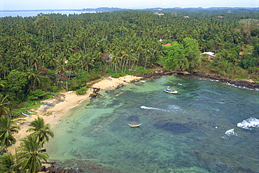
Matara area, the most southerly point on the island, Sri Lanka, Asia
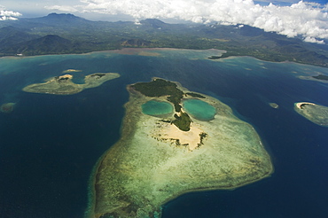
Coral island in shape of a face near Puerto Princesa, Palawan Province, Philippines, Southeast Asia, Asia
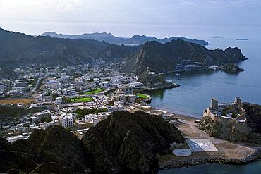
Aerial view showing the Sultan's Palace in the centre of Muscat water-front, Oman
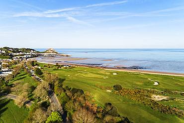
Aerial view of Royal Jersey Golf Course, Mont Orgueil Castle (Gorey Castle), Gorey, Jersey, Channel Islands, United Kingdom, Europe
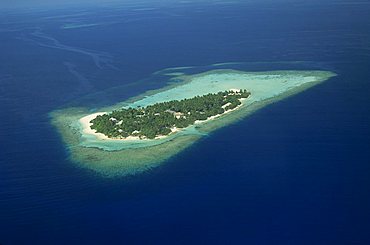
Aerial view of the island of Embudu in the Maldive Islands, Indian Ocean, Asia
Aerial view over the grounds of Fort King George, built between 1784 and 1787, above the town of Scarborough, Tobago, West Indies, Caribbean, Central America
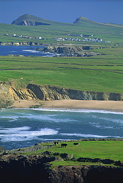
Aerial view over the Dingle Peninsula, County Kerry, Munster, Republic of Ireland, Europe
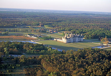
Aerial view of the Chateau of Chambord, UNESCO World Heritage Site, Route of Francois 1er (Francis 1st), Pays de Loire, Loire Valley, France, Europe

Orang Asli village, Cameron Highlands, Perak State, Malaysia, Southeast Asia, Asia

Trees mark a dry riverbed or Lugga which may only flow with water for a few days each year, Matthews Range, Kenya, East Africa, Africa
Mount Everest, Himalayas, border Nepal and Tibet, China, Asia
Cliffs of Hermaness Nature Reserve, looking north towards Vesta Skerry, Tipta Skerry gannetry, Muckle Flugga and its lighthouse in the distance, Unst, Shetland, Scotland, United Kingdom, Europe

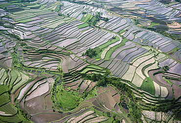
Aerial of rice fields and farm workers at Tirta Gangga, Bali, Indonesia, Southeast Asia, Asia
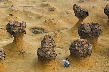
Coastal rock formations, Yehliu, Taipei County, Taiwan, Asia
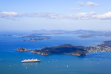
Queen Mary II visits the Bay of Islands, Northland, North Island, New Zealand, Pacific

Aerial view of two hot air balloons floating over brown countryside near Northam in Western Australia, Australia, Pacific
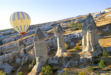
Hot air ballooning over rock formations, Cappadocia, Anatolia, Turkey, Asia Minor, Asia

Aerial view over Yasawa Island, Fiji, Pacific Islands, Pacific
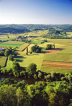
Aerial view of countryside and River Dordogne taken from the bastide town of Domme, Dordogne, Aquitaine, France, Europe
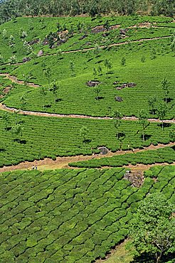
Aerial view of green landscape of tea gardens, plantations in tea country, high in the Western Ghats near Munnar, Kerala, India, Asia
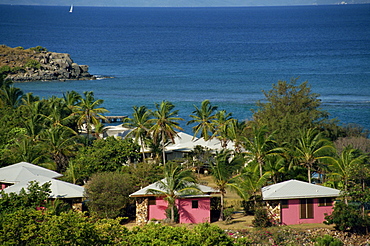
Aerial view over apartments of the Fischer's Cove Resort, near Spanish Town, Virgin Gorda, British Virgin Islands, West Indies, Caribbean, Central America
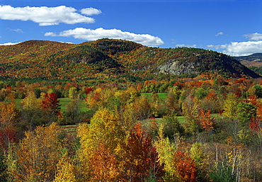
Aerial view over woodland and rolling hills in fall colours, White Mountain National Park, New Hampshire, New England, United States of America, North America
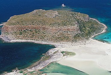
Aerial view of Gramvousa islet, Gramvousa peninsula, western Crete, island of Crete, Greece, Mediterranean, Europe
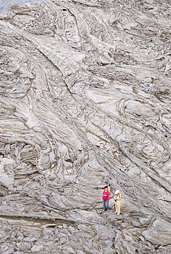
Recent pahoehoe basalt lavas, Erte Ale volcano, Danakil Depression, Ethiopia, Africa
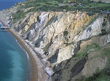
Multi-coloured cliffs on the coast, Alum Bay, Isle of Wight, England, United Kingdom, Europe
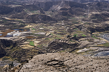
View over valley and Inca terraces near Chivay, Colca Canyon, Peru, South America
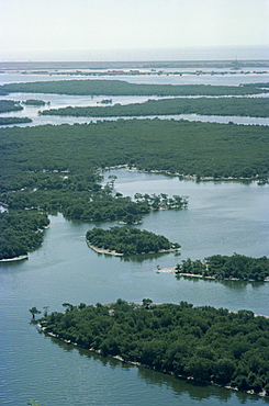
Aerial view of Chaa Creek, Belize, Central America
Ancient karez, underground irrigation system, Pakistan, Asia
Island of Margarita, Venezuela, South America
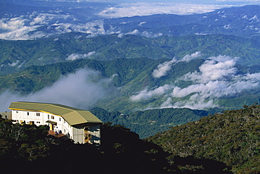
Laban Rata Resthouse, a stop for climbers on Mount Kinabalu, Sabah, Malaysia, Southeast Asia, Asia