Results
« Previous 1 … 3 4 5 6 7 … 15 Next »
1439 results found
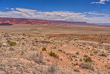
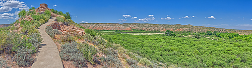
View of Vermilion Cliffs Arizona from US89A from and overlook above House Rock Valley.
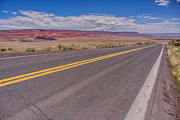
View of Vermilion Cliffs Arizona from US89A ascending to the Kaibab Plateau.
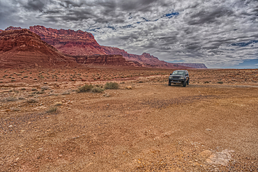
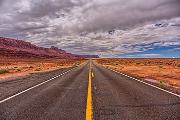
Vehicle parked next to Jackass Creek off of US89A near Echo Cliffs on the way to Vermilion Cliffs Arizona. Located on the Navajo Indian Reservation between Bitter Springs and Marble Canyon.
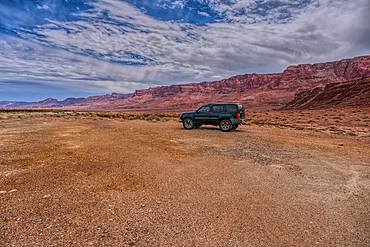
Vehicle parked next to Jackass Creek off of US89A near Echo Cliffs on the way to Vermilion Cliffs Arizona. Located on the Navajo Indian Reservation between Bitter Springs and Marble Canyon.
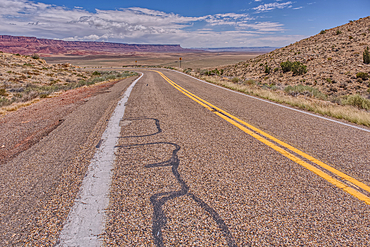
View of Vermilion Cliffs Arizona from US89A ascending to the Kaibab Plateau.
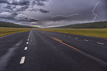
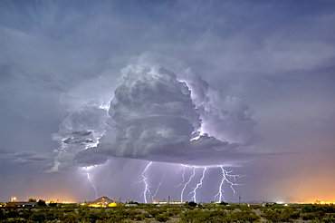
Lightning storm over Pleasant Valley in Kaibab National Forest Arizona, north of Grand Canyon North Rim.
View of a small slot canyon called Jackass Creek off of US89A next to Echo Cliffs on the way to Vermilion Cliffs Arizona. Located on the Navajo Indian Reservation between Bitter Springs and Marble Canyon.
View of Echo Cliffs near Marble Canyon Arizona from US89A on a mostly cloudy day. This section of the cliffs is near the little town of Bitter Springs on the Navajo Reservation adjacent to the Vermilion Cliffs National Monument.
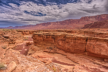
View of a small slot canyon called Jackass Creek off of US89A next to Echo Cliffs on the way to Vermilion Cliffs Arizona. Located on the Navajo Indian Reservation between Bitter Springs and Marble Canyon.
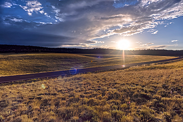
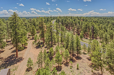
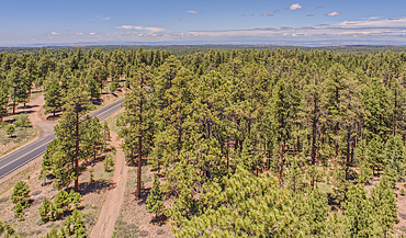
Highway 67 facing south in Pleasant Valley of Kaibab National Forest Arizona near sundown after a rain. North of Grand Canyon North Rim.
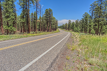
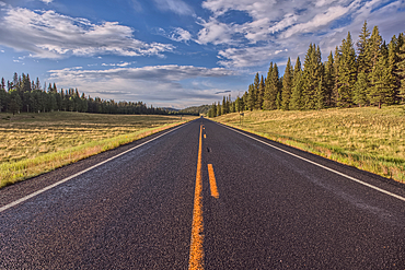
Highway 67 south of Jacob Lake Arizona facing southbound toward Grand Canyon North Rim.
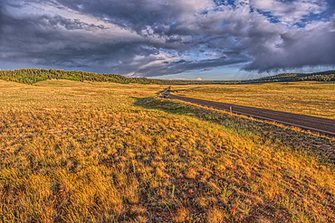
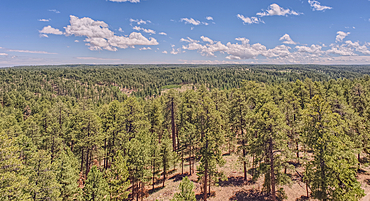
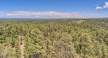
Rolling Hills in Pleasant Valley in the Kaibab National Forest north of Grand Canyon North Rim Arizona near sundown.
Grand Canyon with the historic Watch Tower on the far left, managed by the National Park Service, Grand Canyon National Park, UNESCO World Heritage Site, Arizona, United States of America, North America
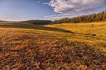
Rolling Hills in Pleasant Valley in the Kaibab National Forest north of Grand Canyon North Rim Arizona near sundown.
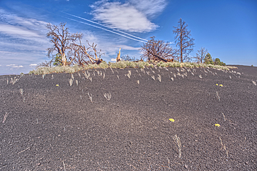
Burned trees on a Volcanic cinder rim in Coconino National Forest, Arizona, USA
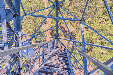
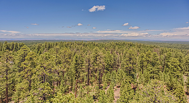
View from the 80 foot tall historic Fire Watchtower at Jacob Lake Arizona. Maintained as a historic landmark by the National Forest Service. No property release needed.
Highway 67 facing north in Pleasant Valley of Kaibab National Forest Arizona near sundown after a rain. North of Grand Canyon North Rim.
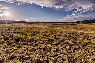
The rolling hills of Pleasant Valley in the Kaibab National Forest north of Grand Canyon North Rim Arizona near sundown.
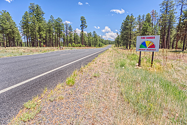
Taken on July 3rd, 2025, a warning sign of high wildfire danger along Highway 67 near Jacob Lake on the way to Grand Canyon North Rim Arizona. On July 4th, 2025, a massive wildfire broke out in this area from a lightning strike.
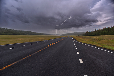
Lightning storm over Pleasant Valley in Kaibab National Forest Arizona, north of Grand Canyon North Rim.
View from the 80 foot tall historic Fire Watchtower at Jacob Lake Arizona. Maintained as a historic landmark by the National Forest Service. No property release needed.
View from the 80 foot tall historic Fire Watchtower at Jacob Lake Arizona. Maintained as a historic landmark by the National Forest Service. No property release needed.
View from the 80 foot tall historic Fire Watchtower at Jacob Lake Arizona. Maintained as a historic landmark by the National Forest Service. No property release needed.
View from the 80 foot tall historic Fire Watchtower at Jacob Lake Arizona. Maintained as a historic landmark by the National Forest Service. No property release needed.
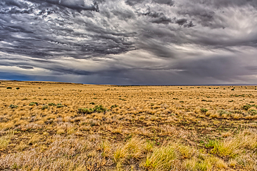
View of storm clouds rolling over prairie grassland in northern Arizona near Wupatki National Monument.
View from the 80 foot tall historic Fire Watchtower at Jacob Lake Arizona. Maintained as a historic landmark by the National Forest Service. No property release needed.
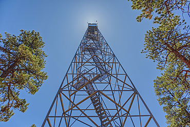
The 80 foot tall historic Fire Watchtower at Jacob Lake Arizona. Maintained as a historic landmark by the National Forest Service. No property release needed.

The 80 foot tall historic Fire Watchtower at Jacob Lake Arizona. Maintained as a historic landmark by the National Forest Service. No property release needed.
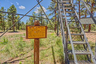
The 80 foot tall historic Fire Watchtower at Jacob Lake Arizona. Sign warns to climb the tower at your own risk. Maintained as a historic landmark by the National Forest Service. No property release needed.
Storm clouds rolling in over Humphrey's Peak near Flagstaff Arizona in the Coconino National Forest. Viewed from US89.
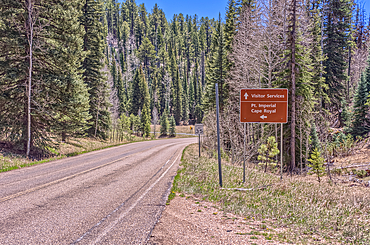
Directional sign pointing the way to Point Imperial and Cape Royal, Grand Canyon National Park, Arizona, USA

A lone tree isolated just off shore in Watson Lake in Prescott, Arizona, United States of America, North America

The Watson Dam Spillway, the small dam holds back Watson Lake in Prescott, Arizona, United States of America, North America
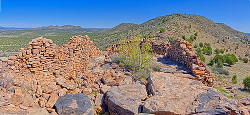
Ancient Ruins on Sullivan Butte in Chino Valley, Arizona, United States of America, North America
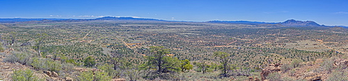
A super panorama of Chino Valley viewed from the summit of Sullivan Butte, Arizona, United States of America, North America
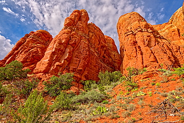
The walls of Cathedral Rock taken by going off the HiLine Trail and hiking up to the south side of the rock face, Arizona, United States of America, North America
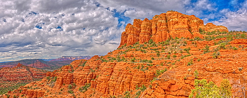
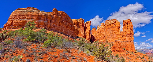
Panorama of Cathedral Rock from the south side just off the HiLine Trail, Sedona, Arizona, United States of America, North America

High angle view of Boulder Creek, the Watson Lake Loop Trail crosses this creek, Prescott, Arizona, United States of America, North America
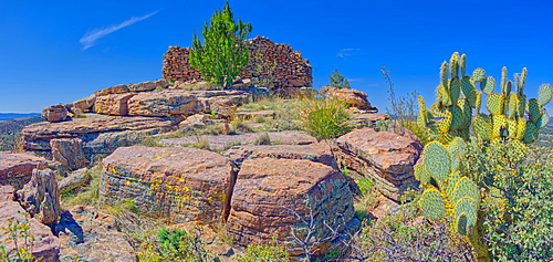
Ancient Indian ruins resembling an old fortress on top Sullivan Butte in Chino Valley, Arizona, United States of America, North America

View of the Secret Cove on the east side of Watson Lake in Prescott, Arizona, United States of America, North America

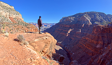
A lone hiker on Angels Window Overlook at Grand Canyon North Rim Arizona looking out at the sunrise.
Shoreline view of the historic Bainbridge Steel Dam near Ash Fork, Kaibab National Forest, Arizona, United States of America
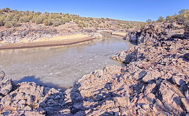
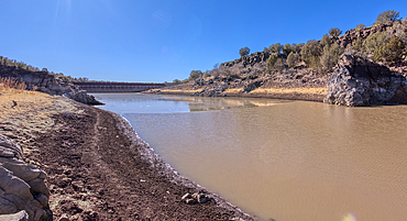
View of the lake created by the historic Bainbridge Steel Dam near Ash Fork, Kaibab National Forest, Arizona, United States of America
View from below the historic Bainbridge Steel Dam near Ash Fork, Kaibab National Forest, Arizona, United States of America
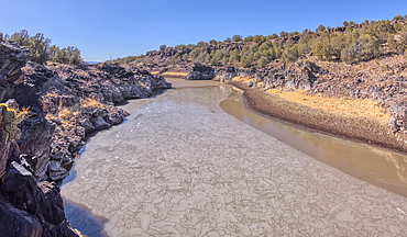
View of the lake created by the historic Bainbridge Steel Dam near Ash Fork, Kaibab National Forest, Arizona, United States of America
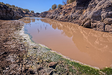
View of the lake created by the historic Bainbridge Steel Dam near Ash Fork, Kaibab National Forest, Arizona, United States of America
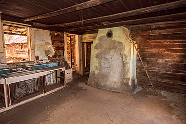
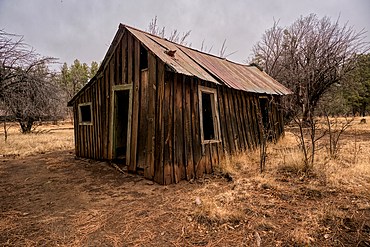
Interior of an abandoned homestead in the Coconino National Forest, Arizona, United States of America
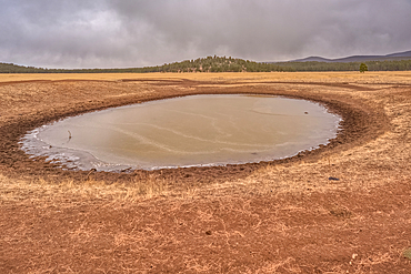
A cattle pond (livestock tank), partially frozen, Coconino National Forest Arizona, United States of America
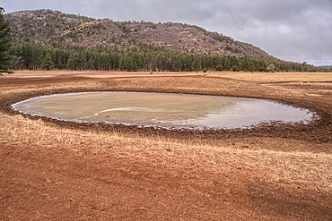
A cattle pond (livestock tank), part frozen, Coconino National Forest, Apache Maid Mountain in the background, Arizona, United States of America
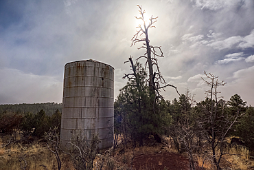
Old water tank perched on a cliff overlooking the T-Bar Ranch Homestead in the Coconino National Forest of Arizona, United States of America
Outbuilding, abandoned historic T-Bar Ranch Homestead, with approaching snow storm, Coconino National Forest, Arizona, United States of America
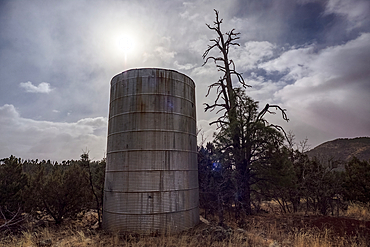
Old water tank perched on a cliff overlooking the T-Bar Ranch Homestead in the Coconino National Forest, Arizona, United States of America

A large wall of fractured Granite along a trail in Constellation Park in Prescott called The Lost Wall, Arizona, United States of America, North America
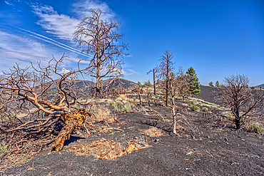
Burned trees on a Volcanic cinder rim in Coconino National Forest, Arizona, USA
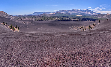
Volcanic cinder rim in Coconino National Forest, Arizona, USA
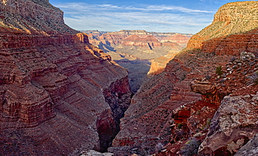
Hermit Creek Canyon viewed from Dripping Springs Trail in the Grand Canyon, Grand Canyon National Park, UNESCO World Heritage Site, Arizona, United States of America, North America

View of Hermit Creek Canyon from a cliff near Santa Maria Springs along the Hermit Trail, Grand Canyon National Park, UNESCO World Heritage Site, Arizona, United States of America, North America
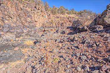
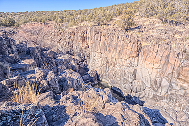
Basalt boulders and cliffs, Johnson Canyon east of Bainbridge Steel Dam Lake near Ash Fork, Kaibab National Forest, Arizona, United States of America
Basalt boulders and cliffs, Johnson Canyon between Bainbridge Steel and Stone Dams, Kaibab National Forest, Arizona, United States of America
Basalt boulders and cliffs, Johnson Canyon between Bainbridge Steel and Stone Dams, Kaibab National Forest, Arizona, United States of America
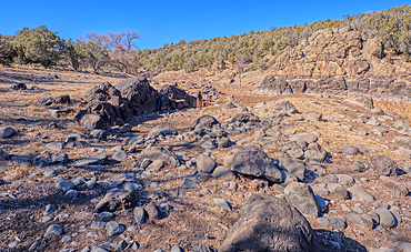
Basalt formation in Johnson Canyon east of the Bainbridge Steel Dam Lake near Ash Fork, Kaibab National Forest, Arizona, United States of America
Basalt boulders and cliffs, Johnson Canyon east of Bainbridge Steel Dam Lake near Ash Fork, Kaibab National Forest, Arizona, United States of America
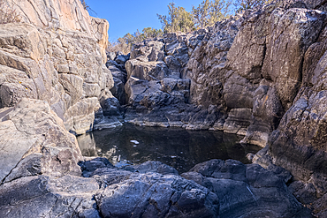
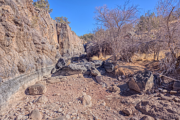
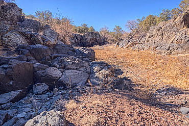
Dry waterfall cliffs, Johnson Canyon between Bainbridge Steel and Stone Dams near Ash Fork, Kaibab National Forest, Arizona, United States of America
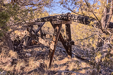
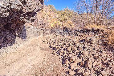
Old water pipe, Johnson Canyon between Bainbridge Steel and Stone Dams near Ash Fork, Kaibab National Forest, Arizona, United States of America
Dry waterfall cliffs, Johnson Canyon between Bainbridge Steel and Stone Dams near Ash Fork, Kaibab National Forest, Arizona, United States of America
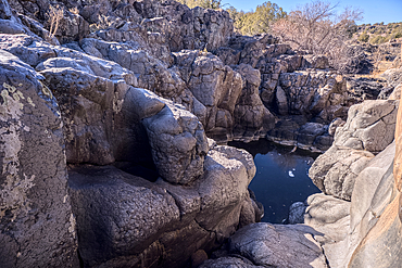
Dry waterfall cliffs, Johnson Canyon between Bainbridge Steel and Stone Dams near Ash Fork, Kaibab National Forest, Arizona, United States of America
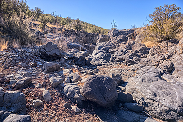
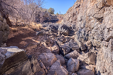
Basalt boulders and cliffs in a section of Johnson Canyon halfway between the Bainbridge Steel Dam and Stone Dam near Ash Fork Arizona in the Kaibab National Forest.
Basalt boulders and cliffs in a section of Johnson Canyon halfway between the Bainbridge Steel Dam and Stone Dam near Ash Fork Arizona in the Kaibab National Forest.
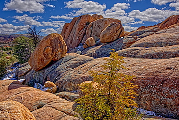
Large boulders balanced on a sloping ledge of Granite along the PMBA Trail in Constellation Park in Prescott, Arizona, United States of America, North America
A hiker looking out from a cliff in Hermit Canyon at Grand Canyon, Grand Canyon National Park, UNESCO World Heritage Site, Arizona, United States of America, North America

Sycamore Canyon viewed from the west side of Sycamore Point near sundown, located in Kaibab National Forest, Williams, Arizona, United States of America, North America

A twisted Juniper Tree near Sycamore Canyon in the Kaibab National Forest south of Williams, Arizona, United States of America, North America
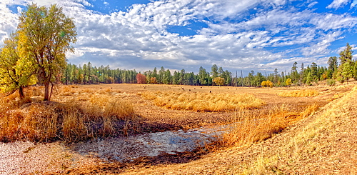
Grassland that used to be the J D Dam Lake, dry due to a drought in Arizona, Kaibab National Forest, south of Williams, Arizona, United States of America, North America
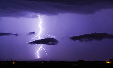
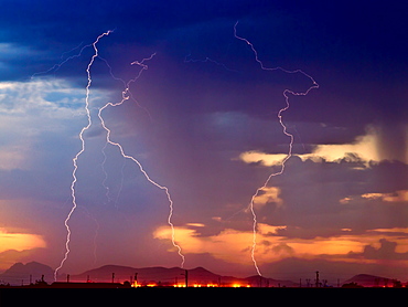
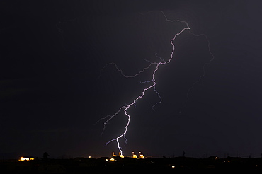
A bright lightning bolt passing through a cloud and striking in the Gila Bend Mountains south of Arlington, Arizona, United States of America, North America
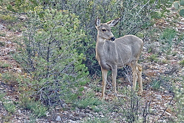
A Mule Deer native to Arizona roaming the forest near Prescott, Arizona, United States of America, North America
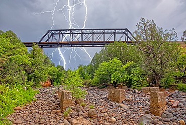
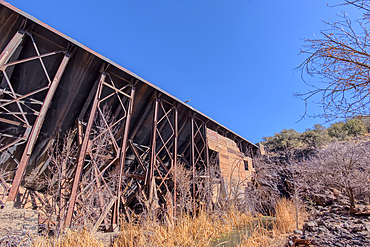
Lightning from a monsoon storm striking behind an old railroad trestle bridge that spans Bear Canyon near Perkinsville, Arizona, United States of America, North America
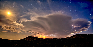
An isolated storm cell near Chino Valley being lit by the Moonlight during the summer monsoon season, Arizona, United States of America, North America

Closeup of an Arizona Gopher Snake (Pituophis Catenifer), a non-venomous constrictor harmless to humans, Arizona, United States of America, North America

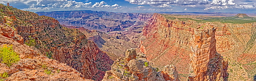
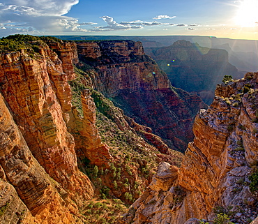
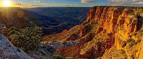
Panorama of the Grand Canyon just east of Zuni Point on the south rim with haze from smoke from a wildfire on the north rim, Grand Canyon National Park, UNESCO World Heritage Site, Arizona, United States of America, North America
The Spire Abyss near Zuni Point on the south rim of the Grand Canyon near sundown, located a mile east of Moran Point, Grand Canyon National Park, UNESCO World Heritage Site, Arizona, United States of America, North America
Grand Canyon view just west of Zuni Point on the South Rim nearing sunset, Grand Canyon National Park, UNESCO World Heritage Site, Arizona, United States of America, North America
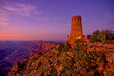
Watch Tower on Grand Canyon South Rim at twilight, Grand Canyon National Park, UNESCO World Heritage Site, Arizona, United States of America, North America
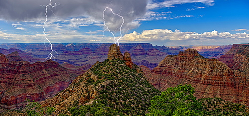
A storm brewing directly over the Sinking Ship on the south rim of the Grand Canyon, Grand Canyon National Park, UNESCO World Heritage Site, Arizona, United States of America, North America
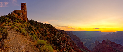
Watch Tower on the South Rim of the Grand Canyon at sundown, Grand Canyon National Park, UNESCO World Heritage Site, Arizona, United States of America, North America
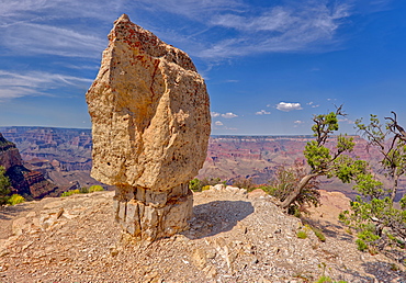
Closeup of Shoshone Rock on the edge of Shoshone Point on the south rim of the Grand Canyon, Grand Canyon National Park, UNESCO World Heritage Site, Arizona, United States of America, North America
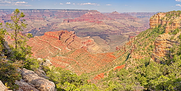
Grand Canyon view west of Shoshone point, which is on the upper right. Located on the south rim, Grand Canyon National Park, UNESCO World Heritage Site, Arizona, United States of America, North America
Three bolts of lightning striking near the Palo Verde Nuclear Station in Wintersburg Arizona during the 2012 Monsoon season, Arizona, United States of America, North America
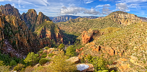
Western view of Sterling Canyon from its crest along the Sterling Pass Trail north of Sedona, Arizona, United States of America, North America
Panorama of Tuzigoot and the Verde Valley, managed by the National Park Service, Arizona, United States of America, North America
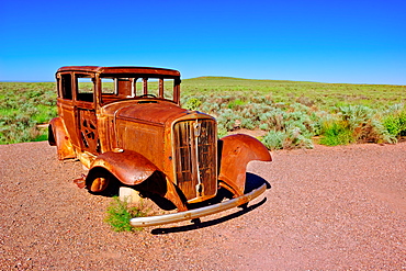
The old rusting steel shell of a Model-T mounted on concrete pillars along the old historic Route 66, Arizona, United States of America, North America
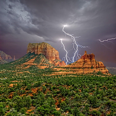
Lightning striking in between Courthouse Butte and Bell Rock near Sedona, Arizona, United States of America, North America
Lightning striking a powerplant in Arlington during the 2016 Monsoon season, Arizona, United States of America, North America

Red Rock Wilderness Lightning, a morning lightning storm over the Secret Red Rock Mountain Wilderness in Sedona, Arizona, United States of America, North America
An isolated storm cell illuminated by moonlight during the 2015 Monsoon season, Arizona, United States of America, North America

Nuclear Lightning, a lightning storm striking near a nuclear power plant in Wintersburg during the 2015 Monsoon Season, Arizona, United States of America, North America
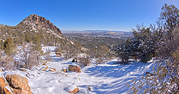
View from Picnic Hill along the Thumb Butte day use hiking trail covered in winter snow and ice, Prescott National Forest, west of Prescott, Arizona, United States of America, North America

A Sandstone Toadstool near the base of the rock formation called the Rabbit Ears in Sedona, Arizona, United States of America, North America
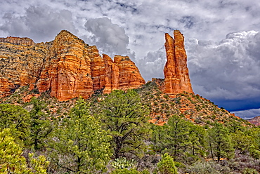
Westside view of the rock formation called Rabbit Ears located in Sedona, Arizona, United States of America, North America
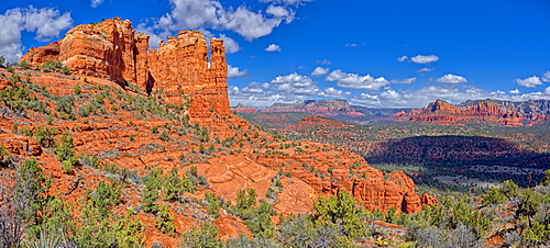
Panorama of Sedona viewed from the secret trail that runs along the eastern side of Cathedral Rock, Sedona, Arizona, United States of America, North America
Close up panorama of Cathedral Rock in Sedona viewed from the secret trail that runs along the eastside of the rock, Sedona, Arizona, United States of America, North America