Results
« Previous 1 … 5 6 7 8 9 … 15 Next »
1439 results found
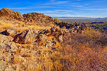
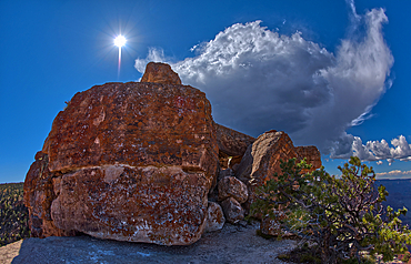
Ancient Indian Ruins near Granite Mountain in the Prescott National Forest, Arizona, United States of America, North America
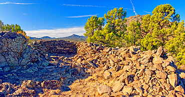
Ancient Indian Ruins near Granite Mountain in the Prescott National Forest, Arizona, United States of America, North America
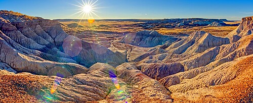
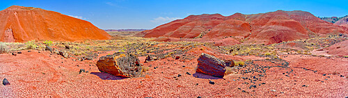
Panorama of the setting sun at the First Forest in Petrified Forest National Park, Arizona, United States of America, North America
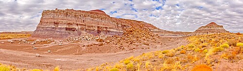
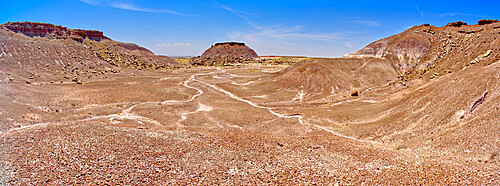
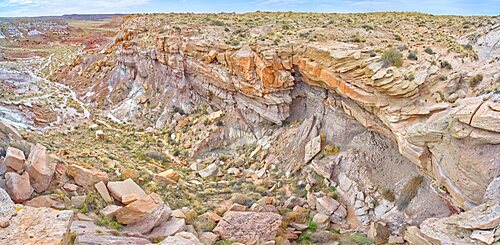
The eastern edge of the Clam Bed Mesa along the Red Basin Trail in Petrified Forest National Park, Arizona, United States of America, North America
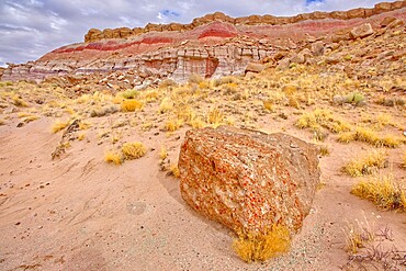
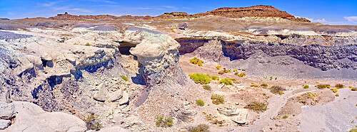
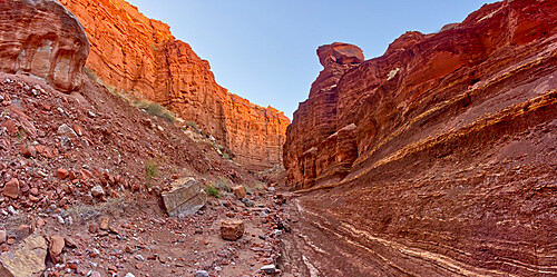
One of many fossil filled boulders in the Clam Beds along Red Basin Trail in Petrified Forest National Park, Arizona, United States of America, North America

A ridge in the Devil's Playground of crumbling hoodoos that resemble Goblins,Petrified Forest National Park, Arizona, United States of America, North America
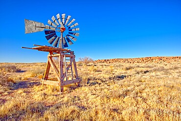
An old windmill marking the boundary of the Devil's Playground in Petrified Forest National Park, Arizona, United States of America, North America

Panorama of a ridge in the Devil's Playground of crumbling hoodoos, Petrified Forest National Park, Arizona, United States of America, North America

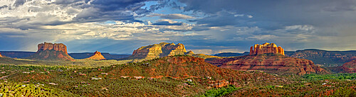
House of Apache Fires in Red Rock State Park with Cathedral Rock in the background, Sedona, Arizona, United States of America, North America

Grand Canyon viewed from the west side of Maricopa Point along the Hermit Road, Grand Canyon National Park, UNESCO World Heritage Site, Arizona, United States of America, North America

Grand Canyon viewed from the east side of Maricopa Point along the Hermit Road, Grand Canyon National Park, UNESCO World Heritage Site, Arizona, United States of America, North America
Clifftop panorama of Oak Creek in Slide Rock State Park north of Sedona, Arizona, United States of America, North America
Slick rock water channel in Slide Rock State Park where most swimmers begin their slide in Oak Creek north of Sedona, Arizona, United States of America, North America
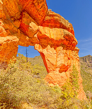
South side of Pendley Arch, Coconino National Forest just outside of Slide Rock State Park, Sedona, Arizona, United States of America, North America
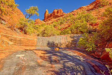
View from the western slope of Steamboat Rock looking north, Coconino National Forest, Sedona, Arizona, United States of America, North America
A dry waterfall sandstone ledge on a trail to Steamboat Rock, Coconino National Forest, Sedona, Arizona, United States of America, North America

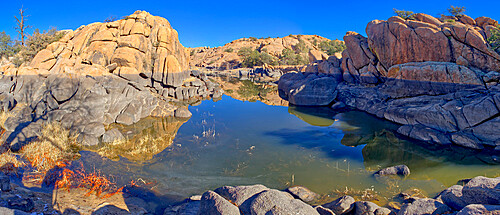
Rocky shore of Watson Lake which has lost much water due to the drought, the gray rock was originally submerged, Arizona, United States of America, North America

Rocky lagoon in Watson Lake along Lakeshore Trail, gray rock shows how much water volume was lost due to the drought, Arizona, United States of America, North America
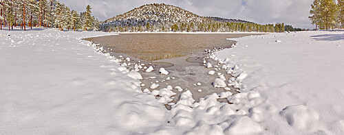
Panorama of Kaibab Lake from its south side, Kaibab National Forest near Williams, Arizona, United States of America, North America

TV, Radio, and Cell Phone Towers perched on the summit of Mingus Mountain near Jerome, Arizona, United States of America, North America
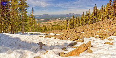
West panorama view from a lava field on the side of Humphrey's Peak near Flagstaff in the Coconino National Forest, Arizona, United States of America, North America
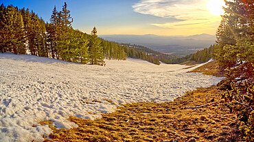
The slopes of Arizona Snow Bowl facing west close to sundown, Coconino National Forest near Flagstaff, Arizona, United States of America, North America
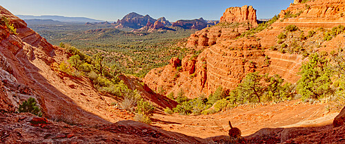
Panorama view of Sedona from the First Bench of Bear Mountain, to the right of center is Doe Mountain, Sedona, Arizona, United States of America, North America

Fay Canyon viewed from the 1st Peak of Bear Mountain in Sedona, Arizona, United States of America, North America
Western view of Sedona from the saddle section of Bear Mountain just past the 1st Peak with True Peak in upper right, Sedona, Arizona, United States of America, North America
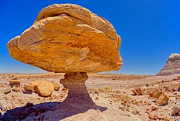
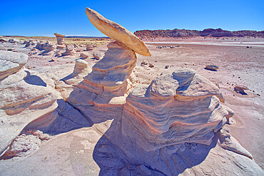
Balanced rock that resembles a toadstool, petrified wood scattered around the formation, Petrified Forest National Park, Arizona, United States of America, North America
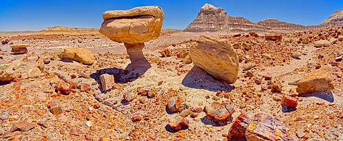
Balanced rock that resembles a toadstool, petrified wood scattered around the formation, Petrified Forest National Park, Arizona, United States of America, North America
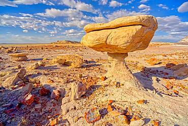
Balanced rock that resembles a toadstool, petrified wood scattered around the formation, Petrified Forest National Park, Arizona, United States of America, North America
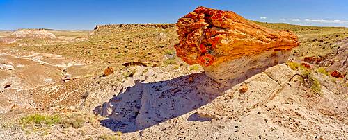
A giant petrified log on a sandstone pedestal on the edge of the Blue Mesa in Petrified Forest National Park, Arizona, United States of America, North America
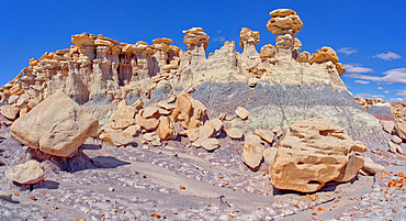
Panorama of three hoodoos shaped like kings, on the edge of the Blue Mesa in Petrified Forest National Park, Arizona, United States of America, North America
Flat top hoodoo on the edge of a cliff along the Billings Gap Trail on Blue Mesa, Petrified Forest National Park, Arizona, United States of America, North America
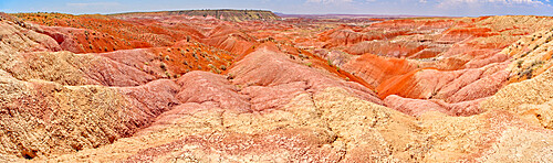
Hills of blood red bentonite clay below Kachina Point in Petrified Forest National Park, Arizona, United States of America, North America
Blood red ridges of Bentonite clay on the east side of Tiponi Point in Petrified Forest National Park, Arizona, United States of America, North America
A dome shaped hill of purple bentonite with a rocky flat top in Petrified Forest National Park, Arizona, United States of America, North America
A dry waterfall made of purple bentonite in the Flat Tops of Petrified Forest National Park, Arizona, United States of America, North America
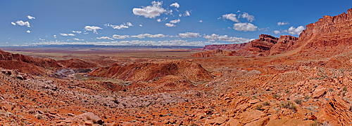
Panorama view from above Sand Hill Spring at Vermilion Cliffs National Monument, with snow covered land in the distance of the Kaibab Plateau, location of the Grand Canyon, Arizona, United States of America, North America
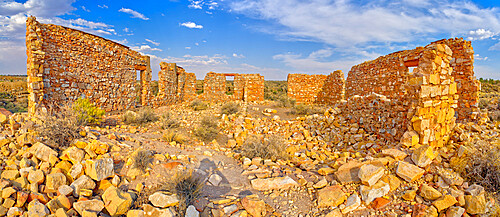
The crumbling stone walls of a derelict building in the ghost town of Two Guns, Arizona, United States of America, North America
The ghostly remains of an old stone tower in the ghost town of Two Guns, Arizona, United States of America, North America

Panorama of Tsu'Vo Buttes in Homolovi State Park, Tsu'Vo is a Hopi word meaning Path of Rattlesnakes, Arizona, United States of America, North America
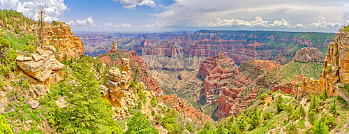
Point Imperial view from Ken Patrick Trail at Grand Canyon North Rim with Mount Hayden the pointed peak left of center, Arizona, United States of America, North America
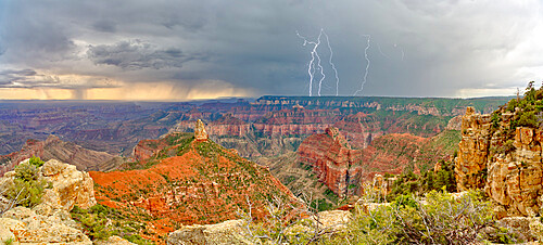
Storm rolling into Point Imperial at Grand Canyon North Rim, Grand Canyon National Park, UNESCO World Heritage Site, Arizona, United States of America, North America
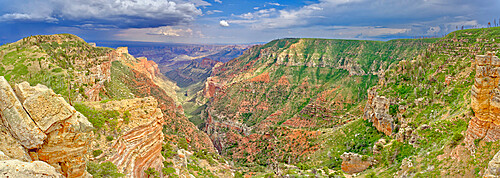
View from the Saddle Mountain Overlook on the northeast edge of Grand Canyon North Rim and the Kaibab National Forest, Arizona, United States of America, North America
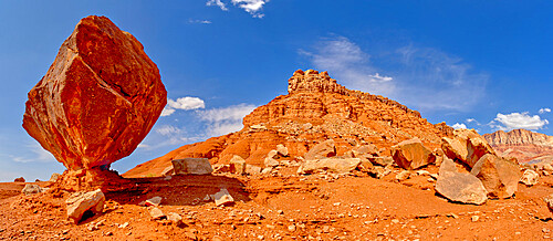
Balanced boulder just below the Upper Soap Creek Bench in Vermilion Cliffs National Monument, Arizona, United States of America, North America
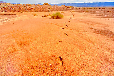
Human footprints in soft sand near the Upper Soap Creek Bench in the Vermilion Cliffs National Monument, Arizona, United States of America, North America
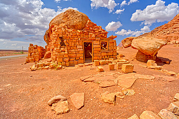
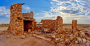
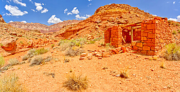
Pioneer Ruins of House Rock at Soap Creek in Vermilion Cliffs National Monument, Arizona, United States of America, North America
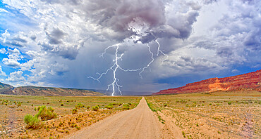
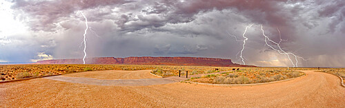
Lightning storm rolling across House Rock Valley Road on the west side of Vermilion Cliffs National Monument, Arizona, United States of America, North America
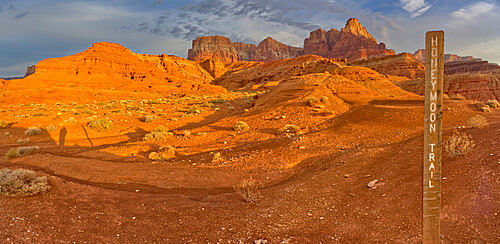
Sign marking the historic Honeymoon Trail in the 7 Mile Draw area of the Vermilion Cliffs National Monument, Arizona, United States of America, North America
Lightning storm rolling into Vermilion Cliffs National Monument viewed from Dominguez Escalante Historical Trailhead, Arizona, United States of America, North America
Pioneer Ruins along Soap Creek in Vermilion Cliffs National Monument, Arizona, United States of America, North America
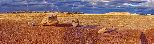
Large storm approaching Blue Mesa in Petrified Forest National Park, viewed from the Red Basin Trail, near Holbrook, Arizona, United States of America, North America
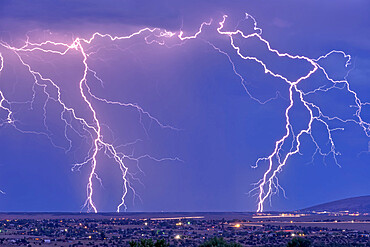
Lightning bolts striking Prescott area in the distance with the town of Chino Valley just north of Prescott Town in the foreground, Arizona, United States of America, North America
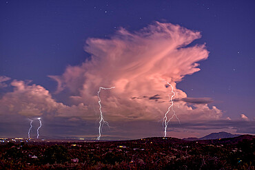
Isolated storm cell passing over the Prescott area of Arizona in the distance with the town of Chhino Valley in the foreground, Arizona, United States of America, North America
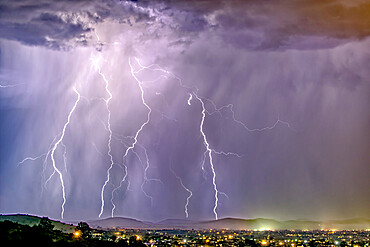
Late night storm during the 2021 Monsoon season rolling into Chino Valley, Arizona, United States of America, North America
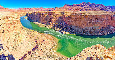
Colorado River flowing through Marble Canyon, viewed above Cathedral Wash, adjacent to the Glen Canyon Recreation Area, Arizona, United States of America, North America
Upper Cathedral Wash in Glen Canyon Recreation Area with path leading to the Vermilion Cliffs, Arizona, United States of America, North America

Classic view of Horseshoe Bend before sundown in the Glen Canyon Recreation Area near Page, Arizona, United States of America, North America
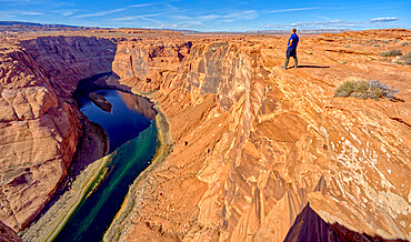
A man hiking on the edge of a cliff overlooking Horseshoe Bend near Page, Arizona, United States of America, North America
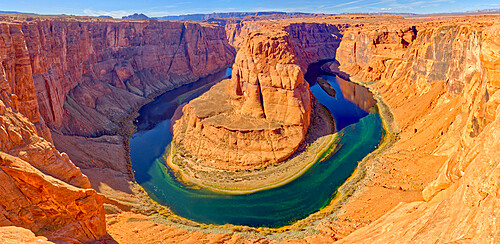
Classic panorama view of Horseshoe Bend just north of the main tourist overlook near Page, Arizona, United States of America, North America

Classic panorama view of Horseshoe Bend from its northeast side near Page, Arizona, United States of America, North America
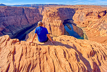
A man sitting on the edge of a cliff overlooking Horseshoe Bend near Page, Arizona, United States of America, North America
Man hiking along rocky shoreline of Lake Powell in an area called the Chains in the Glen Canyon Recreation Area, Page, Arizona, United States of America, North America
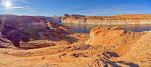
Wide angle view of Glen Canyon Dam from the wavy sandstone mesa of an area called the Chains, Arizona, United States of America, North America
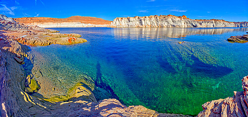
The emerald blue waters of Lake Powell just north of the Glen Canyon Dam in an area called The Chains, near Page, Arizona, United States of America, North America

Front view of the historic Glen Canyon Dam in Page, viewed from the Highway 89 Bridge over the Colorado River, Arizona, United States of America, North America
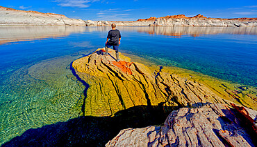
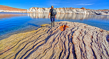
A hiker standing on a rock peninsula at Lake Powell, Arizona, United States of America, North America
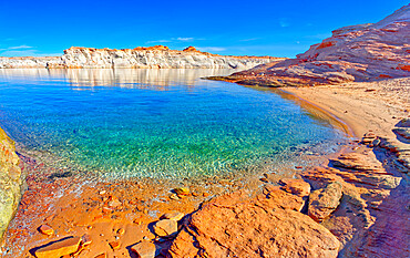
A small lagoon in Lake Powell where boats can drop anchor and come ashore, Arizona, United States of America, North America
Balanced boulder at the base of Vermilion Cliffs in Glen Canyon Recreation Area, Arizona, United States of America, North America
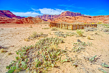
Lonely Dell Ranch Corral at Vermilion Cliffs National Monument near the Glen Canyon Recreation Area, Arizona, United States of America, North America
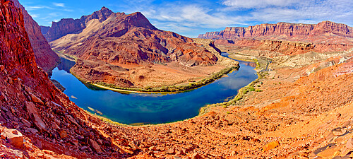
Bend in Colorado River near Lee's Ferry, Glen Canyon Recreation Area, Vermilion Cliffs National Monument in background, Arizona, United States of America, North America

Lee's Ferry Road running between Cathedral Rock and Vermilion Cliffs National Monument in Glen Canyon Recreation Area, Arizona, United States of America, North America
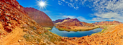
Bend in Colorado River near Lee's Ferry, Glen Canyon Recreation Area, Vermilion Cliffs National Monument in background, Arizona, United States of America, North America
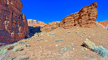
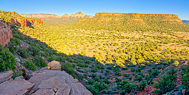
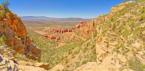
Cliffs of Chocolate Canyon at Vermilion Cliffs National Monument, Arizona, United States of America, North America
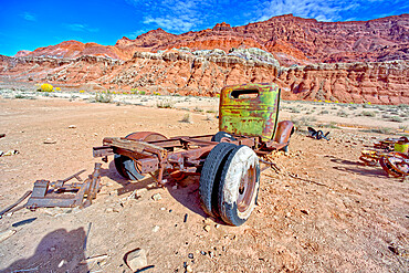
Antique truck at Lonely Dell Ranch, Vermilion Cliffs National Monument, Arizona, United States of America, North America
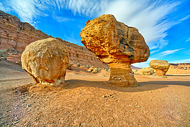
Balanced boulders at the base of Vermilion Cliffs in Glen Canyon Recreation Area, Arizona, United States of America, North America

Cattle Tank viewed from Woodchute Mountain Trail, located in Prescott National Forest with Prescott in the background, Arizona, United States of America, North America
Reflective lagoon along East Bay Trail of Willow Lake, gray line on rock is where the water level used to be, Prescott, Arizona, United States of America, North America
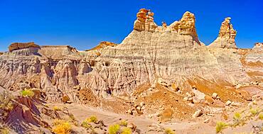
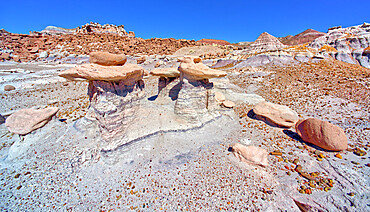
Hoodoo formations in the Devil's Playground in Petrified Forest National Park, Arizona, United States of America, North America

Boulders in Devil's Playground called Gnomes of Desolation, Petrified Forest National Park, Arizona, United States of America, North America

Field of boulders in Devil's Playground within Petrified Forest National Park, Arizona, United States of America, North America
Three hoodoos in a triangular formation in Devil's Playground called the Unholy Trinity, Petrified Forest National Park, Arizona, United States of America, North America
A ridge of hoodoos that resemble dog heads in Devil's Playground at Petrified Forest National Park, Arizona, United States of America, North America
A dry waterfall ledge on the south end of Agate Plateau overlooking Jasper Forest in Petrified Forest National Park Arizona.

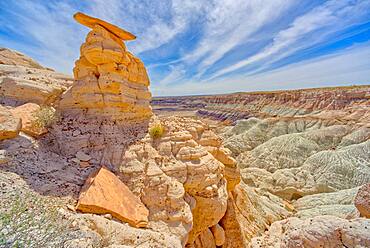
A hoodoo near a natural Spring west of Pintado Point in Petrified Forest National Park Arizona called the Guardian.
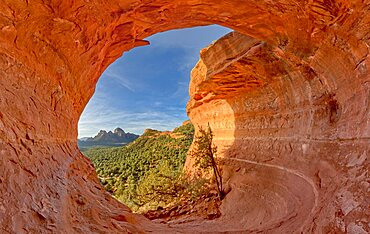
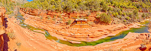
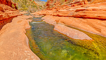
The Birthing Cave on the side of Mescal Mountain in Sedona Arizona. Ancient Indian women came here to give birth.
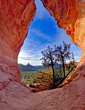
The Birthing Cave on Mescal Mountain in Sedona Arizona. It is said that ancient Indian women came here to give birth.
The Village of Oak Creek on the south side of Sedona viewed from the south end of Airport Mesa near sunset, Arizona, United States of America, North America
The Village of Oak Creek on the south side of Sedona viewed from the Airport Loop Trail, Arizona, United States of America, North America
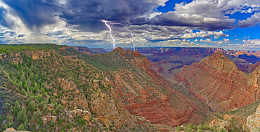
Lightning striking the Sinking Ship at Grand Canyon, viewed from the Buggeln Hill summit, Grand Canyon National Park, UNESCO World Heritage Site, Arizona, United States of America, North America

A hiker looking west from a cliff near Zuni Abyss at Grand Canyon, Zuni Point in the background just right of center, Grand Canyon National Park, UNESCO World Heritage Site, Arizona, United States of America, North America
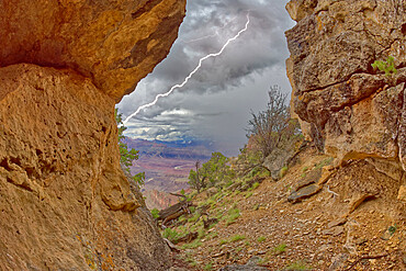
Grand Canyon viewed from inside a cave between Zuni and Papago Points while a storm is rolling into the area, Grand Canyon National Park, UNESCO World Heritage Site, Arizona, United States of America, North America
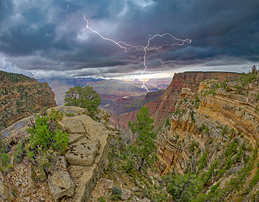
A monsoon storm rolling across Grand Canyon between Zuni Point and Papago Point, Grand Canyon National Park, UNESCO World Heritage Site, Arizona, United States of America, North America
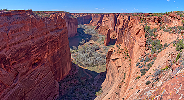
Spring Canyon in Canyon De Chelly National Monument viewed from the Sliding House Overlook on the south rim, Arizona, United States of America, North America

The meanders of the San Juan River at Goosenecks State Park, adjacent to the Navajo Indian Reservation, near Mexican Hat, Utah, United States of America, North America
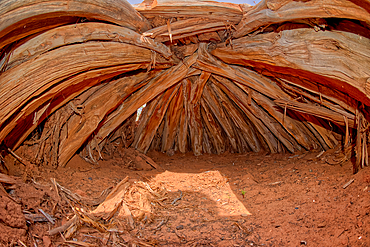
Interior of an Ancient Hogan used in Navajo ceremonies, in Navajo National Monument, Navajo Indian Reservation northwest of the town of Kayenta, Arizona, United States of America, North America

The Sipapu Bridge (Gateway of the Soul in Hopi), the second highest natural arch in America, Natural Bridges National Monument, Utah, United States of America, North America

The Horse Collar Ruins with a sign warning to not disturb them due to instability, located between the Sipapu Arch Bridge and the Kachina Arch Bridge, Natural Bridges National Monument, Utah, United States of America, North America

The Horse Collar Ruins located between the Sipapu Arch Bridge and the Kachina Arch Bridge, Natural Bridges National Monument, Utah, United States of America, North America
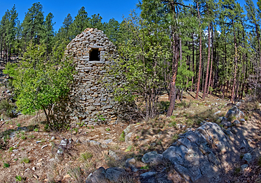
The historic Walker Charcoal Kiln, dating from the late 1880s used to turn oak wood into charcoal for silver smelters, Prescott National Forest, just south of Prescott, Arizona, United States of America, North America
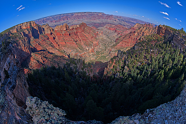
Fisheye view of Hance Canyon from the South Rim of Grand Canyon with Grandview Point is on the left, Grand Canyon National Park, UNESCO World Heritage Site, Arizona, United States of America, North America
Storm clouds approaching Lipan Point at Grand Canyon South Rim, Grand Canyon National Park, UNESCO World Heritage Site, Arizona, United States of America, North America