Results
« Previous 1 … 3 4 5 6 7 … 13 Next »
1207 results found
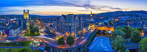
Aerial view by drone over Bath, Somerset, England, United Kingdom, Europe

View by drone of pink sky at sunrise on Ra Gusela, Nuvolau, Averau, Marmolada covered with snow, Dolomites, Belluno, Veneto, Italy, Europe
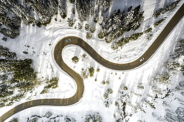
View by drone of scenic winding road connecting Antorno and Misurina along snowy woods, Dolomites, Belluno province, Veneto, Italy, Europe
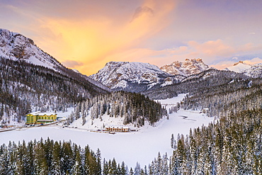
View by drone of sunset over Monte Piana and woods covered with snow, Misurina, Dolomites, Belluno province, Veneto, Italy, Europe
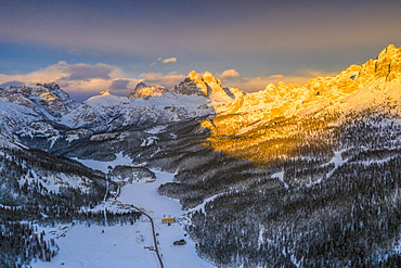
Panoramic view by drone of Tre Cime di Lavaredo and Cadini di Misurina peaks at sunset in winter, Dolomites, Belluno, Veneto, Italy, Europe
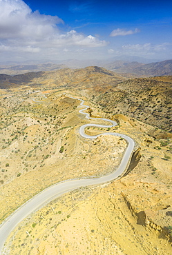
Panoramic view by drone of winding road towards Berhale crossing the dry landscape of Danakil desert, Afar Region, Ethiopia, Africa
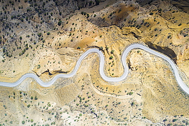
Aerial view by drone of hairpin bends of empty road along Danakil desert from above, Afar Region, Ethiopia, Africa

Aerial view by drone of steam of Ala Lobet (Alol Bet) geyser from above, Semera, Afar Region, Ethiopia, Africa
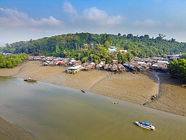
Aerial by drone of Fishing village on stilts in the mangroves of the Mergui (Myeik) Archipelago, Myanmar (Burma), Asia
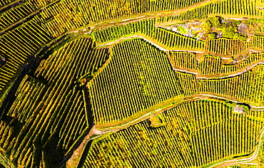
View by drone of top-down high angle view of vineyards, Valtellina, Lombardy, Italy, Europe
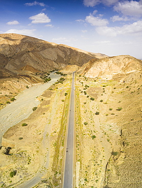
Panoramic view by drone of straight empty road through Danakil desert, Afar Region, Ethiopia, Africa
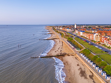
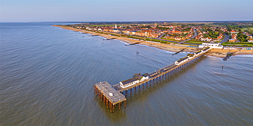
View by drone of Southwold Lighthouse and coast, Southwold, Suffolk, England, United Kingdom, Europe
View by drone of Southwold Lighthouse and Southwold, Suffolk, England, United Kingdom, Europe
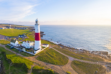
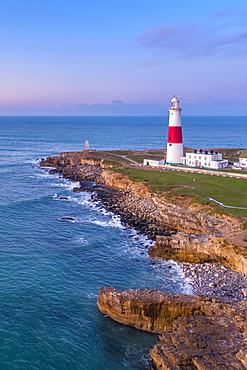
View by drone of Portland Bill Lighthouse, Portland Bill, Isle of Portland, UNESCO World Heritage Site, Dorset, England, United Kingdom, Europe
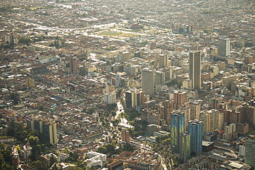
View from Cerro Monserrate, Bogota, Cundinamarca, Colombia, South America
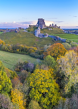
View by drone of Corfe Castle, Dorset, England, United Kingdom, Europe
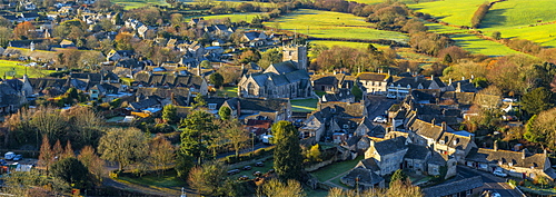
Corfe Castle village, Dorset, England, United Kingdom, Europe

View by drone of Southwold Lighthouse, Southwold, Suffolk, England, United Kingdom, Europe
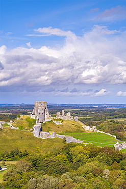
View by drone of Corfe Castle, Dorset, England, United Kingdom, Europe
View by drone of Portland Bill Lighthouse, Portland Bill, Isle of Portland, UNESCO World Heritage Site, Dorset, England, United Kingdom, Europe
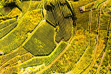
View by drone of top-down high angle view of vineyards, Valtellina, Lombardy, Italy, Europe

View from Cerro Monserrate, Bogota, Cundinamarca, Colombia, South America
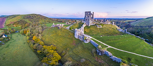
View by drone of Corfe Castle, Dorset, England, United Kingdom, Europe
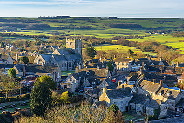
Corfe Castle village, Dorset, England, United Kingdom, Europe
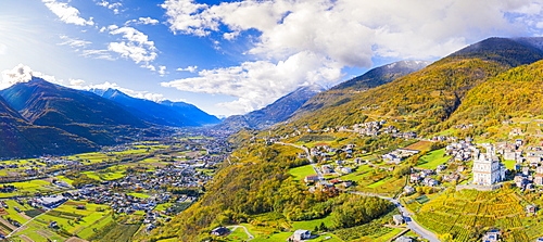
Aerial view by drone of Valtellina in autumn, Lombardy, Italy, Europe

View by drone of Southwold Lighthouse, Southwold, Suffolk, England, United Kingdom, Europe
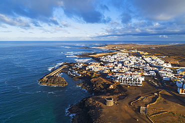
Aerial drone view, El Cotillo, Fuerteventura, Canary Islands, Spain, Atlantic, Europe

Aerial view by drone of jeeps and camping tents in the desert, Semera, Afar Region, Ethiopia, Africa
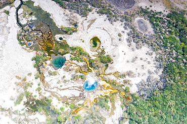
Aerial view by drone of Ala Lobet (Alol Bet) geyser erupting, Semera, Afar Region, Ethiopia, Africa
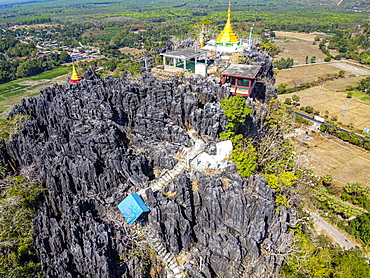
Aerial by drone of Kyauktalon Taung crag with a Hindu temple, near Mawlamyine, Mon state, Myanmar (Burma), Asia
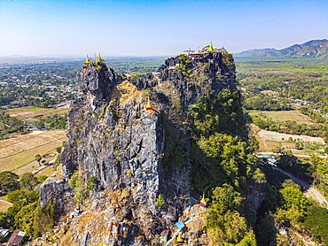
Aerial by drone of Kyauktalon Taung crag with a Hindu temple, near Mawlamyine, Mon state, Myanmar (Burma), Asia
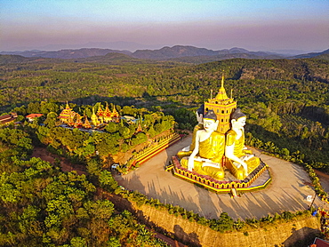
Aerial by drone of the huge sitting Buddhas, Ko Yin Lay, Pupawadoy Monastery near Ye, Mon state, Myanmar (Burma), Asia

Aerial view of skyscrapers and traffic, Seoul, South Korea, Asia
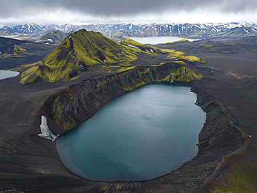
Aerial view taken by drone of Landmannalaugar mountain on a cloudy summer day, Iceland, Polar Regions

Aerial view taken by drone of Landmannalaugar area on a summer day, Iceland, Polar Regions
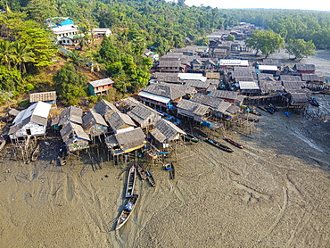
Aerial by drone of Fishing village on stilts in the mangroves of the Mergui (Myeik) Archipelago, Myanmar (Burma), Asia

Aerial by drone of the huge sitting and reclining Buddhas, Ko Yin Lay, Pupawadoy Monastery near Ye, Mon state, Myanmar (Burma), Asia
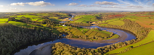
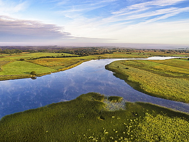
Aerial vista by drone of the River Dart meandering through rolling countryside, Devon, England, United Kingdom, Europe
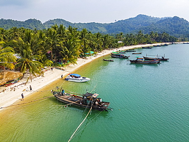
Aerial by drone of a Moken, sea gypsy village on a white sand beach, Mergui (Myeik) Archipelago, Myanmar (Burma), Asia
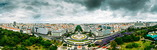
Aerial drone panoramic view of Parque Eduardo XII and Marques the Pombal looking south with Avenida da Liberdade in Lisbon, Portugal, Europe
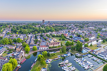
Drone view of Ely Cathedral with Ely Marina and Great Ouse River in foreground, Ely, Cambridgeshire, England, United Kingdom, Europe
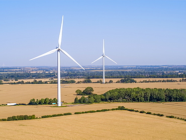
Drone view of Cotton Farm Wind Farm, Cambridgeshire, England, United Kingdom, Europe
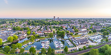
Drone view of Ely Cathedral with Ely Marina and Great Ouse River in foreground, Ely, Cambridgeshire, England, United Kingdom, Europe

Aerial by drone of Gohargeen fort, Yakawlang province, Bamyan, Afghanistan, Asia
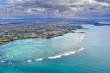
Dramatic sky over coral reef and inland, aerial view by drone Grand Baie (Pereybere), north-west coast, Mauritius, Indian Ocean, Africa
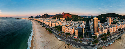
Aerial drone view of Copacabana Beach and urban setting at sunrise, UNESCO World Heritage Site, Rio de Janeiro, Brazil, South America
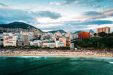
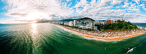
Aerial drone view of Ipanema Beach and neighbourhood, Rio de Janeiro, Brazil, South America
Aerial drone view of Arpoador section of Ipanema Beach with Copacabana and Sugarloaf Mountain visible in the background, Rio de Janeiro, Brazil, South America
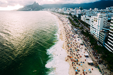
Aerial drone view of Ipanema and Leblon beaches, Rio de Janeiro, Brazil, South America
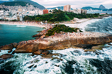
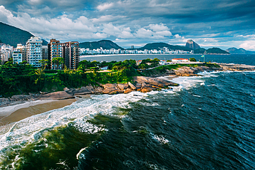
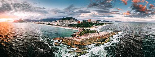
Aerial drone view of Arpoador Rock in Ipanema Beach, with Praia Vermelha visible on right, Rio de Janeiro, Brazil, South America
Aerial drone panorama of Ipanema and Copacabana beaches at sunset with Arpoador Rock closest to foreground and Sugarloaf Mountain visible, Rio de Janeiro, Brazil, South America
Aerial drone panorama of Ipanema beach, Rio de Janeiro, Brazil, South America
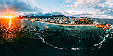
Aerial drone panorama of Ipanema and Copacabana beaches at sunset, Rio de Janeiro, Brazil, South America

Aerial view by drone of mist over Restormel Castle in Cornwall, England, United Kingdom, Europe

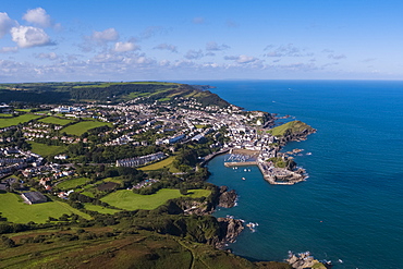
Aerial view by drone of Kingsbridge Estuary and Salcombe in Devon, England, United Kingdom, Europe

Aerial view by drone of State Opera House, Varna, Bulgaria, Europe
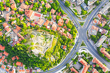
Aerial view by drone of ruins of Eumolpias, a Thracian settlement in 5000 BC, Plovdiv, Bulgaria, Europe

Aerial view by drone of Ivan Vazov National Theatre, Sofia, Bulgaria, Europe
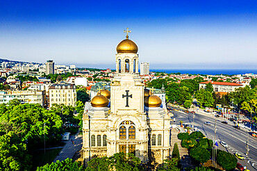
Aerial view by drone of Mother of God Cathedral, Varna, Bulgaria, Europe
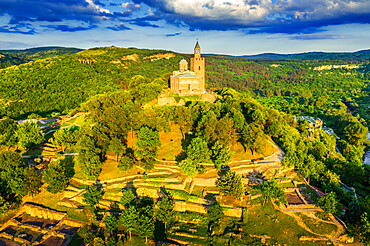
Aerial view by drone of Tsarevets fortress, Veliko Tarnovo, Bulgaria, Europe

Aerial view by drone of Ivan Vazov National Theatre, Sofia, Bulgaria, Europe

Aerial view by drone of Kaleto Rock Fortress rock formations, Belogradchik, Bulgaria, Europe
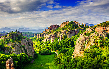
Aerial view by drone of rock formations and forest, Belogradchik, Bulgaria, Europe
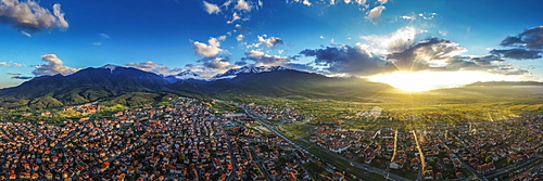
Aerial view by drone of Bansko and Pirin National Park, UNESCO World Heritage Site, Bankso, Bulgaria, Europe
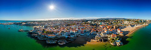
Aerial drone panoramic view of sunset at Cascais Bay, in the Lisbon region of the Portuguese Riveira, Europe
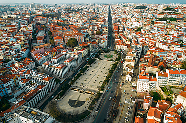
Aerial drone view of Martim Moniz Square in Lisbon, with wider view of northern districts of Lisbon in the background, Lisbon, Portugal, Europe
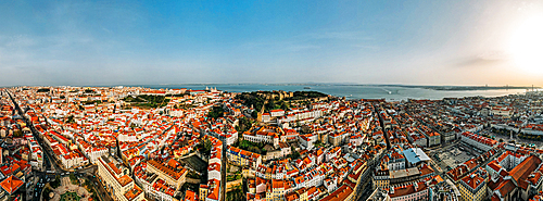
Aerial drone view of Baixa District, facing south towards the Tagus River with the major landmarks visible including St. George Castle, Pantheon, Figueira, Rossio Square, Martim Moniz Squares, Lisbon, Portugal, Europe
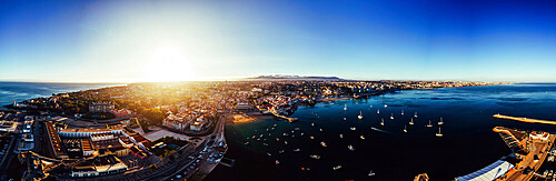
Aerial drone panoramic view of Cascais, on the Portuguese Riviera, in region known as the Green Coast due to the colour of the water, with beaches inclding Rainha, Duquesa and Conceicao, Portugal, Europe
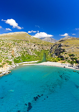
Aerial photo by drone of Preveli beach, Retymno, Crete Island, Greek Islands, Greece, Europe
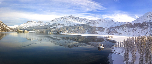
Panoramic of Lej Lagrev seen from drone, Silvaplana, Engadine, Canton of Graubunden, Switzerland, Europe (Drone)
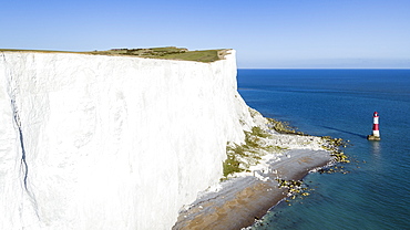
White chalk cliffs of Beachy Head and lighthouse, South Downs National Park, near Eastbourne, East Sussex, England, United Kingdom, Europe (Drone)

Porthmeor beach, St. Ives, Cornwall, England, United Kingdom, Europe (Drone)

Rocky coastline and beaches at Kynance Cove, the Lizard, Cornwall, England, United Kingdom, Europe (Drone)
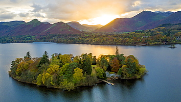
Derwent Water, Lake District National Park, UNESCO World Heritage Site, Cumbria, England, United Kingdom, Europe (Drone)

Keswick and Skiddaw beyond, Lake District National Park, UNESCO World Heritage Site, Cumbria, England, United Kingdom, Europe (Drone)
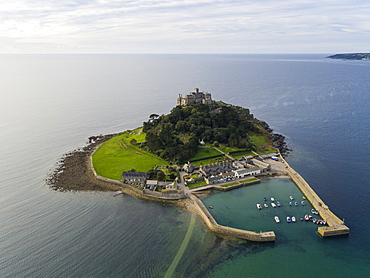
St. Michaels Mount, Marazion, Cornwall, England, United Kingdom, Europe (Drone)
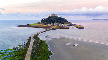
St. Michaels Mount, Marazion, Cornwall, England, United Kingdom, Europe (Drone)
Shannon Callows, Clonmacnoise, County Offaly, Leinster, Republic of Ireland, Europe (Drone)

Aerial view of tropical beach and palm trees, The Maldives, Indian Ocean, Asia (Drone)

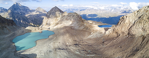
Aerial panoramic view of Lake Sils and Plaun da Lej during winter, Maloja Region, Canton of Graubunden, Engadine, Switzerland, Europe (Drone)
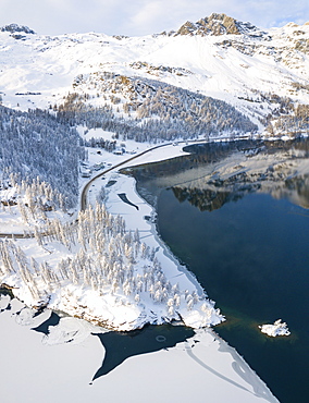
Aerial panoramic view of road around frozen Lake Sils, Plaun da Lej, Maloja Region, Canton of Graubunden, Engadine, Switzerland, Europe (Drone)
Aerial panoramic view of Lake Sils and Plaun da Lej during winter, Maloja Region, Canton of Graubunden, Engadine, Switzerland, Europe (Drone)
Aerial view of Rio Tinto, by drone, Huelva District, Andalucia, Spain, Europe
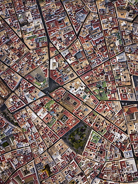
Aerial view of Cadiz, by drone, Andalucia, Spain, Europe
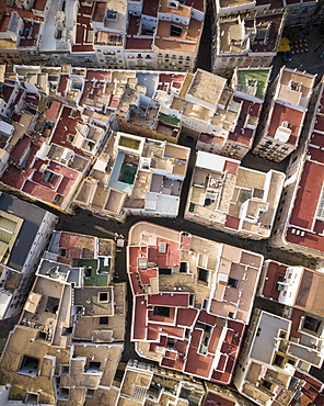
Aerial view by drone of Cadiz, Andalucia, Spain, Europe
Aerial view of Rio Tinto, by drone, Huelva District, Andalucia, Spain, Europe
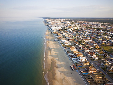
Aerial view of Matalascanas, by drone, Huelva District, Andalucia, Spain, Europe
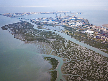
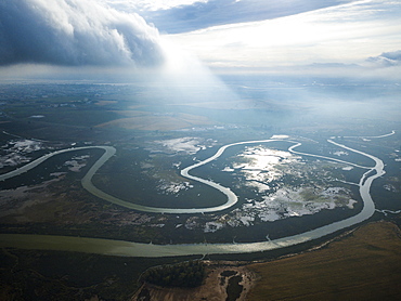
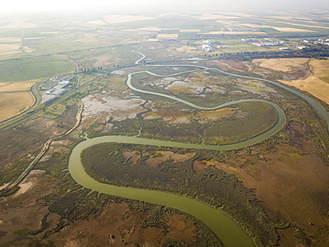
Aerial view, by drone, of San Fernando marshes, Bahia de Cadiz, Cadiz, Andalucia, Spain, Europe
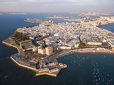
Aerial view, by drone, of Cadiz, Andalucia, Spain, Europe
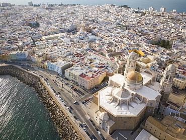
Aerial view of Cadiz Cathedral, by drone, Cadiz, Andalucia, Spain, Europe
Aerial view over the town and North Devon coast, Ilfracombe, Devon, England, United Kingdom, Europe

Wooded valley on the north Devon coast, Lynton, Exmoor, Devon, England, United Kingdom, Europe
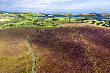
Aerial view over the moors, Exmoor National Park, Devon, England, United Kingdom, Europe
Aerial drone panoramic view of promenade in Cascais, on the Portuguese Riveira 30km west of Lisbon, with Estoril visible on the far right, Cascais, Portugal, Europe
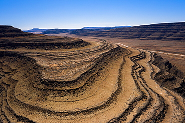
A drone shot of the Fish River Canyon, the second largest canyon in the world, Namibia, Africa
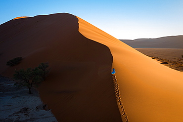
Drone shot of model Climbing Dune 13, Sossusvlei, Namibia, Africa

Drone shot of model Climbing Dune 13, Sossusvlei, Namibia, Africa

Drone shot of model Climbing Dune 13 at sunrise, Sossusvlei, Namibia, Africa

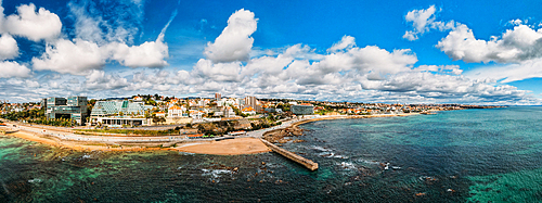
Drone imagery of Kogel Bay Beach an hour from Cape Town, South Africa, Africa
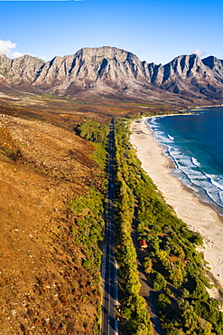
Drone imagery of Kogel Bay Beach an hour from Cape Town, South Africa, Africa