Results
« Previous 1 … 4 5 6 7 8 … 15 Next »
1480 results found
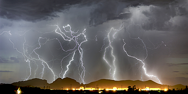
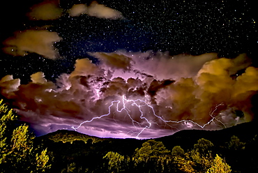
Lightning striking Saddleback Mountain just west of Tonopah, Arizona, United States of America, North America
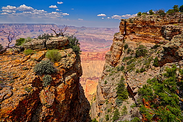
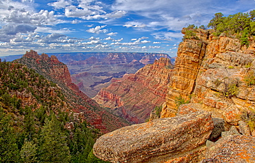
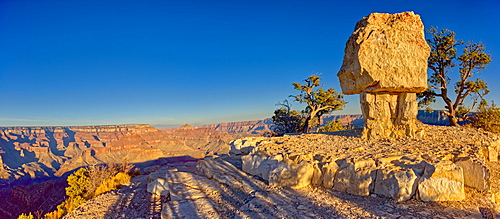
Grand Canyon view between two cliffs with a rock window on the right, located just west of Pinal Point on the south rim, Grand Canyon National Park, UNESCO World Heritage Site, Arizona, United States of America, North America
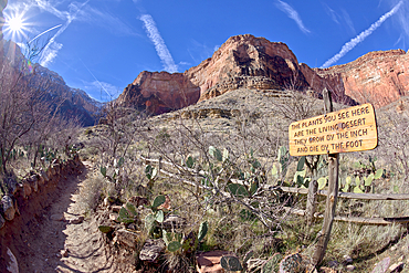
A sign along the Bright Angel Trail in Grand Canyon warning that the plants in this area are very fragile, Grand Canyon National Park, UNESCO World Heritage Site, Arizona, United States of America, North America
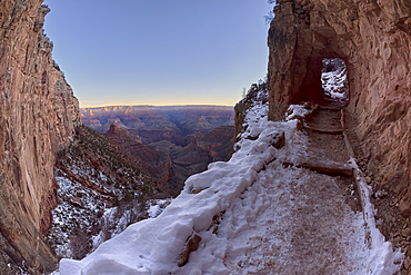
The second tunnel along Bright Angel Trail in winter at sunrise on the South Rim of Grand Canyon, Grand Canyon National Park, UNESCO World Heritage Site, Arizona, United States of America, North America
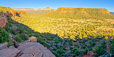
Grand Canyon view from Buggeln Hill on the south rim with the Sinking Ship formation on the left and Coronado Butte in the center, Grand Canyon National Park, UNESCO World Heritage Site, Arizona, United States of America, North America
An evening thunderstorm approaching the Grand Canyon in Arizona, viewed from the Desert View Vista, Grand Canyon National Park, UNESCO World Heritage Site, Arizona, United States of America, North America
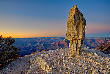
HDR composite of Sinking Ship rock on the South Rim of the Grand Canyon, view from a cliff just below the canyon rim, Grand Canyon National Park, UNESCO World Heritage Site, Arizona, United States of America, North America
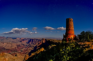
Watch Tower on South Rim of Grand Canyon illuminated by moonlight, Grand Canyon National Park, UNESCO World Heritage Site, Arizona, United States of America, North America
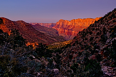
Grand Canyon view just below the summit of Buggeln Hill on the South Rim, Grand Canyon National Park, UNESCO World Heritage Site, Arizona, United States of America, North America
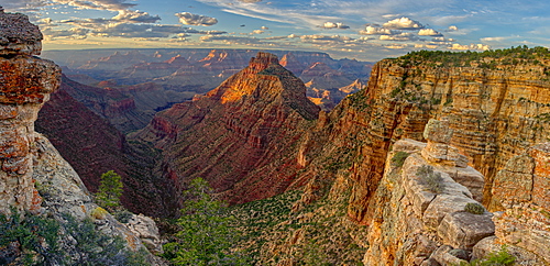
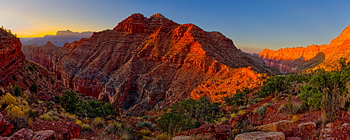
Panorama of Grand Canyon viewed from Buggeln Point just east of Buggeln Hill on the South Rim around sundown, Grand Canyon National Park, UNESCO World Heritage Site, Arizona, United States of America, North America
Grand Canyon view from the east slope of Buggeln Hill on the South Rim, Grand Canyon National Park, UNESCO World Heritage Site, Arizona, United States of America, North America
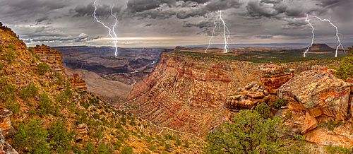
Grand Canyon from the Desert View Trail a mile east of the historic Watch Tower with a lightning storm rolling into the area, Grand Canyon National Park, UNESCO World Heritage Site, Arizona, United States of America, North America
Grand Canyon view from the Tanner Trail with only the twilight glow as the light source, Grand Canyon National Park, UNESCO World Heritage Site, Arizona, United States of America, North America
View of Escalante Butte in the Grand Canyon from the Tanner Trail just before sundown, Grand Canyon National Park, UNESCO World Heritage Site, Arizona, United States of America, North America
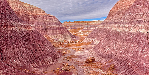
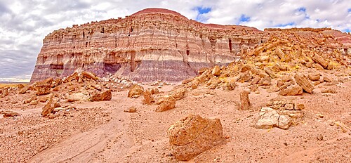
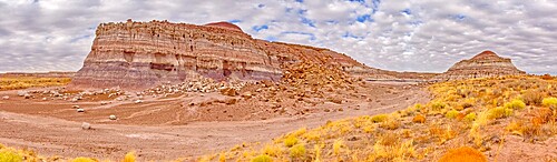
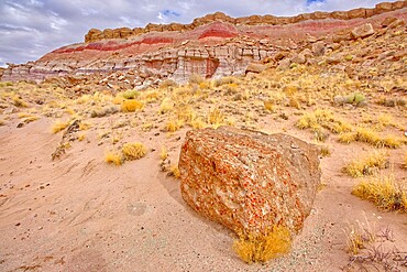
Mounds and cliffs of expansive clay called Bentonite in the Jasper Forest of Petrified Forest National Park, Arizona, United States of America, North America
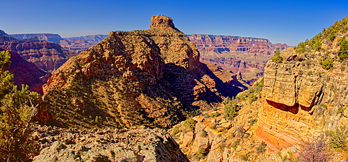
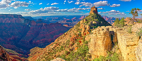
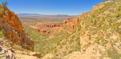
Coronada Butte viewed from the New Hance Trail on the south rim of the Grand Canyon, Grand Canyon National Park, UNESCO World Heritage Site, Arizona, United States of America, North America
A northeast panorama of the Grand Canyon from Shoshone Point at sundown, with Shoshone Rock on the right, Grand Canyon National Park, UNESCO World Heritage Site, Arizona, United States of America, North America
Shoshone Rock at Shoshone Point on the south rim of the Grand Canyon facing north at twilight, Grand Canyon National Park, UNESCO World Heritage Site, Arizona, United States of America, North America
The Lithodendron Wash in the Petrified Forest National Park, Arizona, United States of America, North America
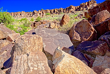
A rocky pile in Petrified Forest National Park called Newspaper Rock, where some rocks have petroglyphs, Arizona, United States of America, North America
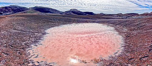
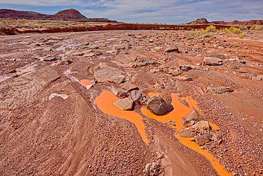
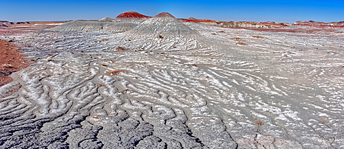
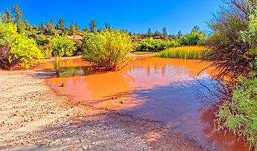
A red pool of salty water along the Blue Forest Trail in Petrified Forest National Park, Arizona, United States of America, North America
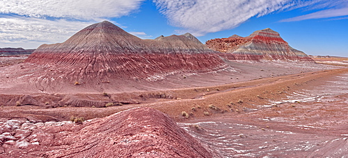
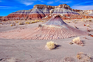
Hills of Bentonite Clay called Teepees at the start of the Blue Forest Trail in Petrified Forest National Park, Arizona, United States of America, North America
Huge formations of Bentonite Clay called the Teepees in the Petrified Forest National Park, Arizona, United States of America, North America
A large petrified log along the Blue Mesa Trail in Petrified Forest National Park, Arizona, United States of America, North America
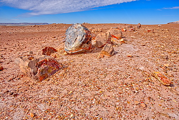
A shattered petrified log in a desolate area of Petrified Forest National Park, Arizona, United States of America, North America
A large petrified log along the Blue Mesa Trail in Petrified Forest National Park, Arizona, United States of America, North America
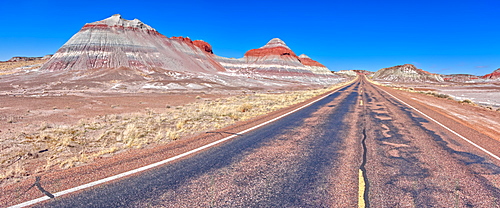
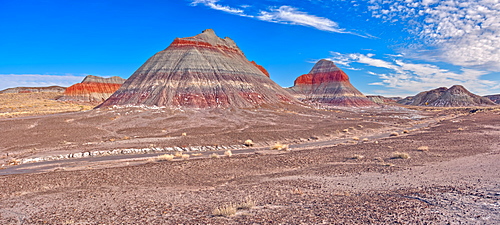
Formation in the Petrified Forest National Park called a Teepee viewed from the main road that runs through the park, Arizona, United States of America, North America
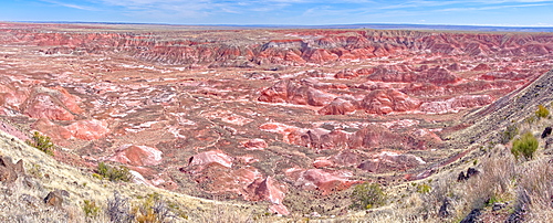
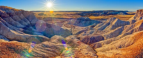
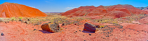
Panorama view of the Painted Desert from Tawa Point in Petrified Forest National Park, Arizona, United States of America, North America

Salt covered hills of Bentonite in the Petrified Forest National Park along the Blue Forest Trail, Arizona, United States of America, North America
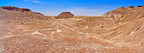
View from a side canyon along the Blue Mesa Trail in Petrified Forest National Park, Arizona, United States of America, North America
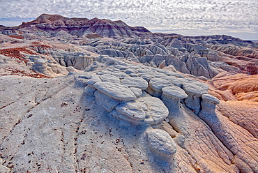
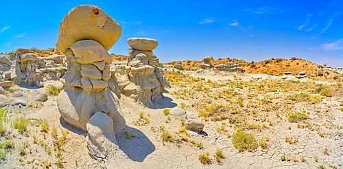
Mushroom shaped formations along the Blue Forest Trail in Petrified Forest National Park, Arizona, United States of America, North America
Salt covered hills of Bentonite in the Petrified Forest National Park along the Blue Forest Trail, Arizona, United States of America, North America
Petroglyph covered boulders on a slope in the Upper Verde River Wildlife Area in Paulden, Arizona, United States of America, North America
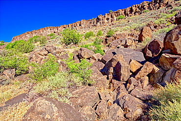
Petroglyph covered boulders on a slope in the Upper Verde River Wildlife Area in Paulden, Arizona, United States of America, North America
Rolling hills and golden Gramma Grass of Chino Valley, located along East Perkinsville Road just east of State Route 89, Arizona, United States of America, North America
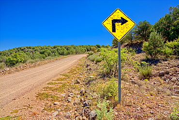
A sign along Forest Service Road 492 that has been shot up by reckless gunfire, Prescott National Forest, Arizona, United States of America, North America
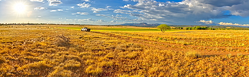
Pickup truck on Fire Road 182 exploring prairie grassland near Drake in the Prescott National Forest, Arizona, United States of America, North America
Narrow road, Fire Road 182, and grassy prairie in Prescott National Forest near Drake, Arizona, United States of America, North America
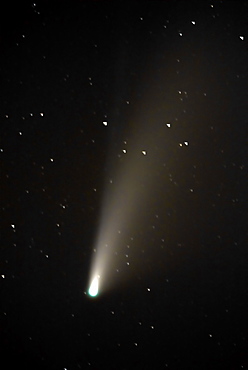
NeoWise Comet of 2020, which will not return for almost 7000 years according to NASA, Chino Valley, Arizona, United States of America, North America
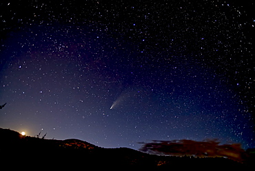
Comet NeoWise 2020 above Sullivan Butte in Chino Valley, with the Moon on the lower left and the Big Dipper in the center, Arizona, United States of America, North America
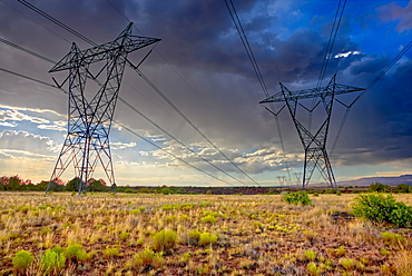
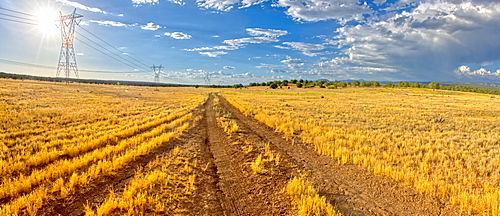
High voltage power lines stretching across Hell Canyon east of Paulden, located in the Prescott National Forest, Arizona, United States of America, North America
A storm approaching Sullivan Butte in Chino Valley at night with a starry sky above, Arizona, United States of America, North America
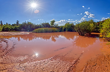
Toxic pond formed from runoff of mine tailings at an abandoned copper mine in the Prescott National Forest near Perkinsville, Arizona, United States of America, North America
Toxic pond formed from runoff of mine tailings at an abandoned copper mine in the Prescott National Forest near Perkinsville, Arizona, United States of America, North America
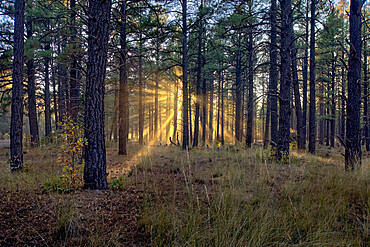
HDR composite of the late day sun shining through the trees of the Kaibab Forest near Williams, Arizona, United States of America, North America
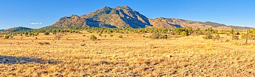
Panorama view of Granite Mountain on the north side of Prescott Arizona.
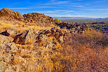
Ancient Indian Ruins near Granite Mountain in the Prescott National Forest, Arizona, United States of America, North America
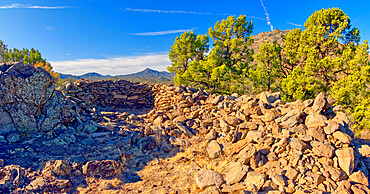
Ancient Indian Ruins near Granite Mountain in the Prescott National Forest, Arizona, United States of America, North America
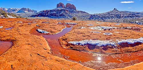
Snow covered Cathedral Rock in Sedona viewed from a sandstone plateau along Secret Slick Rock Trail, Arizona, United States of America, North America
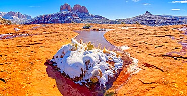
Snow covered Cathedral Rock in Sedona viewed from a sandstone plateau along Secret Slick Rock Trail, Arizona, United States of America, North America
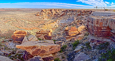
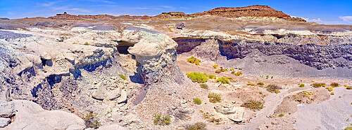
The eastern edge of the Clam Bed Mesa along the Red Basin Trail in Petrified Forest National Park, Arizona, United States of America, North America
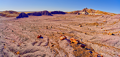
Panorama of the setting sun at the First Forest in Petrified Forest National Park, Arizona, United States of America, North America
The eastern edge of the Clam Bed Mesa along the Red Basin Trail in Petrified Forest National Park, Arizona, United States of America, North America
One of many fossil filled boulders in the Clam Beds along Red Basin Trail in Petrified Forest National Park, Arizona, United States of America, North America

A ridge in the Devil's Playground of crumbling hoodoos that resemble Goblins,Petrified Forest National Park, Arizona, United States of America, North America
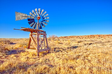
An old windmill marking the boundary of the Devil's Playground in Petrified Forest National Park, Arizona, United States of America, North America
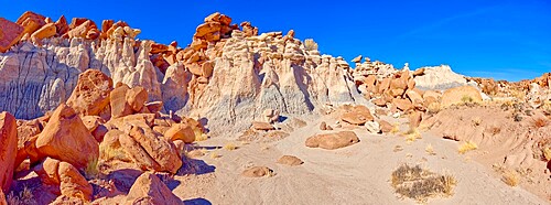
A ridge in the Devil's Playground of crumbling hoodoos that resemble Goblins, Petrified Forest National Park, Arizona, United States of America, North America
Panorama of a ridge in the Devil's Playground of crumbling hoodoos, Petrified Forest National Park, Arizona, United States of America, North America

Panorama of a ridge in the Devil's Playground of crumbling hoodoos, Petrified Forest National Park, Arizona, United States of America, North America
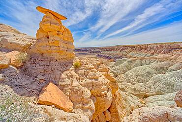
Sand Castle formations on the edge of the Red Basin in Petrified Forest National Park, Arizona, United States of America, North America
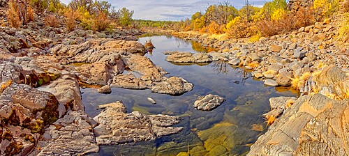
Reflecting pools and volcanic basalt rock boulders in the water, Devil Dog Canyon, near Drake, Arizona, United States of America, North America

House of Apache Fires in Red Rock State Park with Cathedral Rock in the background, Sedona, Arizona, United States of America, North America

Grand Canyon viewed from the west side of Maricopa Point along the Hermit Road, Grand Canyon National Park, UNESCO World Heritage Site, Arizona, United States of America, North America

Grand Canyon viewed from the east side of Maricopa Point along the Hermit Road, Grand Canyon National Park, UNESCO World Heritage Site, Arizona, United States of America, North America
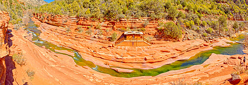
Clifftop panorama of Oak Creek in Slide Rock State Park north of Sedona, Arizona, United States of America, North America
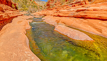
Slick rock water channel in Slide Rock State Park where most swimmers begin their slide in Oak Creek north of Sedona, Arizona, United States of America, North America
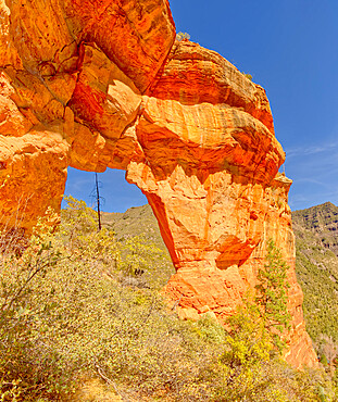
South side of Pendley Arch, Coconino National Forest just outside of Slide Rock State Park, Sedona, Arizona, United States of America, North America
View from the western slope of Steamboat Rock looking north, Coconino National Forest, Sedona, Arizona, United States of America, North America
A dry waterfall sandstone ledge on a trail to Steamboat Rock, Coconino National Forest, Sedona, Arizona, United States of America, North America

Rocky shore of Watson Lake which has lost much water due to the drought, the gray rock was originally submerged, Arizona, United States of America, North America

Rocky lagoon in Watson Lake along Lakeshore Trail, gray rock shows how much water volume was lost due to the drought, Arizona, United States of America, North America
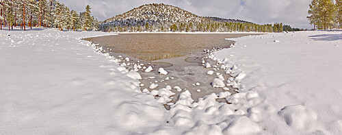
Panorama of Kaibab Lake from its south side, Kaibab National Forest near Williams, Arizona, United States of America, North America

TV, Radio, and Cell Phone Towers perched on the summit of Mingus Mountain near Jerome, Arizona, United States of America, North America
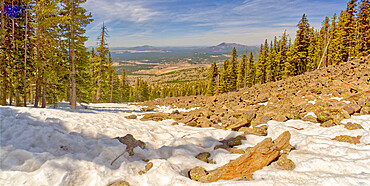
West panorama view from a lava field on the side of Humphrey's Peak near Flagstaff in the Coconino National Forest, Arizona, United States of America, North America
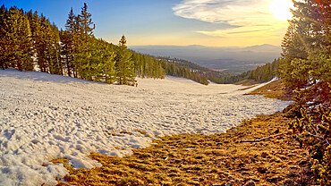
The slopes of Arizona Snow Bowl facing west close to sundown, Coconino National Forest near Flagstaff, Arizona, United States of America, North America
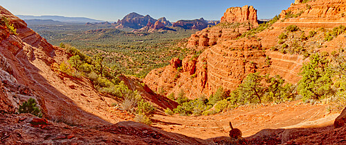
Panorama view of Sedona from the First Bench of Bear Mountain, to the right of center is Doe Mountain, Sedona, Arizona, United States of America, North America

Fay Canyon viewed from the 1st Peak of Bear Mountain in Sedona, Arizona, United States of America, North America
Western view of Sedona from the saddle section of Bear Mountain just past the 1st Peak with True Peak in upper right, Sedona, Arizona, United States of America, North America
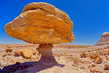
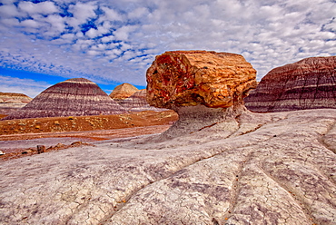
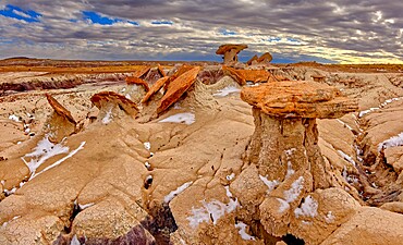
Balanced rock that resembles a toadstool, petrified wood scattered around the formation, Petrified Forest National Park, Arizona, United States of America, North America
Balanced rock that resembles a toadstool, petrified wood scattered around the formation, Petrified Forest National Park, Arizona, United States of America, North America

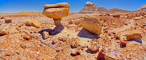
A stone garden of Toadstool rocks on the south end of Keyhole Mesa in Petrified Forest National Park, Arizona, United States of America, North America
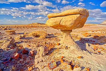
Balanced rock that resembles a toadstool, petrified wood scattered around the formation, Petrified Forest National Park, Arizona, United States of America, North America

Keyhole Mesa, named for a keyhole shaped cave on its north side, in the First Forest of Petrified Forest National Park, Arizona, United States of America, North America
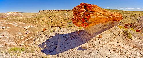
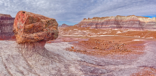
A giant petrified log on a sandstone pedestal on the edge of the Blue Mesa in Petrified Forest National Park, Arizona, United States of America, North America
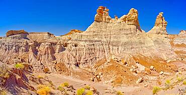
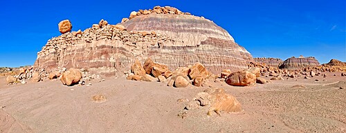
Panorama of three hoodoos shaped like kings, on the edge of the Blue Mesa in Petrified Forest National Park, Arizona, United States of America, North America
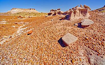
An eroded sandstone formation called a Sandcastle, below the Blue Mesa in Petrified Forest National Park, Arizona, United States of America, North America
Flat top hoodoo on the edge of a cliff along the Billings Gap Trail on Blue Mesa, Petrified Forest National Park, Arizona, United States of America, North America
A long formation of purple Bentonite clay called the Purple Peninsula, in Petrified Forest National Park, Arizona, United States of America, North America
Hills of blood red bentonite clay below Kachina Point in Petrified Forest National Park, Arizona, United States of America, North America
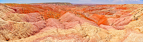
Blood red ridges of Bentonite clay on the east side of Tiponi Point in Petrified Forest National Park, Arizona, United States of America, North America
Field of hoodoos in Goblin Garden in the Flat Tops of Petrified Forest National Park, Arizona, United States of America, North America
A dome shaped hill of purple bentonite with a rocky flat top in Petrified Forest National Park, Arizona, United States of America, North America
A dry waterfall made of purple bentonite in the Flat Tops of Petrified Forest National Park, Arizona, United States of America, North America
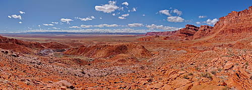
Panorama view from above Sand Hill Spring at Vermilion Cliffs National Monument, with snow covered land in the distance of the Kaibab Plateau, location of the Grand Canyon, Arizona, United States of America, North America
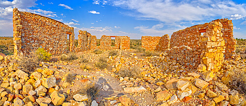
The crumbling stone walls of a derelict building in the ghost town of Two Guns, Arizona, United States of America, North America
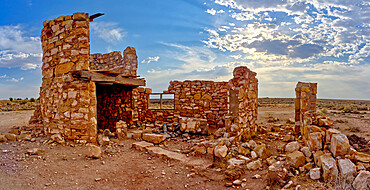
The ghostly remains of an old stone tower in the ghost town of Two Guns, Arizona, United States of America, North America

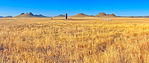
Panorama of Tsu'Vo Buttes in Homolovi State Park, Tsu'Vo is a Hopi word meaning Path of Rattlesnakes, Arizona, United States of America, North America
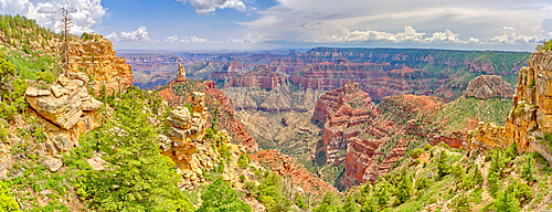
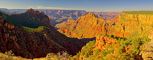
Point Imperial view from Ken Patrick Trail at Grand Canyon North Rim with Mount Hayden the pointed peak left of center, Arizona, United States of America, North America
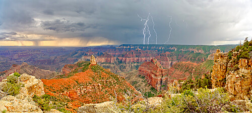
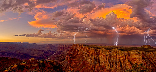
Storm rolling into Point Imperial at Grand Canyon North Rim, Grand Canyon National Park, UNESCO World Heritage Site, Arizona, United States of America, North America
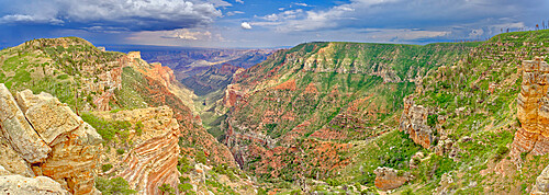
View from the Saddle Mountain Overlook on the northeast edge of Grand Canyon North Rim and the Kaibab National Forest, Arizona, United States of America, North America