Results
« Previous 1 … 6 7 8 9 10 … 15 Next »
1480 results found
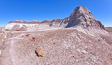
View of a bentonite hill along the Long Logs Trail in Petrified Forest National Park, Arizona, United States of America, North America

A circular walkway for the Long Logs Trail in Petrified Forest National Park, Arizona, United States of America, North America
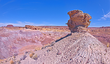
A lone hoodoo rock on the edge of a ridge overlooking the Jim Camp Wash on the south end of Petrified Forest National Park, Arizona, United States of America, North America
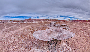
Sandstone that has been eroded into forms that resemble clam shells on the south end of Petrified Forest National Park, Arizona, United States of America, North America
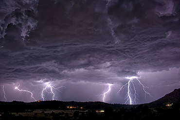
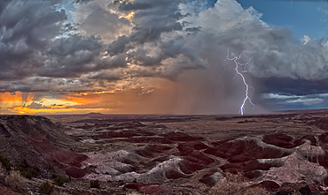
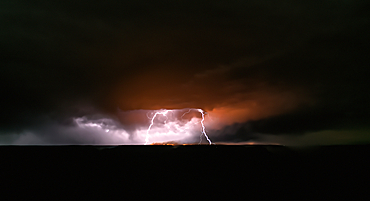
A long exposure capturing multiple lightning strikes on August 14th, 2025 on the south side of Sullivan Butte in Chino Valley Arizona.
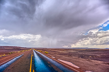
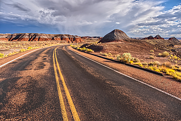
The main road thru Petrified Forest National Park Arizona on a rainy day.
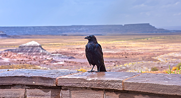
A wild and wet Raven standing on a stone wall at the Jasper Forest overlook in Petrified Forest Arizona during a rainstorm.
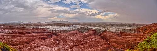
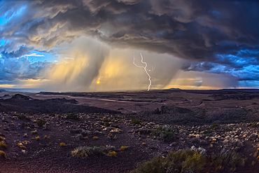
A heavy rainstorm over a section of Petrified Forest National Park Arizona called the Flattops. Because the rain was falling at the time of this photo some falling rain has been captured in the photo.
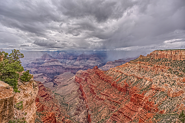
A storm approaching Blue Mesa in Petrified Forest National Park Arizona.
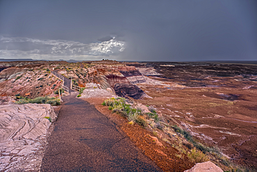
A paved trail leading below Blue Mesa in Petrified Forest National Park Arizona.
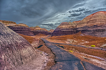
A paved trail leading below Blue Mesa in Petrified Forest National Park Arizona on a rainy day.
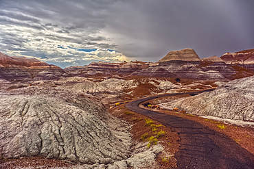
A paved trail leading below Blue Mesa in Petrified Forest National Park Arizona on a rainy day.
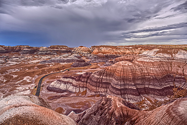
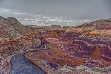
A storm approaching Blue Mesa in Petrified Forest National Park Arizona.
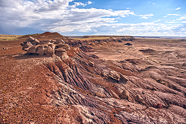
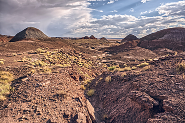
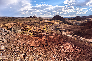
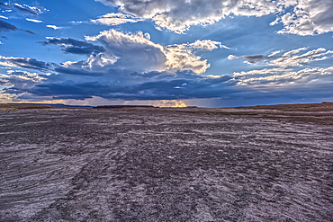
A desolate barren valley of rock and sand in Petrified Forest National Park Arizona just west of Blue Mesa.
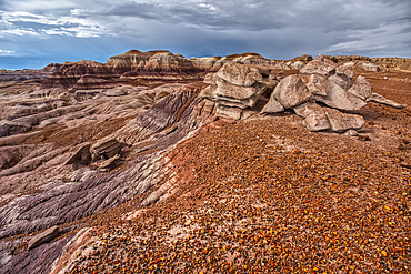
A desolate barren valley of rock and sand in Petrified Forest National Park Arizona just west of Blue Mesa.
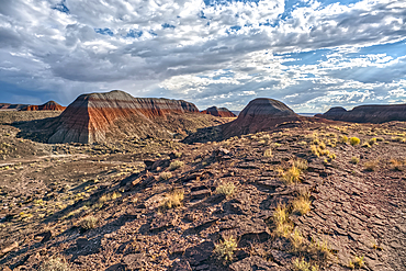
Northside view of the Teepees at Petrified Forest National Park Arizona.
Northside view of the Teepees at Petrified Forest National Park Arizona.
Northside view of the Teepees at Petrified Forest National Park Arizona.
Main road leading to the Teepees at Petrified Forest National Park Arizona.
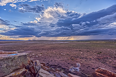
Building storm approaching Petrified Forest National Park Arizona. Viewed from a gray plain south of the Teepees.
Building storm approaching Petrified Forest National Park Arizona. Viewed from the Newspaper Rock Overlook.
An old Model-T marking historic Route-66 in Petrified Forest National Park Arizona with an approaching storm in the background.
Storm approaching Petrified Forest National Park Arizona. Viewed from Whipple Point.
Storm approaching Petrified Forest National Park Arizona. Viewed from Nizhoni Point.
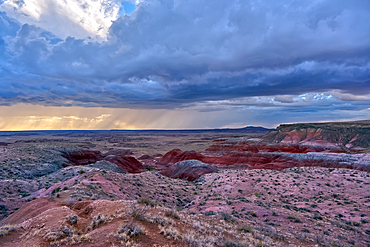
Storm approaching Petrified Forest National Park Arizona. Viewed from Pintado Point near sunset.
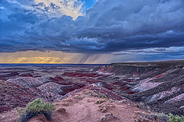
Storm approaching Petrified Forest National Park Arizona. Viewed from Kachina Point near sunset.
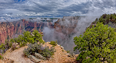
Steamlike fog rising out of Grand Canyon South Rim just east of Grandview Point, Grand Canyon National Park, UNESCO World Heritage Site, Arizona, United States of America, North America
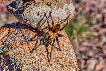
A male Tarantula native to the Chino Valley area of Arizona crawling on rocks. This is a male because the females hide underground and don't roam around like the males.
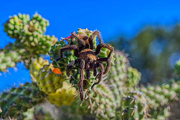
A male Tarantula native to the Chino Valley area of Arizona crawling on a cactus. This is a male because the females hide underground and don't roam around like the males.

A male Tarantula native to the Chino Valley area of Arizona crawling on a cactus. This is a male because the females hide underground and don't roam around like the males.
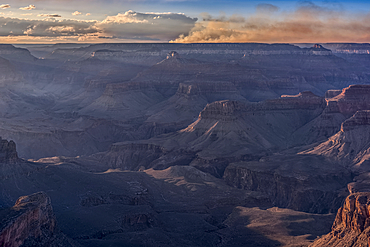
Dragon Bravo wildfire burning on the North Rim of Grand Canyon Arizona with a lightning storm. Viewed from Yavapai Point on the South Rim at night. The fire started from a lightning strike on July 4th, 2025.
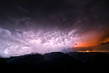
Dragon Bravo wildfire burning on the North Rim of Grand Canyon Arizona with a lightning storm. Viewed from Yavapai Point on the South Rim at night. The fire started from a lightning strike on July 4th, 2025.
Dragon Bravo wildfire burning on the North Rim of Grand Canyon Arizona. Viewed from Pipe Creek Vista on the South Rim at night. The fire started from a lightning strike on July 4th, 2025. Due to high winds and long exposure time there is motion blur.
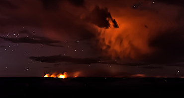
Smoke from the Dragon Bravo wildfire burning on the North Rim of Grand Canyon Arizona. Viewed from Shoshone Point on the South Rim at sundown. The fire started from a lightning strike on July 4th, 2025.
Smoke from the Dragon Bravo wildfire burning on the North Rim of Grand Canyon Arizona. Viewed from Shoshone Point on the South Rim. The fire started from a lightning strike on July 4th, 2025.
View of Honan Point on the North Rim of Grand Canyon National Park, Arizona, USA
A rain storm over the North Rim of Grand Canyon National Park, Arizona, USA
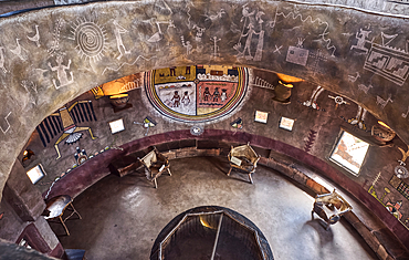
Downward view from the second floor in historic Desert View Watchtower at Grand Canyon South Rim, artwork created by Fred Kobotie in 1933, now owned by the National Park Service, UNESCO World Heritage Site, Arizona, United States of America, North America
Stairs up to the third floor in the historic Desert View Watchtower at Grand Canyon South Rim, artwork created by Fred Kobotie in 1933, now owned by the National Park Service, UNESCO World Heritage Site, Arizona, United States of America, North America

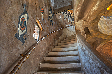
Stairs up to the seconnd floor in the historic Desert View Watchtower at Grand Canyon South Rim, artwork created by Fred Kobotie in 1933, now owned by the National Park Service, UNESCO World Heritage Site, Arizona, United States of America, North America

The top floor of the historic Watchtower at Grand Canyon South Rim, Grand Canyon, UNESCO World Heritage Site, Arizona, United States of America, North America
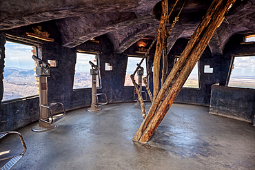
The top floor of the historic Watchtower at Grand Canyon South Rim, UNESCO World Heritage Site, Arizona, United States of America, North America
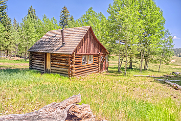
An abandoned homestead in the Kaibab National Forest off of Highway 67 north of Grand Canyon North Rim Arizona. Public land. No property release needed. Preserved by Forest Service as a historical landmark.
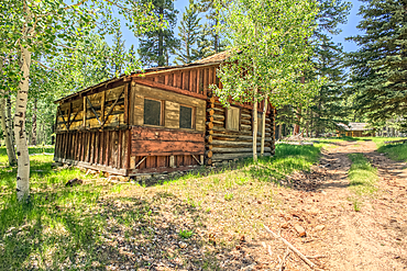
An abandoned homestead in the Kaibab National Forest off of Highway 67 north of Grand Canyon North Rim Arizona. Public land. No property release needed. Preserved by Forest Service as a historical landmark.
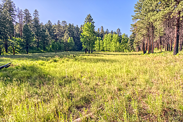
A grassy meadow in a valley near Clear Creek Canyon at Grand Canyon North Rim Arizona.
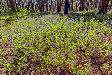
A field of purple wildflowers called Lupine at Grand Canyon North Rim Arizona near Clear Creek Canyon. Species Lupinus in the family Fabaceae.
Dry Waterfall on the north end of Clear Creek Canyon at Grand Canyon North Rim Arizona.
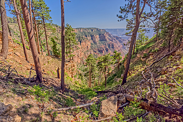
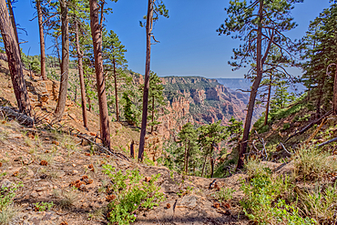
View of Clear Creek Canyon from its north cliffs at Grand Canyon North Rim Arizona.
The jagged north cliffs of Clear Creek Canyon at Grand Canyon North Rim Arizona.
Dry Waterfall on the north end of Clear Creek Canyon at Grand Canyon North Rim Arizona.
Dry Waterfall on the north end of Clear Creek Canyon at Grand Canyon North Rim Arizona.
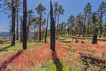
Burned trees at the north edge of Clear Creek Canyon at Grand Canyon North Rim Arizona.
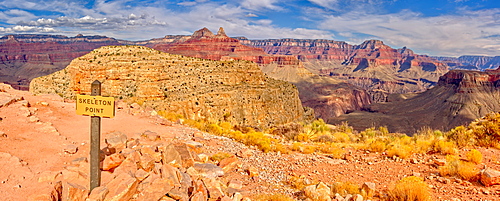
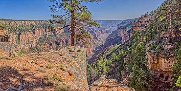
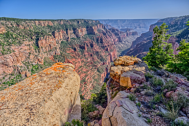
Grand Canyon view from Skeleton Point along the South Kaibab Trail on the south rim, Grand Canyon National Park, UNESCO World Heritage Site, Arizona, United States of America, North America
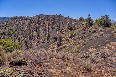
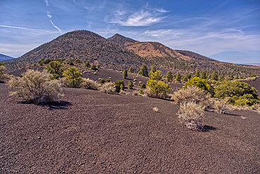
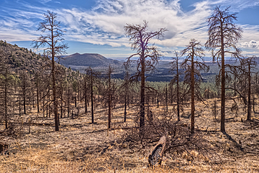
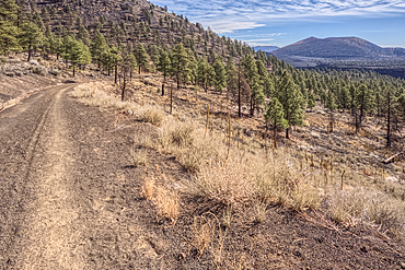
Volcanic cinder hills in Coconino National Forest, Arizona, USA
Volcanic cinder hills in Coconino National Forest, Arizona, USA
The North Valley below the Blue Mesa in Petrified Forest National Park, Arizona, United States of America, North America
The Little Teepees on the north side of Haystack Mesa in Petrified Forest National Park, Arizona, United States of America, North America
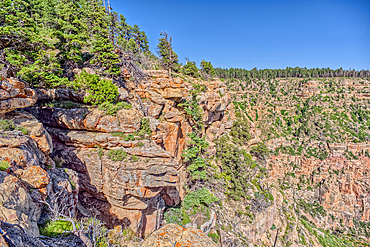
The Red Wall of sandstone east of Supai Tunnel on North Kaibab Trail, Grand Canyon North Rim, UNESCO, Arizona, United States of America
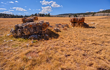
Lonely Boulders and exposed rock in Pleasant Valley, Kaibab National Forest just north of Grand Canyon North Rim, Arizona, United States of America
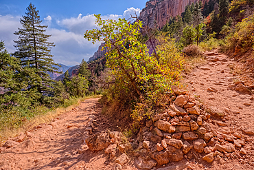
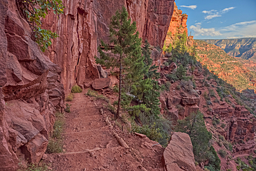
The 20th switchback along the North Kaibab Trail at Grand Canyon North Rim, UNESCO, Arizona, United States of America
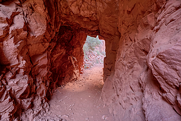
The interior of the Supai Tunnel along the North Kaibab Trail, Grand Canyon North Rim, UNESCO, Arizona, United States of America
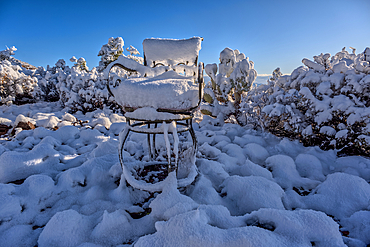
Snow covered landscape, Chino Valley, Arizona, USA
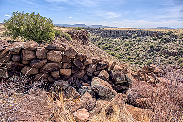
The Pueblo La Plata Indian Ruins near Silver Creek Canyon in the Agua Fria National Monument of Arizona. Located north of Black Canyon City
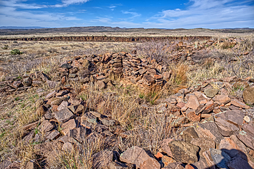
Ancient wall of the Fort Silver Indian Ruins overlooking Silver Creek Canyon in Agua Fria National Monument of Arizona
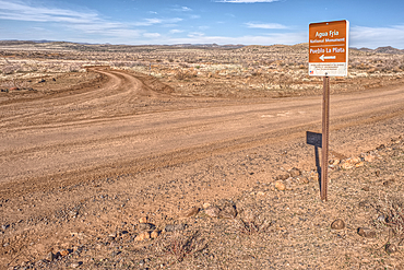
Road sign along Bloody Basin Road in the Agua Fria National Monument of Arizona directing the way to the Pueblo La Plata Indian Ruins
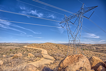
High Tension Power Lines stretching across Bloody Basin in Agua Fria National Monument north of Black Canyon City Arizona
A Saguaro covered scenic ridge overlooking the Agua Fria River in the Agua Fria National Monument of Arizona, USA
Path leading to a scenic overlook in the Agua Fria National Monument near the abandoned Richinbar Mine, Arizona, USA
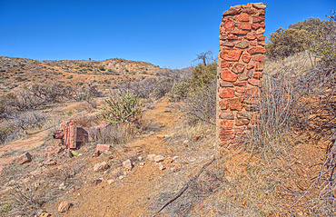
Remnants of the Richinbar Mine within the Agua Fria National Monument, Black Canyon City, Arizona, USA
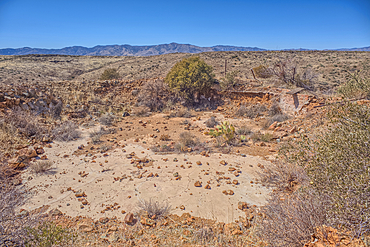
Remnants of the Richinbar Mine within the Agua Fria National Monument, Black Canyon City, Arizona, USA
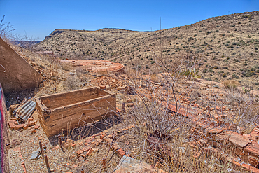
Remnants of the Richinbar Mine within the Agua Fria National Monument, Black Canyon City, Arizona, USA
O'Leary Peak, Coconino National Forest, Arizona, USA
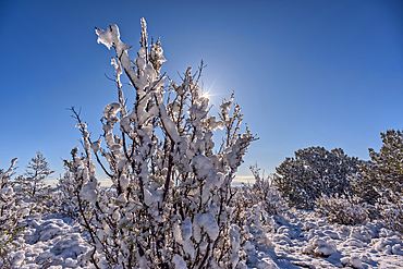
Snow covered landscape, Chino Valley, Arizona, USA
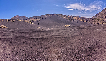
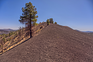
Volcanic cinder hills in Coconino National Forest, Arizona, USA
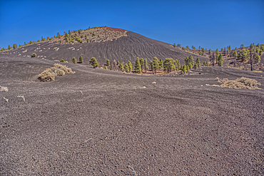
Volcanic cinder hills in Coconino National Forest, Arizona, USA
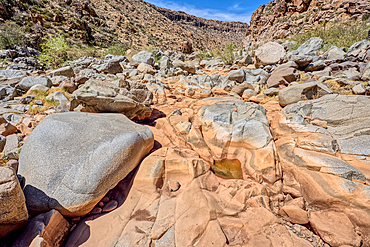
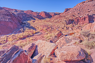
The granite riverbed of the Agua Fria River Canyon in the Agua Fria National Monument of Arizona.
Dead trees from a past forest fire on the slope of O'Leary Peak in northern Arizona. Sunset Crater Volcano is in the background.
Sunset Crater Volcano viewed from the forested slope of O'Leary Peak in northern Arizona.
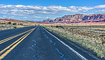
Echo Cliffs mountains, Arizona, USA

Bellizona and the Church of Saints Peter and Steven, seen from Castelgrande, Canton Ticino, Switzerland

An Indian dwelling in Petrified Forest National Park called the Agate House, built between 1030AD and 1300AD, Arizona, United States of America, North America
An unnamed canyon that leads to Dead Wash in Petrified Forest National Park, Arizona, United States of America
An island of rock in an unnamed canyon that leads to Dead Wash in Petrified Forest National Park, Arizona, United States of America
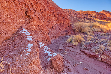
Patches of snow in the shade of a hill in Dead Wash at Petrified Forest National Park, Arizona, United States of America
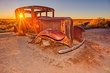
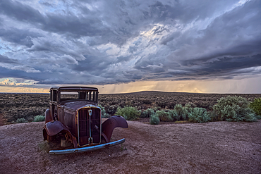
An old Model-T placed as a marker for the Route 66 Road Alignment in Petrified Forest National Park, Arizona, United States of America
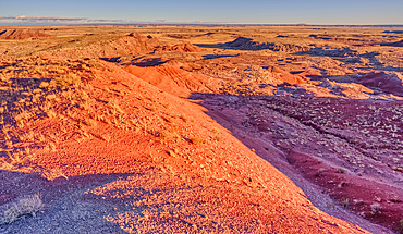
Cliff view of Dead Wash Valley in Petrified Forest National Park, at sundown, Arizona, United States of America
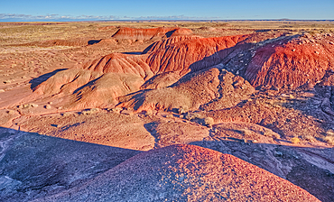
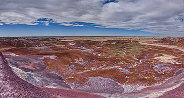
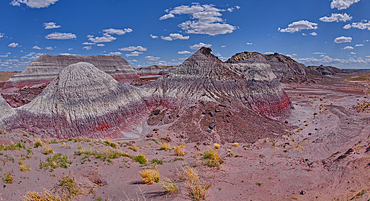
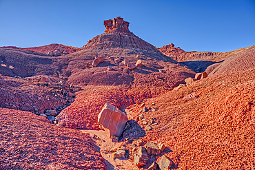
Red hills of bentonite clay overlooking Dead Wash in Petrified Forest National Park, Arizona, United States of America

Wet Beaver Creek Canyon viewed from the south end of White Mesa in Coconino National Forest, Arizona, United States of America
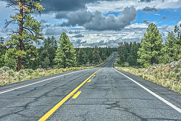
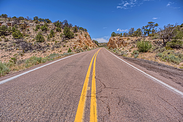
State Route 64 heading north to Grand Canyon South Rim, Arizona, USA

Overhead view of the Icy shore of Stone Dam Lake in the Kaibab National Forest, Arizona, USA
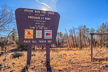
An information sign on the summit of Apache Maid Mountai, Coconino National Forest, Arizona, United States of America
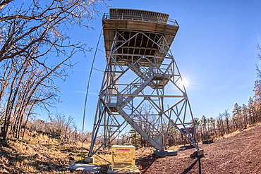
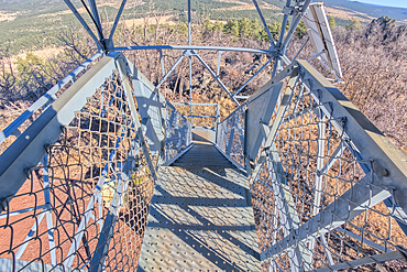
Fisheye view from below the fire watchtower on summit of Apache Maid Mountain, Coconino National Forest, Arizona, United States of America
View from second deck of fire watchtower on summit of Apache Maid Mountain, Coconino National Forest, Arizona, United States of America
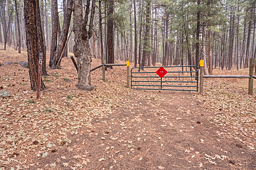
The gate for the Campbell Draw Tank, Coconino National Forest, Arizona, United States of America
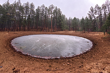
The frozen Campbell Draw Tank with approaching snow storm, Coconino National Forest, Arizona, United States of America
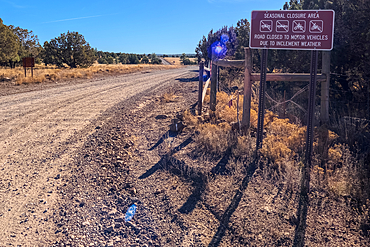
A warning sign stating that the road can be closed seasonally, Coconino National Forest, Arizona, United States of America
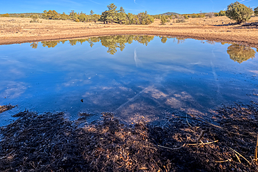
A cattle pond, Rarick Tank, Coconino National Forest, Arizona, United States of America
US89A ascending to the Kaibab Plateau in Arizona north of the Vermilion Cliffs National Monument.