Results
« Previous 1 … 6 7 8 9 10 … 15 Next »
1467 results found
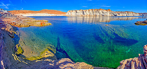
The emerald blue waters of Lake Powell just north of the Glen Canyon Dam in an area called The Chains, near Page, Arizona, United States of America, North America

Front view of the historic Glen Canyon Dam in Page, viewed from the Highway 89 Bridge over the Colorado River, Arizona, United States of America, North America
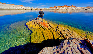
A hiker standing on a rock peninsula at Lake Powell, Arizona, United States of America, North America

Front view of the historic Glen Canyon Dam in Page, viewed from the Carl Hayden Museum Overlook, Arizona, United States of America, North America
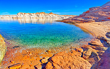
A small lagoon in Lake Powell where boats can drop anchor and come ashore, Arizona, United States of America, North America
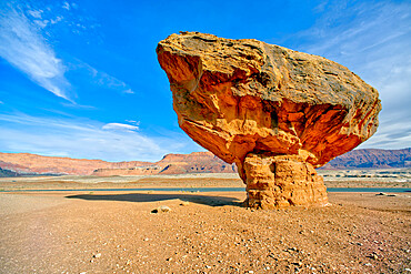
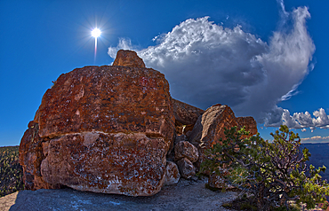
Balanced boulder at the base of Vermilion Cliffs in Glen Canyon Recreation Area, Arizona, United States of America, North America
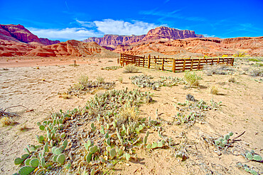
Lonely Dell Ranch Corral at Vermilion Cliffs National Monument near the Glen Canyon Recreation Area, Arizona, United States of America, North America
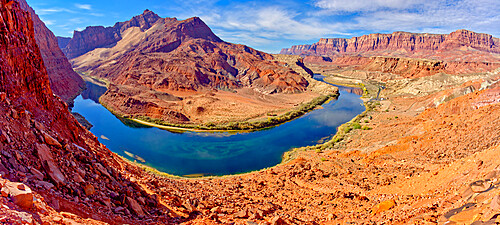
Bend in Colorado River near Lee's Ferry, Glen Canyon Recreation Area, Vermilion Cliffs National Monument in background, Arizona, United States of America, North America

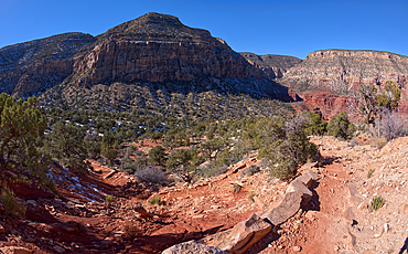
Lee's Ferry Road running between Cathedral Rock and Vermilion Cliffs National Monument in Glen Canyon Recreation Area, Arizona, United States of America, North America
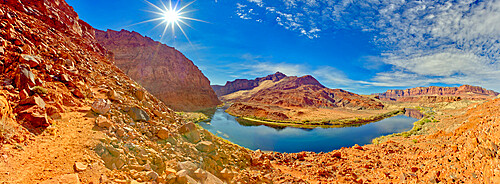
Bend in Colorado River near Lee's Ferry, Glen Canyon Recreation Area, Vermilion Cliffs National Monument in background, Arizona, United States of America, North America
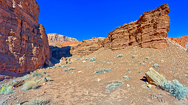
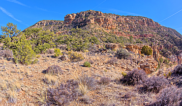
Cliffs of Chocolate Canyon at Vermilion Cliffs National Monument, Arizona, United States of America, North America
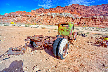
Antique truck at Lonely Dell Ranch, Vermilion Cliffs National Monument, Arizona, United States of America, North America
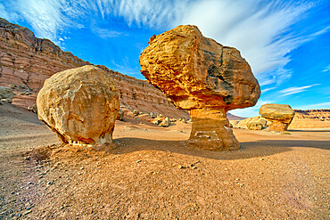
Balanced boulders at the base of Vermilion Cliffs in Glen Canyon Recreation Area, Arizona, United States of America, North America

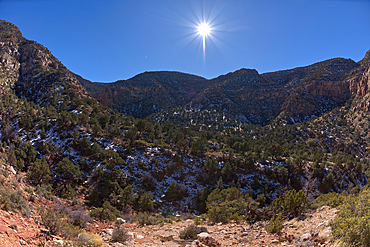
Cattle Tank viewed from Woodchute Mountain Trail, located in Prescott National Forest with Prescott in the background, Arizona, United States of America, North America
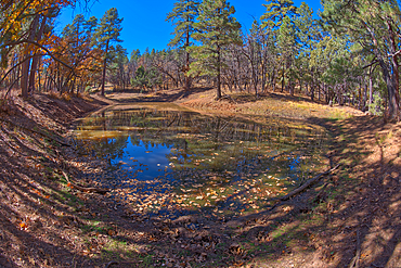
Reflective lagoon along East Bay Trail of Willow Lake, gray line on rock is where the water level used to be, Prescott, Arizona, United States of America, North America

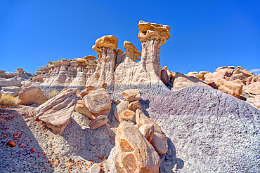
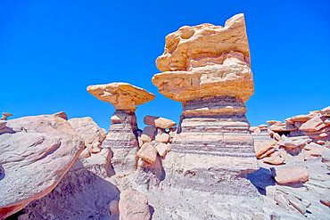
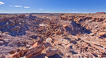
Three hoodoos in a triangular formation in Devil's Playground called the Unholy Trinity, Petrified Forest National Park, Arizona, United States of America, North America
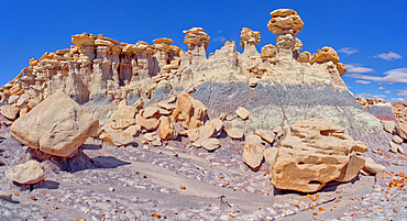
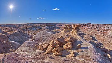
Hoodoo formations in the Devil's Playground in Petrified Forest National Park, Arizona, United States of America, North America

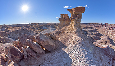
A tall hoodoo called the Leviathan in Devil's Playground, Petrified Forest National Park, Arizona, United States of America, North America
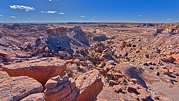
A hoodoo ridge in Devil's Playground at Petrified Forest National Park, Arizona, United States of America, North America

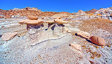
Boulders in Devil's Playground called Gnomes of Desolation, Petrified Forest National Park, Arizona, United States of America, North America

Field of boulders in Devil's Playground within Petrified Forest National Park, Arizona, United States of America, North America
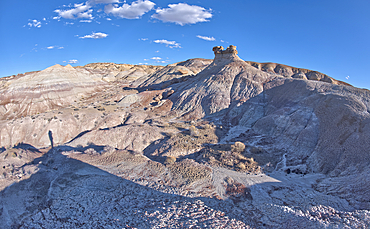
South side of Damnation Mesa on the north end of Devil's Playground in Petrified Forest National Park, Arizona, United States of America, North America
Three hoodoos in a triangular formation in Devil's Playground called the Unholy Trinity, Petrified Forest National Park, Arizona, United States of America, North America
A ridge of hoodoos that resemble dog heads in Devil's Playground at Petrified Forest National Park, Arizona, United States of America, North America
Towering pillars of rock in Devil's Playground at Petrified Forest National Park, Arizona, United States of America, North America
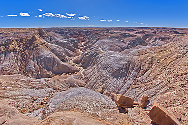
The desolate Hellscape of Devil's Playground in Petrified Forest National Park, Arizona, United States of America, North America
A dry waterfall ledge on the south end of Agate Plateau overlooking Jasper Forest in Petrified Forest National Park Arizona.

A hoodoo near a natural Spring west of Pintado Point in Petrified Forest National Park Arizona called the Guardian.
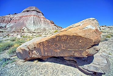
Ancient Indian petroglyphs on a boulder near Martha's Butte in Petrified Forest National Park Arizona.
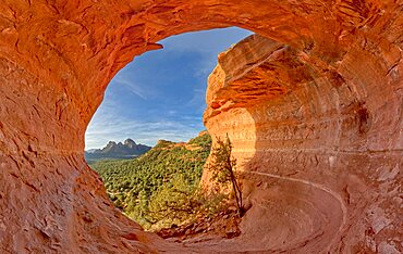
The Birthing Cave on the side of Mescal Mountain in Sedona Arizona. Ancient Indian women came here to give birth.
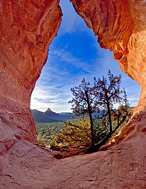
The Birthing Cave on Mescal Mountain in Sedona Arizona. It is said that ancient Indian women came here to give birth.
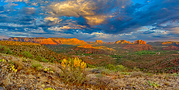
The Village of Oak Creek on the south side of Sedona viewed from the south end of Airport Mesa near sunset, Arizona, United States of America, North America
The Village of Oak Creek on the south side of Sedona viewed from the Airport Loop Trail, Arizona, United States of America, North America
A large storm rolling into Grand Canyon near Grandview Point during the 2022 Monsoon season, Grand Canyon National Park, UNESCO World Heritage Site, Arizona, United States of America, North America
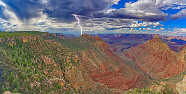
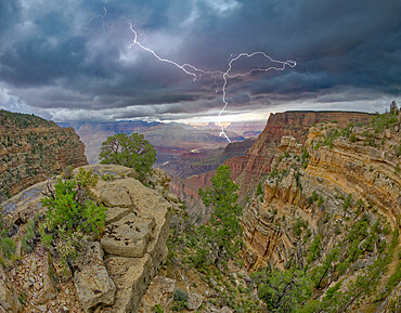
Lightning striking the Sinking Ship at Grand Canyon, viewed from the Buggeln Hill summit, Grand Canyon National Park, UNESCO World Heritage Site, Arizona, United States of America, North America
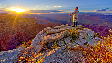
A hiker watching the sun go down west of Moran Point at Grand Canyon, Grand Canyon National Park, UNESCO World Heritage Site, Arizona, United States of America, North America

A hiker looking west from a cliff near Zuni Abyss at Grand Canyon, Zuni Point in the background just right of center, Grand Canyon National Park, UNESCO World Heritage Site, Arizona, United States of America, North America
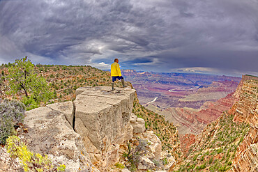
A hiker standing on a cliff between Zuni and Papago Points at Grand Canyon on a stormy day, Grand Canyon National Park, UNESCO World Heritage Site, Arizona, United States of America, North America
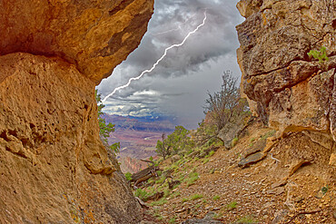
Grand Canyon viewed from inside a cave between Zuni and Papago Points while a storm is rolling into the area, Grand Canyon National Park, UNESCO World Heritage Site, Arizona, United States of America, North America
A monsoon storm rolling across Grand Canyon between Zuni Point and Papago Point, Grand Canyon National Park, UNESCO World Heritage Site, Arizona, United States of America, North America
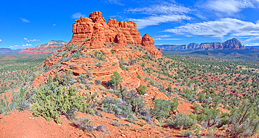
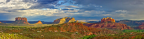
The spires of Cockscomb Butte in Sedona viewed from its south end summit, Arizona, United States of America, North America

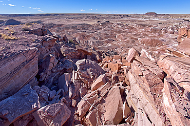
Giant pieces of broken petrified wood in Jasper Forest at Petrified Forest National Park Arizona.
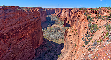
Spring Canyon in Canyon De Chelly National Monument viewed from the Sliding House Overlook on the south rim, Arizona, United States of America, North America

The meanders of the San Juan River at Goosenecks State Park, adjacent to the Navajo Indian Reservation, near Mexican Hat, Utah, United States of America, North America
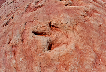
Dinosaur tracks at a tourist attraction on the Navajo Indian Reservation near Tuba City, Arizona, United State of America, North America
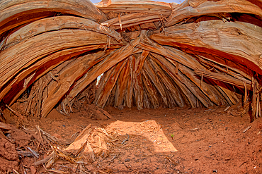
Interior of an Ancient Hogan used in Navajo ceremonies, in Navajo National Monument, Navajo Indian Reservation northwest of the town of Kayenta, Arizona, United States of America, North America

The Sipapu Bridge (Gateway of the Soul in Hopi), the second highest natural arch in America, Natural Bridges National Monument, Utah, United States of America, North America

The Horse Collar Ruins with a sign warning to not disturb them due to instability, located between the Sipapu Arch Bridge and the Kachina Arch Bridge, Natural Bridges National Monument, Utah, United States of America, North America
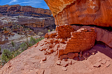
The Horse Collar Ruins located between the Sipapu Arch Bridge and the Kachina Arch Bridge, Natural Bridges National Monument, Utah, United States of America, North America

The Horse Collar Ruins located between the Sipapu Arch Bridge and the Kachina Arch Bridge, Natural Bridges National Monument, Utah, United States of America, North America
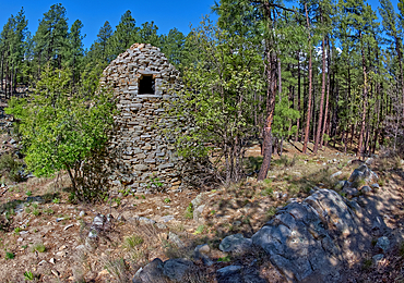
The historic Walker Charcoal Kiln, dating from the late 1880s used to turn oak wood into charcoal for silver smelters, Prescott National Forest, just south of Prescott, Arizona, United States of America, North America
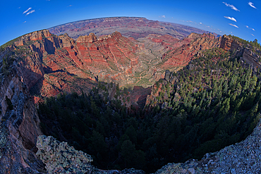
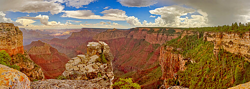
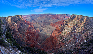
Fisheye view of Hance Canyon from the South Rim of Grand Canyon with Grandview Point is on the left, Grand Canyon National Park, UNESCO World Heritage Site, Arizona, United States of America, North America
Storm clouds approaching Lipan Point at Grand Canyon South Rim, Grand Canyon National Park, UNESCO World Heritage Site, Arizona, United States of America, North America
One of three ponds called the Hearst Tanks, on Grand Canyon South Rim, located one mile east of Grandview Point, Grand Canyon National Park, UNESCO World Heritage Site, Arizona, United States of America, North America

Craggy rock spires overlooking South Rim Gorge, an area between Hance Canyon and the Sinking Ship, which is right of center in the distance, southern most part of Grand Canyon National Park, UNESCO World Heritage Site, Arizona, United States of America, North America
A dry waterfall in Crystal Creek below Crystal Mesa west of Hamilili Point in Petrified Forest National Park, Arizona, United States of America, North America
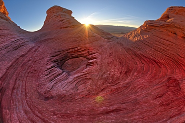
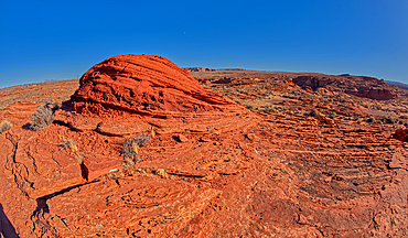
The west rock ridge of the New Wave along the Beehive Trail in the Glen Canyon Recreation Area near Page, Arizona, United States of America, North America
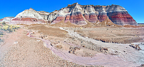
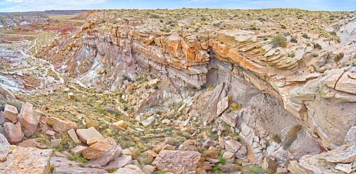
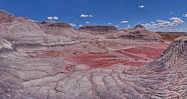
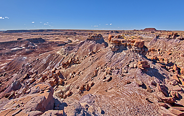
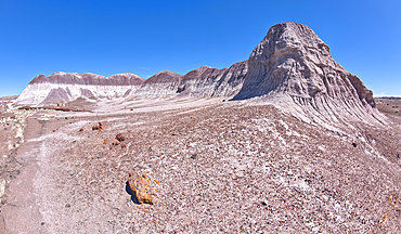
View from below the north cliffs of Blue Mesa in Petrified Forest National Park, Arizona, United States of America, North America
East slopes of Haystack Mesa in Petrified Forest National Park, Arizona, United States of America, North America
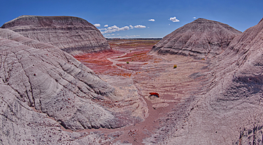
East slopes of Haystack Mesa in Petrified Forest National Park, Arizona, United States of America, North America

A dry waterfall at the base of a rock island at Ferry Swale in the Glen Canyon Recreation Area near Page, Arizona, United States of America, North America
A fossilized sand dune in the shape of a dome near the Spur Canyon at Horseshoe Bend, Arizona, United States of America, North America
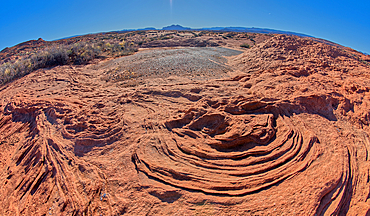
The ripples of fossilized sand dunes in the badlands of Horseshoe Bend, Arizona, United States of America, North America
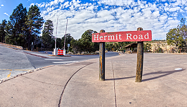
The Hermit Road Transfer Station Bus Stop and entry gate at Grand Canyon South Rim, Arizona, United States of America, North America
Monument Creek viewed from along the rim trail halfway between The Abyss and Monument Creek Vista Overlook with Mohave Point on right and Pima Point on the left in the distance, Grand Canyon, Arizona, United States of America, North America
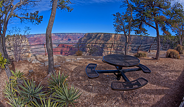
Steel picnic table along the rim trail overlooking Grand Canyon South Rim off Hermit Road halfway between Monument Creek Vista and The Abyss, Grand Canyon, Arizona, United States of America, North America
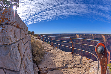
The safety rails of the Great Mohave Wall Overlook at Grand Canyon, Arizona, United States of America, North America
The end of Hermit Road, Hermits Rest is just beyond the parking lot, Grand Canyon, Arizona, United States of America, North America
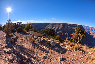
Picnic table on the west side of Hermits Rest at Grand Canyon, Arizona, United States of America, North America
A look back at the cliffs of Hermits Rest, the Hermit Trailhead starts on the cliff line to the upper left of the photo, viewed from 1000 feet off of the official trail, Grand Canyon, Arizona, United States of America, North America
The very rocky pathway of the unmaintained Hermit Canyon Trail at Grand Canyonin winter with Waldron Canyon on the left in the distance, Grand Canyon, Arizona, United States of America, North America
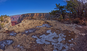
Frozen water puddles along the cliffs of Grand Canyon east of the Monument Creek Vista, Grand Canyon National Park, UNESCO World Heritage Site, Arizona, United States of America, North America

The Great Mohave Wall at Grand Canyon viewed just west of Monument Creek, part of the canyon below this cliff wall, Grand Canyon National Park, UNESCO World Heritage Site, Arizona, United States of America, North America
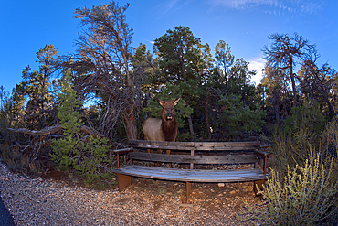
A female Elk that came out of the forest along the Greenway Trail that runs between Pima Point and Monument Creek Vista, Grand Canyon, Arizona, United States of America, North America
View of Waldron Canyon southwest of Hermit Canyon in winter, accessible via Hermit Trail, Grand Canyon, Arizona, United States of America, North America

Off trail view of Waldron Canyon southwest of Hermit Canyon in winter, accessible via Hermit Trail to the Waldron Trail Junction, Grand Canyon, Arizona, United States of America, North America
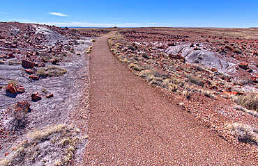
The paved trail that leads to the historic Agate House in Petrified Forest National Park, Arizona, United States of America, North America
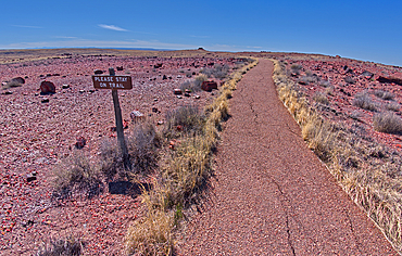
A warning sign to stay on the trail to the historic Agate House in Petrified Forest National Park, Arizona, United States of America, North America
A divide in the trail loop for the Giant Logs trail at Petrified Forest National Park with the Rainbow Forest Museum on upper left, Arizona, United States of America, North America
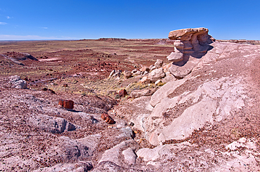
A scenic overlook on the west side of the Giant Logs Trail at Petrified Forest National Park, Arizona, United States of America, North America
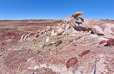
A scenic overlook on the west side of the Giant Logs Trail at Petrified Forest National Park, Arizona, United States of America, North America
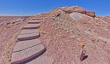
Steps along the Giant Logs Trail leading to a scenic overlook in Petrified Forest National Park, Arizona, United States of America, North America
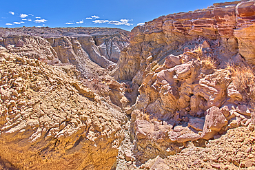
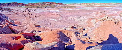
A deep canyon eroded thru the hills of purple and gray bentonite clay near Hamilili Point on the south end of Petrified Forest National Park, Arizona, United States of America, North America
A deep canyon eroded thru the hills of purple and gray bentonite clay near Hamilili Point on the south end of Petrified Forest National Park, Arizona, United States of America, North America
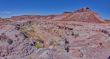
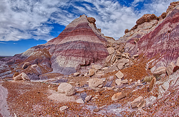
Purple badlands of bentonite near Hamilili Point on the south end of Petrified Forest National Park, Arizona, United States of America, North America
Rock islands above the purple badlands near Hamilili Point on the south end of Petrified Forest National Park, Arizona, United States of America, North America
Rock islands just off a mesa near Hamilili Point on the south end of Petrified Forest National Park, Arizona, United States of America, North America
The crumbling cliffs of a mesa near Hamilili Point on the south end of Petrified Forest National Park, Arizona, United States of America, North America
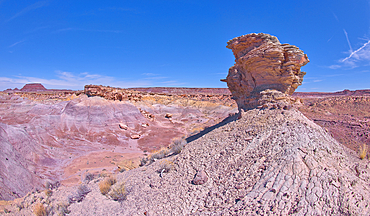
A solitary rock hoodoo in the purple badlands near Hamilili Point on the south end of Petrified Forest National Park, Arizona, United States of America, North America
A solitary rock hoodoo in the purple badlands near Hamilili Point on the south end of Petrified Forest National Park, Arizona, United States of America, North America
A solitary rock hoodoo in the purple badlands near Hamilili Point on the south end of Petrified Forest National Park, Arizona, United States of America, North America
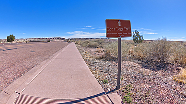
A sign along the main road pointing the way to the Long Logs Trail, and Agate House, Petrified Forest National Park, Arizona, United States of America, North America
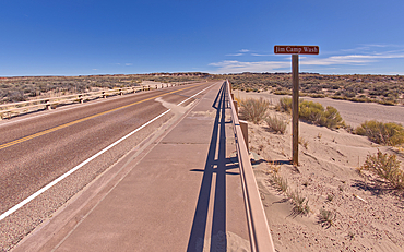
Sign along the path to the Long Logs Trail, marking the Jim Camp Wash along the main road of Petrified Forest National Park, Arizona, United States of America, North America
View of a bentonite hill along the Long Logs Trail in Petrified Forest National Park, Arizona, United States of America, North America

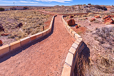
A circular walkway for the Long Logs Trail in Petrified Forest National Park, Arizona, United States of America, North America
A lone hoodoo rock on the edge of a ridge overlooking the Jim Camp Wash on the south end of Petrified Forest National Park, Arizona, United States of America, North America
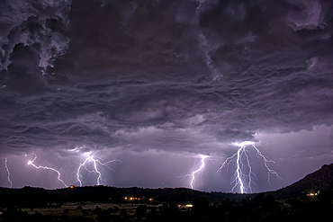
A long exposure capturing multiple lightning strikes on August 14th, 2025 on the south side of Sullivan Butte in Chino Valley Arizona.
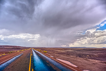
The main road thru Petrified Forest National Park Arizona on a rainy day.
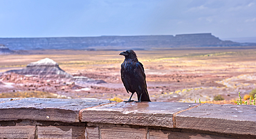
A wild and wet Raven standing on a stone wall at the Jasper Forest overlook in Petrified Forest Arizona during a rainstorm.
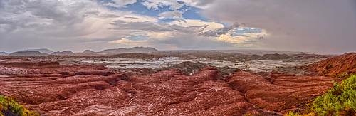
A heavy rainstorm over a section of Petrified Forest National Park Arizona called the Flattops. Because the rain was falling at the time of this photo some falling rain has been captured in the photo.