Results
« Previous 1 … 7 8 9 10 11 … 15 Next »
1467 results found
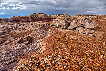
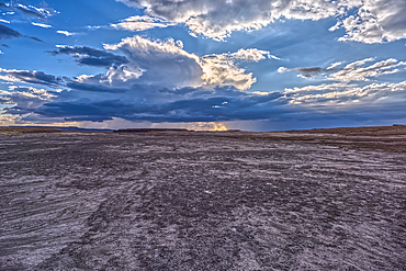
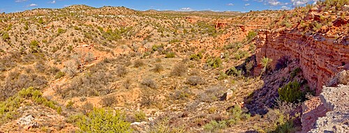
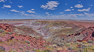
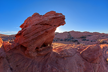
A desolate barren valley of rock and sand in Petrified Forest National Park Arizona just west of Blue Mesa.
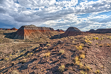
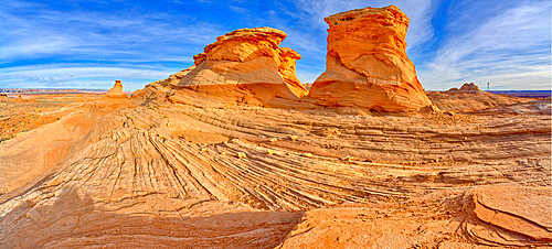
Northside view of the Teepees at Petrified Forest National Park Arizona.
Northside view of the Teepees at Petrified Forest National Park Arizona.
Northside view of the Teepees at Petrified Forest National Park Arizona.
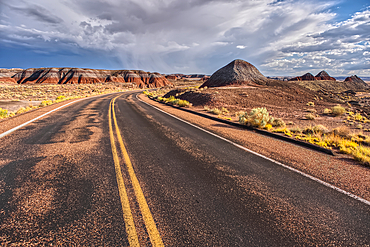
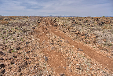
Main road leading to the Teepees at Petrified Forest National Park Arizona.
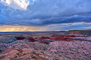
Building storm approaching Petrified Forest National Park Arizona. Viewed from a gray plain south of the Teepees.
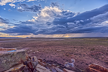
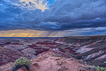
Building storm approaching Petrified Forest National Park Arizona. Viewed from the Newspaper Rock Overlook.
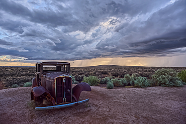
An old Model-T marking historic Route-66 in Petrified Forest National Park Arizona with an approaching storm in the background.
Storm approaching Petrified Forest National Park Arizona. Viewed from Whipple Point.
Storm approaching Petrified Forest National Park Arizona. Viewed from Nizhoni Point.
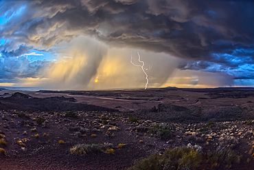
Storm approaching Petrified Forest National Park Arizona. Viewed from Pintado Point near sunset.
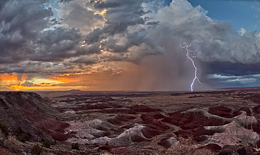
Storm approaching Petrified Forest National Park Arizona. Viewed from Kachina Point near sunset.
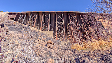
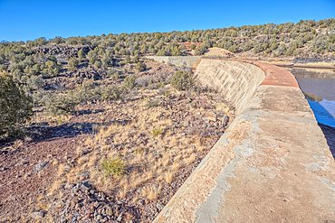
View from below the historic Bainbridge Steel Dam near Ash Fork Arizona in the Kaibab National Forest. It was originally constructed in the late 1800s and is now a historic landmark that is open to the public.
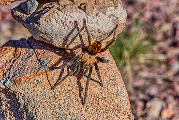
A male Tarantula native to the Chino Valley area of Arizona crawling on rocks. This is a male because the females hide underground and don't roam around like the males.
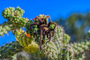
A male Tarantula native to the Chino Valley area of Arizona crawling on a cactus. This is a male because the females hide underground and don't roam around like the males.

A male Tarantula native to the Chino Valley area of Arizona crawling on a cactus. This is a male because the females hide underground and don't roam around like the males.
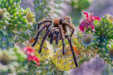
A male Tarantula native to the Chino Valley area of Arizona crawling on a cactus. This is a male because the females hide underground and don't roam around like the males.
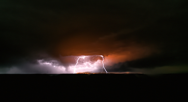
Dragon Bravo wildfire burning on the North Rim of Grand Canyon Arizona with a lightning storm. Viewed from Yavapai Point on the South Rim at night. The fire started from a lightning strike on July 4th, 2025.
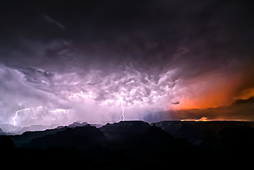
Dragon Bravo wildfire burning on the North Rim of Grand Canyon Arizona with a lightning storm. Viewed from Yavapai Point on the South Rim at night. The fire started from a lightning strike on July 4th, 2025.
Smoke from the Dragon Bravo wildfire burning on the North Rim of Grand Canyon Arizona. Viewed from Shoshone Point on the South Rim. The fire started from a lightning strike on July 4th, 2025.
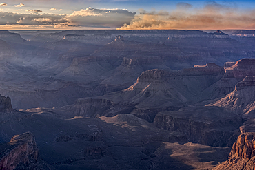
Smoke from the Dragon Bravo wildfire burning on the North Rim of Grand Canyon Arizona. Viewed from Shoshone Point on the South Rim. The fire started from a lightning strike on July 4th, 2025.
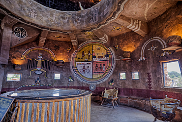
An interior view of the historic Desert View Watchtower at Grand Canyon South Rim, artwork created by Fred Kobotie in 1933, now owned by the National Park Service, Arizona, United States of America, North America
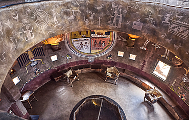
Downward view from the second floor in historic Desert View Watchtower at Grand Canyon South Rim, artwork created by Fred Kobotie in 1933, now owned by the National Park Service, UNESCO World Heritage Site, Arizona, United States of America, North America
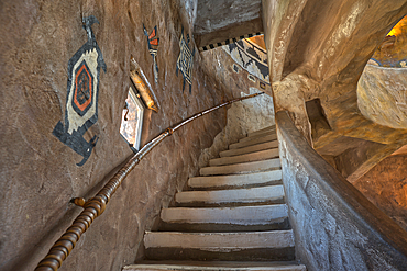
Stairs up to the third floor in the historic Desert View Watchtower at Grand Canyon South Rim, artwork created by Fred Kobotie in 1933, now owned by the National Park Service, UNESCO World Heritage Site, Arizona, United States of America, North America
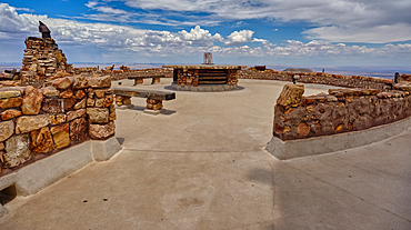
The observation deck of the Desert View Watchtower at Grand Canyon South Rim, UNESCO World Heritage Site, Arizona, United States of America, North America
View from the observation deck of the Desert View Watchtower at Grand Canyon South Rim, UNESCO World Heritage Site, Arizona, United States of America, North America
North view of Grand Canyon South Rim Arizona from the top floor of the historic Watchtower, taken through glass window, Grand Canyon, UNESCO World Heritage Site, Arizona, United States of America, North America
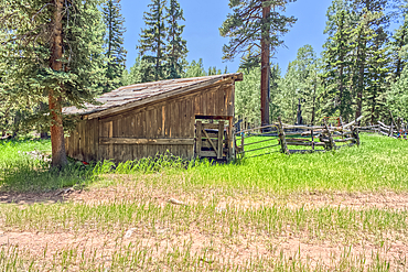
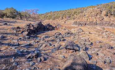
An abandoned homestead in the Kaibab National Forest off of Highway 67 north of Grand Canyon North Rim Arizona. Public land. No property release needed. Preserved by Forest Service as a historical landmark.
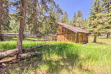
An abandoned homestead in the Kaibab National Forest off of Highway 67 north of Grand Canyon North Rim Arizona. Public land. No property release needed. Preserved by Forest Service as a historical landmark.
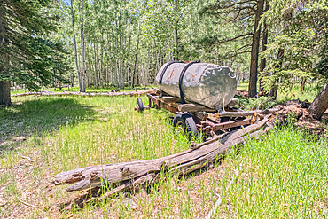
An abandoned homestead in the Kaibab National Forest off of Highway 67 north of Grand Canyon North Rim Arizona. Public land. No property release needed. Preserved by Forest Service as a historical landmark.
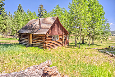
An abandoned homestead in the Kaibab National Forest off of Highway 67 north of Grand Canyon North Rim Arizona. Public land. No property release needed. Preserved by Forest Service as a historical landmark.
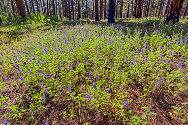
A field of purple wildflowers called Lupine at Grand Canyon North Rim Arizona near Clear Creek Canyon. Species Lupinus in the family Fabaceae.
Dry Waterfall on the north end of Clear Creek Canyon at Grand Canyon North Rim Arizona.
View of Clear Creek Canyon from its north cliffs at Grand Canyon North Rim Arizona.
Dry Waterfall on the north end of Clear Creek Canyon at Grand Canyon North Rim Arizona.
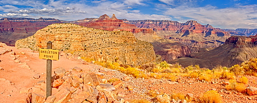
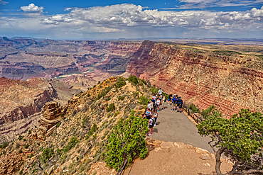
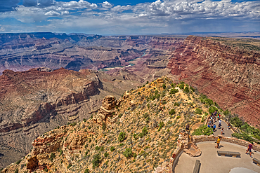
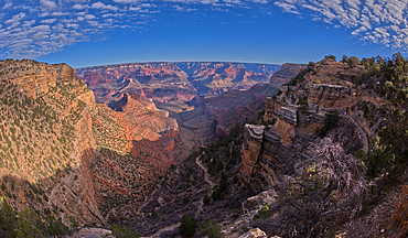
Grand Canyon view from Skeleton Point along the South Kaibab Trail on the south rim, Grand Canyon National Park, UNESCO World Heritage Site, Arizona, United States of America, North America
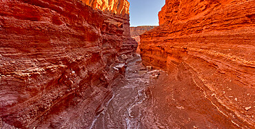
Silver Creek Canyon in the Agua Fria National Monument, Black Canyon City Arizona, USA
A primitive road in the Agua Fria National Monument that branches off from Forest Service Road 9023 near Silver Creek Canyon Arizona
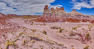
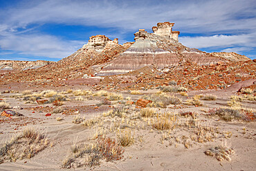
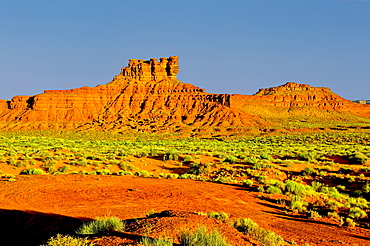
Tall hoodoo towers in the valley below Blue Mesa in Petrified Forest National Park, Arizona, United States of America, North America
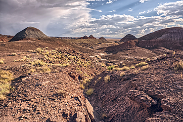
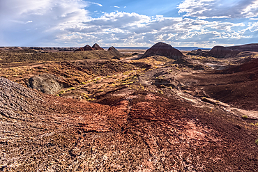
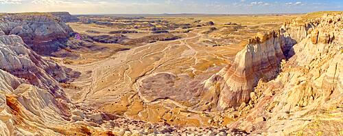
The North Valley below the Blue Mesa in Petrified Forest National Park, Arizona, United States of America, North America
The Little Teepees on the north side of Haystack Mesa in Petrified Forest National Park, Arizona, United States of America, North America
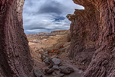
A shallow cave carved out of a cliff wall below the Blue Mesa in Petrified Forest National Park, Arizona, United States of America, North America
Greenland Lake reduced to a mud hole, Grand Canyon North Rim, UNESCO, Arizona, United States of America
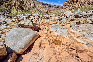
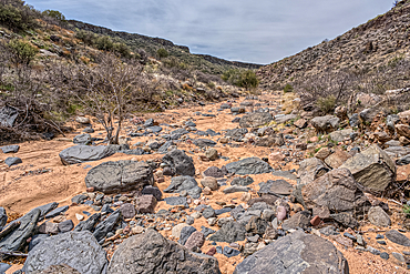
The granite riverbed of the Agua Fria River Canyon in the Agua Fria National Monument of Arizona.
Towering Hoodoos in the Jasper Forest of Petrified Forest National Park, Arizona, United States of America, North America
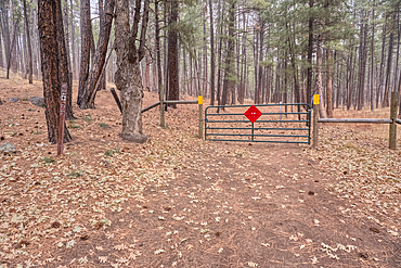
Boundary gate and cattle-proof fence between Coconino National Forest and Wet Beaver Creek Wilderness, Arizona, United States of America
Top view of the Stone Dam in the Kaibab National Forest, USA

Overhead view of the Icy shore of Stone Dam Lake in the Kaibab National Forest, Arizona, USA
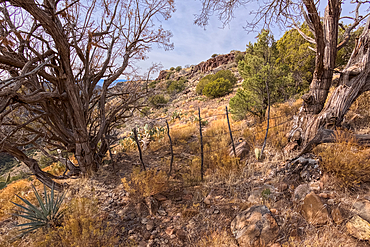
The gate for the Campbell Draw Tank, Coconino National Forest, Arizona, United States of America
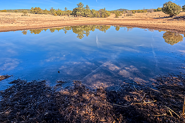
A cattle pond, Rarick Tank, Coconino National Forest, Arizona, United States of America
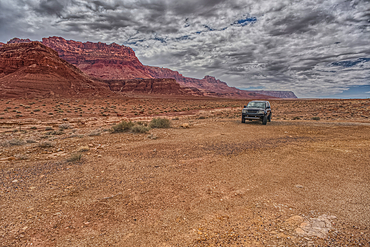
Vehicle parked next to Jackass Creek off of US89A near Echo Cliffs on the way to Vermilion Cliffs Arizona. Located on the Navajo Indian Reservation between Bitter Springs and Marble Canyon.
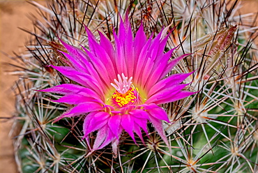
Flower of the Escobaria Vivipara cactus (Pin Cushion Cactus), Arizona, United States of America, North America
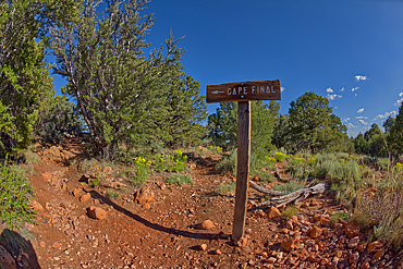
A sign posted by the Park Service pointing the way to Cape Final on the North Rim of Grand Canyon, Arizona, United States of America, North America
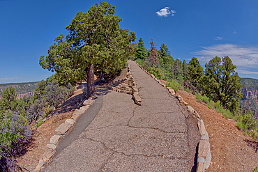
The junction where the Transept Trail meets the Bright Angel Point Trail on the North Rim of Grand Canyon, Grand Canyon National Park, UNESCO World Heritage Site, Arizona, United States of America, North America

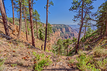
An overlook along the Transept Trail with Oza Butte just right of center at Grand Canyon North Rim, Grand Canyon National Park, UNESCO World Heritage Site, Arizona, United States of America, North America
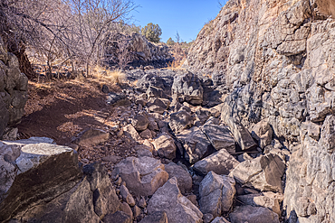
Basalt boulders and cliffs, Johnson Canyon between Bainbridge Steel and Stone Dams, Kaibab National Forest, Arizona, United States of America
Basalt formation in Johnson Canyon east of the Bainbridge Steel Dam Lake near Ash Fork, Kaibab National Forest, Arizona, United States of America
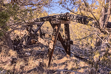
Old water pipe, Johnson Canyon between Bainbridge Steel and Stone Dams near Ash Fork, Kaibab National Forest, Arizona, United States of America

A late night lightning storm in Arlington during the 2012 Monsoon season, Arizona, United States of America, North America
Eastern Mitten Ridge viewed from the Cow Pies section of Hangover Trail in Sedona, Arizona, United States of America, North America
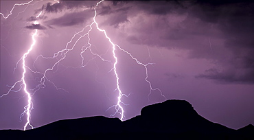
A panorama photo of lightning striking the slopes of Woolsey Peak during the 2012 Arizona Monsoon season, Arizona, United States of America, North America
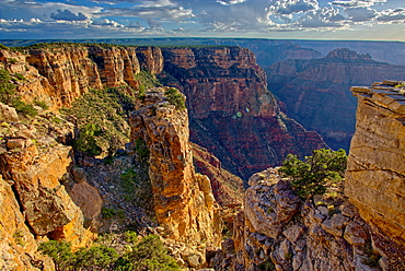
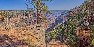
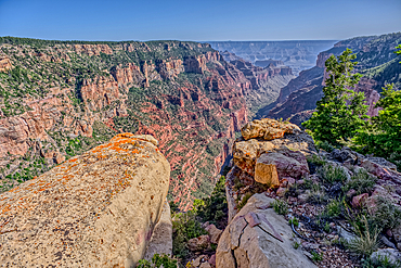
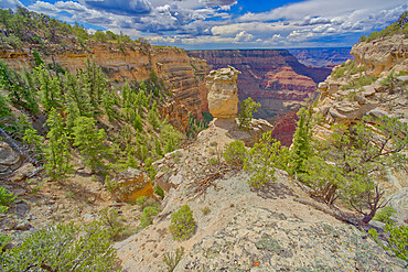
Pillars of rock standing just away from the cliff of the Grand Canyon south of Zuni Point with Moran Point in the distance, Grand Canyon National Park, UNESCO World Heritage Site, Arizona, United States of America, North America
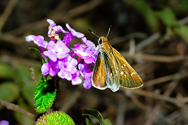
A Texas Roadside Skipper feeding on a wildflower in Arizona, United States of America, North America
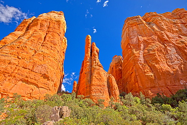
The Central Spires of Cathedral Rock viewed from the west side of the formation, Sedona, Arizona, United States of America, North America
Formation in Valley of the Gods called the Seven Sailors, located near the town Mexican Hat, Utah, United States of America, North America
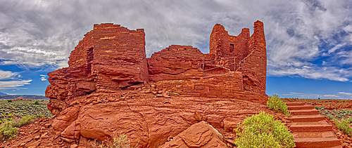
A low angle exterior closeup view of the Wukoki Pueblo at the Wupatki National Monument, Arizona, United States of America, North America

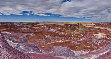
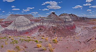
Salt covered hills of Bentonite in the Petrified Forest National Park along the Blue Forest Trail, Arizona, United States of America, North America
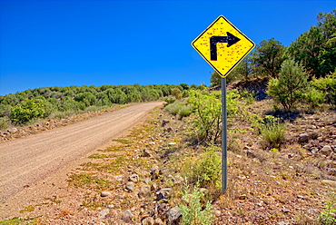
A sign along Forest Service Road 492 that has been shot up by reckless gunfire, Prescott National Forest, Arizona, United States of America, North America
The eastern edge of the Clam Bed Mesa along the Red Basin Trail in Petrified Forest National Park, Arizona, United States of America, North America
A canyon in Dead Horse Ranch State Park along the historic Lime Kiln Trail, Cottonwood, Arizona, United States of America, North America
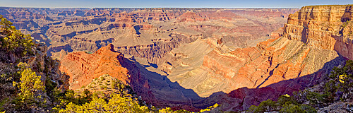
Grand Canyon viewed from the vista of Mohave Point along the Hermit Road, Grand Canyon National Park, UNESCO World Heritage Site, Arizona, United States of America, North America
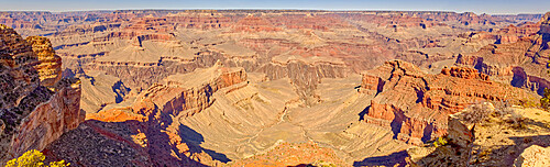
Panorama of Grand Canyon viewed from Powell Point along the Hermit Road, Grand Canyon National Park, UNESCO World Heritage Site, Arizona, United States of America, North America

Keyhole Mesa, named for a keyhole shaped cave on its north side, in the First Forest of Petrified Forest National Park, Arizona, United States of America, North America
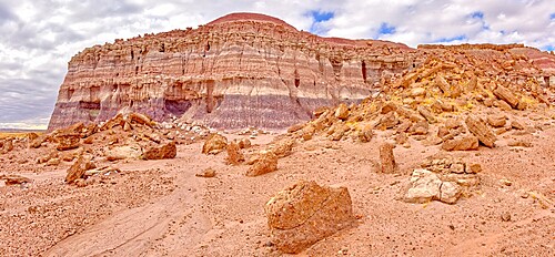
A sheer cliff of rock jutting out from the Blue Mesa along the Billings Gap Trail in Petrified Forest National Park, Arizona, United States of America, North America
Wavy sandstone formation called Beehive Rock in Glen Canyon Recreation Area, The New Wave near Beehive campground, Arizona, United States of America, North America
Upper Cathedral Wash in Glen Canyon Recreation Area with path leading to the Vermilion Cliffs, Arizona, United States of America, North America
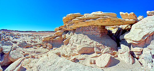
A rock bridge in Devil's Playground where Trolls could hide, Petrified Forest National Park, Arizona, United States of America, North America
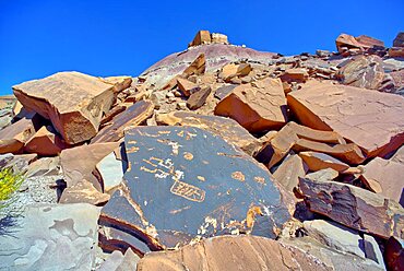
Ancient Indian petroglyphs on a boulder near Martha's Butte in Petrified Forest National Park Arizona.
Loki's Rock at Grand Canyon east of Thor's Hammer Overlook, Grand Canyon National Park, UNESCO World Heritage Site, Arizona, United States of America, North America
North East Branch of Haystack Mesa in Petrified Forest National Park, Arizona, United States of America, North America

The overhang of a sandstone mesa, a fossilized sand dune, at Ferry Swale in the Glen Canyon Recreation Area near Page, Arizona, United States of America, North America
View from the top of a sandstone mesa, a fossilized sand dune, at Ferry Swale in the Glen Canyon Recreation Area near Page, Arizona, United States of America, North America
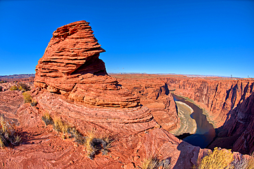
Sandstone hoodoo formation north of the Horseshoe Bend Overlook along the Colorado River in Page, Arizona, United States of America, North America
A hoodoo shaped like a vulture's head, at Horseshoe Bend in the Glen Canyon Recreation Area, near Page, Arizona, United States of America, North America
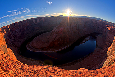
Horseshoe Bend in the Glen Canyon Recreation Area at sundown, near Page, Arizona, United States of America, North America
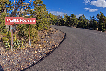
The sign marking the entry pathway to the Powell Memorial from the parking lot off Hermit Road, Grand Canyon, Arizona, United States of America, North America
Bright Angel Trail at Grand Canyon South Rim viewed from the Trailview Overlook along Hermit Road, Grand Canyon, UNESCO World Heritage Site, Arizona, United States of America, North America
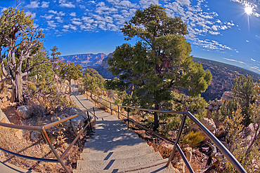
Stairway leading down to the Trailview Overlook East Vista at Grand Canyon South Rim, off Hermit Road, Grand Canyon, UNESCO World Heritage Site, Arizona, United States of America, North America
The Trailview Overlook East Vista at Grand Canyon South Rim, just off Hermit Road, Grand Canyon, UNESCO World Heritage Site, Arizona, United States of America, North America
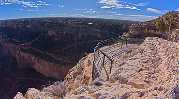
The Trailview Overlook East Vista at Grand Canyon South Rim, just off Hermit Road, Grand Canyon, UNESCO World Heritage Site, Arizona, United States of America, North America
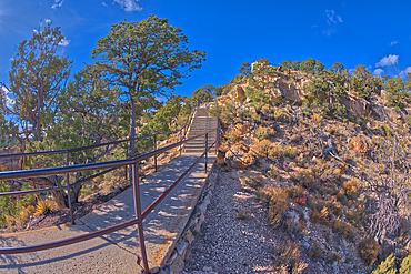
Stairway leading down to the Trailview Overlook East Vista at Grand Canyon South Rim, off Hermit Road, Grand Canyon, Arizona, United States of America, North America
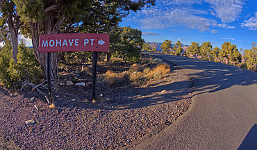
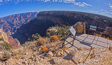
A sign marking the one way entrance to Mohave Point off of Hermit Road, Grand Canyon, UNESCO World Heritage Site, Arizona, United States of America, North America
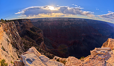
View of Grand Canyon Arizona from the west side of Mohave Point near sundown, UNESCO World Heritage Site, Arizona, United States of America, North America
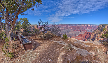
A bench along the rim trail overlooking Grand Canyon South Rim off Hermit Road halfway between Monument Creek Vista and The Abyss, Grand Canyon, Arizona, United States of America, North America
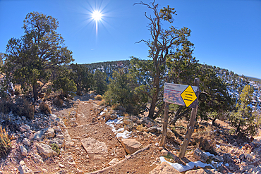
A warning sign at the start of the Hermit Canyon Trail stating that getting to the bottom is optional, but getting back to the top is mandatory, Grand Canyon, Arizona, United States of America, North America
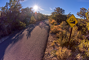
The paved Greenway trail west of Monument Creek Vista with a sign warning cyclists of a steep gradient ahead, Grand Canyon, Arizona, United States of America, North America
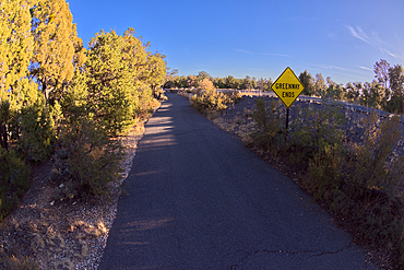
Sign marking the end of the paved Greenway Trail that runs between Monument Creek Vista and Pima Point, Grand Canyon, Arizona, United States of America, North America
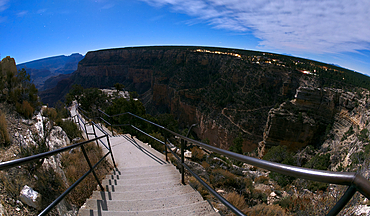
Steps leading down to Trailview Overlook under moonlight, Grand Canyon, Arizona, United States of America, North America