Results
« Previous 1 … 3 4 5 6 7 … 21 Next »
2001 results found
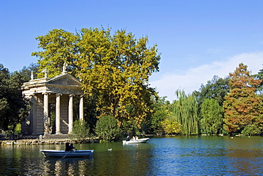
Aesculapius Temple, Lake in Villa Giulia Garden, Rome, Lazio, Italy, Europe

Cape gannet (Morus capensis) pair necking, Bird Island, Lambert's Bay, South Africa, Africa
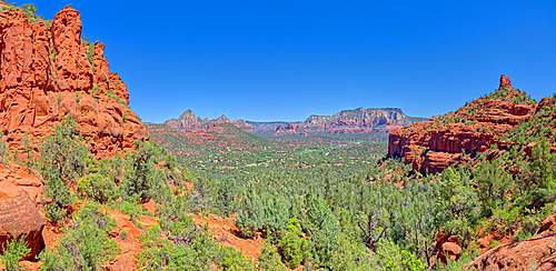
View of Sedona from the north slope of the Twin Buttes, Arizona, United States of America, North America
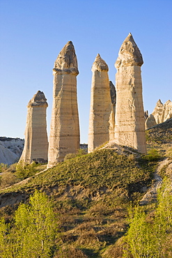
Phallic pillars known as fairy chimneys in the valley known as Love Valley near Goreme in Cappadocia, Anatolia, Turkey, Asia Minor, Eurasia
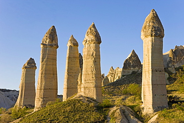
Phallic pillars known as fairy chimneys in the valley known as Love Valley near Goreme in Cappadocia, Anatolia, Turkey, Asia Minor, Eurasia

Al Azhar area, Islamic Cairo, Cairo, Egypt, North Africa, Africa
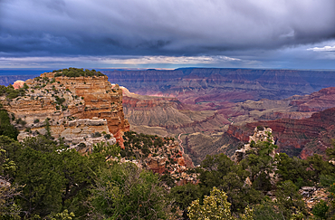
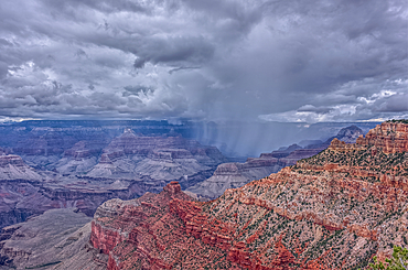
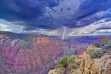
Storm rolling over Grand Canyon viewed from the Walhalla Overlook on North Rim Arizona.
Storm rolling over Grand Canyon viewed from the Walhalla Overlook on North Rim Arizona. Cape Final is on the left.
Storm rolling over Grand Canyon viewed from the Walhalla Overlook on North Rim Arizona.
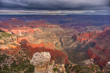
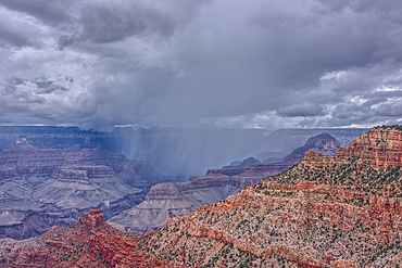
Storm rolling over Grand Canyon viewed from North Rim Arizona. Just left of center is Freya's Castle and Vishnu Temple. Cape Royal is right of center.
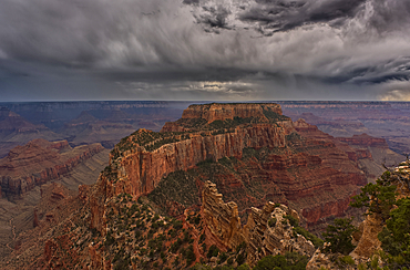
Storm rolling over Grand Canyon viewed from North Rim Arizona. The butte directly ahead is Wotans Throne.
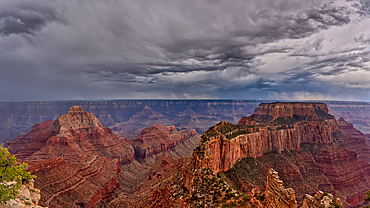
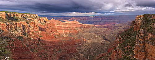
Panorama of storm clouds passing over Grand Canyon Arizona, viewed from Cape Royal on the North Rim. Composed of 3 photos stitched together.
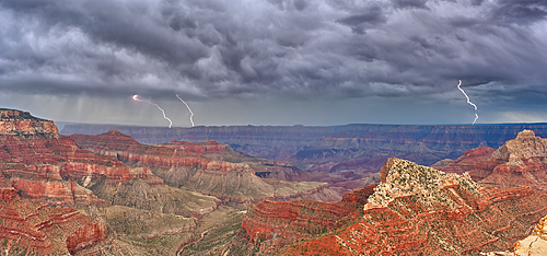
Panorama of a lightning storm passing over Grand Canyon Arizona, viewed from Cape Royal on the North Rim. Composed of 5 photos stitched together.
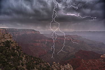
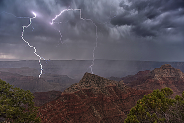
Lightning striking directly overhead viewed from the Walhalla Overlook on Grand Canyon North Rim Arizona.
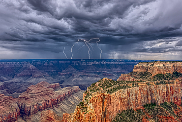
Lightning striking Freya's Castle viewed from Cape Royal on Grand Canyon North Rim Arizona.
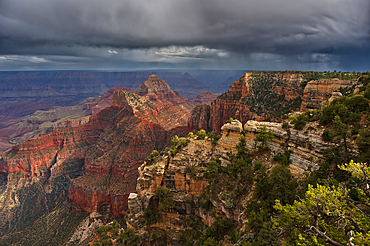
A thunderstorm approaching the South Rim of Grand Canyon Arizona. Viewed from Cape Royal on the North Rim.
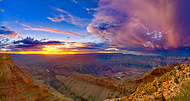
A dying storm at twilight viewed from Lipan Point, Grand Canyon, with Spider Lightning visible, Grand Canyon National Park, UNESCO World Heritage Site, Arizona, United States of America, North America

Elephants (Loxodonta africana), greeting, Addo National Park, South Africa, Africa
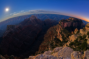
View from Cape Royal, below is Vishnu Creek running between Vishnu Temple on the left with Wotans Throne on the right at twilight with the Moon rising, Grand Canyon National Park, UNESCO World Heritage Site, Arizona, United States of America, North America
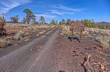
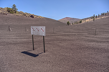
Fire Road 546 where it branches off from Sunset Crater National Monument into Coconino National Forest of Arizona.
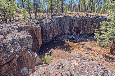
The cliff rim of Keyhole Sink in the Kaibab National Forest near Williams Arizona. This sink is an open ended sinkhole where water can flow out of it.
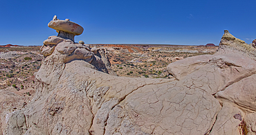
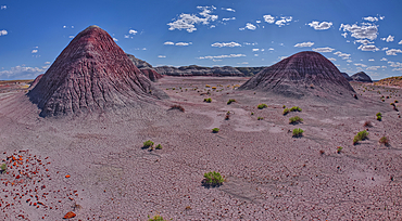
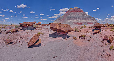
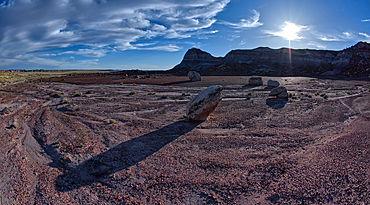
Mushroom shaped sandstone spire on an eroded ridge west of Hamilili Point in Petrified Forest National Park, Arizona, United States of America, North America

Women In Traditional Dress, Jaisalmer, Western Rajasthan, India
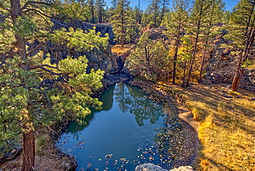
One of several natural ponds near Sycamore Falls known as the Pomeroy Tanks, Kaibab National Forest near Williams, Arizona, United States of America, North America

A twisted Juniper Tree near Sycamore Canyon in the Kaibab National Forest south of Williams, Arizona, United States of America, North America

Heart shaped box of soft candy hearts for Valentine's Day
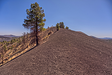
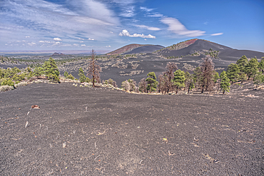
Volcanic cinder rim in Coconino National Forest near Sunset Crater National Monument of Arizona. Humphrey's Peak is in the background.
A rain storm over the North Rim of Grand Canyon National Park Arizona. Viewed from the Pipe Creek Vista on the South Rim.
A rain storm over the North Rim of Grand Canyon National Park Arizona. Viewed from the Pipe Creek Vista on the South Rim.
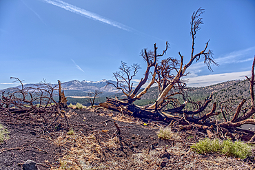
Burned trees on a Volcanic cinder rim in Coconino National Forest near Sunset Crater National Monument of Arizona. Humphrey's Peak is in the background.
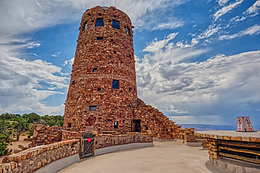
The upper half of the Desert View Watchtower viewed from the observation deck at Grand Canyon South Rim, UNESCO World Heritage Site, Arizona, United States of America, North America
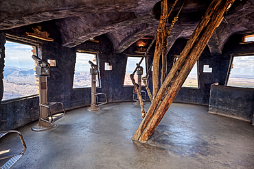
The top floor of the historic Watchtower at Grand Canyon South Rim, UNESCO World Heritage Site, Arizona, United States of America, North America

People strolling in the Interdente neighbourhood, Lisbon, Portugal, Europe
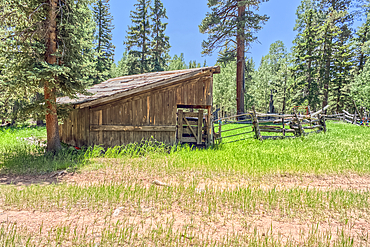
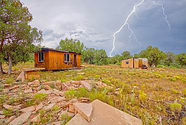
An abandoned homestead in the Kaibab National Forest off of Highway 67 north of Grand Canyon North Rim Arizona. Public land. No property release needed. Preserved by Forest Service as a historical landmark.
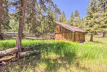
An abandoned homestead in the Kaibab National Forest off of Highway 67 north of Grand Canyon North Rim Arizona. Public land. No property release needed. Preserved by Forest Service as a historical landmark.
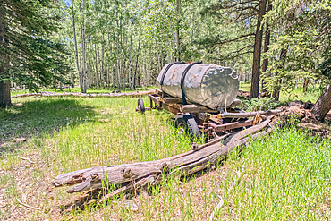
An abandoned homestead in the Kaibab National Forest off of Highway 67 north of Grand Canyon North Rim Arizona. Public land. No property release needed. Preserved by Forest Service as a historical landmark.
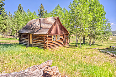
An abandoned homestead in the Kaibab National Forest off of Highway 67 north of Grand Canyon North Rim Arizona. Public land. No property release needed. Preserved by Forest Service as a historical landmark.
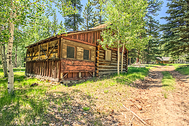
An abandoned homestead in the Kaibab National Forest off of Highway 67 north of Grand Canyon North Rim Arizona. Public land. No property release needed. Preserved by Forest Service as a historical landmark.
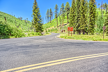
The point where Fuller Canyon Road divides in Grand Canyon North Rim Arizona. Left fork leads to Point Imperial. Right fork leads to Cape Royal.
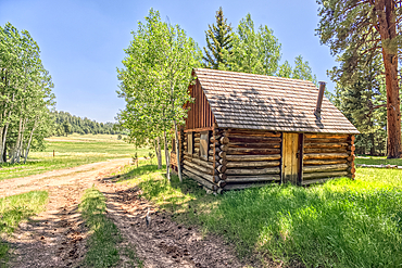
An abandoned homestead in the Kaibab National Forest off of Highway 67 north of Grand Canyon North Rim Arizona. Public land. No property release needed. Preserved by Forest Service as a historical landmark.
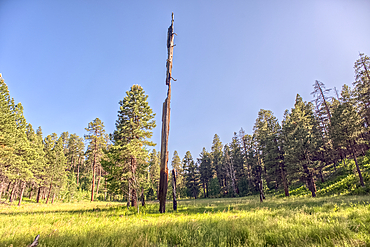
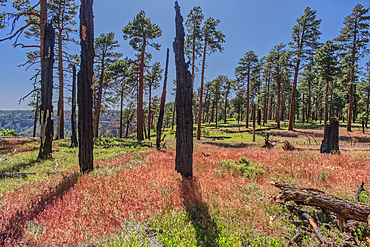
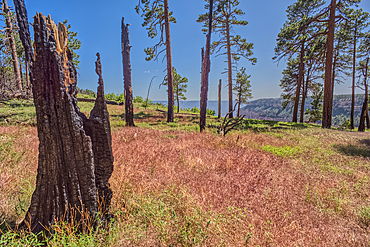
A burned tree in a grassy meadow in a valley near Clear Creek Canyon at Grand Canyon North Rim Arizona.
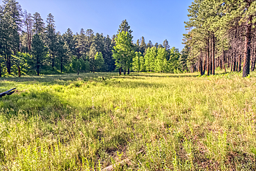
A grassy meadow in a valley near Clear Creek Canyon at Grand Canyon North Rim Arizona.
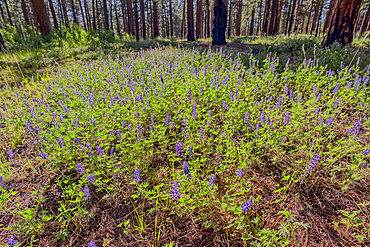
A field of purple wildflowers called Lupine at Grand Canyon North Rim Arizona near Clear Creek Canyon. Species Lupinus in the family Fabaceae.
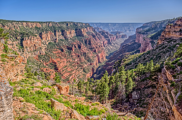
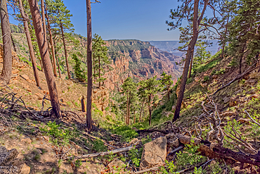
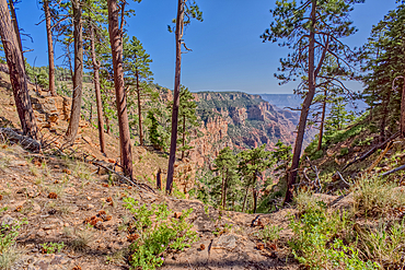
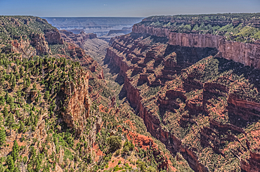
View of Clear Creek Canyon from its north cliffs at Grand Canyon North Rim Arizona.
Dry Waterfall on the north end of Clear Creek Canyon at Grand Canyon North Rim Arizona.
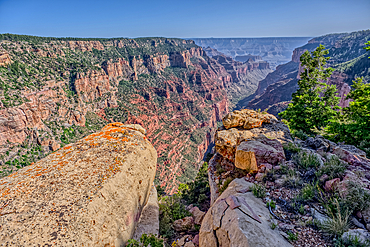
View of Clear Creek Canyon from its north cliffs at Grand Canyon North Rim Arizona.
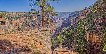
The jagged north cliffs of Clear Creek Canyon at Grand Canyon North Rim Arizona.
Dry Waterfall on the north end of Clear Creek Canyon at Grand Canyon North Rim Arizona.
Dry Waterfall on the north end of Clear Creek Canyon at Grand Canyon North Rim Arizona.
Dry Waterfall on the north end of Clear Creek Canyon at Grand Canyon North Rim Arizona.
Burned trees at the north edge of Clear Creek Canyon at Grand Canyon North Rim Arizona.
View of Clear Creek Canyon from its east rim at Grand Canyon North Rim Arizona.
Burned trees on the north end of Clear Creek Canyon at Grand Canyon North Rim Arizona.
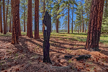
Burned tree in the forest of Grand Canyon North Rim Arizona near the edge of Clear Creek Canyon.
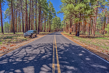
An SUV parked along Cape Royal Road at Grand Canyon North Rim Arizona.
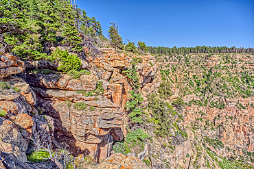
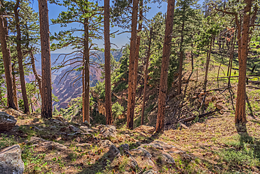
The forest of Grand Canyon North Rim Arizona near the edge of Clear Creek Canyon.
A storm rolling across Grand Canyon near the Sinking Ship formation, viewed from Coronado Ridge, Grand Canyon National Park, UNESCO World Heritage Site, Arizona, United States of America, North America
Naji Ravine just south of Naji Point on the North Rim of Grand Canyon National Park, UNESCO World Heritage Site, Arizona, United States of America, North America
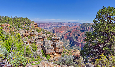
Cliff views from the edge of Naji Point on the North Rim of Grand Canyon National Park, UNESCO World Heritage Site, Arizona, United States of America, North America
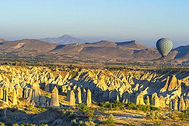
Aerial view of hot air balloon over rock formations in Love Valley at sunrise, Goreme, Goreme Historical National Park, UNESCO Worrld Heritage Site, Cappadocia, Central Anatolia Region, Anatolia, Turkey, Asia Minor, Asia
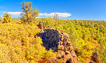
The crumbling walls of ancient Indian Ruins along the south rim of Rattlesnake Canyon near the historic Chavez Trail, Arizona, United States of America, North America
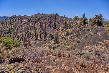
Volcanic cinder hills in Coconino National Forest near Sunset Crater National Monument of Arizona.
Volcanic cinder hills in Coconino National Forest near Sunset Crater National Monument of Arizona.
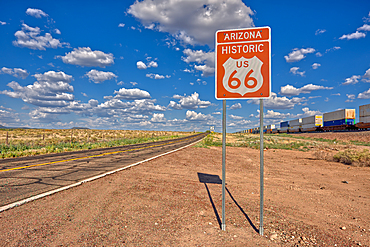
Road sign marking Historic Route 66 just east of Seligman, the birthplace of the famous road, Arizona, United States of America, North America
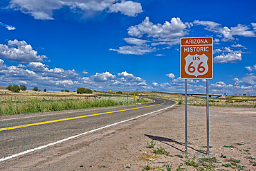
A road sign marking the Historic Route 66 just west of Ash Fork, Arizona, United States of America, North America

Japanese wedding at Itsukushima Shrine, Shinto temple, Miyajima Island, UNESCO World Heritage Site, Hiroshima Prefecture, Honshu, Japan, Asia

Love Taupo sign on the shore of lake Taupo in sunset light. A scenic point of North Island of New Zealand
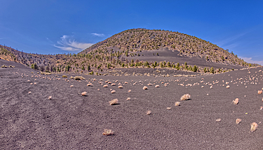
Volcanic cinder hills in Coconino National Forest near Sunset Crater National Monument of Arizona.
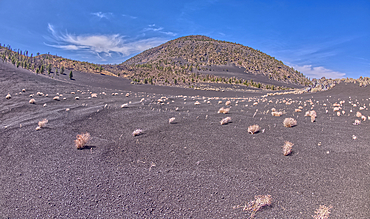
Volcanic cinder hills in Coconino National Forest near Sunset Crater National Monument of Arizona.

AI generated image of a Young goldendoodle pup sitting on the ground

AI generated image of Two cute Alaskan Husky pups licking snow

AI generated image of Two cute French Bulldog pups playing and running together in the grass

AI generated image of Two cute Maltese pups sitting in a wicker basket

AI generated image of Two cute pocket Dog pups seated on ground

AI generated image of Two cute Mexican Hairless pups seated and looking at each other
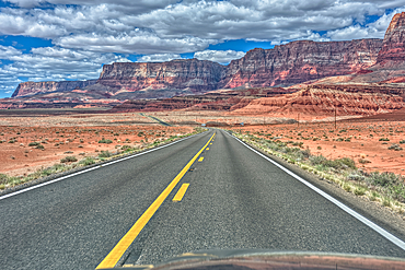
Vermilion Cliffs National Monument Arizona viewed thru the windshield of a moving vehicle traveling on highway US89A.
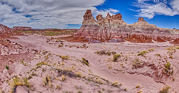
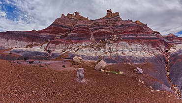
Tall hoodoo towers in the valley below Blue Mesa in Petrified Forest National Park, Arizona, United States of America, North America
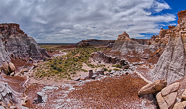
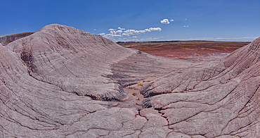
A valley below the east cliffs of Blue Mesa in Petrified Forest National Park, Arizona, United States of America, North America
The Billings Gap Overlook on the east side of Blue Mesa in Petrified Forest National Park, Arizona, United States of America, North America
The Billings Gap Overlook on the east side of Blue Mesa in Petrified Forest National Park, Arizona, United States of America, North America
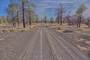
Fire Road 546 where it branches off from Sunset Crater National Monument into Coconino National Forest of Arizona.
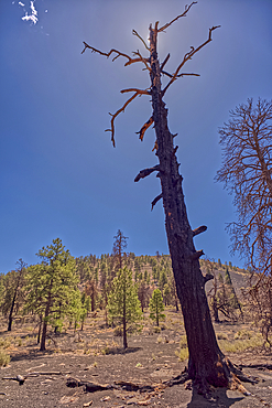
A burned tree below a volcanic cinder hill in the Coconino National Forest near Sunset Crater National Monument Arizona.
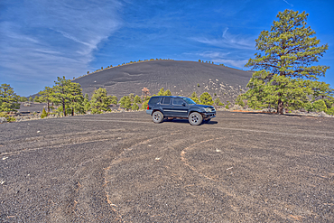
An SUV traveling near Volcanic cinder hills in Coconino National Forest near Sunset Crater National Monument of Arizona.
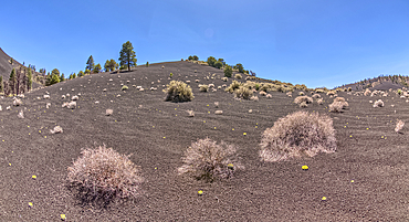
Volcanic cinder hills in Coconino National Forest near Sunset Crater National Monument of Arizona.

View of the Grand Canyon west of Navajo Point with a storm rolling in from the west, Arizona, United States of America, North America
Lightning striking from a monsoon storm building up over the abandoned Mexican Quarry near Perkinsville, Arizona, United States of America, North America
The boundary fence between Coconino National Forest and Sunset Crater National Monument of Arizona.
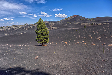
Lone Pine Tree in a volcanic valley in Coconino National Forest near Sunset Crater National Monument of Arizona.
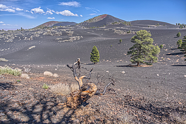
Volcanic cinder hills in Coconino National Forest near Sunset Crater National Monument of Arizona.
Volcanic cinder hills in Coconino National Forest near Sunset Crater National Monument of Arizona.
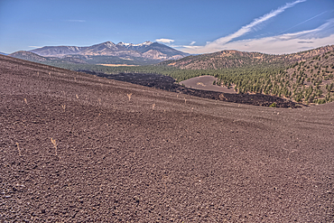
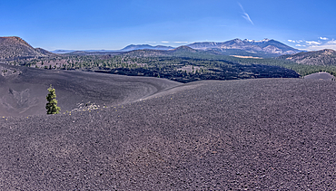
Volcanic cinder hill in Coconino National Forest near Sunset Crater National Monument of Arizona with snow capped Humphrey's Peak in the background.

AI generated image of Puppies dogs and cats in a colorful flower setting
The Little Teepees on the north side of Haystack Mesa in Petrified Forest National Park, Arizona, United States of America, North America

Sex shop, Rue Saint-Denis, Paris, France
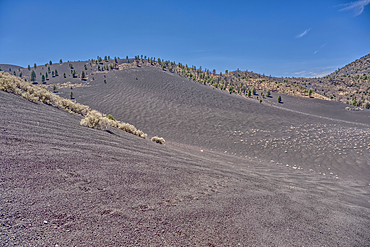
Volcanic cinder hills in Coconino National Forest near Sunset Crater National Monument of Arizona.
East slopes of Haystack Mesa in Petrified Forest National Park, Arizona, United States of America, North America
The south Haystack Hill in Petrified Forest National Park, Arizona, United States of America, North America
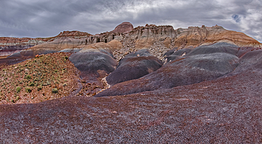
Hoodoo filled cliffs on the north side of Blue Mesa in Petrified Forest National Park, Arizona, United States of America, North America
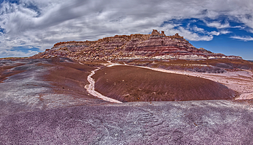
The east cliffs of Blue Mesa near sunset, Petrified Forest National Park, Arizona, United States of America, North America
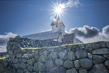
Vioareioi Church and the sun aligned with bell tower, Faroe Islands, Denmark, North Atlantic, Europe