Results
« Previous 1 … 4 5 6 7 8 … 21 Next »
2001 results found
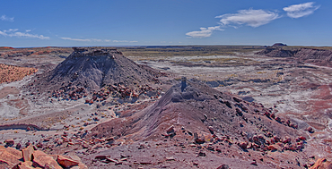
View of Anvil Hill and Crystal Butte from the summit of Crystal Mesa west of Hamilili Point in Petrified Forest National Park, Arizona, United States of America, North America
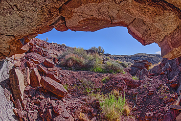
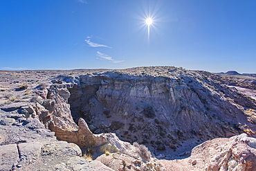
A cliff cave below Crystal Mesa west of Hamilili Point in Petrified Forest National Park, Arizona, United States of America, North America
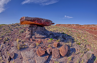
A rock table sculpted by the wind on Crystal Mesa west of Hamilili Point in Petrified Forest National Park, Arizona, United States of America, North America
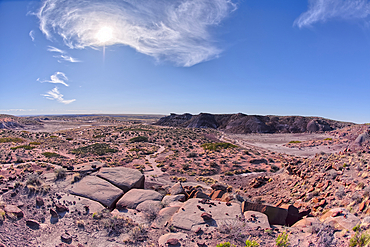
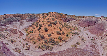
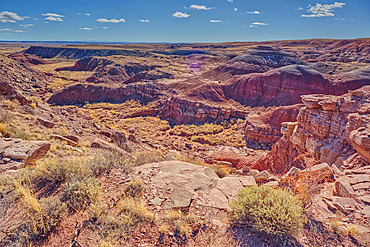
View of Crystal Mesa west of Hamilili Point in Petrified Forest National Park, Arizona, United States of America, North America
A dry waterfall west of Hamilili Point in Petrified Forest National Park, Arizona, United States of America, North America
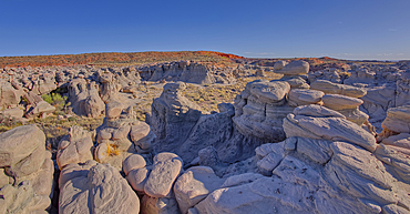
Goblin Garden west of Hamilili Point in Petrified Forest National Park, Arizona, United States of America, North America
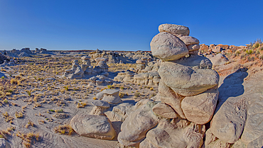
Goblin Garden west of Hamilili Point in Petrified Forest National Park, Arizona, United States of America, North America
Goblin Garden west of Hamilili Point in Petrified Forest National Park, Arizona, United States of America, North America
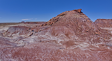
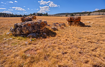
Anvil Hill west of Hamilili Point in Petrified Forest National Park, Arizona, United States of America, North America
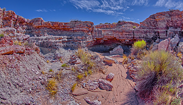
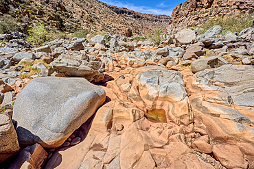
A dry waterfall in Crystal Creek below Crystal Mesa west of Hamilili Point in Petrified Forest National Park, Arizona, United States of America, North America
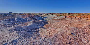
A sloping red sand dune above Hamilili Wash in Petrified Forest National Park, Arizona, United States of America, North America
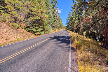
Cape Royal Road winding through Fuller Canyon at Grand Canyon North Rim, UNESCO, Arizona, United States of America
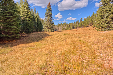
A meadow in Fuller Canyon off Cape Royal Road at Grand Canyon North Rim, Arizona, United States of America
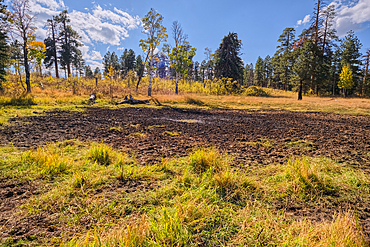
Greenland Lake reduced to a mud hole, Grand Canyon North Rim, UNESCO, Arizona, United States of America
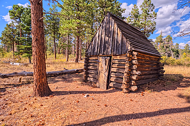
The historic Salt Cabin dating back to 1870s near Greenland Lake at Grand Canyon North Rim, UNESCO, Arizona, United States of America

Aspen trees in autumn colors east of Greenland Lake, Grand Canyon North Rim, Arizona, United States of America
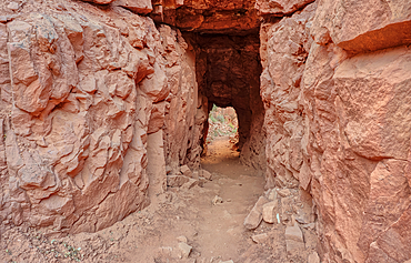
The west entrance of Supai Tunnel on North Kaibab Trail, Grand Canyon North Rim, UNESCO, Arizona, United States of America
The Red Wall of sandstone east of Supai Tunnel on North Kaibab Trail, Grand Canyon North Rim, UNESCO, Arizona, United States of America
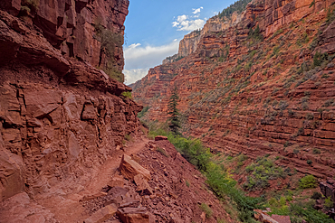
The sheer cliff of the Red Wall along the North Kaibab Trail, Grand Canyon North Rim, UNESCO, Arizona, United States of America
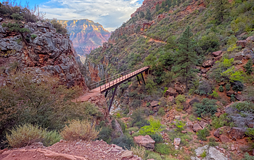
View above Red Wall Bridge crossing Roaring Springs Canyon, North Kaibab Trail, Grand Canyon North Rim, UNESCO, Arizona, United States of America
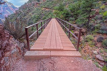
Red Wall Bridge crossing Roaring Springs Canyon on North Kaibab Trail, Grand Canyon North Rim, UNESCO, Arizona, United States of America
Lonely Boulders and exposed rock in Pleasant Valley, Kaibab National Forest just north of Grand Canyon North Rim, Arizona, United States of America
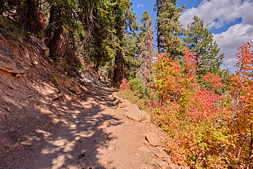
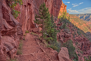
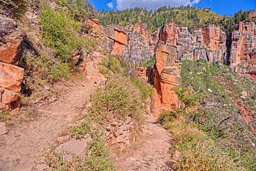
Looking back up the first leg of the North Kaibab Trail at Grand Canyon North Rim, UNESCO, Arizona, United States of America
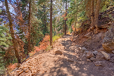
The upper leg of the North Kaibab Trail at Grand Canyon North Rim, UNESCO, Arizona, United States of America

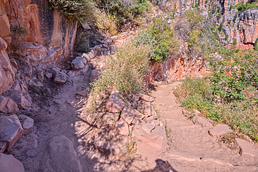
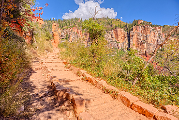
The Coconino Overlook along the North Kaibab Trail at Grand Canyon North Rim, UNESCO, Arizona, United States of America
The 11th switchback along the North Kaibab Trail at Grand Canyon North Rim, UNESCO, Arizona, United States of America
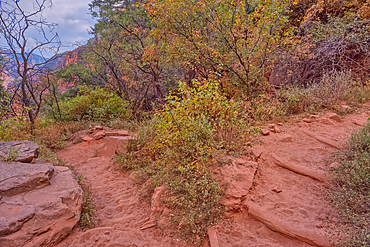
The 17th switchback along the North Kaibab Trail at Grand Canyon North Rim, UNESCO, Arizona, United States of America
The 18th switchback along the North Kaibab Trail at Grand Canyon North Rim, UNESCO, Arizona, United States of America
The 23rd switchback along the North Kaibab Trail at Grand Canyon North Rim, UNESCO, Arizona, United States of America
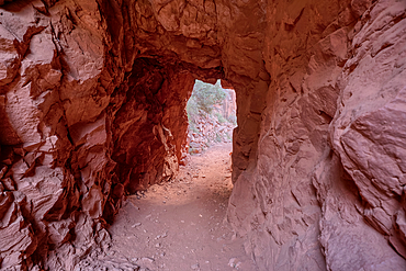
The interior of the Supai Tunnel along the North Kaibab Trail, Grand Canyon North Rim, UNESCO, Arizona, United States of America
Snow covered landscape from a late winter storm in Chino Valley Arizona.
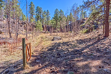
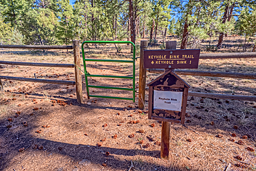
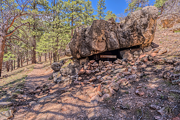
An old gate to the sinkhole called the Keyhole Sink in Williams Arizona within the Kaibab National Forest.
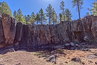
The cliff wall of the Keyhole Sink in the Kaibab National Forest near Williams Arizona. This sink is an open ended sinkhole where water can flow out of it.
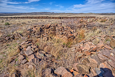
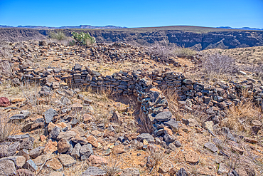
The Pueblo La Plata Indian Ruins near Silver Creek Canyon in the Agua Fria National Monument of Arizona. Located north of Black Canyon City.
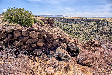
Ancient wall of the Fort Silver Indian Ruins overlooking Silver Creek Canyon in Agua Fria National Monument of Arizona. Located near the Pueblo La Plata ruins.
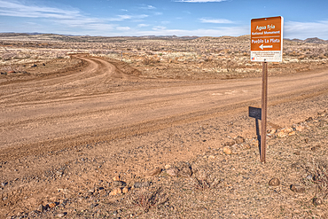
Road sign along Bloody Basin Road in the Agua Fria National Monument of Arizona directing the way to the Pueblo La Plata Indian Ruins.
The primitive Bloody Basin Road winding thru the Agua Fria National Monument north of Black Canyon City Arizona.
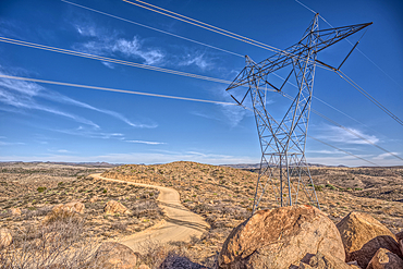
High Tension Power Lines stretching across Bloody Basin in Agua Fria National Monument north of Black Canyon City Arizona.
Look back up the freeway exit ramp for Bloody Basin Road in the Agua Fria National Monument of Arizona. Located north of Black Canyon City.
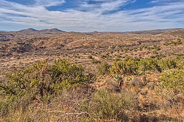
A Saguaro covered scenic ridge overlooking the Agua Fria River in the Agua Fria National Monument of Arizona.
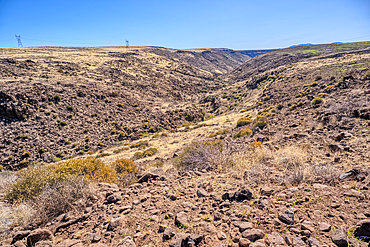
The Agua Fria River Canyon in the Agua Fria National Monument north of Black Canyon City Arizona.
A Saguaro covered scenic ridge overlooking the Agua Fria River in the Agua Fria National Monument of Arizona.
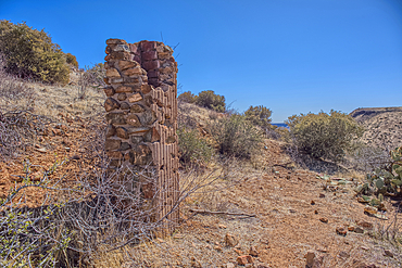
Remnants of the Richinbar Mine within the Agua Fria National Monument north of Black Canyon City Arizona. Mine was established in 1905 but was abandoned in 1940 when the company that owned it went bankrupt.
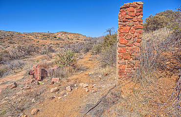
Remnants of the Richinbar Mine within the Agua Fria National Monument north of Black Canyon City Arizona. Mine was established in 1905 but was abandoned in 1940 when the company that owned it went bankrupt.
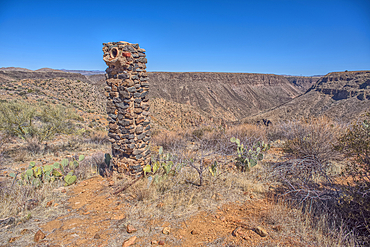
Remnants of the Richinbar Mine within the Agua Fria National Monument north of Black Canyon City Arizona. Mine was established in 1905 but was abandoned in 1940 when the company that owned it went bankrupt.
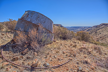
Remnants of the Richinbar Mine within the Agua Fria National Monument north of Black Canyon City Arizona. Mine was established in 1905 but was abandoned in 1940 when the company that owned it went bankrupt.
Remnants of the Richinbar Mine within the Agua Fria National Monument north of Black Canyon City Arizona. Mine was established in 1905 but was abandoned in 1940 when the company that owned it went bankrupt.
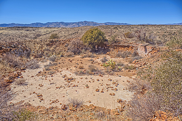
Remnants of the Richinbar Mine within the Agua Fria National Monument north of Black Canyon City Arizona. Mine was established in 1905 but was abandoned in 1940 when the company that owned it went bankrupt.
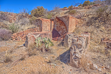
Remnants of the Richinbar Mine within the Agua Fria National Monument north of Black Canyon City Arizona. Mine was established in 1905 but was abandoned in 1940 when the company that owned it went bankrupt.
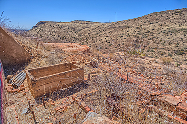
Remnants of the Richinbar Mine within the Agua Fria National Monument north of Black Canyon City Arizona. Mine was established in 1905 but was abandoned in 1940 when the company that owned it went bankrupt.
Ancient Indian Ruins near the historic Richinbar Mine in the Agua Fria National Monument north of Black Canyon City Arizona.
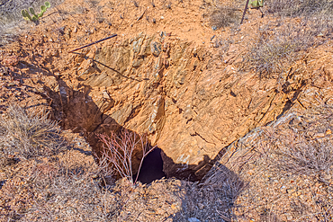
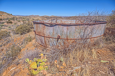
Open mine shaft at the Richinbar Mine within the Agua Fria National Monument north of Black Canyon City Arizona. Mine was established in 1905 but was abandoned in 1940 when the company that owned it went bankrupt.
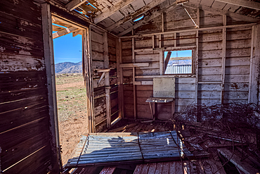
An abandoned cabin next to an active cattle corral in the Agua Fria National Monument north of Black Canyon City Arizona. Public land. No property release needed.
An unnamed tributary canyon that feeds into the Agua Fria River near the Sunset Point Rest Stop off of I-17 north of Black Canyon City AZ.
Trailhead for a sinkhole called the Keyhole Sink in Williams Arizona within the Kaibab National Forest.
The southeast summit of O'Leary Peak viewed from a volcanic cinder hill in Coconino National Forest near Sunset Crater National Monument of Arizona.
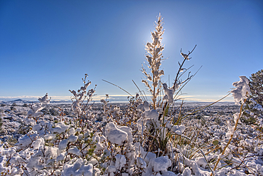
Snow covered landscape from a late winter storm in Chino Valley Arizona.
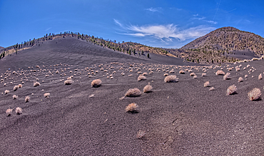
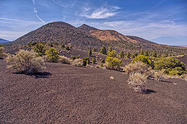
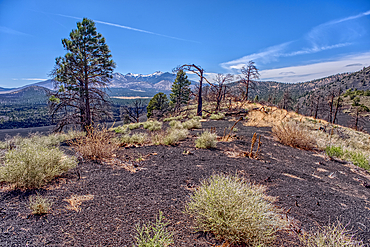
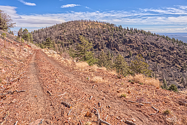
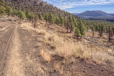
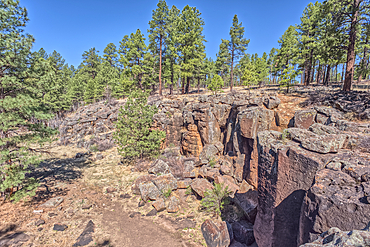
Volcanic cinder hills in Coconino National Forest near Sunset Crater National Monument of Arizona.
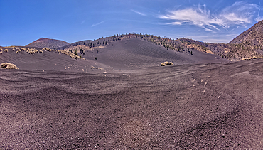
Volcanic cinder hills in Coconino National Forest near Sunset Crater National Monument of Arizona.
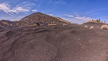
Volcanic cinder hills in Coconino National Forest near Sunset Crater National Monument of Arizona.
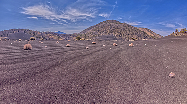
Volcanic cinder hills in Coconino National Forest near Sunset Crater National Monument of Arizona.
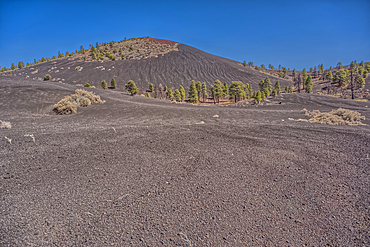
Volcanic cinder hills in Coconino National Forest near Sunset Crater National Monument of Arizona.
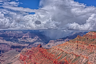
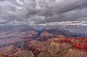
A rain storm over the North Rim of Grand Canyon National Park Arizona. Viewed from the Pipe Creek Vista on the South Rim.
A rain storm over the North Rim of Grand Canyon National Park Arizona. Viewed from the Pipe Creek Vista on the South Rim.
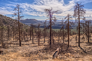
Burned trees on a Volcanic cinder rim in Coconino National Forest near Sunset Crater National Monument of Arizona. Humphrey's Peak is in the background.
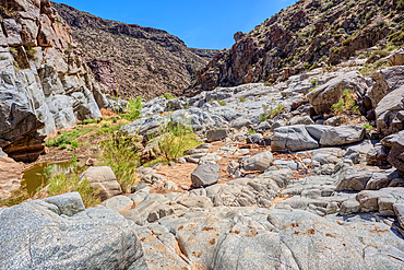
The granite riverbed of the Agua Fria River Canyon in the Agua Fria National Monument of Arizona.
The granite riverbed of the Agua Fria River Canyon in the Agua Fria National Monument of Arizona.
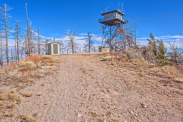
The fire watchtower on the summit of O'Leary Peak in the Coconino National Forest of Arizona. Adjacent to the Sunset Crater National Monument.
Forest Service Road that leads to the O'Leary Peak Watchtower and Overlook. Adjacent to Sunset Crater National Monument Arizona in the Coconino National Forest.
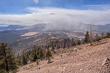
A snow squall storm building up over Humphrey's Peak. Viewed from O'Leary Peak in the Coconino National Forest of Arizona. Adjacent to Sunset Crater National Monument.
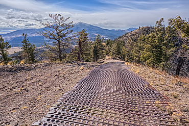
End of the Forest Service Road that leads to the O'Leary Peak Watchtower and Overlook. The metal grating is to add traction for vehicles. Adjacent to Sunset Crater National Monument Arizona in the Coconino National Forest.
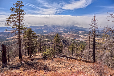
A snow squall storm building up over Humphrey's Peak. Viewed from O'Leary Peak in the Coconino National Forest of Arizona. Adjacent to Sunset Crater National Monument.
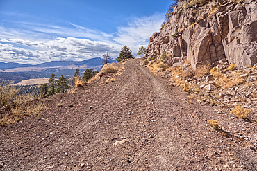
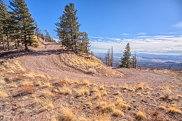
The Forest Service Road that leads to the summit of O'Leary Peak in the Coconino National Forest of Arizona.
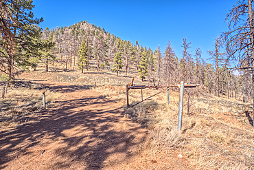
Gateway to the summit of O'Leary Peak in northern Arizona.
Dead trees from a past forest fire on the slope of O'Leary Peak in northern Arizona. Sunset Crater Volcano is in the background.
The eastern summit of O'Leary Peak in the Coconino National Forest of Arizona. Adjacent to the Sunset Crater National Monument.
Sunset Crater Volcano viewed from the forested slope of O'Leary Peak in northern Arizona.
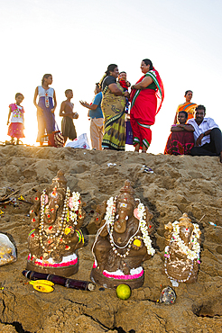
Statuettes of Ganesh at Marina Beach, Baie of Bengal, Chennai (Madras), Coromandel Coast, Tamil Nadu state, South India, Asia

Grand Canyon view at sunset from the west side of Moran Point, Grand Canyon National Park, UNESCO World Heritage Site, Arizona, United States of America, North America
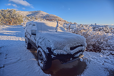
A snow covered vehicle from a late winter storm the night before in Chino Valley Arizona.
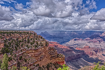
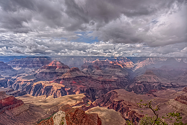
A rain storm over the North Rim of Grand Canyon National Park Arizona. Viewed from Yavapai Point on the South Rim.
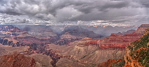
Panorama of a rain storm over the North Rim of Grand Canyon National Park Arizona. Viewed from Yavapai Point on the South Rim. Composed of 3 separate photos stitched together.
Rainy skies over the North Rim of Grand Canyon National Park Arizona. Viewed from Yavapai Point on the South Rim.
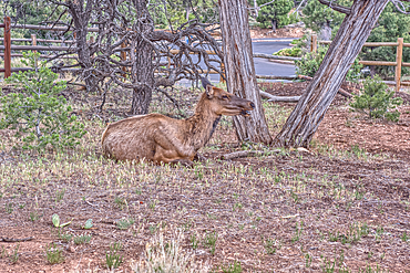
A female Elk relaxing under a tree near Yavapai Point at Grand Canyon South Rim Arizona.
The cliff rim of Keyhole Sink in the Kaibab National Forest near Williams Arizona. This sink is an open ended sinkhole where water can flow out of it.
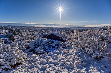
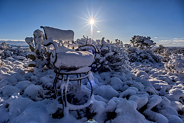
Snow covered landscape from a late winter storm in Chino Valley Arizona.
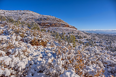
Snow covered landscape from a late winter storm in Chino Valley Arizona.
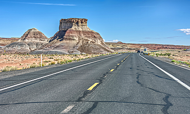
A butte of Bentonite clay along highway US89 north of Cameron Arizona in an area called the Painted Desert. This photo was taken thru the windshield of a vehicle in motion.
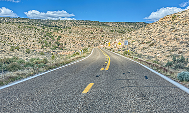
Highway US89A ascending onto the Kaibab Plateau in northern Arizona.
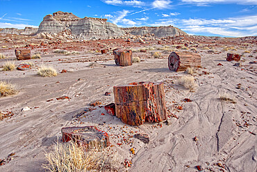
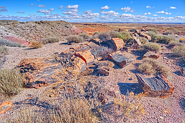
Shattered pieces of petrified wood in a sandy wash in the Jasper Forest of Petrified Forest National Park, Arizona, United States of America, North America
A Hoodoo of expansive clay called Bentonite in the Jasper Forest of Petrified Forest National Park, Arizona, United States of America, North America
Shattered pieces of petrified wood in a sandy wash in the Jasper Forest of Petrified Forest National Park, Arizona, United States of America, North America
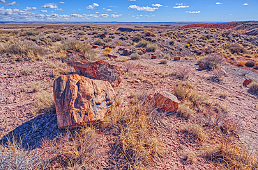
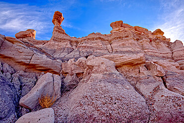
Pieces of petrified wood on hills overlooking Dead Wash, Petrified Forest National Park, Arizona, United States of America
Pieces of petrified wood on hills overlooking Dead Wash, Petrified Forest National Park, Arizona, United States of America
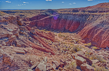
A canyon that drains into Dead Wash, Petrified Forest National Park, Arizona, United States of America
A canyon that drains into Dead Wash, Petrified Forest National Park, Arizona, United States of America
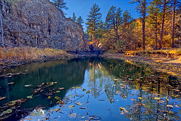
Pomeroy Tanks near Sycamore Falls, located in the Kaibab National Forest near Williams, Arizona, United States of America, North America
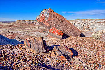
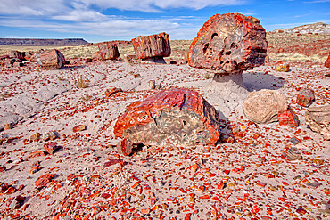
Large pieces of petrified wood in the Jasper Forest of Petrified Forest National Park, Arizona, United States of America, North America
Indian Ruins along Cliff Springs Trail at North Rim in Grand Canyon National Park Arizona.
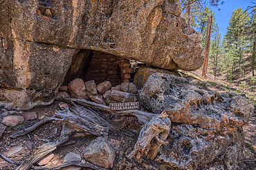
Indian Ruins along Cliff Springs Trail at North Rim in Grand Canyon National Park Arizona.