Results
« Previous 1 … 5 6 7 8 9 … 21 Next »
2001 results found
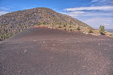
O'Leary Peak viewed from a Volcanic cinder rim slope in Coconino National Forest near Sunset Crater National Monument of Arizona.
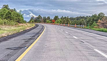
Entering a construction zone while traveling on westbound I-40 between Flagstaff and Williams Arizona. Photo was taken from a moving vehicle thru the windshield. There might be some motion blur.
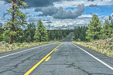
Approaching a steep grade on westbound I-40 near Ash Fork Arizona. Taken from a moving vehicle thru the windshield. There may be some motion blur.
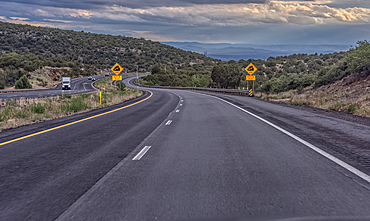
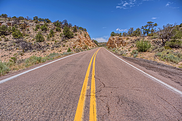
State Route 64 heading north to Grand Canyon South Rim Arizona. Viewed thru the windshield of a moving vehicle. There may be some motion blur.
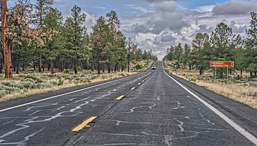
A sign along State Route 64 in Arizona marking 5 miles to Grand Canyon National Park. Viewed thru the windshield of a moving vehicle. There may be some motion blur.
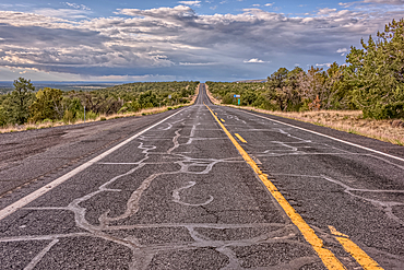
State Route 64 eastbound along Grand Canyon South Rim Arizona.
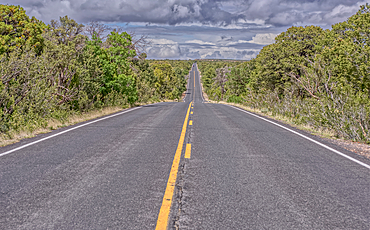
State Route 64 heading north to Grand Canyon South Rim Arizona.
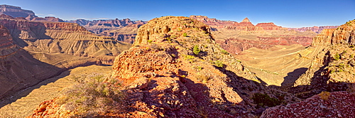
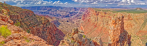
Grand Canyon view from western edge of Horseshoe Mesa, Grand Canyon National Park, UNESCO World Heritage Site, Arizona, United States of America, North America

Panorama view of Freya's Castle and Wotan's Throne from the southwest side of Cape Royal on Grand Canyon North Rim, Arizona, United States of America, North America
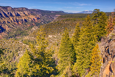
View of San Francisco Peaks from a cliff at the end of the Telephone Trail north of Sedona with Oak Creek Canyon on the left, Arizona, United States of America, North America
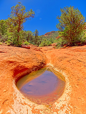
Sandstone bowl of captured rainwater reflecting the sky along Hog Heaven Trail in Sedona, Arizona, United States of America, North America
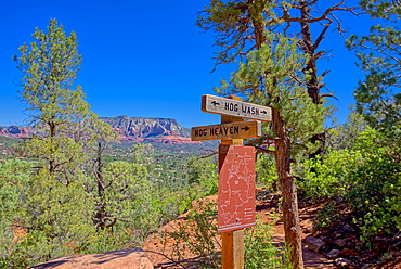
Hog Wash (Hog Heaven), the intersection of two trails on the Northwest side of the Twin Buttes in Sedona, Arizona, United States of America, North America
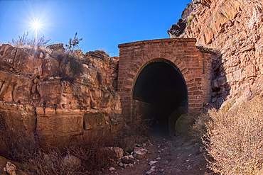
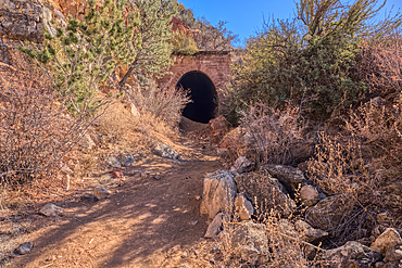
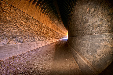
The south entrance of the historic Johnson Canyon Railroad Tunnel, Kaibab National Forest of Arizona, USA
The south entrance of the historic Johnson Canyon Railroad Tunnel, Kaibab National Forest of Arizona, USA

The old abandoned homestead of Rods Winter Camp in the Kaibab National Forest of Arizona, USA
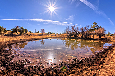
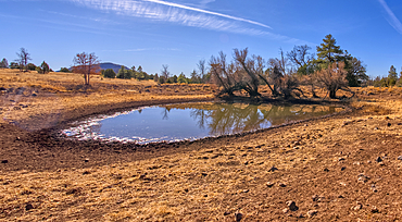
An artificial pond for cattle called Rods Winter Camp Tank in the Kaibab National Forest of Arizona, USA

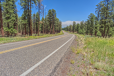
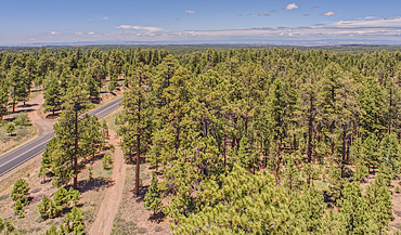
Forest Service Road 709 in the Kaibab National Forest of Arizona, USA

The south entrance of the historic Johnson Canyon Railroad Tunnel, Kaibab National Forest of Arizona, USA
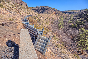
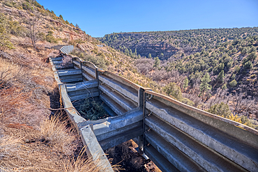
A metal retaining wall holding up the Johnson Canyon Railroad grade that has been damaged, Kaibab National Forest of Arizona, USA
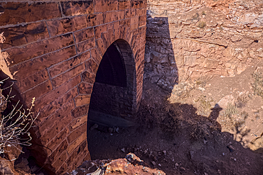
The north entrance of the historic Johnson Canyon Railroad Tunnel, Kaibab National Forest of Arizona, USA
Interior view of the Johnson Canyon Railroad Tunnel, Kaibab National Forest of Arizona, USA
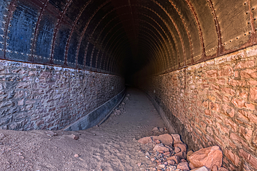
The north entrance of the historic Johnson Canyon Railroad Tunnel, Kaibab National Forest of Arizona, USA
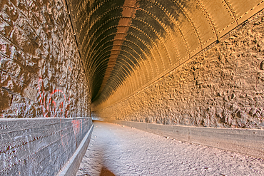
Interior view of the Johnson Canyon Railroad Tunnel, Kaibab National Forest of Arizona, USA
A metal retaining wall along the Johnson Canyon Railroad, Kaibab National Forest of Arizona, USA
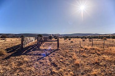
A livestock corral for the Thirteen Mile Cattle Tank off of Corva Road, Kaibab National Forest, Arizona, USA

Forest Service Road 709 in the Kaibab National Forest of Arizona, USA

A water leak from a crack in Stone Dam in the Kaibab National Forest, Arizona, USA

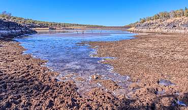
View from below the Stone Dam in the Kaibab National Forest, Arizona, USA
View from below the Stone Dam in the Kaibab National Forest, Arizona, USA
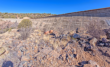
View from below the Stone Dam in the Kaibab National Forest, Arizona, USA
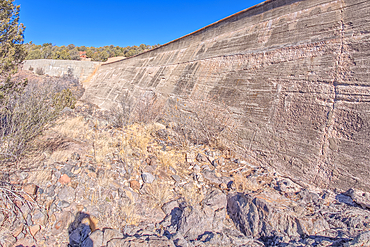
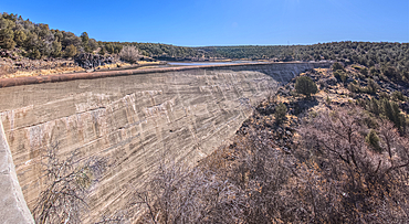
Johnson Canyon face of the Stone Dam in the Kaibab National Forest, Arizona, USA

Johnson Canyon face of the Stone Dam in the Kaibab National Forest, Arizona, USA
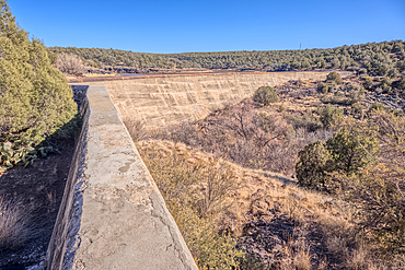
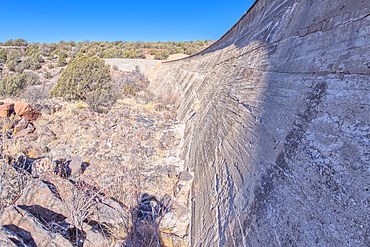
Top view from the Stone Dam in the Kaibab National Forest, Arizona, USA
Top view of the Stone Dam in the Kaibab National Forest, Arizona, USA
View from below the Stone Dam in the Kaibab National Forest, Arizona, USA
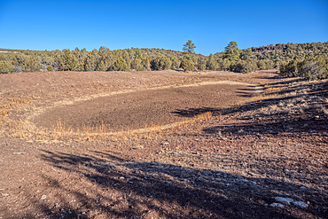
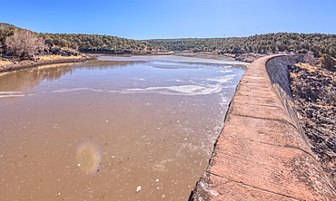
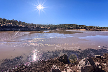
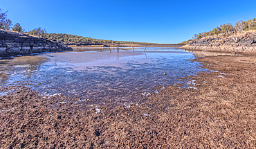
View from the shore of Stone Dam Lake in the Kaibab National Forest, Arizona, USA
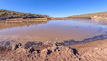
View from the shore of Stone Dam Lake in the Kaibab National Forest, Arizona, USA
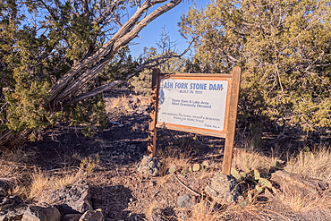
Historical information sign at Stone Dam Lake in the Kaibab National Forest, Arizona, USA
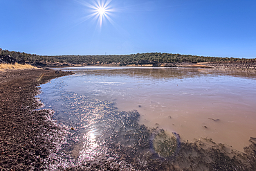
View from the shore of Stone Dam Lake in the Kaibab National Forest, Arizona, USA
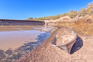
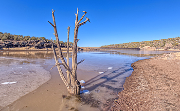
An abandoned boat along the shore of Stone Dam Lake in the Kaibab National Forest, Arizona, USA

Overhead view of the Icy shore of Stone Dam Lake in the Kaibab National Forest, Arizona, USA
View from the shore of Stone Dam Lake in the Kaibab National Forest, Arizona, USA
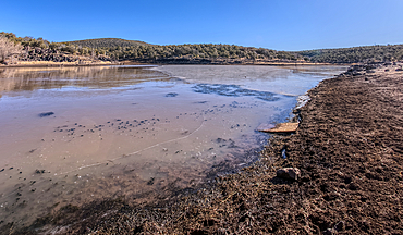
View from the shore of Stone Dam Lake in the Kaibab National Forest, Arizona, USA
View from the shore of Stone Dam Lake in the Kaibab National Forest, Arizona, USA
View from the shore of Stone Dam Lake in the Kaibab National Forest, Arizona, USA

Wishes written on wooden tags by visitors in Huangling ancient village, Wuyuan County, Shangrao City, Jiangxi Province, China
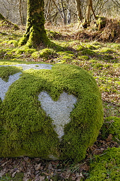
Love Heart shape in moss on granite bolder, United Kingdom, Europe

Love Heart shape in moss on granite bolder
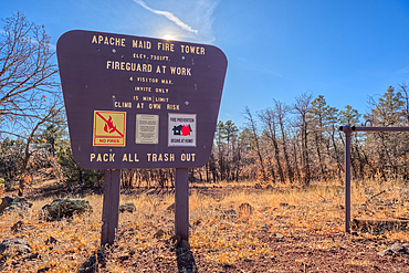
An information sign on the summit of Apache Maid Mountai, Coconino National Forest, Arizona, United States of America
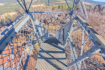
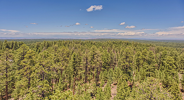
View from second deck of fire watchtower on summit of Apache Maid Mountain, Coconino National Forest, Arizona, United States of America
The gate for the Campbell Draw Tank, Coconino National Forest, Arizona, United States of America
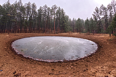
The frozen Campbell Draw Tank with approaching snow storm, Coconino National Forest, Arizona, United States of America
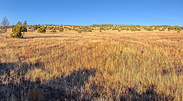
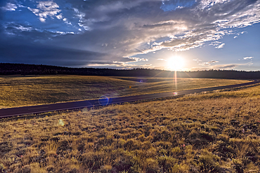
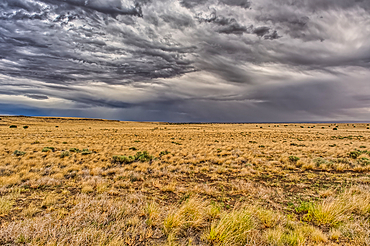
Golden grassland prairie near sundown, Coconino National Forest, Arizona, United States of America
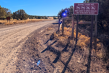
A warning sign stating that the road can be closed seasonally, Coconino National Forest, Arizona, United States of America
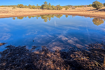
A cattle pond, Rarick Tank, Coconino National Forest, Arizona, United States of America
A cattle pond, Rarick Tank, Coconino National Forest, Arizona, United States of America
A cattle pond, Rarick Tank, Coconino National Forest, Arizona, United States of America
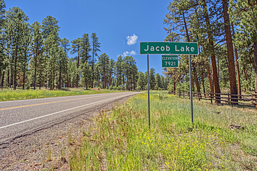
A sign marking the boundary of Jacob Lake, a settlement within the Kaibab National Forest in northern Arizona.
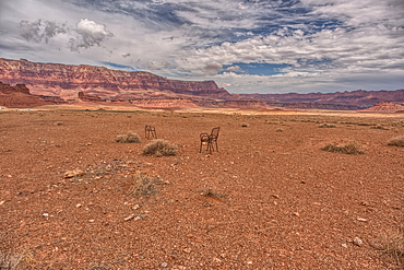
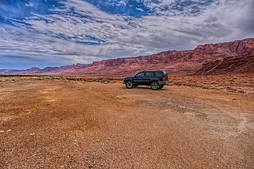
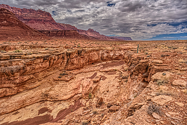
An abandoned lawn chair in view of Vermilion Cliffs near Marble Canyon Arizona from US89A on a mostly cloudy day. Located between the little town of Bitter Springs on the Navajo Reservation and the Vermilion Cliffs National Monument.
US89A ascending to the Kaibab Plateau in Arizona north of the Vermilion Cliffs National Monument.
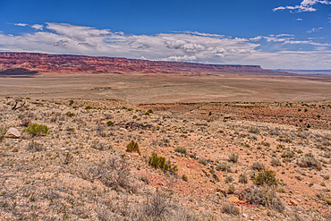
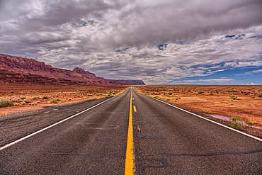
View of Vermilion Cliffs Arizona from US89A from and overlook above House Rock Valley.
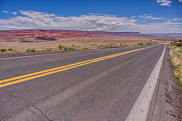
View of Vermilion Cliffs Arizona from US89A ascending to the Kaibab Plateau.
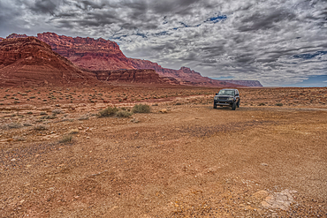
Vehicle parked next to Jackass Creek off of US89A near Echo Cliffs on the way to Vermilion Cliffs Arizona. Located on the Navajo Indian Reservation between Bitter Springs and Marble Canyon.
Vehicle parked next to Jackass Creek off of US89A near Echo Cliffs on the way to Vermilion Cliffs Arizona. Located on the Navajo Indian Reservation between Bitter Springs and Marble Canyon.
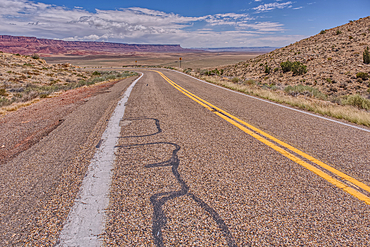
View of Vermilion Cliffs Arizona from US89A ascending to the Kaibab Plateau.
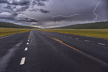
Lightning storm over Pleasant Valley in Kaibab National Forest Arizona, north of Grand Canyon North Rim.
View of a small slot canyon called Jackass Creek off of US89A next to Echo Cliffs on the way to Vermilion Cliffs Arizona. Located on the Navajo Indian Reservation between Bitter Springs and Marble Canyon.
View of Echo Cliffs near Marble Canyon Arizona from US89A on a mostly cloudy day. This section of the cliffs is near the little town of Bitter Springs on the Navajo Reservation adjacent to the Vermilion Cliffs National Monument.
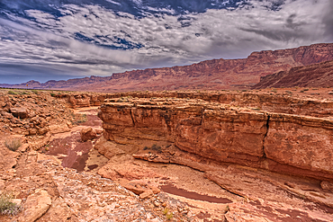
View of a small slot canyon called Jackass Creek off of US89A next to Echo Cliffs on the way to Vermilion Cliffs Arizona. Located on the Navajo Indian Reservation between Bitter Springs and Marble Canyon.
Highway 67 facing south in Pleasant Valley of Kaibab National Forest Arizona near sundown after a rain. North of Grand Canyon North Rim.
Highway 67 south of Jacob Lake Arizona facing southbound toward Grand Canyon North Rim.
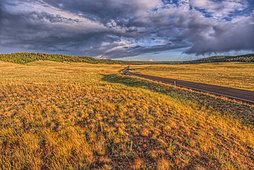
Rolling Hills in Pleasant Valley in the Kaibab National Forest north of Grand Canyon North Rim Arizona near sundown.
Grand Canyon with the historic Watch Tower on the far left, managed by the National Park Service, Grand Canyon National Park, UNESCO World Heritage Site, Arizona, United States of America, North America
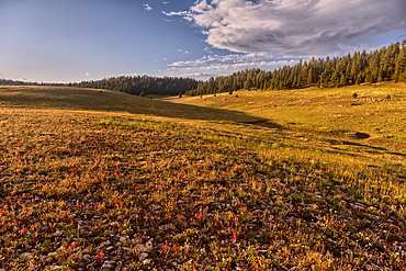
Rolling Hills in Pleasant Valley in the Kaibab National Forest north of Grand Canyon North Rim Arizona near sundown.
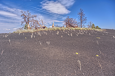
Burned trees on a Volcanic cinder rim in Coconino National Forest near Sunset Crater National Monument of Arizona.
View from the 80 foot tall historic Fire Watchtower at Jacob Lake Arizona. Maintained as a historic landmark by the National Forest Service. No property release needed.
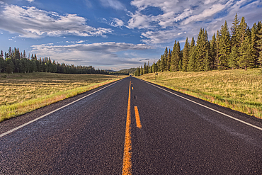
Highway 67 facing north in Pleasant Valley of Kaibab National Forest Arizona near sundown after a rain. North of Grand Canyon North Rim.
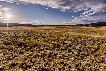
The rolling hills of Pleasant Valley in the Kaibab National Forest north of Grand Canyon North Rim Arizona near sundown.
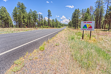
Taken on July 3rd, 2025, a warning sign of high wildfire danger along Highway 67 near Jacob Lake on the way to Grand Canyon North Rim Arizona. On July 4th, 2025, a massive wildfire broke out in this area from a lightning strike.
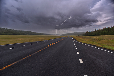
Lightning storm over Pleasant Valley in Kaibab National Forest Arizona, north of Grand Canyon North Rim.
View from the 80 foot tall historic Fire Watchtower at Jacob Lake Arizona. Maintained as a historic landmark by the National Forest Service. No property release needed.
View from the 80 foot tall historic Fire Watchtower at Jacob Lake Arizona. Maintained as a historic landmark by the National Forest Service. No property release needed.
View from the 80 foot tall historic Fire Watchtower at Jacob Lake Arizona. Maintained as a historic landmark by the National Forest Service. No property release needed.
View from the 80 foot tall historic Fire Watchtower at Jacob Lake Arizona. Maintained as a historic landmark by the National Forest Service. No property release needed.
View of storm clouds rolling over prairie grassland in northern Arizona near Wupatki National Monument.
View from the 80 foot tall historic Fire Watchtower at Jacob Lake Arizona. Maintained as a historic landmark by the National Forest Service. No property release needed.
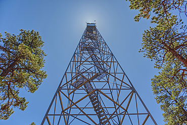
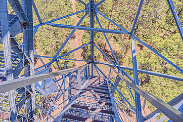
The 80 foot tall historic Fire Watchtower at Jacob Lake Arizona. Maintained as a historic landmark by the National Forest Service. No property release needed.

The 80 foot tall historic Fire Watchtower at Jacob Lake Arizona. Maintained as a historic landmark by the National Forest Service. No property release needed.
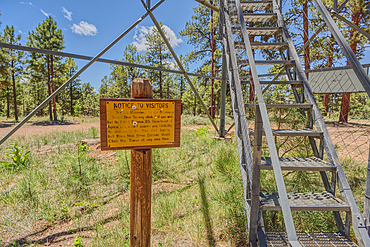
The 80 foot tall historic Fire Watchtower at Jacob Lake Arizona. Sign warns to climb the tower at your own risk. Maintained as a historic landmark by the National Forest Service. No property release needed.
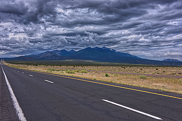
Storm clouds rolling in over Humphrey's Peak near Flagstaff Arizona in the Coconino National Forest. Viewed from US89.

A lone tree isolated just off shore in Watson Lake in Prescott, Arizona, United States of America, North America

The Watson Dam Spillway, the small dam holds back Watson Lake in Prescott, Arizona, United States of America, North America
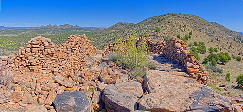
Ancient Ruins on Sullivan Butte in Chino Valley, Arizona, United States of America, North America
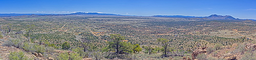
A super panorama of Chino Valley viewed from the summit of Sullivan Butte, Arizona, United States of America, North America
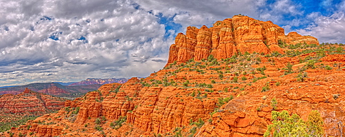
Panorama of Cathedral Rock from the south side just off the HiLine Trail, Sedona, Arizona, United States of America, North America

High angle view of Boulder Creek, the Watson Lake Loop Trail crosses this creek, Prescott, Arizona, United States of America, North America
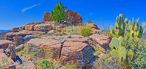
Ancient Indian ruins resembling an old fortress on top Sullivan Butte in Chino Valley, Arizona, United States of America, North America

View of the Secret Cove on the east side of Watson Lake in Prescott, Arizona, United States of America, North America

A sunset picnic on the beach, Westward Ho!, north Devon, England, United Kingdom, Europe
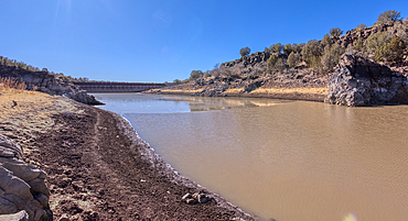
Shoreline view of the historic Bainbridge Steel Dam near Ash Fork, Kaibab National Forest, Arizona, United States of America