Results
« Previous 1 … 6 7 8 9 10 … 15 Next »
1439 results found
One of three ponds called the Hearst Tanks, on Grand Canyon South Rim, located one mile east of Grandview Point, Grand Canyon National Park, UNESCO World Heritage Site, Arizona, United States of America, North America

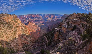
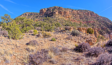
Craggy rock spires overlooking South Rim Gorge, an area between Hance Canyon and the Sinking Ship, which is right of center in the distance, southern most part of Grand Canyon National Park, UNESCO World Heritage Site, Arizona, United States of America, North America
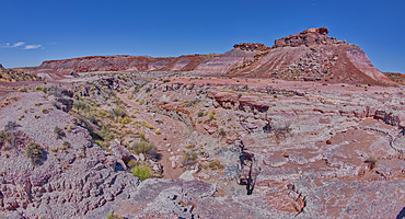
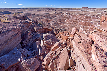
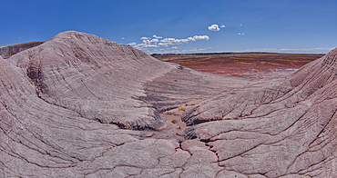
A dry waterfall in Crystal Creek below Crystal Mesa west of Hamilili Point in Petrified Forest National Park, Arizona, United States of America, North America
View from the top of a sandstone mesa, a fossilized sand dune, at Ferry Swale in the Glen Canyon Recreation Area near Page, Arizona, United States of America, North America
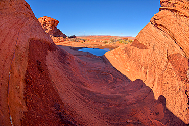
A wavy sandstone formation with a puddle of water north of the Horseshoe Bend Overlook along the Colorado River in Page, Arizona, United States of America, North America
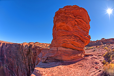
Sandstone hoodoo formation north of the Horseshoe Bend Overlook along the Colorado River in Page, Arizona, United States of America, North America
Sandstone hoodoo formation north of the Horseshoe Bend Overlook along the Colorado River in Page, Arizona, United States of America, North America
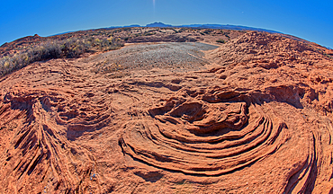
The ripples of fossilized sand dunes in the badlands of Horseshoe Bend, Arizona, United States of America, North America
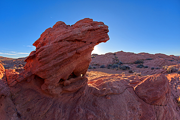
A hoodoo shaped like a vulture's head, at Horseshoe Bend in the Glen Canyon Recreation Area, near Page, Arizona, United States of America, North America
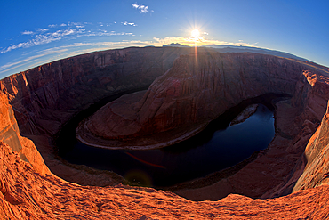
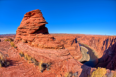
Horseshoe Bend in the Glen Canyon Recreation Area at sundown, near Page, Arizona, United States of America, North America
A hoodoo shaped like a vulture's head, at Horseshoe Bend in the Glen Canyon Recreation Area, near Page, Arizona, United States of America, North America
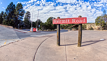
The Hermit Road Transfer Station Bus Stop and entry gate at Grand Canyon South Rim, Arizona, United States of America, North America
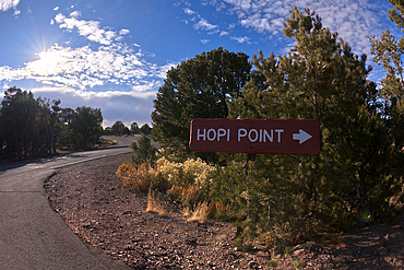
A sign marking the one way entrance to Hopi Point from Hermit Road at Grand Canyon, Arizona, United States of America, North America
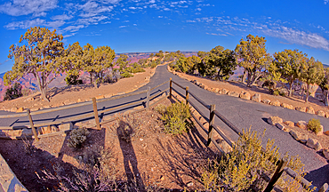
The divided paved entry pathway to the Powell Memorial from the parking lot off Hermit Road, Grand Canyon, Arizona, United States of America, North America
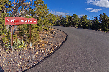
The sign marking the entry pathway to the Powell Memorial from the parking lot off Hermit Road, Grand Canyon, Arizona, United States of America, North America
Bright Angel Trail at Grand Canyon South Rim viewed from the Trailview Overlook along Hermit Road, Grand Canyon, UNESCO World Heritage Site, Arizona, United States of America, North America
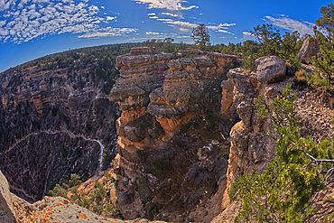
An outcrop of rock overlooking the Bright Angel Trail below at Grand Canyon South Rim off Hermit Road, Grand Canyon, UNESCO World Heritage Site, Arizona, United States of America, North America
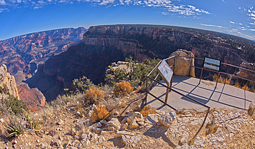
The Trailview Overlook East Vista at Grand Canyon South Rim, just off Hermit Road, Grand Canyon, UNESCO World Heritage Site, Arizona, United States of America, North America
The Trailview Overlook East Vista at Grand Canyon South Rim, just off Hermit Road, Grand Canyon, UNESCO World Heritage Site, Arizona, United States of America, North America
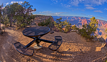
A metal picnic table along the rim trail overlooking Grand Canyon South Rim off of Hermit Road just west of Hopi Point, Grand Canyon, UNESCO World Heritage Site, Arizona, United States of America, North America
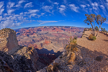
A view of Grand Canyon from the west side of Maricopa Point, Grand Canyon, UNESCO World Heritage Site, Arizona, United States of America, North America
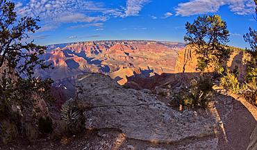
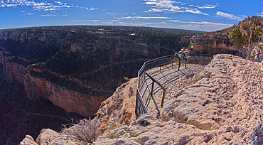
Grand Canyon view from a cliff between Hopi Point and Mohave Point, Grand Canyon, UNESCO World Heritage Site, Arizona, United States of America, North America
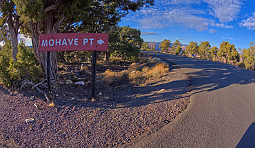
A sign marking the one way entrance to Mohave Point off of Hermit Road, Grand Canyon, UNESCO World Heritage Site, Arizona, United States of America, North America
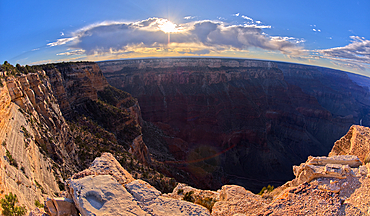
View of Grand Canyon Arizona from the west side of Mohave Point near sundown, UNESCO World Heritage Site, Arizona, United States of America, North America
The end of Hermit Road, Hermits Rest is just beyond the parking lot, Grand Canyon, Arizona, United States of America, North America
A look back at the cliffs of Hermits Rest, the Hermit Trailhead starts on the cliff line to the upper left of the photo, viewed from 1000 feet off of the official trail, Grand Canyon, Arizona, United States of America, North America
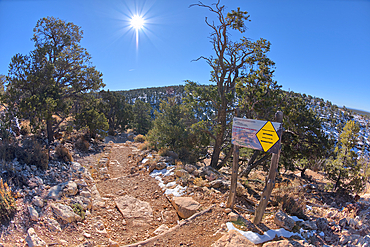
A warning sign at the start of the Hermit Canyon Trail stating that getting to the bottom is optional, but getting back to the top is mandatory, Grand Canyon, Arizona, United States of America, North America
The very rocky pathway of the unmaintained Hermit Canyon Trail at Grand Canyonin winter with Waldron Canyon on the left in the distance, Grand Canyon, Arizona, United States of America, North America
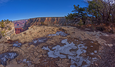
Frozen water puddles along the cliffs of Grand Canyon east of the Monument Creek Vista, Grand Canyon National Park, UNESCO World Heritage Site, Arizona, United States of America, North America

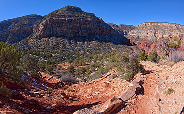
The Great Mohave Wall at Grand Canyon viewed just west of Monument Creek, part of the canyon below this cliff wall, Grand Canyon National Park, UNESCO World Heritage Site, Arizona, United States of America, North America
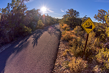
The paved Greenway trail west of Monument Creek Vista with a sign warning cyclists of a steep gradient ahead, Grand Canyon, Arizona, United States of America, North America
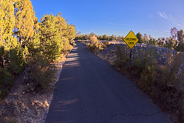
Sign marking the end of the paved Greenway Trail that runs between Monument Creek Vista and Pima Point, Grand Canyon, Arizona, United States of America, North America
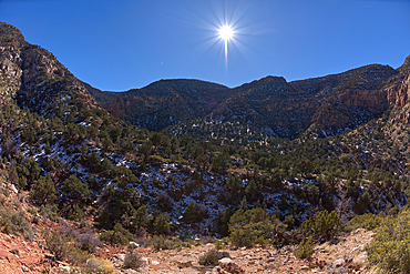
View of Waldron Canyon southwest of Hermit Canyon in winter, accessible via Hermit Trail, Grand Canyon, Arizona, United States of America, North America

Off trail view of Waldron Canyon southwest of Hermit Canyon in winter, accessible via Hermit Trail to the Waldron Trail Junction, Grand Canyon, Arizona, United States of America, North America
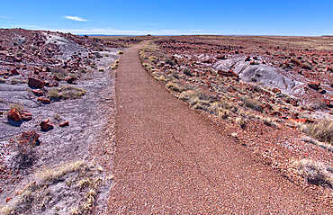
The paved trail that leads to the historic Agate House in Petrified Forest National Park, Arizona, United States of America, North America
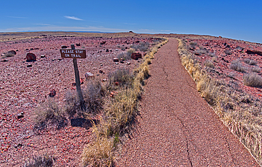
A warning sign to stay on the trail to the historic Agate House in Petrified Forest National Park, Arizona, United States of America, North America
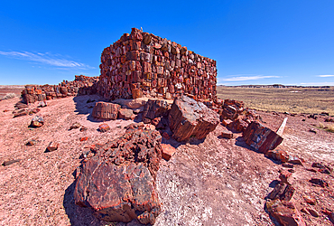
Closeup of the historic Agate House in Petrified Forest National Park, Arizona, United States of America, North America
A warning sign to stay on the trail to the historic Agate House in Petrified Forest National Park, Arizona, United States of America, North America
A divide in the trail loop for the Giant Logs trail at Petrified Forest National Park with the Rainbow Forest Museum on upper left, Arizona, United States of America, North America
A scenic overlook on the west side of the Giant Logs Trail at Petrified Forest National Park, Arizona, United States of America, North America
A scenic overlook on the west side of the Giant Logs Trail at Petrified Forest National Park, Arizona, United States of America, North America
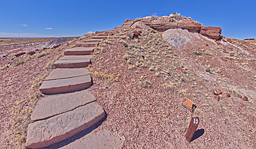
Steps along the Giant Logs Trail leading to a scenic overlook in Petrified Forest National Park, Arizona, United States of America, North America
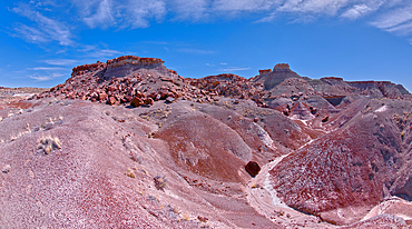
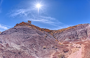
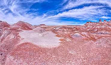
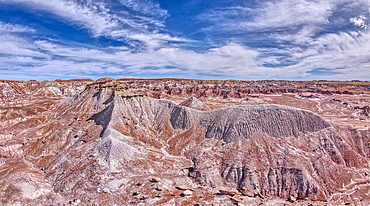
Hills of purple and gray bentonite near Hamilili Point on the south end of Petrified Forest National Park, Arizona, United States of America, North America
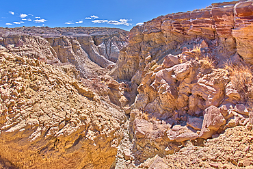
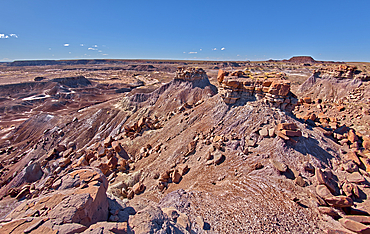
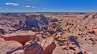
A deep canyon eroded thru the hills of purple and gray bentonite clay near Hamilili Point on the south end of Petrified Forest National Park, Arizona, United States of America, North America
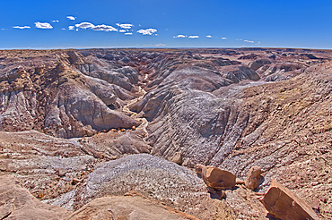
A deep canyon eroded thru the hills of purple and gray bentonite clay near Hamilili Point on the south end of Petrified Forest National Park, Arizona, United States of America, North America
Purple badlands of bentonite near Hamilili Point on the south end of Petrified Forest National Park, Arizona, United States of America, North America
Purple badlands of bentonite near Hamilili Point on the south end of Petrified Forest National Park, Arizona, United States of America, North America
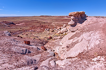
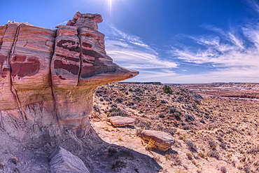
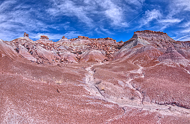
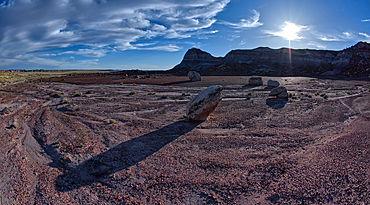
Rock islands above the purple badlands near Hamilili Point on the south end of Petrified Forest National Park, Arizona, United States of America, North America
Rock islands just off a mesa near Hamilili Point on the south end of Petrified Forest National Park, Arizona, United States of America, North America
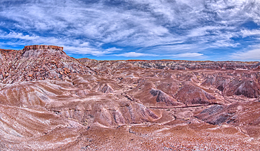
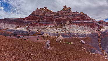
The crumbling cliffs of a mesa near Hamilili Point on the south end of Petrified Forest National Park, Arizona, United States of America, North America
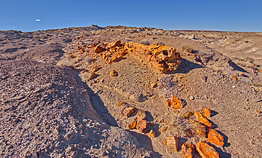
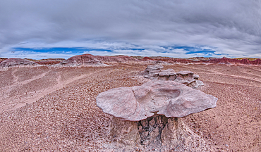
A petrified tree log that has shattered over time, located on a mesa near Hamilili Point on the south end of Petrified Forest National Park, Arizona, United States of America, North America
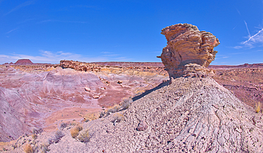
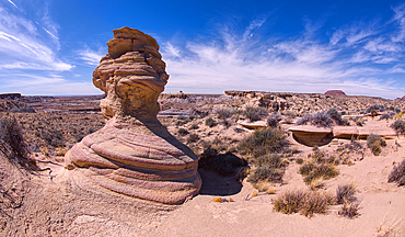
A solitary rock hoodoo in the purple badlands near Hamilili Point on the south end of Petrified Forest National Park, Arizona, United States of America, North America
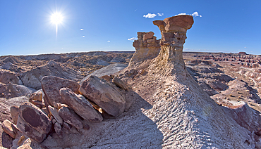
A solitary rock hoodoo in the purple badlands near Hamilili Point on the south end of Petrified Forest National Park, Arizona, United States of America, North America
A solitary rock hoodoo in the purple badlands near Hamilili Point on the south end of Petrified Forest National Park, Arizona, United States of America, North America
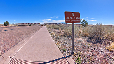
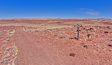
A sign along the main road pointing the way to the Long Logs Trail, and Agate House, Petrified Forest National Park, Arizona, United States of America, North America
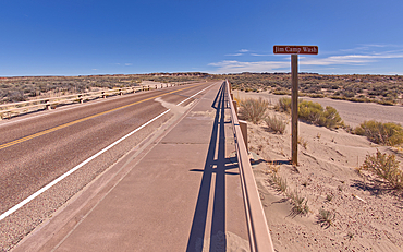
Sign along the path to the Long Logs Trail, marking the Jim Camp Wash along the main road of Petrified Forest National Park, Arizona, United States of America, North America
The gateway to the Long Logs Trail and Agate House in Petrified Forest National Park, Arizona, United States of America, North America
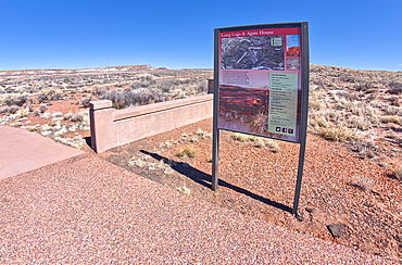
The map sign at the gateway for the Long Logs Trail and Agate House in Petrified Forest National Park, Arizona, United States of America, North America
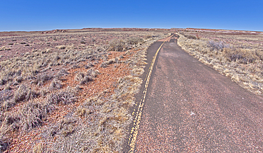
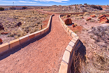
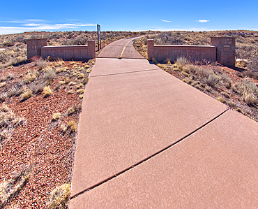
The paved path, that used to be an old road, leading to the Long Logs Trail and Agate House in Petrified Forest National Park, Arizona, United States of America, North America

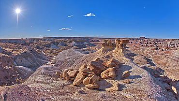
The sun shade shelter along the Long Logs Trail at Petrified Forest National Park, Arizona, United States of America, North America
View of a bentonite hill along the Long Logs Trail in Petrified Forest National Park, Arizona, United States of America, North America

A circular walkway for the Long Logs Trail in Petrified Forest National Park, Arizona, United States of America, North America
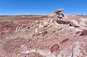
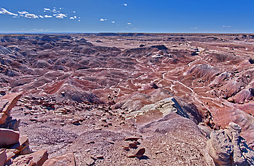
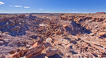
Crumbling islands of rock near Hamilili Point in Petrified Forest, Arizona, United States of America, North America
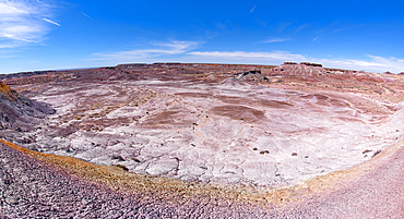
Islands of Rock in Hamilili Valley on the south end of Petrified Forest National Park, Arizona, United States of America, North America
A lone hoodoo rock on the edge of a ridge overlooking the Jim Camp Wash on the south end of Petrified Forest National Park, Arizona, United States of America, North America
A lone hoodoo rock on the edge of a ridge overlooking the Jim Camp Wash on the south end of Petrified Forest National Park, Arizona, United States of America, North America
View from below a ridge that overlooks the Jim Camp Wash on the south end of Petrified Forest National Park, Arizona, United States of America, North America
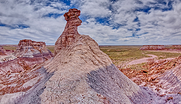
A cliff overhang shaped like the head of a Duck west of Hamilili Point on the south end of Petrified Forest National Park, Arizona, United States of America, North America
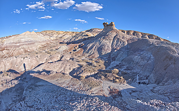
A hoodoo called the Zuni Warrior on the edge of a cliff near Hamilili Point, Hamilili is Zuni meaning petrified wood, Petrified Forest National Park, Arizona, United States of America, North America
A dry waterfall on the west side of Hamilili Point, Hamilili being a Zuni word for petrified wood, next to a hoodoo on the south end of Petrified Forest National Park, Arizona, United States of America, North America
A small hill of gray bentonite clay that appears to be melting into the purple bentonite of Hamilili Valley on the south end of Petrified Forest National Park, Arizona, United States of America, North America
Crumbling cliffs of a mesa near Hamilili Point in Petrified Forest, Arizona, United States of America, North America
Purple hills of volcanic bentonite near Hamilili Point on the south end of Petrified Forest National Park, Arizona, United States of America, North America
A ridge of gray bentonite viewed from a nearby flat top mesa on the south end of Petrified Forest National Park, Arizona, United States of America, North America
Sandstone that has been eroded into forms that resemble clam shells on the south end of Petrified Forest National Park, Arizona, United States of America, North America
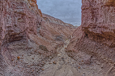
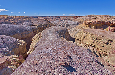
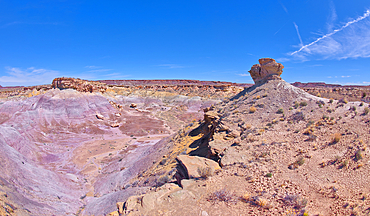
A narrow slot canyon of bentonite on the south end of Petrified Forest National Park, Arizona, United States of America, North America
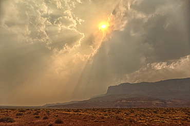
Sun shining thru dense smoke from the Dragon Bravo Wildfire enshrouding Vermilion Cliffs National Monument Arizona. Viewed from US89A.
Late day sun shining thru dense smoke from the Dragon Bravo Wildfire billowing off the Kaibab Plateau. Viewed from US89A across from Vermilion Cliffs Arizona.
Echo Cliffs near Marble Canyon Arizona near sunset with smoke in the sky from the Dragon Bravo Wildfire burning on Grand Canyon North Rim.
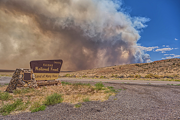
Smoke from the Dragon Bravo Wildfire burning on Grand Canyon North Rim billowing off the Kaibab Plateau. Viewed from US89A at the Kaibab National Forest Boundary.
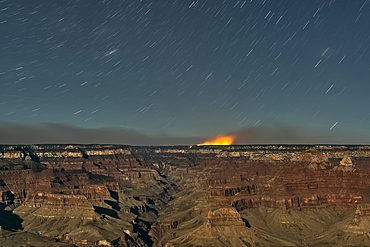
Dragon Bravo Wildfire on Grand Canyon North Rim viewed from Yavapai Point on South Rim Arizona at night under moonlight.
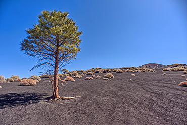
Lone Pine Tree, Coconino National Forest, Arizona, USA
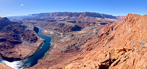
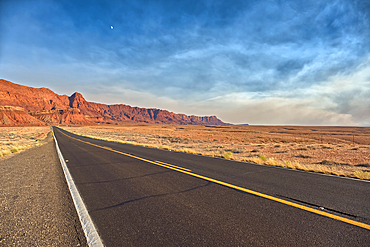
The Vermilion Cliffs adjacent to Glen Canyon Recreation Area viewed from the plateau at the end of Spencer Trail in Marble Canyon with Lee's Ferry on the lower left with the Colorado River, Arizona, United States of America, North America
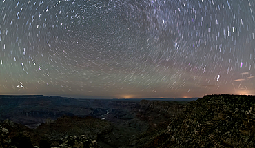
The swirl of stars in the night sky over Grand Canyon South Rim viewed from Navajo Point with the historic Watchtower in the distance on the right, Grand Canyon National Park, UNESCO World Heritage Site, Arizona, United States of America, North America
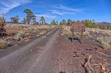
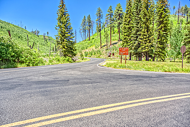
Fire Road 546 where it branches off from Sunset Crater National Monument into Coconino National Forest of Arizona, USA
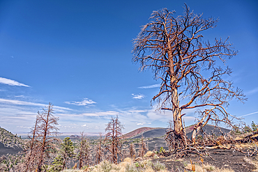
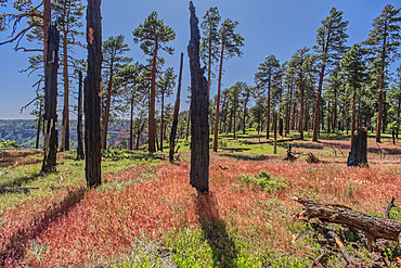
Burned trees on a Volcanic cinder rim in Coconino National Forest, Arizona, USA
The point where Fuller Canyon Road divides in Grand Canyon North Rim Arizona. Left fork leads to Point Imperial. Right fork leads to Cape Royal.
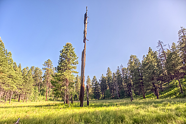
A burned tree in a grassy meadow in a valley near Clear Creek Canyon at Grand Canyon North Rim Arizona.
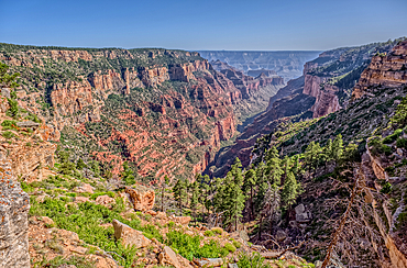
View of Clear Creek Canyon from its north cliffs at Grand Canyon North Rim Arizona.
Burned trees at the north edge of Clear Creek Canyon at Grand Canyon North Rim Arizona.
A hoodoo spire shaped like a Horse Head, in the valley below Blue Mesa of Petrified Forest National Park, Arizona, United States of America, North America
The Billings Gap Overlook on the east side of Blue Mesa in Petrified Forest National Park, Arizona, United States of America, North America
Fire Road 546 where it branches off from Sunset Crater National Monument into Coconino National Forest of Arizona, USA
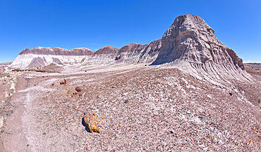
East slopes of Haystack Mesa in Petrified Forest National Park, Arizona, United States of America, North America
The east cliffs of Blue Mesa near sunset, Petrified Forest National Park, Arizona, United States of America, North America
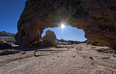
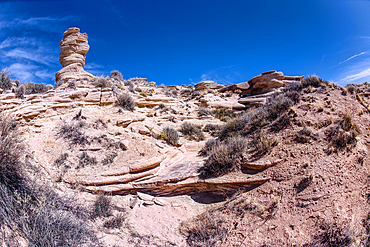
A small bentonite arch in Goblin Garden west of Hamilili Point in Petrified Forest National Park, Arizona, United States of America, North America
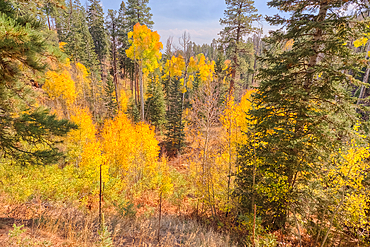
Autumn colored Aspen trees off Cape Royal Road in Grand Canyon North Rim, UNESCO, Arizona, United States of America
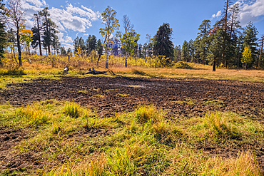
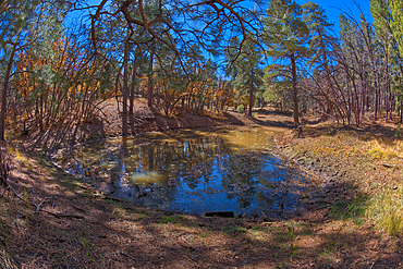
Greenland Lake reduced to a mud hole, Grand Canyon North Rim, UNESCO, Arizona, United States of America
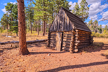
The historic Salt Cabin dating back to 1870s near Greenland Lake at Grand Canyon North Rim, UNESCO, Arizona, United States of America
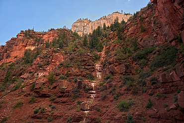
Ephemeral Spring on Red Wall of Roaring Springs Canyon, North Kaibab Trail, Grand Canyon North Rim, UNESCO, Arizona, United States of America