Results
« Previous 1 … 7 8 9 10 11 … 15 Next »
1439 results found
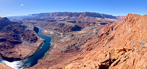
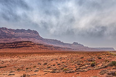
The Vermilion Cliffs adjacent to Glen Canyon Recreation Area viewed from the plateau at the end of Spencer Trail in Marble Canyon with Lee's Ferry on the lower left with the Colorado River, Arizona, United States of America, North America
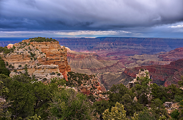
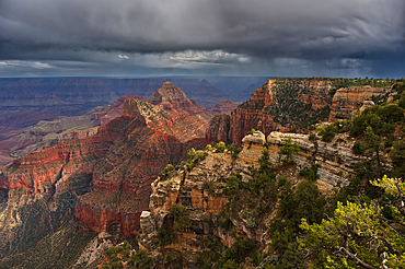
Storm rolling over Grand Canyon viewed from the Walhalla Overlook on North Rim Arizona.
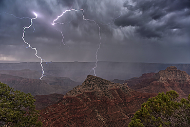
Lightning striking Freya's Castle viewed from Cape Royal on Grand Canyon North Rim Arizona.
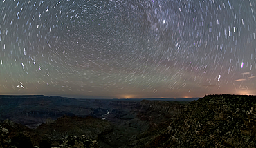
The swirl of stars in the night sky over Grand Canyon South Rim viewed from Navajo Point with the historic Watchtower in the distance on the right, Grand Canyon National Park, UNESCO World Heritage Site, Arizona, United States of America, North America
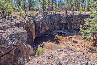
The cliff rim of Keyhole Sink in the Kaibab National Forest near Williams, Arizona, USA
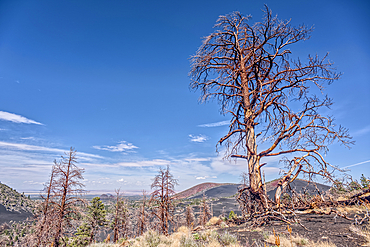
Burned trees on a Volcanic cinder rim in Coconino National Forest, Arizona, USA
The point where Fuller Canyon Road divides in Grand Canyon North Rim Arizona. Left fork leads to Point Imperial. Right fork leads to Cape Royal.
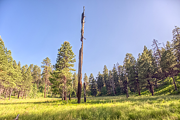
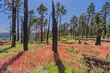
A burned tree in a grassy meadow in a valley near Clear Creek Canyon at Grand Canyon North Rim Arizona.
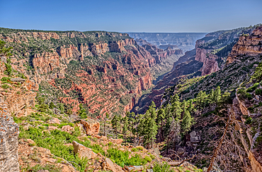
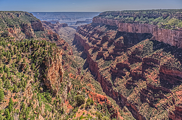
View of Clear Creek Canyon from its north cliffs at Grand Canyon North Rim Arizona.
Burned trees at the north edge of Clear Creek Canyon at Grand Canyon North Rim Arizona.
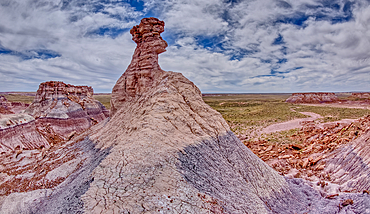
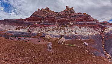
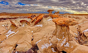
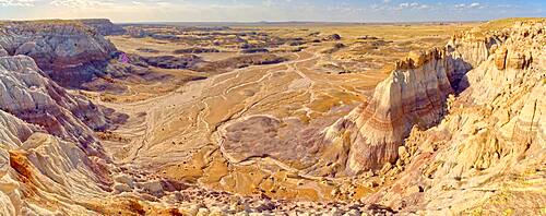
A hoodoo spire shaped like a Horse Head, in the valley below Blue Mesa of Petrified Forest National Park, Arizona, United States of America, North America
The Billings Gap Overlook on the east side of Blue Mesa in Petrified Forest National Park, Arizona, United States of America, North America
The Billings Gap Overlook on the east side of Blue Mesa in Petrified Forest National Park, Arizona, United States of America, North America
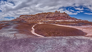
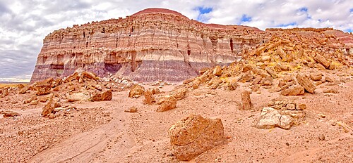
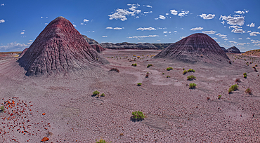
East slopes of Haystack Mesa in Petrified Forest National Park, Arizona, United States of America, North America
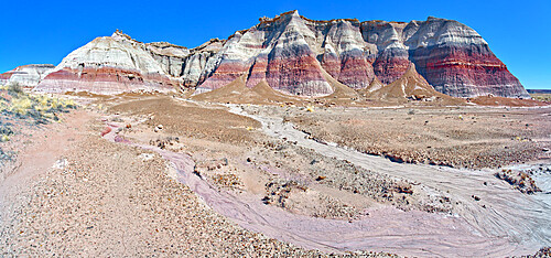
The east cliffs of Blue Mesa near sunset, Petrified Forest National Park, Arizona, United States of America, North America
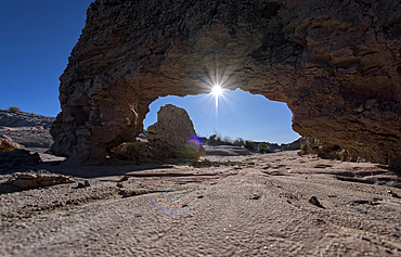
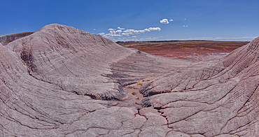
A small bentonite arch in Goblin Garden west of Hamilili Point in Petrified Forest National Park, Arizona, United States of America, North America
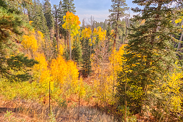
Autumn colored Aspen trees off Cape Royal Road in Grand Canyon North Rim, UNESCO, Arizona, United States of America
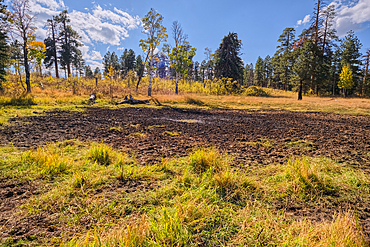
Greenland Lake reduced to a mud hole, Grand Canyon North Rim, UNESCO, Arizona, United States of America
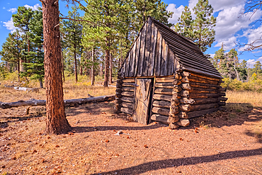
The historic Salt Cabin dating back to 1870s near Greenland Lake at Grand Canyon North Rim, UNESCO, Arizona, United States of America
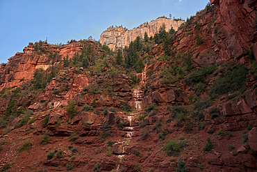
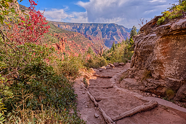
Ephemeral Spring on Red Wall of Roaring Springs Canyon, North Kaibab Trail, Grand Canyon North Rim, UNESCO, Arizona, United States of America
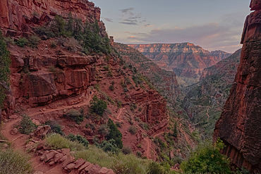
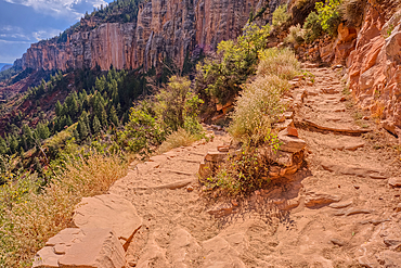
View of Roaring Springs Canyon along the North Kaibab Trail at Grand Canyon North Rim, UNESCO, Arizona, United States of America
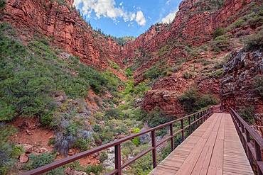
View of the Roaring Springs Canyon cliffs from the Red Wall Bridge, Grand Canyon North Rim, UNESCO, Arizona, United States of America
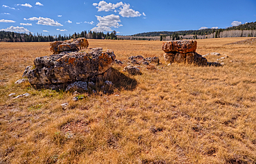
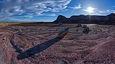
Lonely Boulders and exposed rock in Pleasant Valley, Kaibab National Forest just north of Grand Canyon North Rim, Arizona, United States of America
Looking back up the first leg of the North Kaibab Trail at Grand Canyon North Rim, UNESCO, Arizona, United States of America
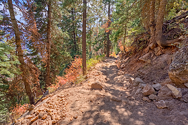
The upper leg of the North Kaibab Trail at Grand Canyon North Rim, UNESCO, Arizona, United States of America
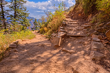
The 7th switchback along the North Kaibab Trail at Grand Canyon North Rim, UNESCO, Arizona, United States of America
The 12th switchback along the North Kaibab Trail at Grand Canyon North Rim, UNESCO, Arizona, United States of America
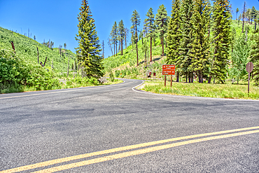
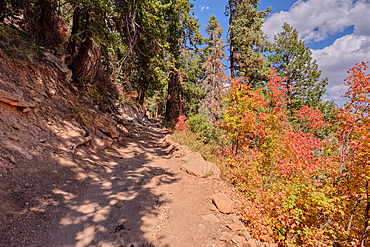
A curve in the North Kaibab Trail between Coconino Overlook and the Supai Tunnel Rest Area, Grand Canyon, Arizona, United States of America
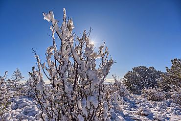
Snow covered landscape, Chino Valley, Arizona, USA
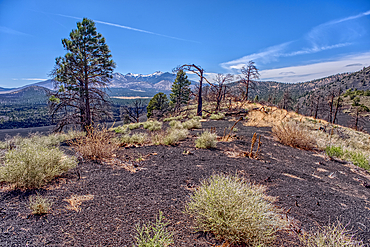
Burned trees on a Volcanic cinder rim in Coconino National Forest, Arizona, USA
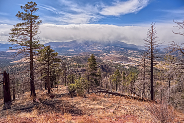
A snow squall storm building up over Humphrey's Peak. Viewed from O'Leary Peak in the Coconino National Forest of Arizona. Adjacent to Sunset Crater National Monument.
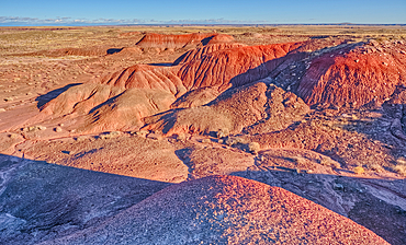
Red hills of bentonite clay overlooking Dead Wash in Petrified Forest National Park, Arizona, United States of America

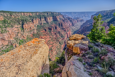
Grand Canyon view from the north side of Horseshoe Mesa, Grand Canyon National Park, UNESCO World Heritage Site, Arizona, United States of America, North America
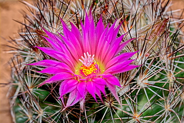
Flower of the Escobaria Vivipara cactus (Pin Cushion Cactus), Arizona, United States of America, North America
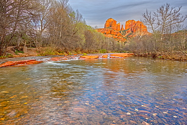
View of Cathedral Rock in Sedona from the middle of Oak Creek, Arizona, United States of America, North America
A panorama photo of lightning striking the slopes of Woolsey Peak during the 2012 Arizona Monsoon season, Arizona, United States of America, North America
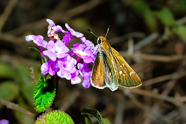
A Texas Roadside Skipper feeding on a wildflower in Arizona, United States of America, North America
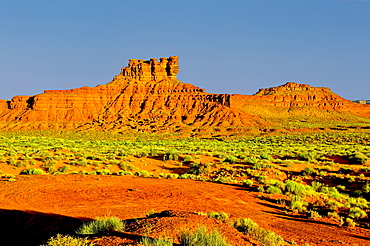
Formation in Valley of the Gods called the Seven Sailors, located near the town Mexican Hat, Utah, United States of America, North America
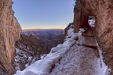
The second tunnel along Bright Angel Trail in winter at sunrise on the South Rim of Grand Canyon, Grand Canyon National Park, UNESCO World Heritage Site, Arizona, United States of America, North America
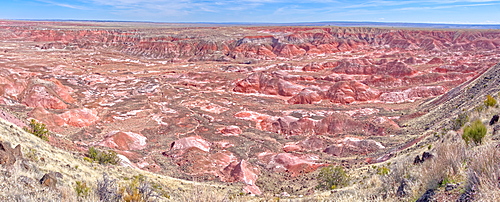
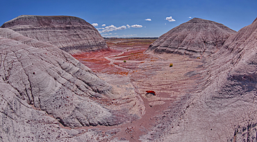
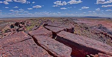
Panorama view of the Painted Desert from Tawa Point in Petrified Forest National Park, Arizona, United States of America, North America
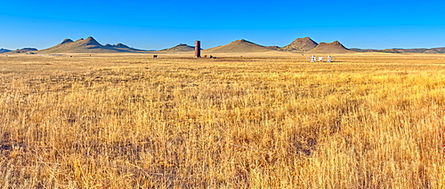
Rolling hills and golden Gramma Grass of Chino Valley, located along East Perkinsville Road just east of State Route 89, Arizona, United States of America, North America
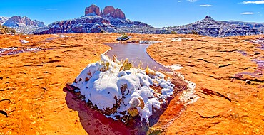
Snow covered Cathedral Rock in Sedona viewed from a sandstone plateau along Secret Slick Rock Trail, Arizona, United States of America, North America
The eastern edge of the Clam Bed Mesa along the Red Basin Trail in Petrified Forest National Park, Arizona, United States of America, North America
Sand Castle formations on the edge of the Red Basin in Petrified Forest National Park, Arizona, United States of America, North America
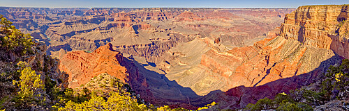
Grand Canyon viewed from the vista of Mohave Point along the Hermit Road, Grand Canyon National Park, UNESCO World Heritage Site, Arizona, United States of America, North America
A sheer cliff of rock jutting out from the Blue Mesa along the Billings Gap Trail in Petrified Forest National Park, Arizona, United States of America, North America
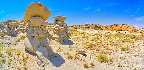
Field of hoodoos in Goblin Garden in the Flat Tops of Petrified Forest National Park, Arizona, United States of America, North America
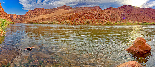
Panorama of the Colorado River just north of Lee's Ferry in the Glen Canyon Recreation Area, Arizona, United States of America, North America

Front view of the historic Glen Canyon Dam in Page, viewed from the Carl Hayden Museum Overlook, Arizona, United States of America, North America

A tall hoodoo called the Leviathan in Devil's Playground, Petrified Forest National Park, Arizona, United States of America, North America
South side of Damnation Mesa on the north end of Devil's Playground in Petrified Forest National Park, Arizona, United States of America, North America
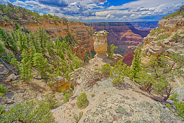
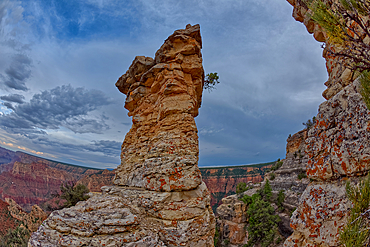
Loki's Rock at Grand Canyon east of Thor's Hammer Overlook, Grand Canyon National Park, UNESCO World Heritage Site, Arizona, United States of America, North America
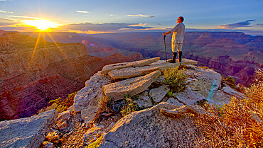
A hiker watching the sun go down west of Moran Point at Grand Canyon, Grand Canyon National Park, UNESCO World Heritage Site, Arizona, United States of America, North America
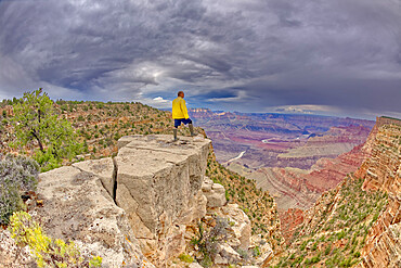
A hiker standing on a cliff between Zuni and Papago Points at Grand Canyon on a stormy day, Grand Canyon National Park, UNESCO World Heritage Site, Arizona, United States of America, North America
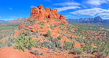
The spires of Cockscomb Butte in Sedona viewed from its south end summit, Arizona, United States of America, North America
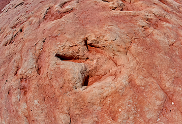
Dinosaur tracks at a tourist attraction on the Navajo Indian Reservation near Tuba City, Arizona, United State of America, North America
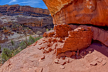
The Horse Collar Ruins located between the Sipapu Arch Bridge and the Kachina Arch Bridge, Natural Bridges National Monument, Utah, United States of America, North America
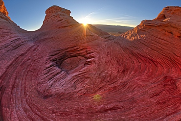
The west rock ridge of the New Wave along the Beehive Trail in the Glen Canyon Recreation Area near Page, Arizona, United States of America, North America
East slopes of Haystack Mesa in Petrified Forest National Park, Arizona, United States of America, North America

The overhang of a sandstone mesa, a fossilized sand dune, at Ferry Swale in the Glen Canyon Recreation Area near Page, Arizona, United States of America, North America

A dry waterfall at the base of a rock island at Ferry Swale in the Glen Canyon Recreation Area near Page, Arizona, United States of America, North America
An outcrop of rock overlooking the Bright Angel Trail below at Grand Canyon South Rim off Hermit Road, Grand Canyon, UNESCO World Heritage Site, Arizona, United States of America, North America
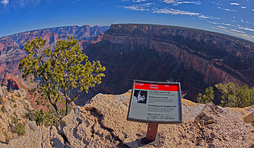
A sign in different languages warning of a dangerous cliff at the West Vista of the Trailview Overlook along the Hermit Road rim trail, Grand Canyon, UNESCO World Heritage Site, Arizona, United States of America, North America
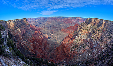
Monument Creek viewed from along the rim trail halfway between The Abyss and Monument Creek Vista Overlook with Mohave Point on right and Pima Point on the left in the distance, Grand Canyon, Arizona, United States of America, North America
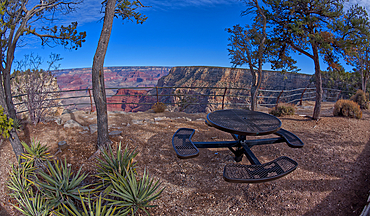
Steel picnic table along the rim trail overlooking Grand Canyon South Rim off Hermit Road halfway between Monument Creek Vista and The Abyss, Grand Canyon, Arizona, United States of America, North America
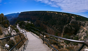
Steps leading down to Trailview Overlook under moonlight, Grand Canyon, Arizona, United States of America, North America
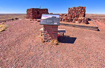
An information sign detailing the history of Agate House in Petrified Forest National Park, Arizona, United States of America, North America
The summit of Haystack Mesa in Petrified Forest National Park, Arizona, United States of America, North America
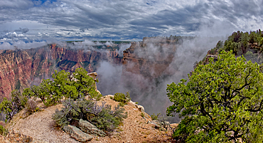
Steamlike fog rising out of Grand Canyon South Rim just east of Grandview Point, Grand Canyon National Park, UNESCO World Heritage Site, Arizona, United States of America, North America
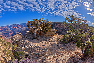
A rock spire just east of Grandview Point at Grand Canyon South Rim, Grand Canyon National Park, UNESCO World Heritage Site, Arizona, United States of America, North America
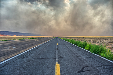
Smoke from the Dragon Bravo Wildfire enshrouding Vermilion Cliffs National Monument Arizona. Viewed from US89A.
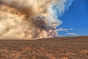
Smoke from the Dragon Bravo Wildfire burning on Grand Canyon North Rim billowing off the Kaibab Plateau. Viewed from US89A across from Vermilion Cliffs.
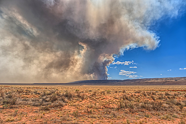
Smoke from the Dragon Bravo Wildfire burning on Grand Canyon North Rim billowing off the Kaibab Plateau. Viewed from US89A across from Vermilion Cliffs.
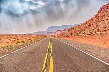
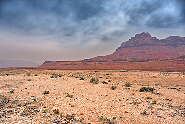
Vermilion Cliffs at Marble Canyon Arizona enshrouded with smoke from the Dragon Bravo Wildfire burning on Grand Canyon North Rim. Viewed from US89A.
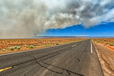
Smoke from the Dragon Bravo Wildfire burning on Grand Canyon North Rim billowing off the Kaibab Plateau. Viewed from US89A next to Vermilion Cliffs.
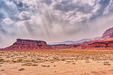
Vermilion Cliffs at Marble Canyon Arizona enshrouded with smoke from the Dragon Bravo Wildfire burning on Grand Canyon North Rim. Viewed from US89A.
Echo Cliffs near Marble Canyon Arizona enshrouded with smoke from the Dragon Bravo Wildfire burning on Grand Canyon North Rim.
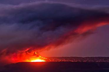
Dragon Bravo Wildfire on Grand Canyon North Rim viewed from US89A near Vermilion Cliffs Arizona at night under moonlight.
Echo Cliffs near Marble Canyon Arizona enshrouded with smoke from the Dragon Bravo Wildfire burning on Grand Canyon North Rim.
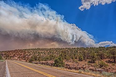
Smoke from the Dragon Bravo Wildfire burning on Grand Canyon North Rim billowing off the Kaibab Plateau. Viewed from US89A.
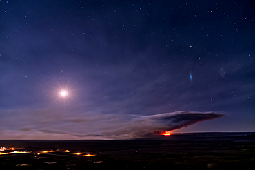
Dragon Bravo Wildfire burning on Grand Canyon North Rim viewed from Antelope Pass on Echo Cliffs off of US89 at night under moonlight.
Dragon Bravo Wildfire burning on Grand Canyon North Rim viewed from Antelope Pass on Echo Cliffs off of US89 at night under moonlight.
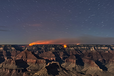
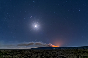
Dragon Bravo Wildfire on Grand Canyon North Rim viewed from Yavapai Point on South Rim Arizona at night under moonlight.
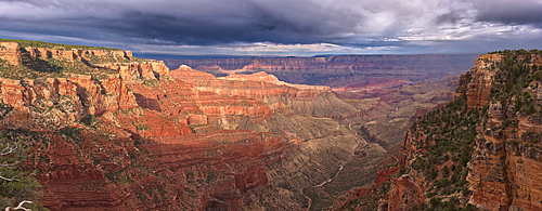
Storm rolling over Grand Canyon viewed from the Walhalla Overlook on North Rim Arizona. Cape Final is on the left.
Storm rolling over Grand Canyon viewed from the Walhalla Overlook on North Rim Arizona.
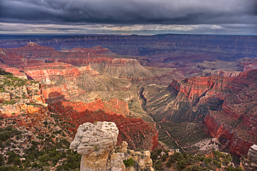
Storm rolling over Grand Canyon viewed from North Rim Arizona. Just left of center is Freya's Castle and Vishnu Temple. Cape Royal is right of center.
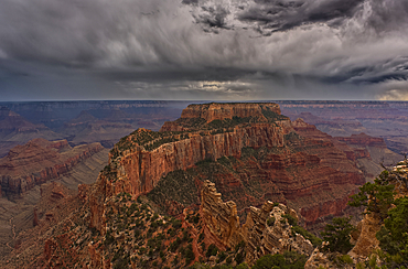
Storm rolling over Grand Canyon viewed from North Rim Arizona. The butte directly ahead is Wotans Throne.
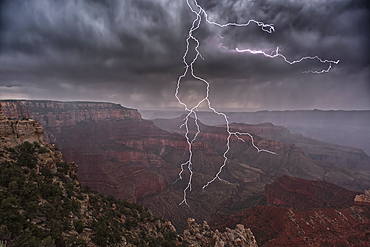
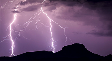
Lightning striking directly overhead viewed from the Walhalla Overlook on Grand Canyon North Rim Arizona.
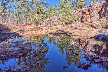
A still pond in Keyhole Sink in the Kaibab National Forest near Williams, Arizona, USA
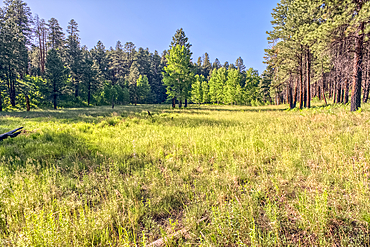
A grassy meadow in a valley near Clear Creek Canyon at Grand Canyon North Rim Arizona.
View of Clear Creek Canyon from its north cliffs at Grand Canyon North Rim Arizona.
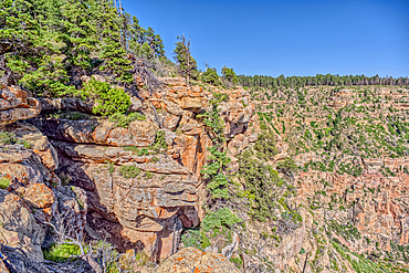
The jagged north cliffs of Clear Creek Canyon at Grand Canyon North Rim Arizona.
View of Clear Creek Canyon from its east rim at Grand Canyon North Rim Arizona.
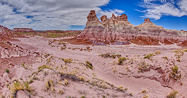
Tall hoodoo towers in the valley below Blue Mesa in Petrified Forest National Park, Arizona, United States of America, North America
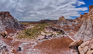
A valley below the east cliffs of Blue Mesa in Petrified Forest National Park, Arizona, United States of America, North America
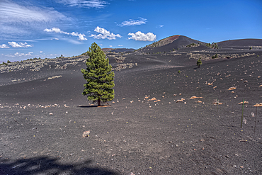
Lone Pine Tree in a volcanic valley in Coconino National Forest, Arizona, USA
The Little Teepees on the north side of Haystack Mesa in Petrified Forest National Park, Arizona, United States of America, North America
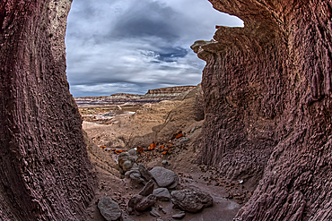
A shallow cave carved out of a cliff wall below the Blue Mesa in Petrified Forest National Park, Arizona, United States of America, North America
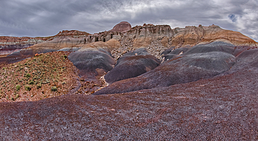
Hoodoo filled cliffs on the north side of Blue Mesa in Petrified Forest National Park, Arizona, United States of America, North America
Cape Royal Road winding through Fuller Canyon at Grand Canyon North Rim, UNESCO, Arizona, United States of America